Start website main content

Accessible trails

1 pathway

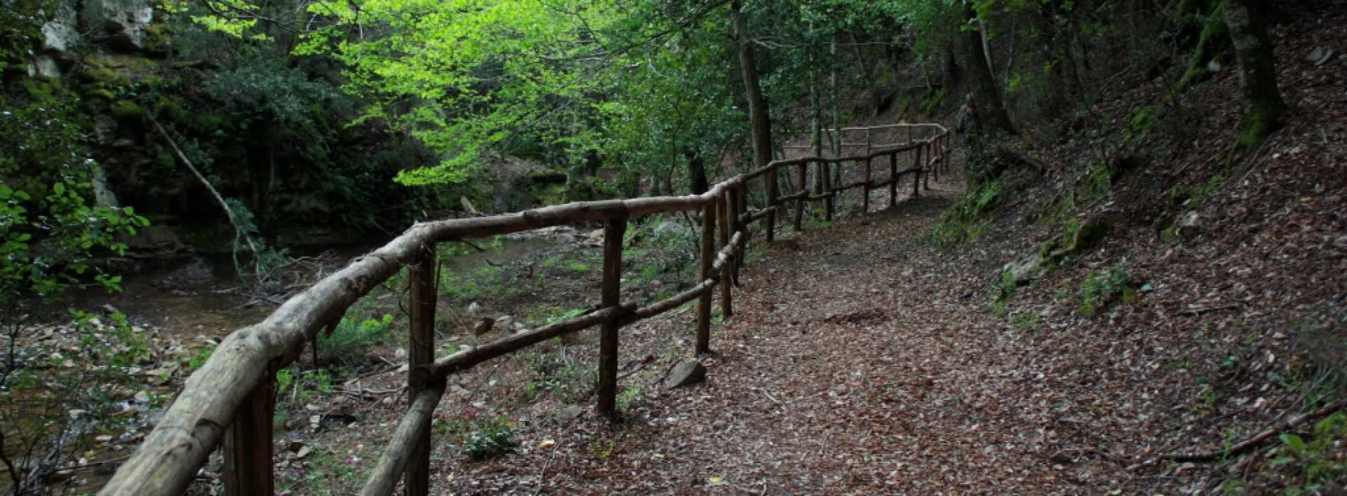
Sentieri per tutti...in questa categoria rientrano i sentieri progettati o riadattati perchè il contatto con l'ambiente naturale sia sempre di stimolo al miglioramento della vita personale di chiunque, con attenzione alle condizioni di disabilità motoria, sensoriale o della sfera psichica e relazionale...

Rio Ermolinos.jpg

Results

Sentiero Italia (Tappa Z20) Caserma Forestale Montarbu - Taquisara

In sintesi

Il Sentiero Italia attraversa in lunghezza il settore orientale dell’isola toccandone i sistemi montuosi più rilevanti, in 28 tappe.  Partendo da nord: tocca il massiccio del Monte Limbara, attraversa i calcari del Mont'Albo e del Tuttavista sfiorando il Golfo di Orosei,  attraversa il Supramonte, il Gennargentu, i Tacchi dell’Ogliastra e giunge a Perdasdefogu.  Più a sud, transita da Armungia e dalla subregione del Gerrei. Infine tocca l’abitato di Burcei e San Gregorio, per continuare nel massiccio dei Sette Fratelli fino alle vecchie carceri di Castiadas.

Informazioni generali sull'itinerario sentiero Italia

Il Sentiero Italia, come spiegato anche nel sito ufficiale, è un itinerario (o Cammino) lungo tutta l'Italia, che utilizza prevalentemente ma non esclusivamente "sentieri accatastati".   
In particolare, in Sardegna, non tutte le tappe del Sentiero Italia del CAI coincidono con sentieri già inseriti nel catasto della Rete Escursionistica della Sardegna (RES), perché non hanno ancora superato le verifiche di percorribilità oppure semplicemente perché non possono essere accatastati non avendone i requisiti.  Tuttavia, nel suo insieme, il Sentiero Italia rappresenta l'unica, la più grande dorsale escursionistica che attraversa attualmente la nostra Isola da nord (S. Teresa Gallura, tappa Z 1) a sud (Castiadas, fine tappa Z 28) toccando le aree montane della Sardegna centro-Orientale più affascinanti: l'altopiano di Buddusò, Tepilora, la valle del Cedrino, i boschi vetusti di Montes, Perda Liana e la foresta demaniale di Montarbu, il Monte Genis, e infine la foresta demaniale di Settefratelli (tra le tante attraversate dal lungo itinerario escursionistico a tappe).

Info sul percorso di questa tappa

Partenza dalla caserma della forestale di Montarbu, bellissimo posto che l'azienda Fo.Re.S.T.A.S. mette a disposizione per pernottamento, prenotando qualche giorno prima presso la direzione competente di Lanusei. Il sito è bene attrezzato, e tra le altre cose si può fare rifornimento d'acqua

Si cammina su uno sterrato carrabile e dopo circa 800 metri si attraversa un cancello e si prosegue lungo un sentiero ben segnato fino ad avere la ferrovia alla nostra destra. Al momento il trenino verde che percorre quella tratta non è attivo per lavori di manutenzione sul ponte "su irtzioni" che si trova 800 metri più avanti. 

Il sentiero prosegue su una sterrata parallela alla ferrovia, in mezzo al bosco e dopo circa 2 km, sbuca in un largo spiazzo dove c'è un area picnic ed un pinnetto da restaurare. Più avanti, deviando a sinistra per circa 300 metri, c'è la bella sorgente "funtana de sa berda". Il sentiero prosegue in discesa, e con un paio di tornanti si arriva al fiume "Riu sa taula”, lo si attraversa nei pressi di una bella piscina naturale con una piccola cascata. Si prosegue in salita lungo il corso del fiume ricco di particolarità, tra cui una grande formazione calcarea a forma di testuggine. Dopo circa 1 km si arriva ad una altra area picnic, in località "Tuvu Nieddu" dove sgorga una ricca sorgente d'acqua. Si attraversa il fiume e si prosegue su una sterrata carrabile fino al bar ristorante dove si trova una bella area attrezzata, non aperta tutto l'anno, nei cui pressi si trova anche una fermata del trenino verde, chiamata "Stazione di Niala”.

Il Sentiero Italia prosegue sulla sinistra in una salita ripida a tratti cementata. Sulla destra, a metà salita, deviando dal sentiero, c'è un opera di un famoso artista Pinuccio Sciola raffigurante 6 palle di calcare del diametro di 80 cm, anche qui c'è acqua e un'area picnic

Rientrando sul percorso, sempre in mezzo al bosco, si arriva su un altopiano dove una sterrata carrabile ci porta, dopo circa 5 km, ad una zona archeologica di particolare interesse "is Tostoinus". Si possono ammirare un nuraghe ed una tomba dei giganti

Più avanti, attraversando un rio con un ponte in legno molto bello, si raggiunge un area picnic con acqua ed un pinnetto molto bene tenuto che in futuro si potrebbe adibire a bivacco. 

Uscendo da quest'area molto curata da  Fo.Re.S.T.A.S., inizia la salita per raggiungere la cresta. Qui il terreno montuoso ed arido rende il percorso particolarmente impegnativo durante l'estate. Dopo circa 4 km inizia la discesa verso il fine tappa lungo un sentiero ben pulito e molto panoramico, che costeggia tutta la vallata. Arrivati a Gairo Taquisara, piccolo e bellissimo borgo con 300 abitanti situato ai piedi di una vallata piena di lecci e abeti, è possibile pernottare presso hotel o B&B o rifocillarsi al bar. 

Tappa molto bella, non molto lunga, in mezzo ai boschi del "Tonneri di Ussasai-Seui", ombreggiata e ben fornita di sorgenti.

Informazioni utili

Lungo il percorso non sarà sempre presente la copertura telefonica

Lenght 12.300 m

SI Z20.gpx

Total elevation gain 603 metri

Sentiero Italia (Stage Z19) Terra Ona - Caserma Forestale Montarbu

Overview of the itinerary

Sentiero Italia runs the length of the island’s eastern side, covering its most important mountains, in 28 stages.  Starting from the north: it flanks the Monte Limbara massif, crosses the limestones of Mont’Albo and Tuttavista, skirting the Gulf of Orosei, it crosses the Supramonte, Gennargentu and the Tacchi of Ogliastra and reaches Perdasdefogu.  Further south, it passes through Armungia and the Gerrei sub-region. Lastly, it touches on the villages of Burcei and San Gregorio, continuing on the Sette Fratelli massif to the old prisons of Castiadas.

General information on Sentiero Italia (Grand Italian Trail)

Sentiero Italia, or Grand Italian Trail, as also explained on the official website, is a walking route that crosses the whole of Italy, using mainly but not exclusively “registered trails”.   
In particular, in Sardinia, not all the stages of the Sentiero Italia of CAI (Italian Alpine Club) are made of trails already included in the registry of the Sardinia Trail Network (RES), either because they have not yet been tested and approved or simply because they cannot be registered as they do not meet the requirements.  However, as a whole, the Sentiero Italia is the single longest walking route currently crossing Sardinia from the north (S. Teresa Gallura, stage Z 1) to the south (Castiadas, end of stage Z 28), touching on the most fascinating mountain areas in central-eastern Sardinia: the plateau of Buddusò, Tepilora, the Cedrino river valley, the ancient forests of Montes, Perda Liana and the regional forest of Montarbu, Monte Genis, and lastly the regional forest of Settefratelli (among the many crossed by the various stages of this long hiking itinerary).

Information on this stage of the trail

This is a medium-length stage that initially retraces a short section of stage Z18 and then continues in a southerly direction on a dirt track that leads to Cuile Gidinis and, from there, in a south-easterly direction until it arrives at the road and the bridge that crosses the Rio Pirincanes stream. Travel along this road for a short distance before turning, after a couple of bends, in an easterly direction, then south, towards Perda Liana, which you will reach on the path that begins at the car park, after crossing road SS 389. 

Follow the clearly visible path, keeping to the right at the next fork (the path to the left rejoins with this one after a much longer loop). The Perda Liana rock tower, a natural monument and symbol of the Ogliastra area, is visible from all sides as it stands on top of a hill. According to local legend, it once marked the entrance to the underworld. 

Leaving Perda Liana behind you, continue in a southerly direction. After a bend to the north, the trail then heads south-west passing by Su Stampu, an impressive sinkhole about 50 m deep (N39.89595° E9.39277°). 

Continue, still at high elevation, along the valley of the Flumendosa river to reach the summit of Pizzu Margiani Pubusa (1325 m asl) where there is a fire lookout. 

From this summit, the descent towards the Montarbu stop point (874 m asl) begins, on a beautiful path through the forest in a southerly direction (at this fork N39.88223° E9.38695° turn right) with several springs along the path, running alongside a stream which in Spring has several small waterfalls.

This is a very scenic stage, particularly after passing Perda Liana, but it is fairly challenging.

Notes

At the Montarbu stop point there is a Fo.Re.S.T.A.S. station, where it is currently possible to stay overnight pitching a tent.

Lenght 19.700 m

SI Z19.gpx

Total elevation gain 1 114 metri

Sentiero Italia (Tappa Z19) Terra Ona - Caserma Forestale Montarbu

In sintesi

Il Sentiero Italia attraversa in lunghezza il settore orientale dell’isola toccandone i sistemi montuosi più rilevanti, in 28 tappe.  Partendo da nord: tocca il massiccio del Monte Limbara, attraversa i calcari del Mont'Albo e del Tuttavista sfiorando il Golfo di Orosei,  attraversa il Supramonte, il Gennargentu, i Tacchi dell’Ogliastra e giunge a Perdasdefogu.  Più a sud, transita da Armungia e dalla subregione del Gerrei. Infine tocca l’abitato di Burcei e San Gregorio, per continuare nel massiccio dei Sette Fratelli fino alle vecchie carceri di Castiadas.

Informazioni generali sull'itinerario sentiero Italia

Il Sentiero Italia, come spiegato anche nel sito ufficiale, è un itinerario (o Cammino) lungo tutta l'Italia, che utilizza prevalentemente ma non esclusivamente "sentieri accatastati".   
In particolare, in Sardegna, non tutte le tappe del Sentiero Italia del CAI coincidono con sentieri già inseriti nel catasto della Rete Escursionistica della Sardegna (RES), perché non hanno ancora superato le verifiche di percorribilità oppure semplicemente perché non possono essere accatastati non avendone i requisiti.  Tuttavia, nel suo insieme, il Sentiero Italia rappresenta l'unica, la più grande dorsale escursionistica che attraversa attualmente la nostra Isola da nord (S. Teresa Gallura, tappa Z 1) a sud (Castiadas, fine tappa Z 28) toccando le aree montane della Sardegna centro-Orientale più affascinanti: l'altopiano di Buddusò, Tepilora, la valle del Cedrino, i boschi vetusti di Montes, Perda Liana e la foresta demaniale di Montarbu, il Monte Genis, e infine la foresta demaniale di Settefratelli (tra le tante attraversate dal lungo itinerario escursionistico a tappe).

Info sul percorso di questa tappa

Tappa di media lunghezza che ripercorre inizialmente un breve tratto della tappa Z18 per poi proseguire in direzione S su sterrata che porta al cuile Gidinis e da questo in direzione sud-est per arrivare alla strada ed al ponte che attraversa il rio Pirincanes. Strada che percorriamo per un breve tratto per poi deviare, dopo un paio di tornanti, in direzione est, successivamente a sud, verso Perda Liana che raggiungiamo sul sentiero che inizia al parcheggio, dopo aver superato la SS 389. 

Il sentiero ben visibile lo percorriamo tenendo la destra nel successivo bivio (il percorso a sinistra si ricongiunge dopo aver fatto un giro molto più ampio). Il torrione di Perda Liana, monumento naturale e simbolo dell’Ogliastra è visibile a 360° in quanto situato sulla sommità di un rilievo. Nelle legende popolari divenne l’ingresso degli inferi. 

Lasciato il torrione alle nostre spalle continuiamo in direzione sud, fatto un’ansa con direzione nord riprendiamo verso sud-ovest per andare a vedere la voragine Su Stampu, inghiottitoio profondo circa 50 metri (N39.89595° E9.39277°). 

Si prosegue, sempre in quota, costeggiando la valle del fiume Flumendosa per giungere alla sommità di Pizzu Margiani Pubusa (1325 slm) dove è presente una vedetta antincendio. 

Da questa vetta inizia la discesa verso il posto tappa di Montarbu (874 slm) percorrendo in direzione sud un bel sentiero immerso nel bosco (in questo bivio N39.88223° E9.38695° prendere verso destra) con diverse sorgenti che si trovano lungo il sentiero costeggiando un torrente con numerose cascatelle presenti nel periodo primaverile.

Tappa molto panoramica, in particolare nella parte successiva al torrione, ma abbastanza impegnativa.

Note

Nel posto tappa Montarbu è presente una caserma dell'Agenzia Regionale Fo.Re.S.T.A.S. dove al momento è possibile il pernottamento con tenda.

Lenght 19.700 m

SI Z19.gpx

Total elevation gain 1 114 metri

Sentiero Italia (Stage Z18) Separadorgiu - Terra Ona

Overview of the itinerary

Sentiero Italia runs the length of the island’s eastern side, covering its most important mountains, in 28 stages.  Starting from the north: it flanks the Monte Limbara massif, crosses the limestones of Mont’Albo and Tuttavista, skirting the Gulf of Orosei, it crosses the Supramonte, Gennargentu and the Tacchi of Ogliastra and reaches Perdasdefogu.  Further south, it passes through Armungia and the Gerrei sub-region. Lastly, it touches on the villages of Burcei and San Gregorio, continuing on the Sette Fratelli massif to the old prisons of Castiadas.

General information on Sentiero Italia (Grand Italian Trail)

Sentiero Italia, or Grand Italian Trail, as also explained on the official website, is a walking route that crosses the whole of Italy, using mainly but not exclusively “registered trails”.   
In particular, in Sardinia, not all the stages of the Sentiero Italia of CAI (Italian Alpine Club) are made of trails already included in the registry of the Sardinia Trail Network (RES), either because they have not yet been tested and approved or simply because they cannot be registered as they do not meet the requirements.  However, as a whole, the Sentiero Italia is the single longest walking route currently crossing Sardinia from the north (S. Teresa Gallura, stage Z 1) to the south (Castiadas, end of stage Z 28), touching on the most fascinating mountain areas in central-eastern Sardinia: the plateau of Buddusò, Tepilora, the Cedrino river valley, the ancient forests of Montes, Perda Liana and the regional forest of Montarbu, Monte Genis, and lastly the regional forest of Settefratelli (among the many crossed by the various stages of this long hiking itinerary).

Information on this stage of the trail

This is a medium-length stage that initially traces back a short stretch of stage Z17 and then continues in a southerly direction after leaving the dirt track. 

Walk along a trail recently traced by the Forestas Regional Agency, which will take you to the Bruncu Spina car park (Sardinia’s one and only ski area). Continue in a south-easterly direction and, after passing alongside Punta Paulinu following the contour line at about 1680 metres asl, you will arrive at a meeting point between two paths near Arcu Gennargentu (1650 asl). Continue along the ridge, crossing Punta La Marmora and, once you get to N39.98703° E9.32408°, take the path to your right in a south-westerly direction that takes you downhill to Arcu Sa Turzi (1604 m asl) and then continue in a southerly direction after a short bend to the east. Following the course of a stream, at elevations varying between 1440 and 1300 m asl, you will reach the Cuile Strumpu at about 1100 m asl, after paying a visit to the Nuragic village of Sa Idda ’e Ruinas

Continue on the dirt track until you reach the Cuile Prediargiu, which you will leave on your left to take a path, for about 3 km, currently marked with stone cairns, that leads to another dirt track heading north to the stop point of Terra Ona

This is a very scenic but fairly challenging stage without easy access to water. Warning: the trail may be exposed to fog.

Itinerary roadbook

Lenght 22.700 m

SI Z18.gpx

Total elevation gain 1 047 metri

Sentiero Italia (Tappa Z18) Separadorgiu - Terra Ona

In sintesi

Il Sentiero Italia attraversa in lunghezza il settore orientale dell’isola toccandone i sistemi montuosi più rilevanti, in 28 tappe.  Partendo da nord: tocca il massiccio del Monte Limbara, attraversa i calcari del Mont'Albo e del Tuttavista sfiorando il Golfo di Orosei,  attraversa il Supramonte, il Gennargentu, i Tacchi dell’Ogliastra e giunge a Perdasdefogu.  Più a sud, transita da Armungia e dalla subregione del Gerrei. Infine tocca l’abitato di Burcei e San Gregorio, per continuare nel massiccio dei Sette Fratelli fino alle vecchie carceri di Castiadas.

Informazioni generali sull'itinerario sentiero Italia

Il Sentiero Italia, come spiegato anche nel sito ufficiale, è un itinerario (o Cammino) lungo tutta l'Italia, che utilizza prevalentemente ma non esclusivamente "sentieri accatastati".   
In particolare, in Sardegna, non tutte le tappe del Sentiero Italia del CAI coincidono con sentieri già inseriti nel catasto della Rete Escursionistica della Sardegna (RES), perché non hanno ancora superato le verifiche di percorribilità oppure semplicemente perché non possono essere accatastati non avendone i requisiti.  Tuttavia, nel suo insieme, il Sentiero Italia rappresenta l'unica, la più grande dorsale escursionistica che attraversa attualmente la nostra Isola da nord (S. Teresa Gallura, tappa Z 1) a sud (Castiadas, fine tappa Z 28) toccando le aree montane della Sardegna centro-Orientale più affascinanti: l'altopiano di Buddusò, Tepilora, la valle del Cedrino, i boschi vetusti di Montes, Perda Liana e la foresta demaniale di Montarbu, il Monte Genis, e infine la foresta demaniale di Settefratelli (tra le tante attraversate dal lungo itinerario escursionistico a tappe).

Info sul percorso di questa tappa

Tappa di media lunghezza che ripercorre inizialmente un breve tratto della tappa Z17 per poi proseguire, in direzione sud, dopo aver lasciato la sterrata. 

Si cammina in un sentiero recentemente realizzato dall’Agenzia Regionale Fo.Re.S.T.A.S. che ci porta al parcheggio di Bruncu Spina (il sogno della Sardegna di poter avere impianti sciistici). Si prosegue in direzione sud-est e dopo aver costeggiato Punta Paulinu seguendo la curva di livello a circa 1680 slm, arriviamo ad una confluenza di sentieri in prossimità di Arcu Gennargentu (1650 slm). Continuiamo in cresta, attraversiamo Punta La Marmora ed arrivati a N39.98703° E9.32408° si prende il sentiero alla nostra destra in direzione sud-ovest che ci porta in discesa verso Arcu Sa Turzi (1604 slm) per poi proseguire in direzione sud dopo un breve tornante verso est. Costeggiando un corso di un rio, a quote variabili fra 1440 me 1300 raggiungiamo su sterrata il cuile Strumpu a circa 1100 slm, dopo aver visitato precedentemente il villaggio nuragico Sa Idda ‘e Ruinas

Continuiamo sulla sterrata per giungere nei pressi del cuile Prediargiu che lasceremo alla nostra sinistra per prendere un sentiero, per circa 3 km, attualmente segnalato con omini di pietra che ci porta ad una successiva sterrata in direzione nord del posto tappa di Terra Ona

Tappa molto panoramica ma abbastanza impegnativa con difficoltà di approvvigionamento idrico. Attenzione in caso di nebbia.


Informazioni utili

Lungo il percorso non sarà sempre presente la copertura telefonica

Itinerary roadbook

Lenght 22.700 m

SI Z18.gpx

Total elevation gain 1 047 metri

Sentiero Italia (Stage Z17) Ilodei Malu (Caserma Montes) - Separadorgiu

Overview of the itinerary

Sentiero Italia runs the length of the island’s eastern side, covering its most important mountains, in 28 stages.  Starting from the north: it flanks the Monte Limbara massif, crosses the limestones of Mont’Albo and Tuttavista, skirting the Gulf of Orosei, it crosses the Supramonte, Gennargentu and the Tacchi of Ogliastra and reaches Perdasdefogu.  Further south, it passes through Armungia and the Gerrei sub-region. Lastly, it touches on the villages of Burcei and San Gregorio, continuing on the Sette Fratelli massif to the old prisons of Castiadas.

General information on Sentiero Italia (Grand Italian Trail)

Sentiero Italia, or Grand Italian Trail, as also explained on the official website, is a walking route that crosses the whole of Italy, using mainly but not exclusively “registered trails”.   
In particular, in Sardinia, not all the stages of the Sentiero Italia of CAI (Italian Alpine Club) are made of trails already included in the registry of the Sardinia Trail Network (RES), either because they have not yet been tested and approved or simply because they cannot be registered as they do not meet the requirements.  However, as a whole, the Sentiero Italia is the single longest walking route currently crossing Sardinia from the north (S. Teresa Gallura, stage Z 1) to the south (Castiadas, end of stage Z 28), touching on the most fascinating mountain areas in central-eastern Sardinia: the plateau of Buddusò, Tepilora, the Cedrino river valley, the ancient forests of Montes, Perda Liana and the regional forest of Montarbu, Monte Genis, and lastly the regional forest of Settefratelli (among the many crossed by the various stages of this long hiking itinerary).

Information on this stage of the trail

This is a medium-length stage that links two mountain systems: Supramonte di Orgosolo and the Gennargentu Massif, which features Punta La Marmora, the highest peak in Sardinia rising to 1834 m asl. 

The trail starts from the forest of Montes and, after leaving Monte Fumai, 1316 m asl, to the left, follows a route that, in its middle part, runs alongside the Rio Flumineddu to its source in Sa Muidorgia, to reach the Correboi mountain pass, which is the dividing line between the two mountain system, where there is currently a former Carabinieri station. From this pass, the Sardinia’s highest mountain range begins. After crossing the pass and passing through a newly built juniper gate, the path turns downhill. At point N40.07154° E9.35489°, you will find a fork pointing east towards the Sos Ghidileddos fountain (about 100 m). However, keep following the route heading north at first and then east, where the trail starts climbing again along the southern slope of Nodu e Littipori towards Genna e Monte (1507 m asl). 

Just before reaching the ridge, the trail turns south towards Monte Arbu (1567 m asl) and then continues along a dirt track towards the Genna Duio pass. From here you can easily reach the Su Separadorgiu stop point. To use the facility, you need to contact Tore Moro (338.4566078 - 3807995201) in advance via WhatsApp. 

This is a very scenic stage of the trail with several water sources. 


Informazioni utili

Lenght 20.300 m

SI Z17.gpx

Total elevation gain 1 377 metri

Geographical area Supramontes

Sentiero Italia (Tappa Z17) Ilodei Malu (Caserma Montes) - Separadorgiu

In sintesi

Il Sentiero Italia attraversa in lunghezza il settore orientale dell’isola toccandone i sistemi montuosi più rilevanti, in 28 tappe.  Partendo da nord: tocca il massiccio del Monte Limbara, attraversa i calcari del Mont'Albo e del Tuttavista sfiorando il Golfo di Orosei,  attraversa il Supramonte, il Gennargentu, i Tacchi dell’Ogliastra e giunge a Perdasdefogu.  Più a sud, transita da Armungia e dalla subregione del Gerrei. Infine tocca l’abitato di Burcei e San Gregorio, per continuare nel massiccio dei Sette Fratelli fino alle vecchie carceri di Castiadas.

Informazioni generali sull'itinerario sentiero Italia

Il Sentiero Italia, come spiegato anche nel sito ufficiale, è un itinerario (o Cammino) lungo tutta l'Italia, che utilizza prevalentemente ma non esclusivamente "sentieri accatastati".   
In particolare, in Sardegna, non tutte le tappe del Sentiero Italia del CAI coincidono con sentieri già inseriti nel catasto della Rete Escursionistica della Sardegna (RES), perché non hanno ancora superato le verifiche di percorribilità oppure semplicemente perché non possono essere accatastati non avendone i requisiti.  Tuttavia, nel suo insieme, il Sentiero Italia rappresenta l'unica, la più grande dorsale escursionistica che attraversa attualmente la nostra Isola da nord (S. Teresa Gallura, tappa Z 1) a sud (Castiadas, fine tappa Z 28) toccando le aree montane della Sardegna centro-Orientale più affascinanti: l'altopiano di Buddusò, Tepilora, la valle del Cedrino, i boschi vetusti di Montes, Perda Liana e la foresta demaniale di Montarbu, il Monte Genis, e infine la foresta demaniale di Settefratelli (tra le tante attraversate dal lungo itinerario escursionistico a tappe).

Info sul percorso di questa tappa

Tappa di media lunghezza che collega due sistemi montuosi, il Supramonte di Orgosolo con il Massiccio del Gennargentu in cui si trova Punta La Marmora, 1834 slm, la cima più alta della Sardegna. 

Si parte dai boschi della foresta di Montes e dopo aver lasciato alla nostra sinistra il Monte Fumai, 1316 slm, attraverso un itinerario che, nella sua parte mediana, si affianca al rio Flumineddu fino alla sua sorgente di Sa Muidorgia, per raggiungere il valico di Correboi che segna la linea di demarcazione tra i due sistemi montuosi, dove attualmente è presente una ex caserma dei Carabinieri. Da questo valico inizia la parte più elevata dei rilievi montuosi dell’isola. Attraversato il valico e superato un cancelletto in ginepro di nuova realizzazione si procede inizialmente in discesa ed arrivati al punto N40.07154° E9.35489° è presente un bivio che indica ad Est la fontana Sos Ghidileddos (circa 100 m) mentre la nostra direzione è inizialmente nord per poi proseguire ad est, costeggiando in decisa salita il versante meridionale di Nodu e Littipori verso Genna e Monte (1507 slm). 

Arrivati quasi alla cresta si devia verso sud in direzione di Monte Arbu (1567 slm) per poi proseguire su sterrata verso il valico di Genna Duio da cui si raggiunge facilmente il punto tappa Su Separadorgiu per il quale è necessario contattare preventivamente via whatsapp Tore Moro (338.4566078 - 3807995201). 

Tappa molto panoramica e di facile approvvigionamento idrico. 

Attenzione in caso di nebbia.

Note

Nota del  06/07/2021. L’agriturismo Separadorgiu è chiuso. Si consiglia di contattare il proprietario via whatsapp (338.4566078 -3807995201) per concordare un minimo di accoglienza.  

Informazioni utili

Lungo il percorso non sarà sempre presente la copertura telefonica

Lenght 20.300 m

Sentiero Italia (Tappa Z17) Ilodei Malu (Caserma Montes) - Separadorgiu.gpx

Total elevation gain 1 377 metri

Geographical area Supramontes

Contiene carte
Spento

Sentiero Italia (Stage Z16) Sa Senipida - Ilodei Malu (Caserma Montes)

Overview of the itinerary

Sentiero Italia runs the length of the island’s eastern side, covering its most important mountains, in 28 stages.  Starting from the north: it flanks the Monte Limbara massif, crosses the limestones of Mont’Albo and Tuttavista, skirting the Gulf of Orosei, it crosses the Supramonte, Gennargentu and the Tacchi of Ogliastra and reaches Perdasdefogu.  Further south, it passes through Armungia and the Gerrei sub-region. Lastly, it touches on the villages of Burcei and San Gregorio, continuing on the Sette Fratelli massif to the old prisons of Castiadas.

General information on Sentiero Italia (Grand Italian Trail)

Sentiero Italia, or Grand Italian Trail, as also explained on the official website, is a walking route that crosses the whole of Italy, using mainly but not exclusively “registered trails”.   
In particular, in Sardinia, not all the stages of the Sentiero Italia of CAI (Italian Alpine Club) are made of trails already included in the registry of the Sardinia Trail Network (RES), either because they have not yet been tested and approved or simply because they cannot be registered as they do not meet the requirements.  However, as a whole, the Sentiero Italia is the single longest walking route currently crossing Sardinia from the north (S. Teresa Gallura, stage Z 1) to the south (Castiadas, end of stage Z 28), touching on the most fascinating mountain areas in central-eastern Sardinia: the plateau of Buddusò, Tepilora, the Cedrino river valley, the ancient forests of Montes, Perda Liana and the regional forest of Montarbu, Monte Genis, and lastly the regional forest of Settefratelli (among the many crossed by the various stages of this long hiking itinerary).

Information on this stage of the trail

The planned stop point at the cuile Sa Sinipida can currently be used as a camping point, with a spring nearby. For support, please contact Efisio Manca, mobile 3202745951. 

The route begins with an easy dirt track that leads to the crossing of the Badde Tureddu stream and then winds uphill passing a spring. At 987 m asl, trail 441 leaves the dirt track and enters the forest. A beautiful trail through a forest of holm oaks and cork trees with route markings on trees and stone cairns. Once past the forest, continue along the trail that becomes a dirt track just before the camping point of ziu Mulittu (two fairly comfortable stone huts). 

At the 441-441C fork, continue north-west on 441 towards the ruins of the cuile (sheepfold) of Sos Pisanos and then go up towards Monte Novo San Giovanni where a fire lookout overlooks a vast unspoilt territory. After leaving Monte Novo, continue south-west towards Monte Fumai, at 1316 m asl, and then head north towards the forest ranger station of Montes (Ilodei Malu).

Lenght 7.900 m

SI Z16.gpx

Total elevation gain 440 metri

Geographical area Supramontes

Sentiero Italia (Tappa Z16) Sa Senipida - Ilodei Malu (Caserma Montes)

In sintesi

Il Sentiero Italia attraversa in lunghezza il settore orientale dell’isola toccandone i sistemi montuosi più rilevanti, in 28 tappe.  Partendo da nord: tocca il massiccio del Monte Limbara, attraversa i calcari del Mont'Albo e del Tuttavista sfiorando il Golfo di Orosei,  attraversa il Supramonte, il Gennargentu, i Tacchi dell’Ogliastra e giunge a Perdasdefogu.  Più a sud, transita da Armungia e dalla subregione del Gerrei. Infine tocca l’abitato di Burcei e San Gregorio, per continuare nel massiccio dei Sette Fratelli fino alle vecchie carceri di Castiadas.

Informazioni generali sull'itinerario sentiero Italia

Il Sentiero Italia, come spiegato anche nel sito ufficiale, è un itinerario (o Cammino) lungo tutta l'Italia, che utilizza prevalentemente ma non esclusivamente "sentieri accatastati".   
In particolare, in Sardegna, non tutte le tappe del Sentiero Italia del CAI coincidono con sentieri già inseriti nel catasto della Rete Escursionistica della Sardegna (RES), perché non hanno ancora superato le verifiche di percorribilità oppure semplicemente perché non possono essere accatastati non avendone i requisiti.  Tuttavia, nel suo insieme, il Sentiero Italia rappresenta l'unica, la più grande dorsale escursionistica che attraversa attualmente la nostra Isola da nord (S. Teresa Gallura, tappa Z 1) a sud (Castiadas, fine tappa Z 28) toccando le aree montane della Sardegna centro-Orientale più affascinanti: l'altopiano di Buddusò, Tepilora, la valle del Cedrino, i boschi vetusti di Montes, Perda Liana e la foresta demaniale di Montarbu, il Monte Genis, e infine la foresta demaniale di Settefratelli (tra le tante attraversate dal lungo itinerario escursionistico a tappe).

Info sul percorso di questa tappa

Il posto tappa previsto al cuile Sa Sinipida è attualmente utilizzabile come bivacco con presenza di sorgente nei pressi. Per assistenza è necessario contattare Efisio Manca, cell. 3202745951. 

Il percorso inizia con una agevole sterrata che porta ad attraversare il rio Badde Tureddu per poi risalire con una serie di tornanti lungo i quali si trova una sorgente. Arrivati a quota 987 slm il sentiero 441 lascia la sterrata ed entra nel bosco. Un bel sentiero in mezzo ad un bosco di lecci e sughere segnalato da segnavia su alberi e da omini in pietra. Superato il bosco si continua sul sentiero che diventa sterrata poco prima dei bivacchi di ziu Mulittu (due costruzioni in pietra abbastanza confortevoli). 

Arrivati al bivio 441-441C si continua sul 441 in direzione nord-ovest verso le rovine del cuile Sos Pisanos per poi risalire verso Monte Novo San Giovanni dove è presente una vedetta antincendio che domina un vasto territorio incontaminato. Lasciato Monte Novo si prosegue in direzione sud-ovest verso Monte Fumai , 1316 slm,  per poi proseguire in direzione nord verso la caserma forestale di Montes (Ilodei Malu).

Informazioni utili

Lungo il percorso non sarà sempre presente la copertura telefonica

Lenght 7.900 m

Sentiero Italia (Tappa Z16) Sa Senipida - Ilodei Malu (Caserma Montes).gpx

Total elevation gain 440 metri

Geographical area Supramontes

Contiene carte
Spento