Accessible trails
Sentieri per tutti...in questa categoria rientrano i sentieri progettati o riadattati perchè il contatto con l'ambiente naturale sia sempre di stimolo al miglioramento della vita personale di chiunque, con attenzione alle condizioni di disabilità motoria, sensoriale o della sfera psichica e relazionale...

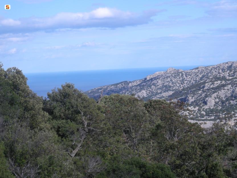
Image credits Sardegna Digital Library Regione Sardegna
Results
Pathways Ghenna 'e Peta - Cala Luna (B 181)
Sentiero Italia (Stage Z13) Dorgali - Sa Barva Loc. Surtana
Overview of the itinerary
Sentiero Italia runs the length of the island’s eastern side, covering its most important mountains, in 28 stages. Starting from the north: it flanks the Monte Limbara massif, crosses the limestones of Mont’Albo and Tuttavista, skirting the Gulf of Orosei, it crosses the Supramonte, Gennargentu and the Tacchi of Ogliastra and reaches Perdasdefogu. Further south, it passes through Armungia and the Gerrei sub-region. Lastly, it touches on the villages of Burcei and San Gregorio, continuing on the Sette Fratelli massif to the old prisons of Castiadas.
General information on Sentiero Italia (Grand Italian Trail)
Sentiero Italia, or Grand Italian Trail, as also explained on the official website, is a walking route that crosses the whole of Italy, using mainly but not exclusively “registered trails”.
In particular, in Sardinia, not all the stages of the Sentiero Italia of CAI (Italian Alpine Club) are made of trails already included in the registry of the Sardinia Trail Network (RES), either because they have not yet been tested and approved or simply because they cannot be registered as they do not meet the requirements. However, as a whole, the Sentiero Italia is the single longest walking route currently crossing Sardinia from the north (S. Teresa Gallura, stage Z 1) to the south (Castiadas, end of stage Z 28), touching on the most fascinating mountain areas in central-eastern Sardinia: the plateau of Buddusò, Tepilora, the Cedrino river valley, the ancient forests of Montes, Perda Liana and the regional forest of Montarbu, Monte Genis, and lastly the regional forest of Settefratelli (among the many crossed by the various stages of this long hiking itinerary).
Information on this stage of the trail
This stage begins by retracing your steps on the paved path, whence you came from Orosei, to the start point of the Iscala Omines, which you will leave on our left to continue towards the old tunnel built in 1863 to connect the town to the sea where the small town of Cala Gonone has since developed.
After walking through the tunnel, you will reach the ridge of the mountain above state road SS 125. Follow a very scenic path in a south-southwesterly direction to the Suttaterra area, passing near a fascinating natural arch.
A steep downhill stretch then leads to road SS 125 (Orientale Sarda) below, which you need to follow for about 550 m. Leaving the road, near the entrance to the ‘Sa Pruna’ Forest, continue downhill, first on a dirt road and then on a well-maintained path, to reach and ford the Rio Flumineddu stream near the path leading to the Gorroppu gorge.
Continuing in a northerly direction and passing the turnoff for the S’Abba Arva bridge you will easily reach the stop point of Surtana. You will find water in the Forest, at a spring along the route. Please note there are no permanent reception facilities at the Surtana stop point. We suggest booking logistical support with Mr Salvatore Fancello, aka Baddore, at 3470086640, owner of an accommodation facility about 800 m from Surtana. We also recommend the utmost caution when walking on the short stretch of the SS 125 road, which is a favourite road of motorcyclists, especially in spring and summer.
Informazioni utili
Tipologia itinerario
- Log in to post comments
Photogallery
gola gorroppu sanna nicola.jpg
La gola di Gorroppu .jpg
gorroppu 2.jpg
su gorroppu 2.jpg
gorroppu monia mura .jpg
su gorroppu monia mura.jpg
panoramica Gorroppu.jpg
Sul sentiero presso Tiscali(481).jpg
La salita verso Monte Tiscali (481).jpg
Sa Curtigia di Tiscali (Partenza 480).jpg
Il villaggio di Tiscali nella grande dolina.jpg
Paesaggio collinare di su Gorroppu.jpg
Dorgali, rio Flumineddu_0.jpg
Sentiero Italia (Tappa Z13) Dorgali - Sa Barva Loc. Surtana
In sintesi
Il Sentiero Italia attraversa in lunghezza il settore orientale dell’isola toccandone i sistemi montuosi più rilevanti, in 28 tappe. Partendo da nord: tocca il massiccio del Monte Limbara, attraversa i calcari del Mont'Albo e del Tuttavista sfiorando il Golfo di Orosei, attraversa il Supramonte, il Gennargentu, i Tacchi dell’Ogliastra e giunge a Perdasdefogu. Più a sud, transita da Armungia e dalla subregione del Gerrei. Infine tocca l’abitato di Burcei e San Gregorio, per continuare nel massiccio dei Sette Fratelli fino alle vecchie carceri di Castiadas.
Informazioni generali sull'itinerario sentiero Italia
Il Sentiero Italia, come spiegato anche nel sito ufficiale, è un itinerario (o Cammino) lungo tutta l'Italia, che utilizza prevalentemente ma non esclusivamente "sentieri accatastati".
In particolare, in Sardegna, non tutte le tappe del Sentiero Italia del CAI coincidono con sentieri già inseriti nel catasto della Rete Escursionistica della Sardegna (RES), perché non hanno ancora superato le verifiche di percorribilità oppure semplicemente perché non possono essere accatastati non avendone i requisiti. Tuttavia, nel suo insieme, il Sentiero Italia rappresenta l'unica, la più grande dorsale escursionistica che attraversa attualmente la nostra Isola da nord (S. Teresa Gallura, tappa Z 1) a sud (Castiadas, fine tappa Z 28) toccando le aree montane della Sardegna centro-Orientale più affascinanti: l'altopiano di Buddusò, Tepilora, la valle del Cedrino, i boschi vetusti di Montes, Perda Liana e la foresta demaniale di Montarbu, il Monte Genis, e infine la foresta demaniale di Settefratelli (tra le tante attraversate dal lungo itinerario escursionistico a tappe).
Info sul percorso di questa tappa
La tappa inizia percorrendo a ritroso il viale lastricato, percorso in arrivo da Orosei, fino all’inizio della Iscala Omines che lasceremo alla nostra sinistra per proseguire verso la vecchia Galleria realizzata nel 1863 per collegare il centro abitato al mare dove attualmente esiste il centro di Cala Gonone.
Attraversata la galleria si raggiunge la cresta della montagna soprastante la SS 125 e si percorre un sentiero molto panoramico in direzione sud-sudovest fino alla zona di Suttaterra, in prossimità di un arco naturale molto caratteristico.
Un successivo tratto in forte pendenza permette di raggiungere la sottostante SS 125 (Orientale Sarda), che si percorre per circa 550 m. Lasciata la strada statale, nei pressi dell’ingresso del Presidio Forestale “Sa Pruna”, si prosegue in discesa, prima su strada sterrata e poi su un sentiero ben curato, per raggiungere e guadare il rio Flumineddu in prossimità del sentiero per la gola di Gorroppu.
Proseguendo in direzione nord e superata la deviazione per il ponte di S’Abba Arva si arriva facilmente al posto tappa di Surtana. Possibile l’approvvigionamento idrico all’interno del Presidio Forestale, in una sorgente lungo il percorso. Da evidenziare la mancanza di strutture stabili di accoglienza nel posto tappa di Surtana. Si consiglia di concordare preventivamente il supporto logistico col sig. Salvatore Fancello, noto Baddore, al n. 3470086640, titolare di una struttura ricettiva distante da Surtana circa 800 m. Si raccomanda, inoltre, la massima attenzione nel breve tratto di S.S. 125, molto frequentata, soprattutto in primavera – estate, da gruppi di motociclisti.
Informazioni utili
Lungo il percorso non sarà sempre presente la copertura telefonica
Tipologia itinerario
- Log in to post comments
Photogallery
gola gorroppu sanna nicola.jpg
La gola di Gorroppu .jpg
gorroppu 2.jpg
su gorroppu 2.jpg
gorroppu monia mura .jpg
su gorroppu monia mura.jpg
panoramica Gorroppu.jpg
Sul sentiero presso Tiscali(481).jpg
La salita verso Monte Tiscali (481).jpg
Sa Curtigia di Tiscali (Partenza 480).jpg
Il villaggio di Tiscali nella grande dolina.jpg
Paesaggio collinare di su Gorroppu.jpg
Dorgali, rio Flumineddu_0.jpg