Start website main content

Nordic Walking

51 pathways

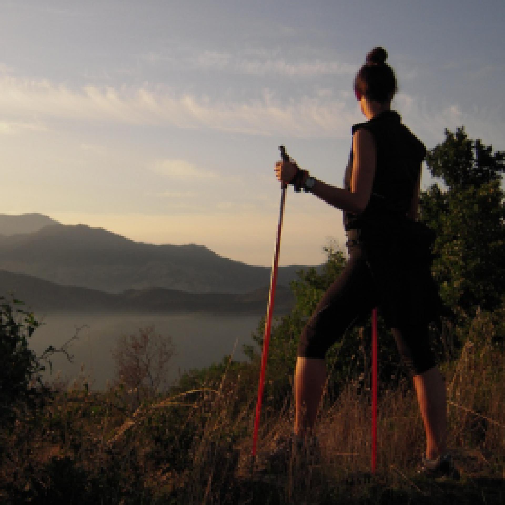
La camminata nordica o camminata con bastoni (in inglese nordic walking o pole walking) è attività fisica e sportiva che ben si coniuga con percorsi in bosco, in pianura o in vallate, lungo scogliere o spiagge.  La Rete dei sentieri della Sardegna offre tantissime occasioni per cimentarsi nella camminata nordica... 

Nordic-walking.png

Results

Gadoni, Foresta Corongia. Between breccas and disterrus

Access 

Depart from the centre of Gadoni along the SP2 in the direction of Seulo, then turning right onto the tarmac road in the direction of Funtana Raminosa. This beautiful road partly follows the miners' old route and runs alongside the allotments and orchards that they tended everyday, on their way to the mine, as they left the village. You gradually gain altitude, with increasingly broader views of the Flumendosa valleys, then you approach the buildings of the abandoned mine that occupies the Riu Saraxinus valley. The mining complex can be visited (www.visitgadoni.info) and a visit is highly recommended. Continue uphill for a few more kilometres until it ends, turning left and following the signs for Foresta Corongia on a partially unsurfaced road. When the road flattens out, you reach the Bauzzoni picnic area, where you leave the car. 

Su Campalini 

Continue on a dirt road on foot, ignoring some minor detours and turning left at the only obvious fork. Just below the road, reachable with some difficulty and unmarked, are the caves of Grutas de Perdu, with a scenic waterfall descending from the vault. The road you follow is now level, beneath a beautiful woodland area where you can identify the circular clearings, devoid of vegetation, where the charcoal burners built their threshing floors for the production of charcoal. Halfway along the long straight stretch, you come to a wooden signpost indicating Su Campalini: you leave the main dirt road and enter the woods, reaching the vertiginous edge of the Lartinatzu walls: here Foresta Corongia precipitates towards the Flumendosa riverbed and here stands a slender and bold rocky pinnacle, almost a bell tower, as its name in Sardinian seems to suggest.

Is Breccas 

After a long panaoramic rest andbreak, you return to the dirt road continuing in a southerly direction until you come to a large fork in the road: Here you turn right, uphill, past a gate and continue on the main road. Soon the road becomes flat again, on clay soil and begins to skirt some unique isolated rock towers that become more and more numerous, until they form a veritable labyrinth of walls, caves, crevices and diaclasas. The area is known as Is Breccas and was the kingdom of shepherds and the bandit Torracorti, who lived over a century ago. 

Su Pinneddu 

Exploring the labyrinth of Is Breccas is worth every minute spent and various floristic endemisms can be recognised in the walls, as you walk along the slender paths that follow the audacious conformations of the rock. You then continue along a dirt road until it emerges from the forest: here, on the right, stands an isolated tower known as Su Pinneddu. The road joins a main dirt track which you follow to the right, beginning to descend and reaching, after a long stretch in the forest, the first fork encountered on the way. Here you turn left, shortly reaching the Bauzzoni area and the car.

Itinerary roadbook

Lenght 25.600 m

Gadoni.gpx

Total elevation gain 1 022 metri

Gadoni, Foresta Corongia. Tra breccas e disterrus

Accesso 

Si parte dal centro abitato di Gadoni percorrendo la SP2 in direzione Seulo, prendendo poi a destra per strada asfaltata in direzione di Funtana Raminosa. La bella strada ricalca in parte la viabilità dei minatori e costeggia gli orti ed i frutteti che essi curavano recandosi alla miniera ogni giorno, partendo dal paese. Si guadagna gradualmente quota, con vista sempre più ampia sulle vallate del Flumendosa, addentrandosi poi tra gli edifici della miniera abbandonata che occupa la valle del Riu Saraxinus

Il complesso minerario è oggi visitabile (www.visitgadoni.info) e la sua visita è fortemente consigliata. Si procede ancora in salita per alcuni km finché essa termina, prendendo a sinistra e seguendo le indicazioni per Foresta Corongia su strada parzialmente sterrata. Quando la strada si spiana si raggiunge l’area attrezzata di Bauzzoni, dove si lascia l’auto. 

Su Campalini 

Si prosegue su strada sterrata a piedi, ignorando alcune deviazioni secondarie e prendendo a sinistra all’unico bivio evidente. Poco sotto la strada, raggiungibili con qualche difficoltà e non segnalate, si incontrerebbero le grotte di Grutas de Perdu, con una scenografica cascata che discende dalla volta. La strada che si percorre è ora in piano, sotto un bel bosco dove si riconoscono gli spiazzi circolari e privi di vegetazione dove i carbonai costruivano le loro aie per la produzione del carbone da legna. 

A metà del lungo rettilineo si incontra un cartello in legno che segnala Su Campalini: si abbandona la sterrata principale e ci si inoltra nel bosco, raggiungendo il ciglio vertiginoso delle pareti di Lartinatzu: qui Foresta Corongia precipita verso il greto del Flumendosa e qui si staglia un pinnacolo roccioso esile ed ardito, quasi un campanile, come il nome in sardo pare suggerire. 

Is Breccas 

Dopo una lunga sosta panoramica si ritorna sulla strada sterrata continuando in direzione sud finché si incontra un grosso bivio: qui si prende a destra, in salita, oltrepassando un cancello e proseguendo sulla strada principale. Ben presto la strada ritorna in piano, su terreno argilloso e comincia a costeggiare dei singolari torrioni isolati di roccia che divengono sempre più numerosi, fino a formare un vero e proprio labirinto di pareti, grotte, fenditure e diaclasi. La zona è nota come Is Breccas ed era il regno di pastori e del bandito Torracorti, vissuto oltre un secolo fa. 

Su Pinneddu 

L’esplorazione del labirinto di Is Breccas vale ogni minuto speso e nelle pareti si potranno riconoscere vari endemismi floristici, mentre si percorrono gli esili sentieri che seguono le ardite conformazioni della roccia. Si prosegue quindi ancora su sterrata finché essa esce dal bosco: qui, sulla destra, si staglia un torrione isolato noto come Su Pinneddu. La strada si congiunge ad una sterrata principale che si segue verso destra, cominciando a scendere ed raggiungendo dopo un lungo tratto nel bosco il primo bivio incontrato all’andata. Qui si prende a sinistra, raggiungendo in breve la zona di Bauzzoni e l’auto.

Itinerary roadbook

Lenght 25.600 m

Gadoni.gpx

Total elevation gain 1 022 metri

Sentiero Italia (Stage Z18) Separadorgiu - Terra Ona

Overview of the itinerary

Sentiero Italia runs the length of the island’s eastern side, covering its most important mountains, in 28 stages.  Starting from the north: it flanks the Monte Limbara massif, crosses the limestones of Mont’Albo and Tuttavista, skirting the Gulf of Orosei, it crosses the Supramonte, Gennargentu and the Tacchi of Ogliastra and reaches Perdasdefogu.  Further south, it passes through Armungia and the Gerrei sub-region. Lastly, it touches on the villages of Burcei and San Gregorio, continuing on the Sette Fratelli massif to the old prisons of Castiadas.

General information on Sentiero Italia (Grand Italian Trail)

Sentiero Italia, or Grand Italian Trail, as also explained on the official website, is a walking route that crosses the whole of Italy, using mainly but not exclusively “registered trails”.   
In particular, in Sardinia, not all the stages of the Sentiero Italia of CAI (Italian Alpine Club) are made of trails already included in the registry of the Sardinia Trail Network (RES), either because they have not yet been tested and approved or simply because they cannot be registered as they do not meet the requirements.  However, as a whole, the Sentiero Italia is the single longest walking route currently crossing Sardinia from the north (S. Teresa Gallura, stage Z 1) to the south (Castiadas, end of stage Z 28), touching on the most fascinating mountain areas in central-eastern Sardinia: the plateau of Buddusò, Tepilora, the Cedrino river valley, the ancient forests of Montes, Perda Liana and the regional forest of Montarbu, Monte Genis, and lastly the regional forest of Settefratelli (among the many crossed by the various stages of this long hiking itinerary).

Information on this stage of the trail

This is a medium-length stage that initially traces back a short stretch of stage Z17 and then continues in a southerly direction after leaving the dirt track. 

Walk along a trail recently traced by the Forestas Regional Agency, which will take you to the Bruncu Spina car park (Sardinia’s one and only ski area). Continue in a south-easterly direction and, after passing alongside Punta Paulinu following the contour line at about 1680 metres asl, you will arrive at a meeting point between two paths near Arcu Gennargentu (1650 asl). Continue along the ridge, crossing Punta La Marmora and, once you get to N39.98703° E9.32408°, take the path to your right in a south-westerly direction that takes you downhill to Arcu Sa Turzi (1604 m asl) and then continue in a southerly direction after a short bend to the east. Following the course of a stream, at elevations varying between 1440 and 1300 m asl, you will reach the Cuile Strumpu at about 1100 m asl, after paying a visit to the Nuragic village of Sa Idda ’e Ruinas

Continue on the dirt track until you reach the Cuile Prediargiu, which you will leave on your left to take a path, for about 3 km, currently marked with stone cairns, that leads to another dirt track heading north to the stop point of Terra Ona

This is a very scenic but fairly challenging stage without easy access to water. Warning: the trail may be exposed to fog.

Itinerary roadbook

Lenght 22.700 m

SI Z18.gpx

Total elevation gain 1 047 metri

Sentiero Italia (Tappa Z18) Separadorgiu - Terra Ona

In sintesi

Il Sentiero Italia attraversa in lunghezza il settore orientale dell’isola toccandone i sistemi montuosi più rilevanti, in 28 tappe.  Partendo da nord: tocca il massiccio del Monte Limbara, attraversa i calcari del Mont'Albo e del Tuttavista sfiorando il Golfo di Orosei,  attraversa il Supramonte, il Gennargentu, i Tacchi dell’Ogliastra e giunge a Perdasdefogu.  Più a sud, transita da Armungia e dalla subregione del Gerrei. Infine tocca l’abitato di Burcei e San Gregorio, per continuare nel massiccio dei Sette Fratelli fino alle vecchie carceri di Castiadas.

Informazioni generali sull'itinerario sentiero Italia

Il Sentiero Italia, come spiegato anche nel sito ufficiale, è un itinerario (o Cammino) lungo tutta l'Italia, che utilizza prevalentemente ma non esclusivamente "sentieri accatastati".   
In particolare, in Sardegna, non tutte le tappe del Sentiero Italia del CAI coincidono con sentieri già inseriti nel catasto della Rete Escursionistica della Sardegna (RES), perché non hanno ancora superato le verifiche di percorribilità oppure semplicemente perché non possono essere accatastati non avendone i requisiti.  Tuttavia, nel suo insieme, il Sentiero Italia rappresenta l'unica, la più grande dorsale escursionistica che attraversa attualmente la nostra Isola da nord (S. Teresa Gallura, tappa Z 1) a sud (Castiadas, fine tappa Z 28) toccando le aree montane della Sardegna centro-Orientale più affascinanti: l'altopiano di Buddusò, Tepilora, la valle del Cedrino, i boschi vetusti di Montes, Perda Liana e la foresta demaniale di Montarbu, il Monte Genis, e infine la foresta demaniale di Settefratelli (tra le tante attraversate dal lungo itinerario escursionistico a tappe).

Info sul percorso di questa tappa

Tappa di media lunghezza che ripercorre inizialmente un breve tratto della tappa Z17 per poi proseguire, in direzione sud, dopo aver lasciato la sterrata. 

Si cammina in un sentiero recentemente realizzato dall’Agenzia Regionale Fo.Re.S.T.A.S. che ci porta al parcheggio di Bruncu Spina (il sogno della Sardegna di poter avere impianti sciistici). Si prosegue in direzione sud-est e dopo aver costeggiato Punta Paulinu seguendo la curva di livello a circa 1680 slm, arriviamo ad una confluenza di sentieri in prossimità di Arcu Gennargentu (1650 slm). Continuiamo in cresta, attraversiamo Punta La Marmora ed arrivati a N39.98703° E9.32408° si prende il sentiero alla nostra destra in direzione sud-ovest che ci porta in discesa verso Arcu Sa Turzi (1604 slm) per poi proseguire in direzione sud dopo un breve tornante verso est. Costeggiando un corso di un rio, a quote variabili fra 1440 me 1300 raggiungiamo su sterrata il cuile Strumpu a circa 1100 slm, dopo aver visitato precedentemente il villaggio nuragico Sa Idda ‘e Ruinas

Continuiamo sulla sterrata per giungere nei pressi del cuile Prediargiu che lasceremo alla nostra sinistra per prendere un sentiero, per circa 3 km, attualmente segnalato con omini di pietra che ci porta ad una successiva sterrata in direzione nord del posto tappa di Terra Ona

Tappa molto panoramica ma abbastanza impegnativa con difficoltà di approvvigionamento idrico. Attenzione in caso di nebbia.


Informazioni utili

Lungo il percorso non sarà sempre presente la copertura telefonica

Itinerary roadbook

Lenght 22.700 m

SI Z18.gpx

Total elevation gain 1 047 metri

Sentiero Italia (Stage Z19) Terra Ona - Caserma Forestale Montarbu

Overview of the itinerary

Sentiero Italia runs the length of the island’s eastern side, covering its most important mountains, in 28 stages.  Starting from the north: it flanks the Monte Limbara massif, crosses the limestones of Mont’Albo and Tuttavista, skirting the Gulf of Orosei, it crosses the Supramonte, Gennargentu and the Tacchi of Ogliastra and reaches Perdasdefogu.  Further south, it passes through Armungia and the Gerrei sub-region. Lastly, it touches on the villages of Burcei and San Gregorio, continuing on the Sette Fratelli massif to the old prisons of Castiadas.

General information on Sentiero Italia (Grand Italian Trail)

Sentiero Italia, or Grand Italian Trail, as also explained on the official website, is a walking route that crosses the whole of Italy, using mainly but not exclusively “registered trails”.   
In particular, in Sardinia, not all the stages of the Sentiero Italia of CAI (Italian Alpine Club) are made of trails already included in the registry of the Sardinia Trail Network (RES), either because they have not yet been tested and approved or simply because they cannot be registered as they do not meet the requirements.  However, as a whole, the Sentiero Italia is the single longest walking route currently crossing Sardinia from the north (S. Teresa Gallura, stage Z 1) to the south (Castiadas, end of stage Z 28), touching on the most fascinating mountain areas in central-eastern Sardinia: the plateau of Buddusò, Tepilora, the Cedrino river valley, the ancient forests of Montes, Perda Liana and the regional forest of Montarbu, Monte Genis, and lastly the regional forest of Settefratelli (among the many crossed by the various stages of this long hiking itinerary).

Information on this stage of the trail

This is a medium-length stage that initially retraces a short section of stage Z18 and then continues in a southerly direction on a dirt track that leads to Cuile Gidinis and, from there, in a south-easterly direction until it arrives at the road and the bridge that crosses the Rio Pirincanes stream. Travel along this road for a short distance before turning, after a couple of bends, in an easterly direction, then south, towards Perda Liana, which you will reach on the path that begins at the car park, after crossing road SS 389. 

Follow the clearly visible path, keeping to the right at the next fork (the path to the left rejoins with this one after a much longer loop). The Perda Liana rock tower, a natural monument and symbol of the Ogliastra area, is visible from all sides as it stands on top of a hill. According to local legend, it once marked the entrance to the underworld. 

Leaving Perda Liana behind you, continue in a southerly direction. After a bend to the north, the trail then heads south-west passing by Su Stampu, an impressive sinkhole about 50 m deep (N39.89595° E9.39277°). 

Continue, still at high elevation, along the valley of the Flumendosa river to reach the summit of Pizzu Margiani Pubusa (1325 m asl) where there is a fire lookout. 

From this summit, the descent towards the Montarbu stop point (874 m asl) begins, on a beautiful path through the forest in a southerly direction (at this fork N39.88223° E9.38695° turn right) with several springs along the path, running alongside a stream which in Spring has several small waterfalls.

This is a very scenic stage, particularly after passing Perda Liana, but it is fairly challenging.

Notes

At the Montarbu stop point there is a Fo.Re.S.T.A.S. station, where it is currently possible to stay overnight pitching a tent.

Lenght 19.700 m

SI Z19.gpx

Total elevation gain 1 114 metri

Sentiero Italia (Tappa Z19) Terra Ona - Caserma Forestale Montarbu

In sintesi

Il Sentiero Italia attraversa in lunghezza il settore orientale dell’isola toccandone i sistemi montuosi più rilevanti, in 28 tappe.  Partendo da nord: tocca il massiccio del Monte Limbara, attraversa i calcari del Mont'Albo e del Tuttavista sfiorando il Golfo di Orosei,  attraversa il Supramonte, il Gennargentu, i Tacchi dell’Ogliastra e giunge a Perdasdefogu.  Più a sud, transita da Armungia e dalla subregione del Gerrei. Infine tocca l’abitato di Burcei e San Gregorio, per continuare nel massiccio dei Sette Fratelli fino alle vecchie carceri di Castiadas.

Informazioni generali sull'itinerario sentiero Italia

Il Sentiero Italia, come spiegato anche nel sito ufficiale, è un itinerario (o Cammino) lungo tutta l'Italia, che utilizza prevalentemente ma non esclusivamente "sentieri accatastati".   
In particolare, in Sardegna, non tutte le tappe del Sentiero Italia del CAI coincidono con sentieri già inseriti nel catasto della Rete Escursionistica della Sardegna (RES), perché non hanno ancora superato le verifiche di percorribilità oppure semplicemente perché non possono essere accatastati non avendone i requisiti.  Tuttavia, nel suo insieme, il Sentiero Italia rappresenta l'unica, la più grande dorsale escursionistica che attraversa attualmente la nostra Isola da nord (S. Teresa Gallura, tappa Z 1) a sud (Castiadas, fine tappa Z 28) toccando le aree montane della Sardegna centro-Orientale più affascinanti: l'altopiano di Buddusò, Tepilora, la valle del Cedrino, i boschi vetusti di Montes, Perda Liana e la foresta demaniale di Montarbu, il Monte Genis, e infine la foresta demaniale di Settefratelli (tra le tante attraversate dal lungo itinerario escursionistico a tappe).

Info sul percorso di questa tappa

Tappa di media lunghezza che ripercorre inizialmente un breve tratto della tappa Z18 per poi proseguire in direzione S su sterrata che porta al cuile Gidinis e da questo in direzione sud-est per arrivare alla strada ed al ponte che attraversa il rio Pirincanes. Strada che percorriamo per un breve tratto per poi deviare, dopo un paio di tornanti, in direzione est, successivamente a sud, verso Perda Liana che raggiungiamo sul sentiero che inizia al parcheggio, dopo aver superato la SS 389. 

Il sentiero ben visibile lo percorriamo tenendo la destra nel successivo bivio (il percorso a sinistra si ricongiunge dopo aver fatto un giro molto più ampio). Il torrione di Perda Liana, monumento naturale e simbolo dell’Ogliastra è visibile a 360° in quanto situato sulla sommità di un rilievo. Nelle legende popolari divenne l’ingresso degli inferi. 

Lasciato il torrione alle nostre spalle continuiamo in direzione sud, fatto un’ansa con direzione nord riprendiamo verso sud-ovest per andare a vedere la voragine Su Stampu, inghiottitoio profondo circa 50 metri (N39.89595° E9.39277°). 

Si prosegue, sempre in quota, costeggiando la valle del fiume Flumendosa per giungere alla sommità di Pizzu Margiani Pubusa (1325 slm) dove è presente una vedetta antincendio. 

Da questa vetta inizia la discesa verso il posto tappa di Montarbu (874 slm) percorrendo in direzione sud un bel sentiero immerso nel bosco (in questo bivio N39.88223° E9.38695° prendere verso destra) con diverse sorgenti che si trovano lungo il sentiero costeggiando un torrente con numerose cascatelle presenti nel periodo primaverile.

Tappa molto panoramica, in particolare nella parte successiva al torrione, ma abbastanza impegnativa.

Note

Nel posto tappa Montarbu è presente una caserma dell'Agenzia Regionale Fo.Re.S.T.A.S. dove al momento è possibile il pernottamento con tenda.

Lenght 19.700 m

SI Z19.gpx

Total elevation gain 1 114 metri

Cucchinadorza - Gavoi

This itinerary ideally follows the course of the Taloro river between Lake Gusana and Lake Cuchinador-za a little further downstream, also known as Lake Taloro. At the start of the itinerary, you will admire Lake Gusana from above, then the route will take you almost to the shore of Lake Cuchinadorza, allow-ing you with a short detour to arrive above the dam, which also serves as the bridge of Provincial Road 4. Reaching the main route again, the climb begins on a historic road, characterised by stone walls in place of the guard-rail. Next is Provincial Road 29, characterised by gentle slopes and beautiful scen-ery. Another attraction is the large granite rock of Punta Manna and, once you reach the outskirts of Ollolai, you return to Gavoi on a fun technical downhill path that used to be a fast communication route between the two villages.

Informazioni utili

The LEADER Territory of the Local Action Group (GAL) Rural District Barbagia Mandrolisai Gennargentu (BMG)

Consisting of the Union of Municipalities of Barbagia and the Mountain Community of Gennargentu Mandrolisai. The GAL BMG, therefore, includes 19 municipalities, with a total area of 854.30 sq km and a resident population of approximately 22,000 inhabitants: Aritzo, Atzara, Austis, Belvì, Desulo, Gadoni, Gavoi, Lodine, Meana Sardo, Ollolai, Oniferi, Olzai, Ortueri, Ovodda, Sarule, Sorgono, Teti, Tiana, Tonara.

The GAL Rural District BMG, established in 2009, is a participation foundation composed of 22 public members and over 200 private members, representing the main institutional, economic, and social components of the territory. The foundation aims to improve the quality of life and well-being of communities in the historical regions of Barbagia, Mandrolisai, and Gennargentu by enhancing local resources. The main thematic and intervention areas identified by the GAL BMG for the definition of its Local Development Strategy 2014-2022 are the development and innovation of local production chains and systems, social inclusion, and sustainable tourism.

THE OAST PROJECT: OUTDOOR ACTIVITIES FOR SUSTAINABLE TOURISM

The project, coordinated by the GAL BMG in partnership with the GAL Sisteron-Buëch (France) and the GAL Kilkenny (Ireland), aims to promote sustainable and active tourism in rural areas of Europe. The specific objective of the project was to enhance and develop the tourist attractiveness of the inland waters of Barbagia, through outdoor sports and water activities, in line with the thematic area "sustainable tourism" chosen in the GAL BMG's PDA. The three territories involved boast a rich and varied natural, landscape, and cultural heritage with strong identity traits and enormous potential for the development of active tourism. However, some problems common to all partners have been highlighted, such as: insufficient enhancement and tourist promotion of inland areas, isolation, the absence of an international network useful for the exchange of good practices, and insufficient diversification, delocalization, deseasonalization, and internationalization of tourist flows. The OAST Project was created to respond to these critical issues, as active tourism and sustainable tourism represent the basis for the revival of territories characterized by enormous problems of depopulation, lack of services, unemployment, and school dropout. The idea, therefore, is to promote forms of sustainable, active, responsible, and experiential tourism, as well as to offer diversified and deseasonalized solutions suitable for a constantly growing number of active tourists. The specific action involved the georeferencing and description, in Italian and English, of 19 GAL BMG itineraries related to the theme of water. The itinerary tracks are available and downloadable, in Gpx format, on these pages and also on the GAL BMG's Wikiloc account.

Lenght 23.800 m

Gavoi - Cucchinadorza.gpx

Total elevation gain 1 115 metri

Geographical area Barbagia

Contiene carte
Spento

Cucchinadorza - Gavoi

AVVERTENZE

QUESTO ITINERARIO è riportato "tal quale" a titolo informativo e di mera recensione/ricognizione degli itinerari presenti nel territorio  -  come fornito e recensito dal progetto OAST condotto dal GAL BMG nel 2024. 
NOTA: Molti itinerari sono composti da percorsi stretti e richiedono una cura periodica della vegetazione, al momento non assicurata da una gestione  di tipo  ufficiale, non essendo il tracciato inserito nella"rete escursionistica della Sardegna".  
Nota 2: Prima di recarvi sul posto si consiglia di raccogliere informazioni sullo stato di fruibilità, presso il comune competente, per avere certezza dell'effettiva percorribilità dell'itinerario scelto.

IL PERCORSO IN PILLOLE (elementi informativi essenziali)

Gavoi è famoso per il lago di Gusana, il più grande e il più alto dei tre invasi del fiume Taloro che poi confluisce nel Tirso all’estremità del lago Omodeo. Questo itinerario segue idealmente il corso del Taloro tra il lago di Gusana e il lago Cuchinadorza poco più a valle, chiamato anche lago Taloro. Il lago di Gusana si ammira dall’alto - le sue rive sono a circa 640 m di quota mentre l’itinerario, nella strada di Sa Matta, si sviluppa a quota 840 m - in compenso la discesa nella prima metà del percorso ci porta quasi in riva al lago Cuchinadorza, a quota 360 m, permettendoci con una breve deviazione lineare di arrivare fin sopra la diga, che fa anche da ponte della Strada Provinciale 4. Siamo nel punto più basso di tutto l’itinerario e, raggiunto nuovamente il percorso anulare, la salita inizia su una sterrata con una pendenza lieve e costante. Si tratta di una strada storica, caratterizzata da muretti in pietra al posto del guard-rail, probabilmente  ’antenata della Strada Provinciale 4 prima che in quel tratto venisse ricostruita poco più a ovest con un segmento più breve e più ripido. Dopo è la volta della Strada Provinciale 29, anch’essa caratterizzata da pendenze lievi e bei paesaggi, che la faranno sembrare più breve dei suoi quasi 8 km di lunghezza. Prima ammiriamo il Monte Pitzuri, a destra per chi sale, facilmente riconoscibile per la sua forma regolare con due cime rocciose alla stessa altezza e una sella tra loro. In realtà c’è una differenza minima: Punta Pitzuri (quella a sud-ovest) è alta 883 m e Punta Arreori (quella a nord-est) 875 m slm, mentre la parte più bassa della sella è a 840 m slm. Altra attrattiva, questa volta a sinistra per chi sale, è la grande rocca granitica di Punta Manna, che da qui apprezziamo nel suo versante sud. Una volta arrivati alla periferia di Ollolai, torniamo a Gavoi su un divertente sentiero tecnico in discesa che era una veloce via di comunicazione tra i due paesi. 

I quasi 8 km della Strada Provinciale 29 rendono quest’itinerario camminabile soltanto in alcune parti. La strada rurale di a Matta è già conosciuta e frequentata dalla popolazione di Gavoi per una passeggiata o una corsa a piedi, ma ci si ferma al termine dell’asfalto, prima che inizi la discesa per il lago Cuchinadorza. Una buona soluzione potrebbe essere completare il percorso fino a questo lago, circa 9 km di prevalente discesa, con appena 100 m di dislivello in salita, e organizzarsi preventivamente un transfer per il rientro a Ollolai e dunque a Gavoi. Altro tratto camminabile è quello tra Gavoi e Ollolai, appena 1,5 km, una buona risorsa non soltanto per lo svago ma anche per i collegamenti quotidiani tra i due centri, a piedi o a cavallo, uscendo dalla schiavitù dell’automobile.

Informazioni utili

Il territorio LEADER del Gruppo di Azione Locale (GAL) Distretto Rurale Barbagia Mandrolisai Gennargentu (BMG) 

Costituito dall'Unione dei Comuni Barbagia e dalla Comunità Montana Gennargentu Mandrolisai. Il GAL BMG comprende, quindi, 19 comuni, per una superficie complessiva di 854,30 kmq e una popolazione residente pari a circa 22.000 abitanti: 

Aritzo, Atzara, Austis, Belvì, Desulo, Gadoni, Gavoi, Lodine, Meana Sardo, Ollolai, Oniferi, Olzai, Ortueri, Ovodda, Sarule, Sorgono, Teti, Tiana, Tonara.


Il GAL Distretto Rurale BMG, costituito nel 2009, è una Fondazione di partecipazione composta da 22 soci pubblici e oltre 200 privati, rappresentativi delle principali componenti istituzionali, economiche e sociali del territorio. La fondazione ha lo scopo di migliorare la qualità della vita e il benessere delle comunità nelle regioni storiche Barbagia, Mandrolisai e Gennargentu mediante la valorizzazione delle risorse locali.
I principali ambiti tematici e di intervento individuati dal GAL BMG per la definizione della propria Strategia di Sviluppo Locale 2014-2022 sono lo sviluppo e l’innovazione delle filiere e dei sistemi produttivi locali, l’inclusione sociale ed il turismo sostenibile.


IL PROGETTO OAST: OUTDOOR ACTIVITIES FOR SUSTAINABLE TOURISM

Il progetto, coordinato dal GAL BMG in partenariato con il GAL Sisteron-Buëch (Francese) e
il GAL Kilkenny (Irelanda), intende promuovere un turismo sostenibile e attivo nelle aree
rurali d’Europa.
L’obiettivo specifico del progetto è stato potenziare e sviluppare l’attrattività turistica delle acque
interne della Barbagia, attraverso gli sport all’aria aperta e le attività acquatiche, in coerenza con l’ambito tematico “turismo sostenibile” prescelto nel PDA del GAL BMG.
I tre territori coinvolti vantano un patrimonio naturalistico, paesaggistico e culturale ricco e variegato con forti caratteri identitari ed enormi potenzialità di sviluppo di turismo attivo
Tuttavia, sono stati evidenziati alcuni problemi comuni a tutti i partner, quali: l’insufficiente valorizzazione e promozione turistica delle aree interne, l’isolamento, l’assenza di un network internazionale utile per lo scambio di buone prassi, e l’insufficiente diversificazione, delocalizzazione, destagionalizzazione e l’internazionalizzazione dei flussi turistici. Il Progetto OAST nasce per rispondere a queste criticità, in quanto il turismo attivo ed il turismo sostenibile rappresentano la base di rilancio dei territori caratterizzati da enormi problemi di spopolamento, carenza di servizi, disoccupazione e dispersione scolastica.
L’idea, quindi è promuovere forme di turismo sostenibile, attivo, responsabile ed esperienziale, nonché
offrire soluzioni diversificate e destagionalizzate adatte ad un numero di turisti attivi in continua crescita.
L’azione specifica ha previsto la georeferenziazione e descrizione, in lingua italiana e inglese, di
19 itinerari del GAL BMG legati al tema dell’acqua. Le tracce degli itinerari sono disponibili e scaricabili, in formato Gpx, in queste pagine e anche nell’account Wikiloc del GAL BMG

Lenght 23.800 m

Gavoi - Cucchinadorza.gpx

Total elevation gain 1 115 metri

Geographical area Barbagia

Contiene carte
Spento

Meana, Ortuabis. The ancient crossroads

Access 

From the inhabited village of Meana, the Ortuabis plateau can be reached via the SS 128 road by car and bicycle, or by following the signs for the nuraghe Nolza at the exit of the village. This leads to a fine asphalt road that proceeds on a lonely descent into the valley, reaching below the forest, the first fork at the bottom of the valley, where you take a right turn. 

The vineyards and the Nuraghe 

You continue uphill, on a ridge from which there is a beautiful view of the village. The more wooded areas are behind you and you find yourself on rolling hillsides occupied by beautiful vineyards. High up on a raised hill is the massive silhouette of the nuraghe Nolza. You continue along this road, always lined with vineyards and following the signs until you reach the ticket office. The expert tour guides and the extraordinary view from the top of the nuraghe make it an extraordinary and essential visit to discover this corner of Sardinia. 

The forest 

Leaving the nuraghe, turn right onto the asphalt road, keeping slightly above the railway. The road becomes a dirt track, slightly uphill: here you take a left and then a right, in quick succession, to finally return to the asphalt road where you take another right, slightly uphill, passing by a disused quarry and then into a beautiful wood where the gradient drops. Here you meet the SS128 again and where you can arrive by car, skipping the first part of the itinerary. Follow the public road on the right until the sign km 74, where there is a sign indicating the hiking trail. Here you enter the forest, pass an open barrier and begin to follow a slightly downhill dirt road. 

The kilns 

The road keeps a firebreak on the right and winds along the same route as the aqueduct on a limestone plateau, formerly used for the production of lime, which was produced in large furnaces. The dirt road gradually deteriorates and you come to a barely noticeable fork where you keep to the right to visit a large lime kiln, located on a gentle slope. You resume heading north on a barely noticeable path, sometimes getting off your bike and soon reaching the area where the Ortuabis reception area is located, currently awaiting management. Take the dirt road that serves the area, turning left once you have passed the larger structures and entering the forest, which also has numerous charcoal burners' farmyards. When you come to a fork in the road, you can take a left to visit a large kiln, then right again returning to route SS128 and, by the known road, retracing the outward route to the village.

Lenght 33.100 m

meana.gpx

Total elevation gain 1 193 metri