Start website main content

Accessible trails

1 pathway

Sentieri per tutti...in questa categoria rientrano i sentieri progettati o riadattati perchè il contatto con l'ambiente naturale sia sempre di stimolo al miglioramento della vita personale di chiunque, con attenzione alle condizioni di disabilità motoria, sensoriale o della sfera psichica e relazionale...

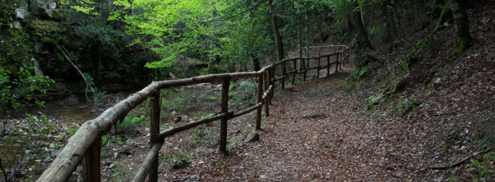
Rio Ermolinos.jpg

Results

CMSB - STAGE 06 – FROM PISCINAS TO MONTEVECCHIO

The stage is mostly uphill with an initial climb to reach the village of Ingurtosu.

You will discover some amazing examples of industrial archaeology in the disused mines of Ingurtosu and Montevecchio.

From the dune complex of Piscinas, you move on to the holm oak woods and to the Mediterranean scrub, where it is common to observe the Sardinian deer that populates this area.

Safety and useful tips

The stage does not present any particular difficulties, even though the route follows the SP04, which is an accessible dirt road.

In the first section, you have to cross twice the Rio Irvi, which flows alongside the road. If this watercourse is in flood and fording is not easy, it is advisable to take the main road, which in any case proceeds in the same direction as the route.

It is only when you reach the Church of Santa Barbara of Ingurtosu that you can take the SP04.18, an asphalted road where, despite the presence of few vehicles, you must pay attention when passing through, especially because of the turns that you find along the way. You will then reach the Management building after which you proceed following the SP 66, which is again a dirt road.

All along the way, you will come across several buildings dating back to the old mining activity, many of which are closed and secured; some others are not, but they are all in a state of disrepair and precarious stability. In order to avoid any problems or accidents, do not cross the fences and/or venture inside the ruined buildings of the old mining plants, but always admire them from a distance without leaving the Trail.

Informazioni utili

The stage presents a medium difficulty due to its mainly uphill development. The route has a length of 18.8 km, which can be covered in 6 hours and 30 minutes and has an altitude difference of 890 m uphill and downhill of 532 m.

FOR UPDATED INFORMATION, CONSULT THE STAGE SHEET ON THE OFFICIAL WEBSITE

Lenght 18.900 m

Links

tappa-06-da-piscinas-montevecchio.gpx

Total elevation gain 927 metri

Geographical area Iglesiente

Elevation gain 890 metri

Negative elevation 532 metri

CMSB - TAPPA 6: DA PISCINAS A MONTEVECCHIO

La tappa si sviluppa in prevalenza in salita con uno strappo iniziale per raggiungere il villaggio di Ingurtosu.

Durante il percorso si passa dal sistema dunale di Piscinas ai boschi di leccio e alla macchia mediterranea  nei quali è frequente l’incontro con esemplari del cervo sardo, animale molto presente in questo territorio.

La tappa si articola all'interno dell'incredibile patrimonio rappresentato dai monumenti di archeologia industriale presenti nelle miniere dismesse di Ingurtosu e Montevecchio.


Informazioni utili

La tappa presenta una difficoltà media a causa del suo sviluppo in prevalenza in salita. Il percorso ha una lunghezza di 18,8 km, percorribili in 6 ore e 30 minuti e un  dislivello  in salita di 890 m e in discesa  di 532 m.
PER LE INFORMAZIONI AGGIORNATE, CONSULTA LA SCHEDA DELLA TAPPA, SUL SITO UFFICIALE 

Il Cammino Minerario di Santa Barbara

Si tratta del primo, tra i cammini sardi, ad essere stato iscritto al registro istituito dalla Regione Sarda nel 2012 con DGR48/9 ("Registro dei cammini di Sardegna, degli itinerari religiosi e dello spirito"). Attualmente è gestito dall'omonima Fondazione.

LA STORIA DEL PROGETTO

L’idea di costruire un itinerario nell’area più estesa e rappresentativa del Parco Geominerario Storico Ambientale della Sardegna, il Sulcis-Iglesiente-Guspinese, riscoprendo gli antichi cammini minerari oggi in gran parte abbandonati, è nata dai volontari dell’Associazione ONLUS Pozzo Sella Per il Parco Geominerario a seguito della grande partecipazione dei cittadini alle escursioni organizzate dalla stessa associazione dopo aver reso fruibili numerosi percorsi minerari.

Con il Cammino Minerario di Santa Barbara si vuole perseguire l’obiettivo di tramandare la memoria degli uomini che nei secoli e nei millenni passati hanno realizzato e percorso gli antichi cammini minerari con il piacere di riscoprire a passo lento la bellezza del territorio.

Un Protocollo d’intesa è stato sottoscritto tra i Comuni di Iglesias, Buggerru, Fluminimaggiore, Arbus, Guspini, Gonnosfanadiga, Villacidro, Domusnovas, Musei, Villamassargia. Narcao, Nuxis, Santadi, Piscinas, Giba, Masainas, San Giovanni Suergiu, Sant’Antioco, Carbonia e Gonnesa, le Diocesi di Iglesias e di Ales Terralba, le Province di Carbonia Iglesias e del Medio Campidano, il Consorzio del Parco Geominerario Storico Ambientale della Sardegna, l’ANCI SARDEGNA e l’Associazione Pozzo Sella: si tratta di un  partenariato per la costruzione e la gestione dell’itinerario storico, culturale, ambientale e religioso denominato “Cammino Minerario di Santa Barbara”.

PER MAGGIORI INFORMAZIONI, DETTAGLI E INFO AGGIORNATE SULLE TAPPE

Si consiglia di consultare il sito ufficiale del cammino: www.camminominerariodisantabarbara.org/

Lenght 18.900 m

Links

tappa-06-da-piscinas-montevecchio.gpx

Total elevation gain 927 metri

Roadbook

Dal sistema dunale di Piscinas si passa ai boschi di leccio e alla macchia mediterranea, dove è frequente l’incontro con il cervo sardo che popola numeroso  questo territorio.

Geographical area Iglesiente

Elevation gain 890 metri

Negative elevation 532 metri

CMSB – STAGE 29 - FROM PORTOSCUSO TO BACU ABIS

From the culture and economy of the sea, you will return to the land of mines by walking along the spectacular volcanic cliffs of the south-west coast to reach the Bacu Abis mine, where mining activity began in the Sulcis coal basin.

While admiring the beauty of the coastal landscape, with a panorama reaching as far as the limestone cliffs of Masua, you will move from the industrial archaeology of the Seruci mine to the classical archaeology of the Nuragic settlement with the same name, retracing 3,500 years of history in just a few kilometres.

Safety and useful tips

The first part of the route runs through the centre of Portoscuso, so you need to pay attention to the presence of urban vehicular traffic. As you leave Capo Altano and the Portoscuso Pine Forest, there's a stretch that passes above the cliffs in the areas of Bucca de Flumini and Capo Giordano. The passage, although quiet and comfortable, presents an exposed part towards the cliff, therefore you must pay attention not to lean out and always stay at a distance from the edge of the cliff. After this suggestive stretch, you need to cross the SP 108 road, therefore it is necessary to pay attention to the presence of vehicular traffic. After passing the archaeological site of Nuraghe Seruci, you will reach once again the SP 108, on which you have to proceed for about 2.3 km in the direction of Terras ColluPay attention to vehicular traffic and try to proceed as much as possible on the embankment flanking the roadway. Upon arriving in the area of Terras Collu, as you go past the ruins of the Church of San Rocco, you need to cross the SP 126 road, therefore you must pay close attention to vehicular traffic. At the roundabout that leads to Bacu Abispay attention to the next crossing that you need to take in order to visit the Castoldi Palace. As you reach Bacu Abis, you have to walk through the roads of the village, therefore once again you need to pay attention to urban traffic.

The stage is long, so prepare yourself properly.

Informazioni utili

This is a challenging stage. The length of the route is 18.9 km which can be covered in 6 hours and 30 minutes and has an uphill difference in altitude of 459 m and a downhill difference of 386 m.

FOR UPDATED INFORMATION, CONSULT THE STAGE SHEET ON THE OFFICIAL WEBSITE

Lenght 19.000 m

Links

CMSB tappa-29-da-portoscuso-bacu-abis.gpx

Total elevation gain 443 metri

Geographical area Iglesiente

Elevation gain 459 metri

Negative elevation 386 metri

CMSB – TAPPA 29: DA PORTOSCUSO A BACU ABIS

Dalla cultura e dall’economia del mare ritorniamo nella terra delle miniere camminando lungo le spettacolari scogliere vulcaniche della costa sud-occidentale fino ad arrivare alla miniera di Bacu Abis dove ha avuto inizio l’attività estrattiva nel bacino carbonifero del Sulcis.

Con lo sguardo rivolto alla bellezza del paesaggio costiero con il panorama che arriva fino alle falesie calcaree di Masua, passiamo dall’archeologia industriale della miniera di Seruci all’archeologia classica dell’omonimo insediamento nuragico attraversando in pochi chilometri le tracce di 3.500 anni di storia del territorio.

Informazioni utili

Si tratta di una tappa impegnativa. La lunghezza del percorso è di 18,9  km percorribili in 6 ore e 30 minuti e presenta un dislivello  in salita di 459  m e in discesa  di 386 m.
PER LE INFORMAZIONI AGGIORNATE, CONSULTA LA SCHEDA DELLA TAPPA, SUL SITO UFFICIALE 

Il Cammino Minerario di Santa Barbara

Si tratta del primo, tra i cammini sardi, ad essere stato iscritto al registro istituito dalla Regione Sarda nel 2012 con DGR48/9 ("Registro dei cammini di Sardegna, degli itinerari religiosi e dello spirito"). Attualmente è gestito dall'omonima Fondazione.

LA STORIA DEL PROGETTO

L’idea di costruire un itinerario nell’area più estesa e rappresentativa del Parco Geominerario Storico Ambientale della Sardegna, il Sulcis-Iglesiente-Guspinese, riscoprendo gli antichi cammini minerari oggi in gran parte abbandonati, è nata dai volontari dell’Associazione ONLUS Pozzo Sella Per il Parco Geominerario a seguito della grande partecipazione dei cittadini alle escursioni organizzate dalla stessa associazione dopo aver reso fruibili numerosi percorsi minerari.

Con il Cammino Minerario di Santa Barbara si vuole perseguire l’obiettivo di tramandare la memoria degli uomini che nei secoli e nei millenni passati hanno realizzato e percorso gli antichi cammini minerari con il piacere di riscoprire a passo lento la bellezza del territorio.

Un Protocollo d’intesa è stato sottoscritto tra i Comuni di Iglesias, Buggerru, Fluminimaggiore, Arbus, Guspini, Gonnosfanadiga, Villacidro, Domusnovas, Musei, Villamassargia. Narcao, Nuxis, Santadi, Piscinas, Giba, Masainas, San Giovanni Suergiu, Sant’Antioco, Carbonia e Gonnesa, le Diocesi di Iglesias e di Ales Terralba, le Province di Carbonia Iglesias e del Medio Campidano, il Consorzio del Parco Geominerario Storico Ambientale della Sardegna, l’ANCI SARDEGNA e l’Associazione Pozzo Sella: si tratta di un  partenariato per la costruzione e la gestione dell’itinerario storico, culturale, ambientale e religioso denominato “Cammino Minerario di Santa Barbara”.

PER MAGGIORI INFORMAZIONI, DETTAGLI E INFO AGGIORNATE SULLE TAPPE

Si consiglia di consultare il sito ufficiale del cammino: www.camminominerariodisantabarbara.org/

Lenght 19.000 m

Links

CMSB tappa-29-da-portoscuso-bacu-abis.gpx

Total elevation gain 443 metri

Geographical area Iglesiente

Elevation gain 459 metri

Negative elevation 386 metri

Sentiero Italia (Stage Z22) San’Antonio di Jerzu - Perdasdefogu

Overview of the itinerary

Sentiero Italia runs the length of the island’s eastern side, covering its most important mountains, in 28 stages.  Starting from the north: it flanks the Monte Limbara massif, crosses the limestones of Mont’Albo and Tuttavista, skirting the Gulf of Orosei, it crosses the Supramonte, Gennargentu and the Tacchi of Ogliastra and reaches Perdasdefogu.  Further south, it passes through Armungia and the Gerrei sub-region. Lastly, it touches on the villages of Burcei and San Gregorio, continuing on the Sette Fratelli massif to the old prisons of Castiadas.

General information on Sentiero Italia (Grand Italian Trail)

Sentiero Italia, or Grand Italian Trail, as also explained on the official website, is a walking route that crosses the whole of Italy, using mainly but not exclusively “registered trails”.   
In particular, in Sardinia, not all the stages of the Sentiero Italia of CAI (Italian Alpine Club) are made of trails already included in the registry of the Sardinia Trail Network (RES), either because they have not yet been tested and approved or simply because they cannot be registered as they do not meet the requirements.  However, as a whole, the Sentiero Italia is the single longest walking route currently crossing Sardinia from the north (S. Teresa Gallura, stage Z 1) to the south (Castiadas, end of stage Z 28), touching on the most fascinating mountain areas in central-eastern Sardinia: the plateau of Buddusò, Tepilora, the Cedrino river valley, the ancient forests of Montes, Perda Liana and the regional forest of Montarbu, Monte Genis, and lastly the regional forest of Settefratelli (among the many crossed by the various stages of this long hiking itinerary).

Information on this stage of the trail

To reach the starting point, from the accommodation facility – the hotel restaurant Rifugio d’Ogliastra – return to the country church located 800 m away, at the end of the previous stage. 

The trail sets off slightly uphill in a south-westerly direction, on a wide, easy dirt track for about 2 km skirting the mountain on your right, then turns left onto an uphill path until it reaches and crosses road SP 23. 

Walk to the right of the road, following the CAI signs, paying attention to several intersections before reaching the car park of the wind farm. Here you can admire the artwork by local artist Maria Lai, ‘la cattura dellala del vento’, a tribute to the use of renewable energy sources. On the right, beyond a gate that is always open, the path continues among the wind turbines. After about 1.5 km, to your left you will see the summit of Monte Codi which has a military and civilian radar. Continue on a dirt track, used for turbine maintenance, for about 2 km. After passing two gates on your right, making a diversion of about 400 m, you will come to a small, dammed reservoir where you can cool off, especially in the hot Sardinian summer. 

Leaving the wind turbine area behind you, continue on for about 100 m alongside the provincial road, then return to the path that will take you down to the valley. The path continues steadily downhill. Shortly before reaching the valley floor, we recommend taking a diversion of about 300 m to the right, to the bank of the stream where stands an impressive thousand-year-old phillyrea tree, with a circumference of over 5 metres (in the Sardinian language, filueverru or arridellu) N39.71043° E9.45934° 

Back on the main trail, head downward until you cross a small stream. Here you will find a small gate in the pasture fence (remember to always close gates after passing through). Past the gate, continue on a narrow path with a steady uphill slope, made gentler by a few bends, walking for about 20 minutes. 

At the top of the path you will come to a clearing with an interesting archaeological site that is still being explored. Next to the site are three restored pinnetos (shepherds’ huts), which can also be used as camping spots, and several ancient livestock enclosures. From here you can admire the entire valley below, crossed by Rio su Ludu, a tributary of the Rio Flumineddu

Leaving this site, an uphill dirt track leads to the sheepfold of Costantino Carta, who is to be commended for having restored the old shepherds’ huts, the pinnetos

Continuing on after about 300 m, you will find another archaeological site with the ruins of several nuraghi, a beautiful sacred well and several circular bases, mostly covered with earth. The trail continues on a dirt road, which in about 2 km arrives in the vicinity near of the sports field (where there is a water fountain), signalling that you are near the end of the stage. 

The stage ends 800 m further on in the northern outskirts of the village, at the crossroads leading to the Santa Barbara forest. It is about 800 m from the end of the stage to the village centre. 

In Perdasdefogu there are several B&Bs and also a small hotel, grocery shops, etc. Bear in mind that the bars close in the afternoon. The village is small and has a nearby military base. 

Notes

There are no drinking water sources along the route of the stage. There are only two water fountains: one at the stage starting point near the small church of San Antonio and the other after the sports field of Perdasdefogu.

Lenght 19.200 m

SI Z22.gpx

Total elevation gain 441 metri

Sentiero Italia (Tappa Z22) San’Antonio di Jerzu - Perdasdefogu

In sintesi

Il Sentiero Italia attraversa in lunghezza il settore orientale dell’isola toccandone i sistemi montuosi più rilevanti, in 28 tappe.  Partendo da nord: tocca il massiccio del Monte Limbara, attraversa i calcari del Mont'Albo e del Tuttavista sfiorando il Golfo di Orosei,  attraversa il Supramonte, il Gennargentu, i Tacchi dell’Ogliastra e giunge a Perdasdefogu.  Più a sud, transita da Armungia e dalla subregione del Gerrei. Infine tocca l’abitato di Burcei e San Gregorio, per continuare nel massiccio dei Sette Fratelli fino alle vecchie carceri di Castiadas.

Informazioni generali sull'itinerario sentiero Italia

Il Sentiero Italia, come spiegato anche nel sito ufficiale, è un itinerario (o Cammino) lungo tutta l'Italia, che utilizza prevalentemente ma non esclusivamente "sentieri accatastati".   
In particolare, in Sardegna, non tutte le tappe del Sentiero Italia del CAI coincidono con sentieri già inseriti nel catasto della Rete Escursionistica della Sardegna (RES), perché non hanno ancora superato le verifiche di percorribilità oppure semplicemente perché non possono essere accatastati non avendone i requisiti.  Tuttavia, nel suo insieme, il Sentiero Italia rappresenta l'unica, la più grande dorsale escursionistica che attraversa attualmente la nostra Isola da nord (S. Teresa Gallura, tappa Z 1) a sud (Castiadas, fine tappa Z 28) toccando le aree montane della Sardegna centro-Orientale più affascinanti: l'altopiano di Buddusò, Tepilora, la valle del Cedrino, i boschi vetusti di Montes, Perda Liana e la foresta demaniale di Montarbu, il Monte Genis, e infine la foresta demaniale di Settefratelli (tra le tante attraversate dal lungo itinerario escursionistico a tappe).

Info sul percorso di questa tappa

Per raggiungere il punto di partenza ci si sposta dal punto di accoglienza, l'hotel Ristorante Rifugio d'Ogliastra, verso la chiesa campestre situata 800 metri più avanti dove c'è il punto di arrivo della tappa precedente. 

Si parte in leggera salita in direzione sud-ovest, si cammina su una sterrata larga e comoda per circa 2 km girando intorno alla montagna che si trova alla nostra destra, si svolta a sinistra in un sentiero in salita fino a raggiungere ed attraversare la S.P. 23. 

Si cammina a destra della provinciale seguendo le indicazioni della segnaletica CAI, facendo attenzione a molteplici incroci che si trovano prima di raggiungere il parcheggio del parco eolico. Qui si può ammirare l'opera d'arte dell'artista ulassase Maria Lai, "la cattura dell'ala del vento", omaggio all'utilizzo delle fonti di energia rinnovabili. Sulla destra, superato un cancello sempre aperto, si cammina in mezzo alle pale eoliche. Dopo circa 1,5 km sulla sx si può vedere la cima, di Monte Codi dove c'è un radar militare e civile. Si prosegue su strada sterrata, utilizzata dal personale per fare manutenzione alle pale, per circa 2 km. Superati due cancelli alla nostra destra, facendo una deviazione di circa 400 metri si trova una piccola diga dove si può trovare refrigerio specialmente nella calda estate sarda. 

Finito il tratto dove sono dislocate le pale eoliche si prosegue per circa 100 metri a lato della provinciale, per rientrare subito dopo sul sentiero che ci porterà giù fino a valle. Il sentiero prosegue in costante discesa e poco prima di arrivare al fondo valle sulla destra è vivamente consigliata una deviazione di circa 300 metri, per arrivare in riva al rio dove si può ammirare un albero millenario di fillirea, con la circonferenza di oltre 5 metri (in Sardo filueverru o arridellu) N39.71043° E9.45934° 

Rientrati sul sentiero principale, si scende fino ad attraversare un piccolo torrente. In questo punto si trova una piccola porticina per non far uscire gli animali, (bisogna chiudere sempre il cancello dopo il passaggio) si attraversa e si prosegue per uno stretto sentiero in costante salita, addolcita da alcuni tornanti, camminando per circa 20 minuti. 

Arrivati in cima al sentiero si sbuca in una radura dove c'è un bel sito archeologico ancora in fase di studio. Accanto al sito si trovano tre pinnetos ristrutturati (che potranno essere utilizzati anche come bivacchi) e vari recinti che usavano i nostri avi come ricovero per le mandrie. Da qui si può ammirare tutta la vallata sottostante dove scorre un affluente del Rio Flumineddu conosciuto come Rio su Ludu

Lasciato il sito ci aspetta una strada sterrata in salita, che ci porta all'ovile del pastore Costantino Carta, al quale va il merito di essersi dato da fare per ristrutturare i pinnetos. 

Proseguendo dopo circa 300 metri, c'è un altro sito archeologico con i ruderi di alcuni  nuraghi, un bel pozzo sacro e vari basamenti circolari per lo più ricoperti di terra. Il sentiero prosegue su una larga sterrata carrabile, in direzione sud, per arrivare dopo circa 2 km in prossimità del campo sportivo (dove c'è una fontanella d'acqua) che ci avvisa che siamo vicino al fine tappa. 

La tappa si conclude 800 metri più avanti in periferia a nord del paese, nell'incrocio che ci porta al bosco di Santa Barbara. Dal fine tappa al centro del paese ci sono circa 800 metri. 

A Perdasdefogu ci sono vari B&B e anche un piccolo hotel, negozi di alimentari ecc. Da tener presente che i bar di pomeriggio chiudono. Il paese è piccolo ed sede di una base militare. 

Note

Lungo il tragitto della tappa non c'è acqua. Le uniche fonti si trovano una alla partenza nei pressi della chiesetta di San Antonio e l'altra dopo il campo sportivo di Perdasdefogu.

Informazioni utili

Lungo il percorso non sarà sempre presente la copertura telefonica

Lenght 19.200 m

SI Z22.gpx

Total elevation gain 441 metri

Sentiero Italia (Stage Z13) Dorgali - Sa Barva Loc. Surtana

Overview of the itinerary

Sentiero Italia runs the length of the island’s eastern side, covering its most important mountains, in 28 stages.  Starting from the north: it flanks the Monte Limbara massif, crosses the limestones of Mont’Albo and Tuttavista, skirting the Gulf of Orosei, it crosses the Supramonte, Gennargentu and the Tacchi of Ogliastra and reaches Perdasdefogu.  Further south, it passes through Armungia and the Gerrei sub-region. Lastly, it touches on the villages of Burcei and San Gregorio, continuing on the Sette Fratelli massif to the old prisons of Castiadas.

General information on Sentiero Italia (Grand Italian Trail)

Sentiero Italia, or Grand Italian Trail, as also explained on the official website, is a walking route that crosses the whole of Italy, using mainly but not exclusively “registered trails”.   
In particular, in Sardinia, not all the stages of the Sentiero Italia of CAI (Italian Alpine Club) are made of trails already included in the registry of the Sardinia Trail Network (RES), either because they have not yet been tested and approved or simply because they cannot be registered as they do not meet the requirements.  However, as a whole, the Sentiero Italia is the single longest walking route currently crossing Sardinia from the north (S. Teresa Gallura, stage Z 1) to the south (Castiadas, end of stage Z 28), touching on the most fascinating mountain areas in central-eastern Sardinia: the plateau of Buddusò, Tepilora, the Cedrino river valley, the ancient forests of Montes, Perda Liana and the regional forest of Montarbu, Monte Genis, and lastly the regional forest of Settefratelli (among the many crossed by the various stages of this long hiking itinerary).

Information on this stage of the trail

This stage begins by retracing your steps on the paved path, whence you came from Orosei, to the start point of the Iscala Omines, which you will leave on our left to continue towards the old tunnel built in 1863 to connect the town to the sea where the small town of Cala Gonone has since developed. 

After walking through the tunnel, you will reach the ridge of the mountain above state road SS 125. Follow a very scenic path in a south-southwesterly direction to the Suttaterra area, passing near a fascinating natural arch

A steep downhill stretch then leads to road SS 125 (Orientale Sarda) below, which you need to follow for about 550 m. Leaving the road, near the entrance to the Sa Pruna’ Forest, continue downhill, first on a dirt road and then on a well-maintained path, to reach and ford the Rio Flumineddu stream near the path leading to the Gorroppu gorge.

Continuing in a northerly direction and passing the turnoff for the S’Abba Arva bridge you will easily reach the stop point of SurtanaYou will find water in the Forest, at a spring along the route. Please note there are no permanent reception facilities at the Surtana stop point. We suggest booking logistical support with Mr Salvatore Fancello, aka Baddore, at 3470086640, owner of an accommodation facility about 800 m from Surtana. We also recommend the utmost caution when walking on the short stretch of the SS 125 road, which is a favourite road of motorcyclists, especially in spring and summer.

Lenght 19.200 m

SI Z13.gpx

Total elevation gain 858 metri

Geographical area Supramontes

Sentiero Italia (Tappa Z13) Dorgali - Sa Barva Loc. Surtana

In sintesi

Il Sentiero Italia attraversa in lunghezza il settore orientale dell’isola toccandone i sistemi montuosi più rilevanti, in 28 tappe.  Partendo da nord: tocca il massiccio del Monte Limbara, attraversa i calcari del Mont'Albo e del Tuttavista sfiorando il Golfo di Orosei,  attraversa il Supramonte, il Gennargentu, i Tacchi dell’Ogliastra e giunge a Perdasdefogu.  Più a sud, transita da Armungia e dalla subregione del Gerrei. Infine tocca l’abitato di Burcei e San Gregorio, per continuare nel massiccio dei Sette Fratelli fino alle vecchie carceri di Castiadas.

Informazioni generali sull'itinerario sentiero Italia

Il Sentiero Italia, come spiegato anche nel sito ufficiale, è un itinerario (o Cammino) lungo tutta l'Italia, che utilizza prevalentemente ma non esclusivamente "sentieri accatastati".   
In particolare, in Sardegna, non tutte le tappe del Sentiero Italia del CAI coincidono con sentieri già inseriti nel catasto della Rete Escursionistica della Sardegna (RES), perché non hanno ancora superato le verifiche di percorribilità oppure semplicemente perché non possono essere accatastati non avendone i requisiti.  Tuttavia, nel suo insieme, il Sentiero Italia rappresenta l'unica, la più grande dorsale escursionistica che attraversa attualmente la nostra Isola da nord (S. Teresa Gallura, tappa Z 1) a sud (Castiadas, fine tappa Z 28) toccando le aree montane della Sardegna centro-Orientale più affascinanti: l'altopiano di Buddusò, Tepilora, la valle del Cedrino, i boschi vetusti di Montes, Perda Liana e la foresta demaniale di Montarbu, il Monte Genis, e infine la foresta demaniale di Settefratelli (tra le tante attraversate dal lungo itinerario escursionistico a tappe).

Info sul percorso di questa tappa

La tappa inizia percorrendo a ritroso il viale lastricato, percorso in arrivo da Orosei, fino all’inizio della Iscala Omines che lasceremo alla nostra sinistra per proseguire verso la vecchia Galleria realizzata nel 1863 per collegare il centro abitato al mare dove attualmente esiste il centro di Cala Gonone

Attraversata la galleria si raggiunge la cresta della montagna soprastante la SS 125 e si percorre un sentiero molto panoramico in direzione sud-sudovest fino alla zona di Suttaterra, in prossimità di un arco naturale molto caratteristico. 

Un successivo tratto in forte pendenza permette di raggiungere la sottostante SS 125 (Orientale Sarda), che si percorre per circa 550 m. Lasciata la strada statale, nei pressi dell’ingresso del Presidio Forestale “Sa Pruna, si prosegue in discesa, prima su strada sterrata e poi su un sentiero ben curato, per raggiungere e guadare il rio Flumineddu in prossimità del sentiero per la gola di Gorroppu.

Proseguendo in direzione nord e superata la deviazione per il ponte di S’Abba Arva si arriva facilmente al posto tappa di Surtana. Possibile l’approvvigionamento idrico all’interno del Presidio Forestale, in una sorgente lungo il percorso. Da evidenziare la mancanza di strutture stabili di accoglienza nel posto tappa di Surtana. Si consiglia di concordare preventivamente il supporto logistico col sig. Salvatore Fancello, noto Baddore, al n. 3470086640, titolare di una struttura ricettiva distante da Surtana circa 800 m. Si raccomanda, inoltre, la massima attenzione nel breve tratto di S.S. 125, molto frequentata, soprattutto in primavera – estate, da gruppi di motociclisti.

Informazioni utili

Lungo il percorso non sarà sempre presente la copertura telefonica

Lenght 19.200 m

SI Z13.gpx

Total elevation gain 858 metri

Geographical area Supramontes

CMSB - STAGE 03 – FROM MASUA TO BUGGERRU

This is one of the most challenging stages of the Trail, especially because of the elevation gains.

The effort is compensated for by the extraordinary beauty of the coastal landscape and by the richness of the geological heritage:

In the area of Canal Grande, you can observe the fossil remains of the first life forms that appeared on the planet.

Also of interest are the examples of industrial archaeology: from the old railway, to the loading plant in Cala Domestica, up to the large excavation of Planu Sartu.

In Cala Domestica, you can stop at the Oasi Beach kiosk; the services offered are: catering, transfer service by jeep or dinghy, and guided tours. It is open daily until November 3rd, afterwards only on weekends.

For those wishing to undertake a less challenging route, an alternative route is available which excludes the stretch overlooking the cliffs between Porto Flavia and Cala Domestica.

Safety and useful tips

Some passages, particularly along the panoramic route after passing the Cantina Belvedere, are exposed to falling from above - do not lean towards the exposed part and, if necessary, keep to the centre or to the upstream side of the roadway.

While walking this panoramic route, both along the climb towards Monte Nai and in the area of the ruins of the Cantina Belvedere, you will see open excavations of old mineral deposits - do not leave the route to visit such areas, always remain on the path.

The stage is challenging in terms of both length and elevation gains, therefore it is advisable to prepare adequately.

At the end of the stage, you will pass through the asphalted roads of the village of Buggerru, make sure to pay attention to vehicular traffic.

Informazioni utili

This is one of the most challenging stages of the Camino especially due to the significant differences in altitude encountered along the way. The route has a length of 19.3 km which can be covered in 7 hours and an uphill difference in altitude of 887 m and a downhill difference of 889 m.

FOR UPDATED INFORMATION, CONSULT THE STAGE SHEET ON THE OFFICIAL WEBSITE


Lenght 19.300 m

Links

tappa-03-da-masua-buggerru.gpx

Total elevation gain 1 109 metri

Geographical area Iglesiente

Elevation gain 887 metri

Negative elevation 889 metri