Start website main content

Nordic Walking

51 pathways

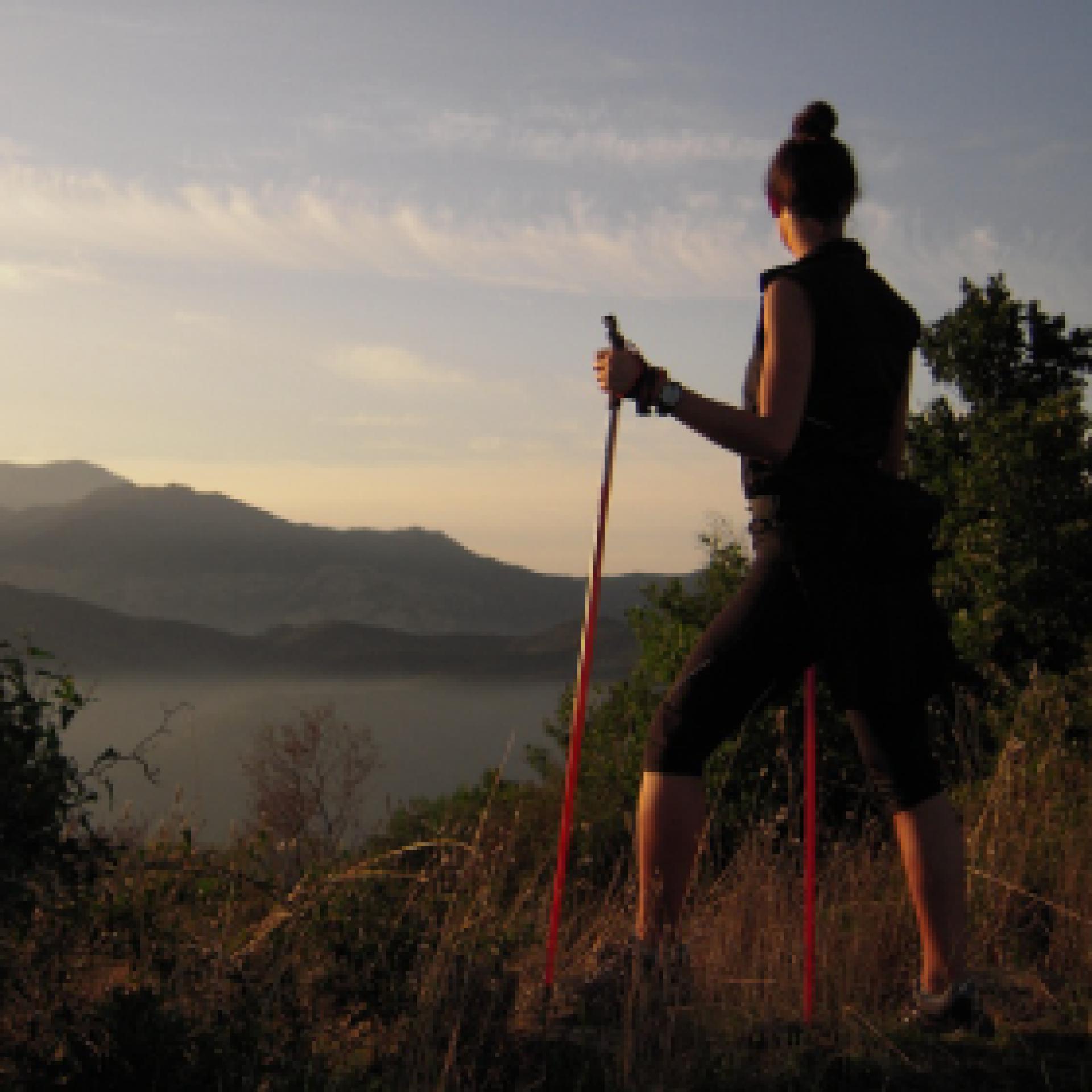
La camminata nordica o camminata con bastoni (in inglese nordic walking o pole walking) è attività fisica e sportiva che ben si coniuga con percorsi in bosco, in pianura o in vallate, lungo scogliere o spiagge.  La Rete dei sentieri della Sardegna offre tantissime occasioni per cimentarsi nella camminata nordica... 

Nordic-walking.png

Results

Oniferi, Sas Concas. The Necropolis

Access 

The two archaeological sites visited by this simple tour can both be reached via the SS 128 road, directly from the village of Oniferi and following the signs for the SS 131. Leaving the last houses behind, you travel about 3.3 km and spot a tourist sign on the left indicating the necropolis. You will then park in a narrow space next to the main road. 

Sas Concas 

You pass a rudimentary wooden gate and descend along a gentle slope between some beautiful cork trees, passing a barely noticeable ford. On the left, a ridge of pyroclastites are clearly distinguishable, with a beautiful pinkish colour. The entire ridge is colonised by beautiful prickly pear plants, in sharp contrast to the orange lichens tenaciously attached to the rock: on these south-east-facing rocks the Neolithic inhabitants decided to find the final resting place for their loved ones, excavating one of the most extraordinary necropolises of their time. Wandering around the area, one can count up to twenty different tombs, often divided into several rooms. The domus de janas necropolis is also famous for the richness of the decorative elements in the burial chambers: ritual hearths, architectural elements relief carved and, above all, the mysterious graffiti symbolising stylised and upside-down men. The petroglyphs of Sas Concas are very similar to other depictions scattered in contemporary sites in Sardinia and represent an archaic and still mysterious symbolism: among the tombs of the necropolis, the best preserved ones are to be found in the large tomb of the hemicycle, preceded by a chamber excavated in the rock that is now largely eroded. 

Nuraghe Ola 

Once the visit to the necropolis is over, you can return to the car by continuing on the SS128, ignoring the detours for the SS 131 DCN and remaining on the old state road for about 3 km: on the left of the road, well signposted and visible, stands the magnificent Nuraghe Ola, at the centre of an area with a high density of archaeological monuments. The ancient nuragic tower, of a simple construction, can be reached by a short path from the car park. Immediately before the monument are two large huts, which have been the subject of archaeological investigation in recent times. The nuraghe was also recently restored. It consists of a large inner tholos chamber, where there are some alcoves, and a splendid intermural staircase that provides access to the upper floor. Here one notices a slab that closes the tholos and that, at the summer solstice, is sometimes removed to allow one to witness the suggestive phenomenon of the sun ray penetrating the darkness of the chamber below at midday. At the end of the visit, you can return to the village or visit the beautiful necropolis of Brodu, not far away, however its not signposted.

Lenght 11.200 m

oniferi.gpx

Total elevation gain 261 metri

Oniferi, Sas Concas. La necropoli

Accesso 

I due siti archeologici visitati da questo semplice itinerario si raggiungono entrambi tramite la SS 128, direttamente dal paese di Oniferi e seguendo le indicazioni per la SS 131. 

Lasciate le ultime case alle spalle si percorrono circa 3,3 km e si individua sulla sinistra un cartello turistico che indica la necropoli. Si posteggia così in un angusto spazio accanto alla statale. 

Sas Concas 

Si supera un rudimentale cancello fatto di legno e si scende un lieve declivio tra alcune belle sughere, superando un guado appena accennato. Sulla sinistra si distingue chiaramente un costone di piroclastiti, dal bel colore rosaceo. L’intero costone è colonizzato da belle piante di fichidindia, in forte contrasto con i licheni arancioni tenacemente attaccati alla roccia: su queste rocce esposte a sudest gli abitanti del Neolitico decisero di trovare l’estrema dimora per i propri cari, scavando una delle necropoli più straordinarie dei loro tempi. 

Girovagando per la zona si possono contare fino a venti tombe diverse, articolate spesso al loro interno in più vani. La necropoli a domus de janas è celebre inoltre per la ricchezza degli elementi decorativi nei vani funerari: si individuano focolari rituali, elementi architettonici scolpiti in rilievo e soprattutto i misteriosi graffiti che simboleggiano uomini stilizzati e capovolti. I petroglifi di Sas Concas sono assai simili ad altre raffigurazioni sparse in siti coevi in Sardegna e rappresentano una simbologia arcaica e ancora misteriosa: tra le tombe della necropoli, quelli meglio conservati si trovano nell’ampia tomba dell’emiciclo, preceduta da un vano scavato nella roccia oggi in gran parte eroso. 

Nuraghe Ola 

Terminata la visita alla necropoli si può tornare all’auto proseguendo sulla SS128, ignorando le deviazioni per la SS 131 DCN e rimanendo sulla vecchia statale per circa 3 km: sulla sinistra della strada, ben segnalato e visibile, si staglia il magnifico Nuraghe Ola, al centro di un’area ad alta densità di monumenti archeologici. 

L’antica torre nuragica, di tipo semplice, si raggiunge per un breve sentiero che si diparte dal parcheggio. Subito prima del monumento si incontrano due ampie capanne, oggetto di indagine archeologica in tempi recenti. Anche il nuraghe è stato recentemente restaurato. Si compone di un’ampia camera interna a tholos, dove sono presenti alcune nicchie, e da una splendida scala intermuraria che permette di accedere al piano superiore. Qui si nota una lastra che chiude la tholos e che, nel solstizio d’estate, viene talvolta rimossa per permettere di assistere al suggestivo fenomeno del raggio di sole che, a mezzogiorno, penetra nel buio della camera sottostante. 

Terminata la visita si può rientrare al paese o visitare la bella necropoli di Brodu, poco distante, ma non segnalata

Lenght 11.200 m

oniferi.gpx

Total elevation gain 261 metri

Sarule, Gonare. The mountain of the spirit

Access 

From the inhabited centre of Sarule, go in the direction of the village cemetery, then continue along the main road until an clear and obvious crossroads dominated by the three pointed peaks of Monte Gonare. Take a left, following the signs for the mountain and continuing to climb on the tarmac road until the next crossroads, where you keep to the right, travelling for a few hundred metres and parking in a large clearing where the road ends, near some buildings that serve as shelters for the worshippers during the festivities. 

The via Crucis: The Way of the Cross 

The sanctuary of Gonare is located near the border between the municipalities of Sarule and Orani and its festivity is particularly ardent celebration The ancient church is said to have been built at the behest of Gonario di Torres to thank the Virgin Mary for having saved him during a storm at sea, but its dominant position highlights a geopolitical and at the same time ascetic intention. From the clearing, a well-marked path can be seen on the left, the same one where Via Crucis take place, leading to the sanctuary, where every step is marked by the passage of pilgrims and cloaked in legends and stories. You gradually gain height, surrounded by a beautiful wood of Holm oaks lashed by the wind. In spring, extraordinary blooms of lilies and peonies enrich the route. 

The church 

A couple of narrow hairpin bends make up the steepest part of the climb, the final one, now dominated by the church. The beautiful medieval building was extended several times and occupies the summit of the mountain, located at an altitude of just under 1100 metres. From the church one can enjoy a vast panorama that embraces the two coasts of Sardinia and a large part of the central and northern regions of the island. One can also admire the sunrise rising over the Gulf of Orosei and the sunset sinking into the waters of the Gulf of Oristano, offshore from Sinis, while the Gennargentu closes the panorama to the south and the jagged peaks of the Limbara mark the last visible places to the north. A door of the church is always open and allows entry to anyone who reaches the summit to grant anyone a prayer, after which they return to their cars by the path they took.

Lenght 13.400 m

sarule.gpx

Total elevation gain 549 metri

Geographical area Barbagia

Sarule, Gonare. La montagna dello spirito

Accesso 

Dal centro abitato di Sarule si segue in direzione del cimitero del paese, proseguendo poi sulla strada principale fino ad un evidente incrocio dominato dalle tre cime appuntite di Monte Gonare

Si prende a sinistra, seguendo le indicazioni per la montagna e continuando a salire su strada asfaltata fino all’incrocio successivo, dove si tiene la destra, percorrendo ancora poche centinaia di metri e posteggiando in un vasto spiazzo dove la strada ha termine, presso alcuni edifici che fungono da ricoveri per i novenanti durante la festività. 

La Via Crucis 

Il santuario di Gonare si trova presso il confine tra i Comuni di Sarule e Orani e la sua festività è particolarmente sentita. L’antica chiesa sarebbe stata edificata per volere di Gonario di Torres per ringraziare la Madonna di averlo salvato durante una tempesta in mare, ma la sua posizione dominante evidenzia un intendo geopolitico ed al contempo ascetico. 

Dallo spiazzo di individua sulla sinistra un sentiero ben marcato, lo stesso dove si svolge la Via Crucis che raggiunge il santuario, dove ogni passo è segnato dal passaggio dei pellegrini ed ammantato di leggende e racconti. 

Si prende quota gradualmente, circondati da un bel bosco di leccio sferzato dal vento. In primavera, straordinarie fioriture di gigli e peonie arricchiscono il percorso. 

La chiesa 

Un paio di stretti tornanti compongono la parte più ripida della salita, quella terminale, ormai dominata dalla chiesa. Il bell’edificio medioevale fu ampliato più volte ed occupa la parte sommitale della montagna, posto ad una quota di poco inferiore ai 1100 metri. 

Dalla chiesa si può ammirare un panorama vastissimo che abbraccia le due coste della Sardegna e grandissima parte delle regioni centrali e settentrionali dell’Isola. Si può ammirare l’alba sorgere sul Golfo di Orosei ed il tramonto abbassarsi nelle acque del Golfo di Oristano, al largo del Sinis, mentre il Gennargentu chiude il panorama a sud e le cime seghettate del Limbara segnano gli ultimi luoghi visibili verso nord. 

Una porta della chiesa è sempre aperta e permette l’ingresso a chi raggiunge la cima per concedere a chiunque una preghiera, dopo la quale si ritorna alle auto per il sentiero percorso.

Lenght 13.400 m

sarule.gpx

Total elevation gain 549 metri

Geographical area Barbagia

CMSB – STAGE 12 - FROM ARENAS TO SU MANNAU

This stage introduces an extraordinary new route that enriches your journey from a natural-environmental and cultural-historical point of view.

Holm oak woods on the limestone mountains, the great perennial spring of Pubusinu and the caves of Su Mannau are the natural jewels that form the backdrop of the mining heritage characterized by the mine of Gutturu Pala, together with the house of Karl Marx who discovered it, and the mine-museum of Su Zurfuru.

You’ll have the chance to devote time to visiting such a heritage thanks to this easy and mostly downhill stage.

Safety and useful tips

The route is easy to follow and runs along an accessible comfortable dirt road.

At the start of the stage, you will come across the ruins of old mining activities and, a little further on, the buildings of the old Genne Carru Mine; avoid crossing any fences and/or venturing inside but always admire them from a distance without leaving the Trail.

Informazioni utili

The stage presents a low difficulty. The route has a length of 13.3 km which can be covered in 4 hours and an uphill difference in height of 399 m and a downhill difference of 788 m.

FOR UPDATED INFORMATION, CONSULT THE STAGE SHEET ON THE OFFICIAL WEBSITE

Lenght 13.300 m

Links

CMSB tappa-12-da-arenas-su-mannau.gpx

Total elevation gain 646 metri

Geographical area Iglesiente

Elevation gain 399 metri

Negative elevation 788 metri

CMSB – TAPPA 12: DA ARENAS A SU MANNAU

Con questa tappa viene aperto un nuovo straordinario percorso che arricchisce il Cammino sotto l’aspetto naturalistico-ambientale e storico-culturale.

I boschi di leccio sulle montagne calcaree, la grande sorgente perenne di Pubusinu e le grotte di Su Mannau sono i gioielli naturali che fanno da cornice al patrimonio minerario segnato dalla miniera di Gutturu Pala con la casa di Carlo Marx che fu il suo scopritore e la miniera-museo di Su Zurfuru.

Trattandosi di una tappa facile e prevalentemente in discesa è quindi possibile dedicare tempo alla visita di questo patrimonio storico ed ambientale.

Informazioni utili

La tappa presenta una bassa difficoltà. Il percorso ha una lunghezza di 13,3  km percorribili in 4 ore  e un  dislivello  in salita di 399 m e in discesa  di 788 m.
PER LE INFORMAZIONI AGGIORNATE, CONSULTA LA SCHEDA DELLA TAPPA, SUL SITO UFFICIALE 

Il Cammino Minerario di Santa Barbara

Si tratta del primo, tra i cammini sardi, ad essere stato iscritto al registro istituito dalla Regione Sarda nel 2012 con DGR48/9 ("Registro dei cammini di Sardegna, degli itinerari religiosi e dello spirito"). Attualmente è gestito dall'omonima Fondazione.

LA STORIA DEL PROGETTO

L’idea di costruire un itinerario nell’area più estesa e rappresentativa del Parco Geominerario Storico Ambientale della Sardegna, il Sulcis-Iglesiente-Guspinese, riscoprendo gli antichi cammini minerari oggi in gran parte abbandonati, è nata dai volontari dell’Associazione ONLUS Pozzo Sella Per il Parco Geominerario a seguito della grande partecipazione dei cittadini alle escursioni organizzate dalla stessa associazione dopo aver reso fruibili numerosi percorsi minerari.

Con il Cammino Minerario di Santa Barbara si vuole perseguire l’obiettivo di tramandare la memoria degli uomini che nei secoli e nei millenni passati hanno realizzato e percorso gli antichi cammini minerari con il piacere di riscoprire a passo lento la bellezza del territorio.

Un Protocollo d’intesa è stato sottoscritto tra i Comuni di Iglesias, Buggerru, Fluminimaggiore, Arbus, Guspini, Gonnosfanadiga, Villacidro, Domusnovas, Musei, Villamassargia. Narcao, Nuxis, Santadi, Piscinas, Giba, Masainas, San Giovanni Suergiu, Sant’Antioco, Carbonia e Gonnesa, le Diocesi di Iglesias e di Ales Terralba, le Province di Carbonia Iglesias e del Medio Campidano, il Consorzio del Parco Geominerario Storico Ambientale della Sardegna, l’ANCI SARDEGNA e l’Associazione Pozzo Sella: si tratta di un  partenariato per la costruzione e la gestione dell’itinerario storico, culturale, ambientale e religioso denominato “Cammino Minerario di Santa Barbara”.

PER MAGGIORI INFORMAZIONI, DETTAGLI E INFO AGGIORNATE SULLE TAPPE

Si consiglia di consultare il sito ufficiale del cammino: www.camminominerariodisantabarbara.org/

Lenght 13.300 m

Links

CMSB tappa-12-da-arenas-su-mannau.gpx

Total elevation gain 646 metri

Roadbook

Da Arenas il percorso scende dolcemente passando attraverso la Foresta Demaniale di Gutturu Pala - Pubusinu gestita dall'Agenzia Fo.re.S.T.A.S. dove  sono presenti numerosi resti minerari testimonianza di un’intensa attività passata, la quale rappresentava la principale risorsa economica per la popolazione locale.

Geographical area Iglesiente

Elevation gain 399 metri

Negative elevation 788 metri

CMSB – STAGE 18 - FROM ROSAS TO NUXIS

Today you will start the descent towards the plains of Lower Sulcis, where there is still much evidence of mining activity.

You will pass through the lead, zinc and copper mine of Sa Marchesa and admire several disused limestone quarries.

Then you’ll take the route of the railway that connected the Cixerri and the Lower Sulcis valleys until you reach the island of Sant'Antioco.

You’ll pass under one of the bridges of this railway and walk along comfortable dirt roads, mule tracks and, in the final part of the route, asphalted roads.

Safety and useful tips

The route proceeds along comfortable and easy roads.

As you arrive in the vicinity of Acquacadda, from which you will climb towards the site of Sa Marchesapay attention to crossings in the urban area and in particular on the SP 78 provincial road, which has to be crossed twice to visit the Museum of Sa Marchesa and come back.

Once in Crabì, you have to walk along the edge of the SP 293 road for about 350 m; also in this case, make sure to pay attention both to this passage and to the passage on the asphalted roads of the small village due to vehicular traffic.

Also, when you arrive in Nuxis you have to cross busy roads, therefore you need to pay attention when crossing and walking along the streets.

Informazioni utili

The stage is considered among the easy ones. The route has a length of 12.5 km, which can be done in 4 hours, and has an uphill height difference of 297 m and a downhill height difference of 348 m.

FOR UPDATED INFORMATION, CONSULT THE STAGE SHEET ON THE OFFICIAL WEBSITE

Lenght 12.500 m

Links

CMSB tappa-18-da-rosas-nuxis.gpx

Total elevation gain 309 metri

Geographical area Iglesiente

Elevation gain 297 metri

Negative elevation 348 metri

CMSB – Tappa 18: DA ROSAS A NUXIS

Con questa tappa si inizia la discesa verso le pianure del Basso Sulcis dove sono ancora presenti numerose testimonianze dell’attività estrattiva. Si attraversa infatti la miniera di piombo, zinco e rame di Sa Marchesa e dove sono presenti anche numerose cave dismesse di calcare.

Il percorso incrocia  il tracciato della ferrovia che collegava la valle del Cixerri con la valle del Basso Sulcis fino a raggiungere l’isola di Sant’Antioco. 

Informazioni utili

La tappa è considerata  tra quelle facili. Il percorso ha una lunghezza di 12,5  km, percorribili in 4 ore e un  dislivello  in salita di 297   m e in discesa  di 348 m.
PER LE INFORMAZIONI AGGIORNATE, CONSULTA LA SCHEDA DELLA TAPPA, SUL SITO UFFICIALE 

Il Cammino Minerario di Santa Barbara

Si tratta del primo, tra i cammini sardi, ad essere stato iscritto al registro istituito dalla Regione Sarda nel 2012 con DGR48/9 ("Registro dei cammini di Sardegna, degli itinerari religiosi e dello spirito"). Attualmente è gestito dall'omonima Fondazione.

LA STORIA DEL PROGETTO

L’idea di costruire un itinerario nell’area più estesa e rappresentativa del Parco Geominerario Storico Ambientale della Sardegna, il Sulcis-Iglesiente-Guspinese, riscoprendo gli antichi cammini minerari oggi in gran parte abbandonati, è nata dai volontari dell’Associazione ONLUS Pozzo Sella Per il Parco Geominerario a seguito della grande partecipazione dei cittadini alle escursioni organizzate dalla stessa associazione dopo aver reso fruibili numerosi percorsi minerari.

Con il Cammino Minerario di Santa Barbara si vuole perseguire l’obiettivo di tramandare la memoria degli uomini che nei secoli e nei millenni passati hanno realizzato e percorso gli antichi cammini minerari con il piacere di riscoprire a passo lento la bellezza del territorio.

Un Protocollo d’intesa è stato sottoscritto tra i Comuni di Iglesias, Buggerru, Fluminimaggiore, Arbus, Guspini, Gonnosfanadiga, Villacidro, Domusnovas, Musei, Villamassargia. Narcao, Nuxis, Santadi, Piscinas, Giba, Masainas, San Giovanni Suergiu, Sant’Antioco, Carbonia e Gonnesa, le Diocesi di Iglesias e di Ales Terralba, le Province di Carbonia Iglesias e del Medio Campidano, il Consorzio del Parco Geominerario Storico Ambientale della Sardegna, l’ANCI SARDEGNA e l’Associazione Pozzo Sella: si tratta di un  partenariato per la costruzione e la gestione dell’itinerario storico, culturale, ambientale e religioso denominato “Cammino Minerario di Santa Barbara”.

PER MAGGIORI INFORMAZIONI, DETTAGLI E INFO AGGIORNATE SULLE TAPPE

Si consiglia di consultare il sito ufficiale del cammino: www.camminominerariodisantabarbara.org/

Lenght 12.500 m

Links

CMSB tappa-18-da-rosas-nuxis.gpx

Total elevation gain 309 metri

Roadbook

Da Rosas si scende verso il Basso Sulcis; in prossimità della località Acquacadda  si trova il sito della miniera di piombo, zinco, argento e rame di  "Sa Marchesa" attiva dalla fine del XIX secolo agli anni '80 del XX. Alla fine degli anni ‘90 l’area mineraria passò definitivamente al Comune di Nuxis che attraverso fondi POR Sardegna realizzò un progetto di riqualificazione degli edifici presenti. Dal 2001 la miniera fa parte del Parco Geominerario Storico e Ambientale della Sardegna.

Geographical area Iglesiente

Elevation gain 297 metri

Negative elevation 348 metri

CMSB – STAGE 27 - FROM NURAXI FIGUS TO CARLOFORTE

You will walk outside the industrial area of Portovesme and immerse yourself in the ancient maritime culture of this territory which, thanks to fishing and tuna processing, has generated a centuries-old history that is still alive today and that is the source of an extraordinary gastronomic tradition.

With this new and unique stage of the Trail, in addition to walking easily on dry land, you will cross a short stretch of sea by ferry to discover the indelible traces of the infrastructures and of the men (railways, depots, berths for boats and ports for steamships) that for a century ensured the transport of merchant minerals produced in the mines of the south-western coast of Sardinia.

ATTENTION: there are no supermarkets or other services in Portixeddu, bars and restaurants are open only in the summer season.

Safety and useful tips

The route begins along the streets of Nuraxi Figus, where you need to pay attention to the presence of urban traffic.

Afterwards, you will walk through easy internal dirt roads until you reach Sa Piramide, where you must cross the SP 82 road and proceed for about 500 m. Pay close attention to the presence of cars.

As you pass Monte Dolorosu with its commemorative cross, you need to cross the SP 108 road, therefore pay attention when crossing.

Once in Portoscuso, you have to walk through the town streets to reach the embarkation point in Portovesme, therefore you need to pay attention to urban traffic.

Once embarked to reach Carloforte, follow the ship's safety rules during the crossing.

As you arrive in Carloforte, be aware of the presence of urban traffic.

Informazioni utili

The stage does not present particular difficulties. The route has a length of 12 km which can be covered in 3 hours and 30 minutes, + 40 minutes by ferry, and an uphill difference in altitude of 196 m and a downhill difference of 310 m.

FOR UPDATED INFORMATION, CONSULT THE STAGE SHEET ON THE OFFICIAL WEBSITE
 

Lenght 12.000 m

Links

CMSB tappa-27-da-nuraxi-figus-carloforte.gpx

Total elevation gain 128 metri

Geographical area Iglesiente

Elevation gain 196 metri

Negative elevation 310 metri