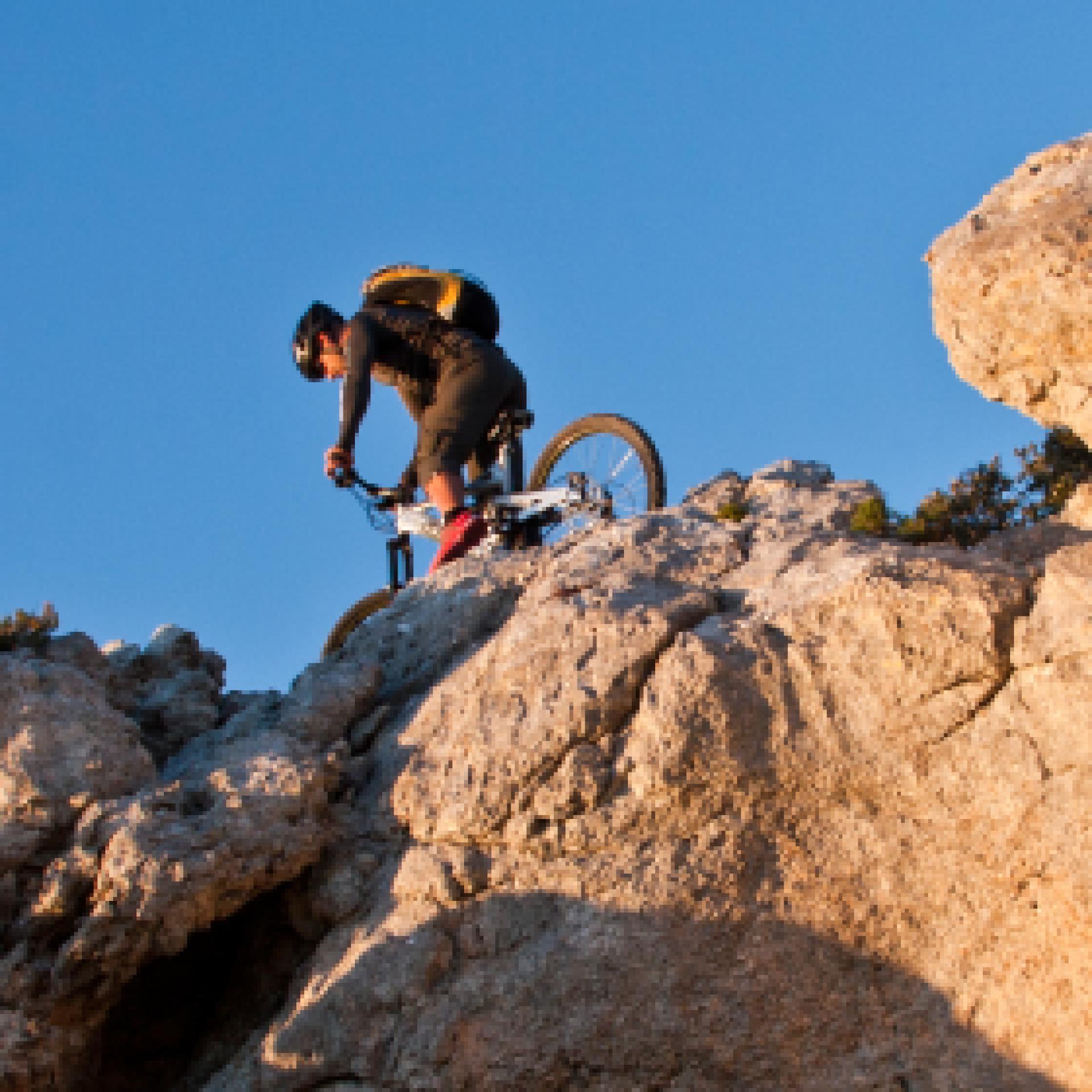
Mountain Bike
Le varie categorie del mountain biking ne fanno un universo a sé stante nel campo del turismo attivo: cross country, all mountain, enduro e freeride, downhill e bike orienteering...possono essere praticati quasi ovunque, ma la maggior parte dei biker pedalano fuoristrada, lungo sentieri di campagna, piste forestali o singletrack (creati e mantenuti principalmente dal passaggio). Gruppi sociali più o meno formalizzati sono frequenti, specialmente nelle uscite più lunghe...
Results
Sentiero Italia (Stage Z16) Sa Senipida - Ilodei Malu (Caserma Montes)
Overview of the itinerary
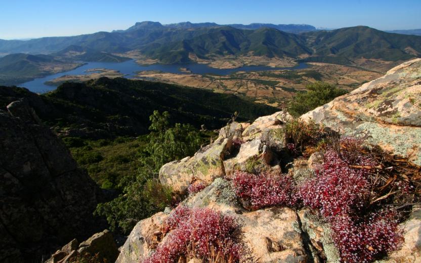
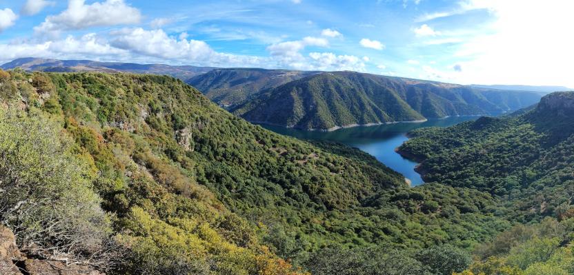
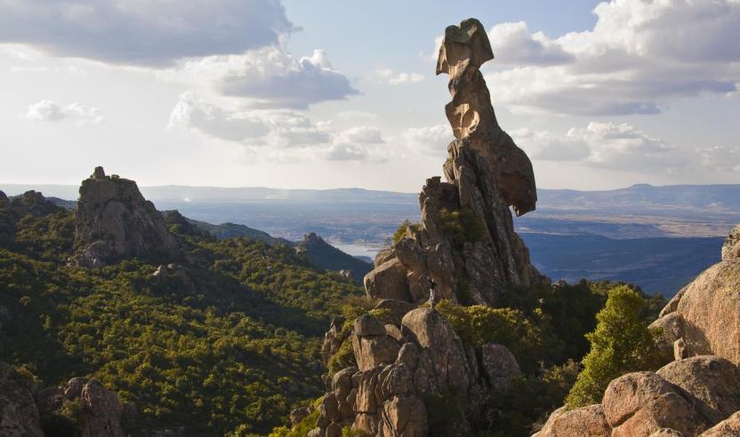
Sentiero Italia runs the length of the island’s eastern side, covering its most important mountains, in 28 stages. Starting from the north: it flanks the Monte Limbara massif, crosses the limestones of Mont’Albo and Tuttavista, skirting the Gulf of Orosei, it crosses the Supramonte, Gennargentu and the Tacchi of Ogliastra and reaches Perdasdefogu. Further south, it passes through Armungia and the Gerrei sub-region. Lastly, it touches on the villages of Burcei and San Gregorio, continuing on the Sette Fratelli massif to the old prisons of Castiadas.
General information on Sentiero Italia (Grand Italian Trail)
Sentiero Italia, or Grand Italian Trail, as also explained on the official website, is a walking route that crosses the whole of Italy, using mainly but not exclusively “registered trails”.
In particular, in Sardinia, not all the stages of the Sentiero Italia of CAI (Italian Alpine Club) are made of trails already included in the registry of the Sardinia Trail Network (RES), either because they have not yet been tested and approved or simply because they cannot be registered as they do not meet the requirements. However, as a whole, the Sentiero Italia is the single longest walking route currently crossing Sardinia from the north (S. Teresa Gallura, stage Z 1) to the south (Castiadas, end of stage Z 28), touching on the most fascinating mountain areas in central-eastern Sardinia: the plateau of Buddusò, Tepilora, the Cedrino river valley, the ancient forests of Montes, Perda Liana and the regional forest of Montarbu, Monte Genis, and lastly the regional forest of Settefratelli (among the many crossed by the various stages of this long hiking itinerary).
Information on this stage of the trail
The planned stop point at the cuile Sa Sinipida can currently be used as a camping point, with a spring nearby. For support, please contact Efisio Manca, mobile 3202745951.
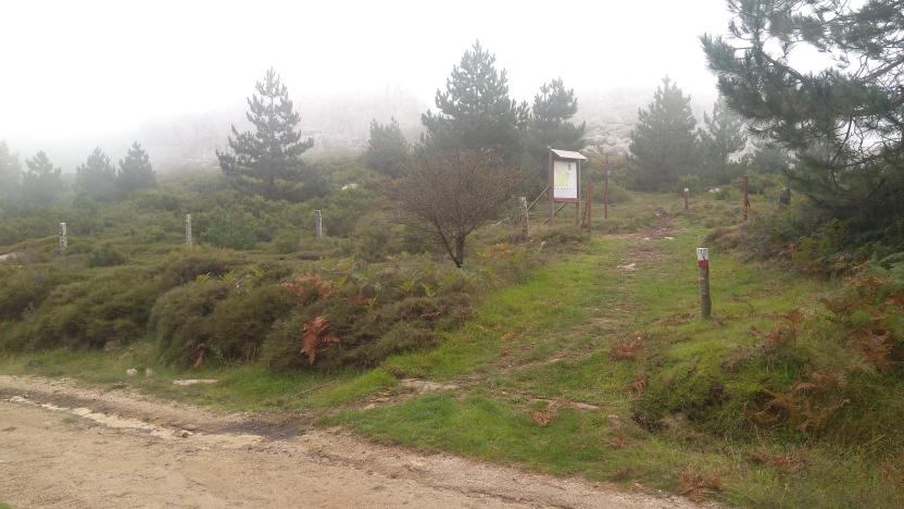
The route begins with an easy dirt track that leads to the crossing of the Badde Tureddu stream and then winds uphill passing a spring. At 987 m asl, trail 441 leaves the dirt track and enters the forest. A beautiful trail through a forest of holm oaks and cork trees with route markings on trees and stone cairns. Once past the forest, continue along the trail that becomes a dirt track just before the camping point of ziu Mulittu (two fairly comfortable stone huts).
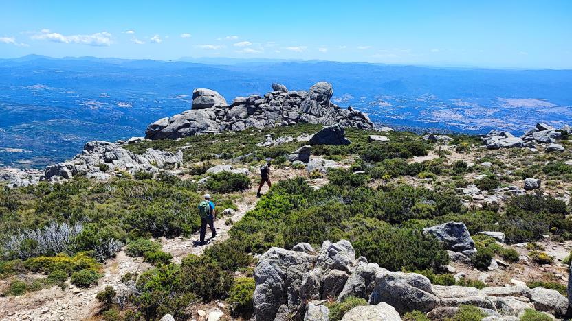
At the 441-441C fork, continue north-west on 441 towards the ruins of the cuile (sheepfold) of Sos Pisanos and then go up towards Monte Novo San Giovanni where a fire lookout overlooks a vast unspoilt territory. After leaving Monte Novo, continue south-west towards Monte Fumai, at 1316 m asl, and then head north towards the forest ranger station of Montes (Ilodei Malu).
Informazioni utili
Tipologia itinerario
- Log in to post comments
Photogallery
Sentiero Italia (Tappa Z16) Sa Senipida - Ilodei Malu (Caserma Montes)
In sintesi
Il Sentiero Italia attraversa in lunghezza il settore orientale dell’isola toccandone i sistemi montuosi più rilevanti, in 28 tappe. Partendo da nord: tocca il massiccio del Monte Limbara, attraversa i calcari del Mont'Albo e del Tuttavista sfiorando il Golfo di Orosei, attraversa il Supramonte, il Gennargentu, i Tacchi dell’Ogliastra e giunge a Perdasdefogu. Più a sud, transita da Armungia e dalla subregione del Gerrei. Infine tocca l’abitato di Burcei e San Gregorio, per continuare nel massiccio dei Sette Fratelli fino alle vecchie carceri di Castiadas.
Informazioni generali sull'itinerario sentiero Italia
Il Sentiero Italia, come spiegato anche nel sito ufficiale, è un itinerario (o Cammino) lungo tutta l'Italia, che utilizza prevalentemente ma non esclusivamente "sentieri accatastati".
In particolare, in Sardegna, non tutte le tappe del Sentiero Italia del CAI coincidono con sentieri già inseriti nel catasto della Rete Escursionistica della Sardegna (RES), perché non hanno ancora superato le verifiche di percorribilità oppure semplicemente perché non possono essere accatastati non avendone i requisiti. Tuttavia, nel suo insieme, il Sentiero Italia rappresenta l'unica, la più grande dorsale escursionistica che attraversa attualmente la nostra Isola da nord (S. Teresa Gallura, tappa Z 1) a sud (Castiadas, fine tappa Z 28) toccando le aree montane della Sardegna centro-Orientale più affascinanti: l'altopiano di Buddusò, Tepilora, la valle del Cedrino, i boschi vetusti di Montes, Perda Liana e la foresta demaniale di Montarbu, il Monte Genis, e infine la foresta demaniale di Settefratelli (tra le tante attraversate dal lungo itinerario escursionistico a tappe).
Info sul percorso di questa tappa
Il posto tappa previsto al cuile Sa Sinipida è attualmente utilizzabile come bivacco con presenza di sorgente nei pressi. Per assistenza è necessario contattare Efisio Manca, cell. 3202745951.
Il percorso inizia con una agevole sterrata che porta ad attraversare il rio Badde Tureddu per poi risalire con una serie di tornanti lungo i quali si trova una sorgente. Arrivati a quota 987 slm il sentiero 441 lascia la sterrata ed entra nel bosco. Un bel sentiero in mezzo ad un bosco di lecci e sughere segnalato da segnavia su alberi e da omini in pietra. Superato il bosco si continua sul sentiero che diventa sterrata poco prima dei bivacchi di ziu Mulittu (due costruzioni in pietra abbastanza confortevoli).
Arrivati al bivio 441-441C si continua sul 441 in direzione nord-ovest verso le rovine del cuile Sos Pisanos per poi risalire verso Monte Novo San Giovanni dove è presente una vedetta antincendio che domina un vasto territorio incontaminato. Lasciato Monte Novo si prosegue in direzione sud-ovest verso Monte Fumai , 1316 slm, per poi proseguire in direzione nord verso la caserma forestale di Montes (Ilodei Malu).
Informazioni utili
Lungo il percorso non sarà sempre presente la copertura telefonica
Tipologia itinerario
- Log in to post comments
Photogallery
Contiene carte
Spento