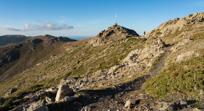
Start website main content

Accessible trails

1 pathway

Sentieri per tutti...in questa categoria rientrano i sentieri progettati o riadattati perchè il contatto con l'ambiente naturale sia sempre di stimolo al miglioramento della vita personale di chiunque, con attenzione alle condizioni di disabilità motoria, sensoriale o della sfera psichica e relazionale...

Rio Ermolinos.jpg

Results

Ispadula - Tonara

This route allows you to admire the high-altitude woods of the Tonara mountains and enjoy the pano-rama of the entire surrounding area. Due to the general smoothness of the terrain, it is suitable for cycling even when there is snow, thus increasing the charm of the excursion. Although short in terms of kilometres, at least by cycling standards, it winds through an environment of great naturalistic val-ue, such that it is a rewarding experience, also in view of the difference in height and altitude. At the Isca 'e sa Mela road pass, the route intercepts State Road 128, which connects Sorgono to the town of Tonara. This point can be useful to connect the itinerary to other villages or to lengthen the excursion towards the surrounding mountains.

Informazioni utili

The LEADER Territory of the Local Action Group (GAL) Rural District Barbagia Mandrolisai Gennargentu (BMG)

Consisting of the Union of Municipalities of Barbagia and the Mountain Community of Gennargentu Mandrolisai. The GAL BMG, therefore, includes 19 municipalities, with a total area of 854.30 sq km and a resident population of approximately 22,000 inhabitants: Aritzo, Atzara, Austis, Belvì, Desulo, Gadoni, Gavoi, Lodine, Meana Sardo, Ollolai, Oniferi, Olzai, Ortueri, Ovodda, Sarule, Sorgono, Teti, Tiana, Tonara.

The GAL Rural District BMG, established in 2009, is a participation foundation composed of 22 public members and over 200 private members, representing the main institutional, economic, and social components of the territory. The foundation aims to improve the quality of life and well-being of communities in the historical regions of Barbagia, Mandrolisai, and Gennargentu by enhancing local resources. The main thematic and intervention areas identified by the GAL BMG for the definition of its Local Development Strategy 2014-2022 are the development and innovation of local production chains and systems, social inclusion, and sustainable tourism.

THE OAST PROJECT: OUTDOOR ACTIVITIES FOR SUSTAINABLE TOURISM

The project, coordinated by the GAL BMG in partnership with the GAL Sisteron-Buëch (France) and the GAL Kilkenny (Ireland), aims to promote sustainable and active tourism in rural areas of Europe. The specific objective of the project was to enhance and develop the tourist attractiveness of the inland waters of Barbagia, through outdoor sports and water activities, in line with the thematic area "sustainable tourism" chosen in the GAL BMG's PDA. The three territories involved boast a rich and varied natural, landscape, and cultural heritage with strong identity traits and enormous potential for the development of active tourism. However, some problems common to all partners have been highlighted, such as: insufficient enhancement and tourist promotion of inland areas, isolation, the absence of an international network useful for the exchange of good practices, and insufficient diversification, delocalization, deseasonalization, and internationalization of tourist flows. The OAST Project was created to respond to these critical issues, as active tourism and sustainable tourism represent the basis for the revival of territories characterized by enormous problems of depopulation, lack of services, unemployment, and school dropout. The idea, therefore, is to promote forms of sustainable, active, responsible, and experiential tourism, as well as to offer diversified and deseasonalized solutions suitable for a constantly growing number of active tourists. The specific action involved the georeferencing and description, in Italian and English, of 19 GAL BMG itineraries related to the theme of water. The itinerary tracks are available and downloadable, in Gpx format, on these pages and also on the GAL BMG's Wikiloc account.

Lenght 16.500 m

Tonara. Ispadula.gpx

Total elevation gain 538 metri

Geographical area Gennargentu

Contiene carte
Spento

Ispadula - Tonara

AVVERTENZE

QUESTO ITINERARIO è riportato "tal quale" a titolo informativo e di mera recensione/ricognizione degli itinerari presenti nel territorio  -  come fornito e recensito dal progetto OAST condotto dal GAL BMG nel 2024. 
NOTA: Molti itinerari sono composti da percorsi stretti e richiedono una cura periodica della vegetazione, al momento non assicurata da una gestione  di tipo  ufficiale, non essendo il tracciato inserito nella"rete escursionistica della Sardegna".  
Nota 2: Prima di recarvi sul posto si consiglia di raccogliere informazioni sullo stato di fruibilità, presso il comune competente, per avere certezza dell'effettiva percorribilità dell'itinerario scelto.

IL PERCORSO IN PILLOLE (elementi informativi essenziali)

Il punto di partenza si trova nel parcheggio lungo la strada principale di Tonara, via Monsignor Tore, di fronte al civico 121. Questa via è anche la Strada Statale 295.

Descrizione

Questo itinerario consente di ammirare i boschi in alta quota delle montagne di Tonara e di godere del panorama su tutto il territorio circostante. Per via della generale scorrevolezza del fondo, si presta a essere percorso anche in caso di neve, aumentando così il fascino dell’escursione. Seppur breve, in termini chilometrici, almeno per gli standard cicloturistici, si snoda in un ambiente di grande pregio naturalistico, tale da costituire una esperienza comunque gratificante, anche in considerazione del dislivello e dell’altitudine. In corrispondenza del valico stradale di S’Isca ‘e sa Mela, il percorso intercetta la Strada Statale 128 che congiunge Sorgono alla Strada Statale 295 e quindi al paese di Tonara. 
Questa connessione può essere una valida alternativa per connettere l’itinerario ad altri paesi senza passare per Tonara o per allungare l’itinerario verso le montagne circostanti.

Camminabilità

L’itinerario può essere facilmente convertito in un percorso da trekking, con l’accortezza, per non camminare eccessivamente sull’asfalto alla periferia di Tonara, di porne il punto di inizio al waypoint BIVIO QUOTA 920. In questo modo la percentuale d’asfalto è molto minore e il percorso diventa di 13 km e 400 m di dislivello. Può essere ulteriormente accorciato evitando l’anello interno del colle di Ispadula, cui si accede da Arcu ‘e sa Fruca, e in tal modo risulta di 11 km e 340 m di dislivello.

Informazioni utili

Il territorio LEADER del Gruppo di Azione Locale (GAL) Distretto Rurale Barbagia Mandrolisai Gennargentu (BMG) 

Costituito dall'Unione dei Comuni Barbagia e dalla Comunità Montana Gennargentu Mandrolisai. Il GAL BMG comprende, quindi, 19 comuni, per una superficie complessiva di 854,30 kmq e una popolazione residente pari a circa 22.000 abitanti: 

Aritzo, Atzara, Austis, Belvì, Desulo, Gadoni, Gavoi, Lodine, Meana Sardo, Ollolai, Oniferi, Olzai, Ortueri, Ovodda, Sarule, Sorgono, Teti, Tiana, Tonara.


Il GAL Distretto Rurale BMG, costituito nel 2009, è una Fondazione di partecipazione composta da 22 soci pubblici e oltre 200 privati, rappresentativi delle principali componenti istituzionali, economiche e sociali del territorio. La fondazione ha lo scopo di migliorare la qualità della vita e il benessere delle comunità nelle regioni storiche Barbagia, Mandrolisai e Gennargentu mediante la valorizzazione delle risorse locali.
I principali ambiti tematici e di intervento individuati dal GAL BMG per la definizione della propria Strategia di Sviluppo Locale 2014-2022 sono lo sviluppo e l’innovazione delle filiere e dei sistemi produttivi locali, l’inclusione sociale ed il turismo sostenibile.


IL PROGETTO OAST: OUTDOOR ACTIVITIES FOR SUSTAINABLE TOURISM

Il progetto, coordinato dal GAL BMG in partenariato con il GAL Sisteron-Buëch (Francese) e
il GAL Kilkenny (Irelanda), intende promuovere un turismo sostenibile e attivo nelle aree
rurali d’Europa.
L’obiettivo specifico del progetto è stato potenziare e sviluppare l’attrattività turistica delle acque
interne della Barbagia, attraverso gli sport all’aria aperta e le attività acquatiche, in coerenza con l’ambito tematico “turismo sostenibile” prescelto nel PDA del GAL BMG.
I tre territori coinvolti vantano un patrimonio naturalistico, paesaggistico e culturale ricco e variegato con forti caratteri identitari ed enormi potenzialità di sviluppo di turismo attivo
Tuttavia, sono stati evidenziati alcuni problemi comuni a tutti i partner, quali: l’insufficiente valorizzazione e promozione turistica delle aree interne, l’isolamento, l’assenza di un network internazionale utile per lo scambio di buone prassi, e l’insufficiente diversificazione, delocalizzazione, destagionalizzazione e l’internazionalizzazione dei flussi turistici. Il Progetto OAST nasce per rispondere a queste criticità, in quanto il turismo attivo ed il turismo sostenibile rappresentano la base di rilancio dei territori caratterizzati da enormi problemi di spopolamento, carenza di servizi, disoccupazione e dispersione scolastica.
L’idea, quindi è promuovere forme di turismo sostenibile, attivo, responsabile ed esperienziale, nonché
offrire soluzioni diversificate e destagionalizzate adatte ad un numero di turisti attivi in continua crescita.
L’azione specifica ha previsto la georeferenziazione e descrizione, in lingua italiana e inglese, di
19 itinerari del GAL BMG legati al tema dell’acqua. Le tracce degli itinerari sono disponibili e scaricabili, in formato Gpx, in queste pagine e anche nell’account Wikiloc del GAL BMG

Lenght 16.500 m

Tonara. Ispadula.gpx

Total elevation gain 538 metri

Geographical area Gennargentu

Contiene carte
Spento

Sorgono, the plateau of the Nuraghes. Between history and nature

Access 

Take the SS 128, which is the main road of the inhabited centre of Sorgono. At the same level of the Cantina Sociale del Mandrolisai, on the opposite side of the road, wooden signs indicate some archaeological sites. You then follow Via Emilia, turning left at a large fork where you come to another signpost indicating Sentiero Escursionistico (Hiking Trail). Continue along the asphalt road for about 4 km until you come to a sign on the right indicating the Nuraghe Lò. You can park the car here. 

Nuraghe Lò 

You turn right uphill along a small dirt road, immersed in an Oak forest. After a short stretch, on the left, the beautiful nuragic tower stands out, built on a rocky outcrop formation and placed in a n elevated position. The plan of the structure is slightly elliptical and has the peculiarity of having an architraved window placed at the end of a slightly curved corridor that is in a mirror-image position to the entrance. 

Santu Loisu 

You descend back to the asphalt road, soon encountering a sign marking the entrance to the forestry yard, which also houses a beautiful nursery. You are now in the locality of Santu Loisu and enter a plot of land to the left of the road, where there are two buildings belonging to a mountain colony and a natual spring. On the right, a small path leads to the domus de Janas of Santu Loisu, consisting of two small chambers at ground level and immersed in a beautiful wood. You return to the tarmac road, continuing for a few hundred metres until you come to an imperceptible bend to the left. On the left of the road, immersed in the woods, is the beautiful tower of Nuraghe Bardacolo, set in a dominant position. Although extremely high, from its summit you can enjoy a wide panorama. 

Nuraghe Orrubiu 

The route continues on the main road, now slightly downhill. On the right-hand side of the road after a long stretch through the beautiful oak forest. Just before an electrical transformer cabin you come to the sign for Nuraghe Orrubiu, on the right. The beautiful single tower is slightly raised on a ploughed field and owes its name to the reddish mosses that have colonised its beautiful granite stones. Continuing along the main road, you will come across another sign, also on the right, that would allow you to visit a giants' tomb. 

S’Incodine 

On the left-hand side of the road, before turning back, you will come across a ladder type style that provides access to a vast pastureland. Behind it, near a rocky prominence stands the monument known as S'Incodine (The Anvil), due to its characteristic shape. Not far away, but difficult to find, are the Domus de Janas of Perdonigheddu and the Cherbos nuraghe. You return to the car by the road followed on the outward journey.

Lenght 17.000 m

Sorgono.gpx

Total elevation gain 485 metri

Sorgono, l’altopiano dei Nuraghes. Tra storia e natura

Accesso 

Si percorre la SS 128 che costituisce la via principale del centro abitato di Sorgono. All’altezza della Cantina Sociale del Mandrolisai, sul lato opposto della strada, si individuano i cartelli in legno che indicano alcuni siti archeologici. Si percorre quindi la Via Emilia, prendendo poi a sinistra ad un grosso bivio dove si incontra un altro cartello che indica “Sentiero Escursionistico”. 

Si prosegue su strada asfaltata per circa 4 km, fino ad incontrare, sulla destra, il cartello che indica il nuraghe Lò

Qui si posteggia. 

Nuraghe Lò 

Si prende a destra in salita per una stradina bianca, immersi nel bosco di querce. Dopo un breve tratto, sulla sinistra, spicca la bella torre nuragica, costruita su uno spuntone roccioso e posto in posizione rilevata. La pianta del monumento è leggermente ellittica ed ha la particolarità di possedere una finestra architravata, posta al termine di un corridoio leggermente curvo che si trova in posizione speculare rispetto all’entrata. 

Santu Loisu 

Si ridiscende alla strada asfaltata, incontrando in breve un cartello che segna l’ingresso del cantiere forestale che ospita anche un bel vivaio. Si è in località Santu Loisu e si entra in un terreno alla sinistra della strada, dove si trovano due edifici appartenenti ad una colonia montana ed una sorgente. Sulla destra, un piccolo sentierino porta alle Domus de Janas di Santu Loisu, costituite da due piccole celle all’altezza del terreno ed immerse in un bel bosco. Si ritorna alla strada asfaltata, proseguendo per poche centinaia di metri fino ad incontrare una impercettibile curva a sinistra. Sulla sinistra della strada, immersa nel bosco, si trova la bella torre di Nuraghe Bardacolo, posta in posizione dominante. Anche se svettata, dalla sua cima si gode di un ampio panorama. 

Nuraghe Orrubiu 

Si riprende ancora sulla strada principale che va a sterrarsi, ora leggermente in discesa. Sulla destra della strada, dopo un lungo tratto nel bel querceto. Poco prima di una cabina di trasformazione elettrica si incontra il segnale per Nuraghe Orrubiu, sulla destra. Il bel mono-torre è leggermente rilevato su un campo arato e deve il suo nome ai muschi rossicci che ne hanno colonizzato le belle pietre granitiche. Continuando sulla strada principale si incontra un’altra indicazione, sempre sulla destra, che permetterebbe di visitare una tomba dei giganti

S’Incodine 

A sinistra della strada, prima di tornare indietro, si incontra uno scalandrino che permette di accedere a un vasto pascolo. Alle sue spalle, presso un risalto roccioso, si trova il monumento noto come S’Incodine, per la sua forma caratteristica. Non lontane, ma di difficile reperimento, si trovano le Domus de Janas di Perdonigheddu ed il nuraghe Cherbos. Si ritorna all’auto per la strada seguita all’andata

Lenght 17.000 m

Sorgono.gpx

Total elevation gain 485 metri

Austis, Sa Crabarissa. The rock of legend

Access 

From the village, follow the signs for Sa Crabarissa, following Via Gramsci, which soon turns into a country lane. you leave the beautiful sanctuary of S. Antonio on the right, still on an asphalted road, descending slightly to an obvious fork where you turn left, still following the signs. 

Bortamelone 

The area is overlooked by the gentle prominence of Monte Bortamelone, recognisable by its impressive reforestation. The road runs between pastures and scrubland. On the left is the rock of Nodu Pertuntu, not signposted, with its characteristic perforated summit. You continue along the main road, surrounded by arbutus trees, until the asphalt ends and the road proceeds, unpaved, always in excellent condition and slightly downhill, and now very scenic. 

Sa Crabarissa 

You reach a wide dirt clearing, keeping Bortamelone behind you, and after parking, take a right onto an clear path that heads toward the soaring, elegant silhouette of Sa Crabarissa. This extraordinary natural monument owes its name to a legend: a woman from Cabras (a crabarissa) who fell in love with a shepherd from Austis who was in her village for transhumance. The two swore eternal love to each other, but when she went to visit him, she discovered that he was already married and had a family. The girl went back, but the terrible pain turned her into stone: her form still resembles that of a girl from Cabras in typical costume. The rock is set in an extraordinary environmental context and can be reached along the beautiful path, keeping to the left. 

Ring in the bush 

Continue along the path, with a little slope, spotting a fork on the right that, once taken, leads uphill to a small artificial lake. Here, turn right onto a dirt track, still keeping to the right and returning to the car in a short time.

Lenght 19.500 m

austis.gpx

Total elevation gain 511 metri

Austis, Sa Crabarissa La roccia della leggenda

Accesso

Dall’abitato si seguono le indicazioni per Sa Crabarissa, percorrendo la via Gramsci che si tramuta ben presto in un viottolo di campagna. Si lascia a destra il bel santuario di S. Antonio, sempre su strada asfaltata, scendendo leggermente fino ad un bivio evidente dove si prende a sinistra, sempre seguendo le indicazioni.

Bortamelone

La zona è dominata dal morbido rilievo del Monte Bortamelone, riconoscibile dagli imponenti rimboschimenti. La strada corre tra pascoli e zone a macchia. Sulla sinistra si cela la roccia di Nodu Pertuntu, non segnalata, dalla caratteristica sommità forata.
Si prosegue sempre sulla strada principale, circondati dai corbezzoli, finché l’asfalto termina e la strada procede, sterrata, sempre in ottime condizioni e in leggera discesa, ora molto panoramica.

Sa Crabarissa

Si raggiunge un vasto spiazzo sterrato, tenendo alle spalle Bortamelone e dopo aver parcheggiato si prende a destra per un sentiero evidente che si dirige verso la sagoma slanciata ed elegante di Sa Crabarissa.
Questo straordinario monumento naturale deve il suo nome ad una leggenda: una donna di Cabras (una crabarissa) si innamorò di un pastore di Austis che si trovava nel paese di lei per la transumanza. I due si giurarono eterno amore ma, quando lei andò a trovarlo, scoprì che lui era già sposato ed aveva una famiglia. La ragazza tornò indietro, ma il terribile dolore la tramutò in pietra: ancora le sue forme ricordano quelle di una ragazza di Cabras col tipico costume.

La roccia è posta in un contesto ambientale straordinario e si raggiunge per il bel sentiero, tenendola sulla sinistra.


Anello nella macchia

Si prosegue sul sentiero, con poche pendenze, individuando un bivio sulla destra che, una volta imboccato, porta in salita ad un piccolo laghetto artificiale. Qui si prende a destra, su sterrata, tenendo ancora la destra e ritornando in breve all’auto.

Lenght 19.500 m

austis.gpx

Total elevation gain 511 metri

Contiene carte
Spento

Sentiero Italia (Stage Z19) Terra Ona - Caserma Forestale Montarbu

Overview of the itinerary

Sentiero Italia runs the length of the island’s eastern side, covering its most important mountains, in 28 stages.  Starting from the north: it flanks the Monte Limbara massif, crosses the limestones of Mont’Albo and Tuttavista, skirting the Gulf of Orosei, it crosses the Supramonte, Gennargentu and the Tacchi of Ogliastra and reaches Perdasdefogu.  Further south, it passes through Armungia and the Gerrei sub-region. Lastly, it touches on the villages of Burcei and San Gregorio, continuing on the Sette Fratelli massif to the old prisons of Castiadas.

General information on Sentiero Italia (Grand Italian Trail)

Sentiero Italia, or Grand Italian Trail, as also explained on the official website, is a walking route that crosses the whole of Italy, using mainly but not exclusively “registered trails”.   
In particular, in Sardinia, not all the stages of the Sentiero Italia of CAI (Italian Alpine Club) are made of trails already included in the registry of the Sardinia Trail Network (RES), either because they have not yet been tested and approved or simply because they cannot be registered as they do not meet the requirements.  However, as a whole, the Sentiero Italia is the single longest walking route currently crossing Sardinia from the north (S. Teresa Gallura, stage Z 1) to the south (Castiadas, end of stage Z 28), touching on the most fascinating mountain areas in central-eastern Sardinia: the plateau of Buddusò, Tepilora, the Cedrino river valley, the ancient forests of Montes, Perda Liana and the regional forest of Montarbu, Monte Genis, and lastly the regional forest of Settefratelli (among the many crossed by the various stages of this long hiking itinerary).

Information on this stage of the trail

This is a medium-length stage that initially retraces a short section of stage Z18 and then continues in a southerly direction on a dirt track that leads to Cuile Gidinis and, from there, in a south-easterly direction until it arrives at the road and the bridge that crosses the Rio Pirincanes stream. Travel along this road for a short distance before turning, after a couple of bends, in an easterly direction, then south, towards Perda Liana, which you will reach on the path that begins at the car park, after crossing road SS 389. 

Follow the clearly visible path, keeping to the right at the next fork (the path to the left rejoins with this one after a much longer loop). The Perda Liana rock tower, a natural monument and symbol of the Ogliastra area, is visible from all sides as it stands on top of a hill. According to local legend, it once marked the entrance to the underworld. 

Leaving Perda Liana behind you, continue in a southerly direction. After a bend to the north, the trail then heads south-west passing by Su Stampu, an impressive sinkhole about 50 m deep (N39.89595° E9.39277°). 

Continue, still at high elevation, along the valley of the Flumendosa river to reach the summit of Pizzu Margiani Pubusa (1325 m asl) where there is a fire lookout. 

From this summit, the descent towards the Montarbu stop point (874 m asl) begins, on a beautiful path through the forest in a southerly direction (at this fork N39.88223° E9.38695° turn right) with several springs along the path, running alongside a stream which in Spring has several small waterfalls.

This is a very scenic stage, particularly after passing Perda Liana, but it is fairly challenging.

Notes

At the Montarbu stop point there is a Fo.Re.S.T.A.S. station, where it is currently possible to stay overnight pitching a tent.

Lenght 19.700 m

SI Z19.gpx

Total elevation gain 1 114 metri