Start website main content

Nordic Walking

51 pathways

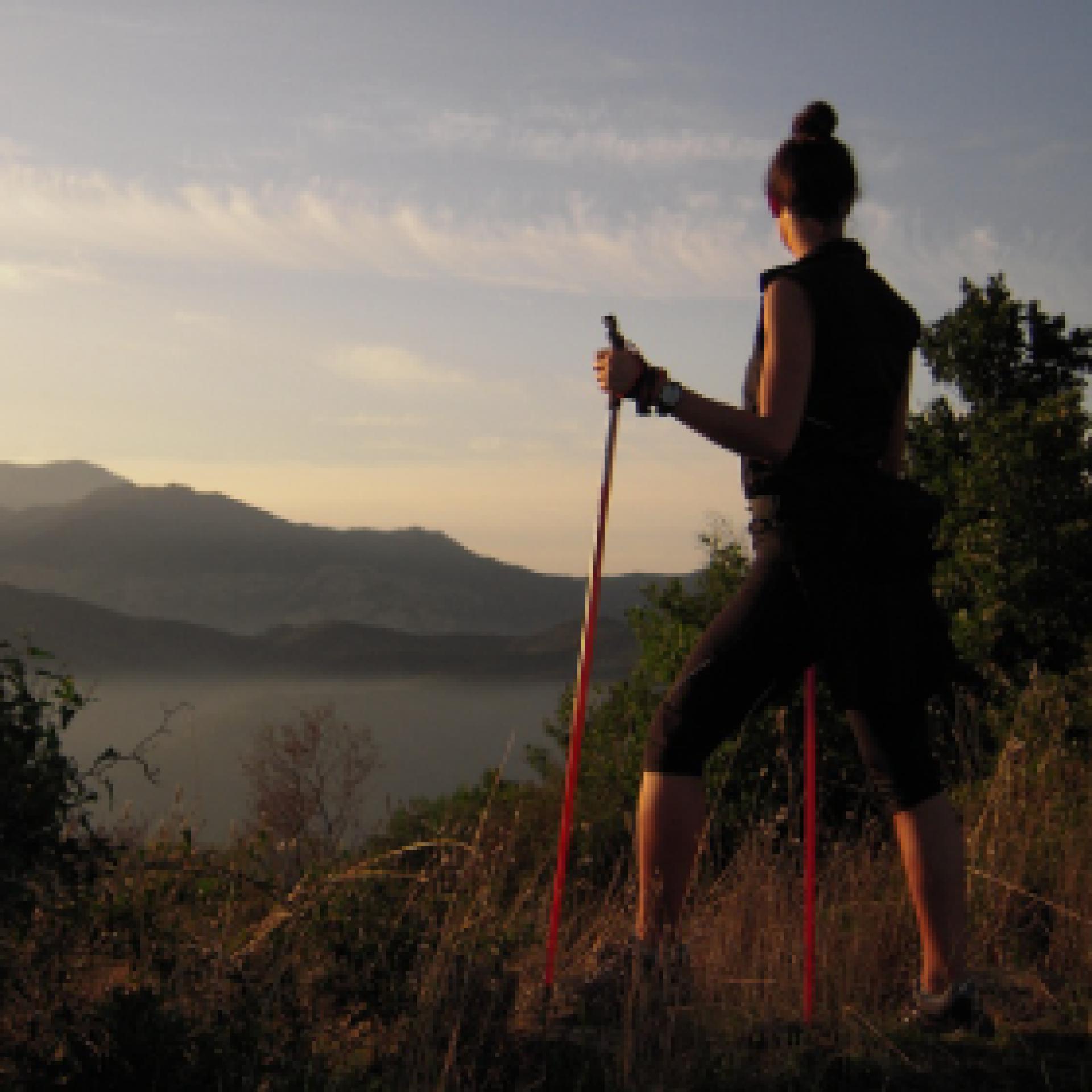
La camminata nordica o camminata con bastoni (in inglese nordic walking o pole walking) è attività fisica e sportiva che ben si coniuga con percorsi in bosco, in pianura o in vallate, lungo scogliere o spiagge.  La Rete dei sentieri della Sardegna offre tantissime occasioni per cimentarsi nella camminata nordica... 

Nordic-walking.png

Results

Sentiero Italia (Stage Z28) Valico Sette Fratelli - Castiadas

Overview of the itinerary

Sentiero Italia runs the length of the island’s eastern side, covering its most important mountains, in 28 stages.  Starting from the north: it flanks the Monte Limbara massif, crosses the limestones of Mont’Albo and Tuttavista, skirting the Gulf of Orosei, it crosses the Supramonte, Gennargentu and the Tacchi of Ogliastra and reaches Perdasdefogu.  Further south, it passes through Armungia and the Gerrei sub-region. Lastly, it touches on the villages of Burcei and San Gregorio, continuing on the Sette Fratelli massif to the old prisons of Castiadas.

General information on Sentiero Italia (Grand Italian Trail)

Sentiero Italia, or Grand Italian Trail, as also explained on the official website, is a walking route that crosses the whole of Italy, using mainly but not exclusively “registered trails”.   
In particular, in Sardinia, not all the stages of the Sentiero Italia of CAI (Italian Alpine Club) are made of trails already included in the registry of the Sardinia Trail Network (RES), either because they have not yet been tested and approved or simply because they cannot be registered as they do not meet the requirements.  However, as a whole, the Sentiero Italia is the single longest walking route currently crossing Sardinia from the north (S. Teresa Gallura, stage Z 1) to the south (Castiadas, end of stage Z 28), touching on the most fascinating mountain areas in central-eastern Sardinia: the plateau of Buddusò, Tepilora, the Cedrino river valley, the ancient forests of Montes, Perda Liana and the regional forest of Montarbu, Monte Genis, and lastly the regional forest of Settefratelli (among the many crossed by the various stages of this long hiking itinerary).

Information on this stage of the trail

Baccu Malu is one of the peaks of the Sette Fratelli (Seven Brothers) massif, an imposing granite range in the south-eastern tip of Sardinia. The last stage in Sardinia of the ‘Sentiero Italia’ (Grand Italian Trail) developed by CAI (Italian Alpine Club) is fairly easy, also because it is mainly downhill through the Monte Arbu forest and then uphill to Bruncu su Adulu, from where you will enjoy a splendid view of the end point. 

The route ends near the old farming penal colony of Castiadas, on the coastal plain, established in the 19th century and closed in the 1950s. Today the old prison buildings can be visited with an interesting museum itinerary.

Itinerary roadbook

Lenght 14.900 m

072023_z28CAI.gpx

Total elevation gain 445 metri

Geographical area Sarrabus-Sette Fratelli

Sentiero Italia (Tappa Z28) Valico Sette Fratelli - Castiadas

In sintesi

Il Sentiero Italia attraversa in lunghezza il settore orientale dell’isola toccandone i sistemi montuosi più rilevanti, in 28 tappe.  Partendo da nord: tocca il massiccio del Monte Limbara, attraversa i calcari del Mont'Albo e del Tuttavista sfiorando il Golfo di Orosei,  attraversa il Supramonte, il Gennargentu, i Tacchi dell’Ogliastra e giunge a Perdasdefogu.  Più a sud, transita da Armungia e dalla subregione del Gerrei. Infine tocca l’abitato di Burcei e San Gregorio, per continuare nel massiccio dei Sette Fratelli fino alle vecchie carceri di Castiadas.

Informazioni generali sull'itinerario sentiero Italia

Il Sentiero Italia, come spiegato anche nel sito ufficiale, è un itinerario (o Cammino) lungo tutta l'Italia, che utilizza prevalentemente ma non esclusivamente "sentieri accatastati".   
In particolare, in Sardegna, non tutte le tappe del Sentiero Italia del CAI coincidono con sentieri già inseriti nel catasto della Rete Escursionistica della Sardegna (RES), perché non hanno ancora superato le verifiche di percorribilità oppure semplicemente perché non possono essere accatastati non avendone i requisiti.  Tuttavia, nel suo insieme, il Sentiero Italia rappresenta l'unica, la più grande dorsale escursionistica che attraversa attualmente la nostra Isola da nord (S. Teresa Gallura, tappa Z 1) a sud (Castiadas, fine tappa Z 28) toccando le aree montane della Sardegna centro-Orientale più affascinanti: l'altopiano di Buddusò, Tepilora, la valle del Cedrino, i boschi vetusti di Montes, Perda Liana e la foresta demaniale di Montarbu, il Monte Genis, e infine la foresta demaniale di Settefratelli (tra le tante attraversate dal lungo itinerario escursionistico a tappe).

Info sul percorso di questa tappa

Baccu Malu è una delle cime del massiccio dei Sette Fratelli, le punte che caratterizzano il versante granitico che svetta nella punta sud orientale della Sardegna. L’ultima tappa sull’isola del cammino o itinerario chiamato "Sentiero Italia Cai" non presenta difficoltà particolari anche perché si svolge su terreno prevalentemente in discesa attraverso la foresta di Monte Arbu e ancora su fino al Bruncu su Adulu da cui si gode uno  splendido panorama  sulla meta d’arrivo. 

Il percorso termina nei pressi della colonia agricola penale di Castiadas, quasi sul livello del mare, bonificata nell’800 e utilizzata fino agli anni ’50 del Novecento quando fu definitivamente chiusa. Oggi si può visitare grazie a un interessante percorso museale.

Informazioni utili

Lungo il percorso non sarà sempre presente la copertura telefonica

Itinerary roadbook

Lenght 14.900 m

072023_z28CAI.gpx

Total elevation gain 445 metri

Geographical area Sarrabus-Sette Fratelli

Contiene carte
Spento

Sentiero Italia (Stage Z27) Burcei – Valico Sette Fratelli

Overview of the itinerary

Sentiero Italia runs the length of the island’s eastern side, covering its most important mountains, in 28 stages.  Starting from the north: it flanks the Monte Limbara massif, crosses the limestones of Mont’Albo and Tuttavista, skirting the Gulf of Orosei, it crosses the Supramonte, Gennargentu and the Tacchi of Ogliastra and reaches Perdasdefogu.  Further south, it passes through Armungia and the Gerrei sub-region. Lastly, it touches on the villages of Burcei and San Gregorio, continuing on the Sette Fratelli massif to the old prisons of Castiadas.

General information on Sentiero Italia (Grand Italian Trail)

Sentiero Italia, or Grand Italian Trail, as also explained on the official website, is a walking route that crosses the whole of Italy, using mainly but not exclusively “registered trails”.   
In particular, in Sardinia, not all the stages of the Sentiero Italia of CAI (Italian Alpine Club) are made of trails already included in the registry of the Sardinia Trail Network (RES), either because they have not yet been tested and approved or simply because they cannot be registered as they do not meet the requirements.  However, as a whole, the Sentiero Italia is the single longest walking route currently crossing Sardinia from the north (S. Teresa Gallura, stage Z 1) to the south (Castiadas, end of stage Z 28), touching on the most fascinating mountain areas in central-eastern Sardinia: the plateau of Buddusò, Tepilora, the Cedrino river valley, the ancient forests of Montes, Perda Liana and the regional forest of Montarbu, Monte Genis, and lastly the regional forest of Settefratelli (among the many crossed by the various stages of this long hiking itinerary).

Information on this stage of the trail

From the town of Burcei, the rout is mainly on dirt tracks towards the old cantoniera (roadside house) of Campu Omu. This marks the start of the route towards the Sette Fratelli, the last mountain massif you will encounter on your journey across the island. 

The trail falls within the Sette Fratelli (seven brothers) park which, with ten thousand hectares of forest stretching over the mountains, is one of the greenest and most stunning places in Sardinia, a nature reserve offering lush nature and breathtaking views

The trail, which is of medium difficulty, ends at the Campu Omu forest ranger station.

Note

You can camp at the ‘Campu Omu’ station of the Forestas Agency, about 3 km from Su Baccu Malu

Lenght 13.700 m

SI Z27.gpx

Total elevation gain 828 metri

Geographical area Gerrei Sarrabus-Sette Fratelli

Sentiero Italia (Tappa Z27) Burcei – Valico Sette Fratelli

In sintesi

Il Sentiero Italia attraversa in lunghezza il settore orientale dell’isola toccandone i sistemi montuosi più rilevanti, in 28 tappe.  Partendo da nord: tocca il massiccio del Monte Limbara, attraversa i calcari del Mont'Albo e del Tuttavista sfiorando il Golfo di Orosei,  attraversa il Supramonte, il Gennargentu, i Tacchi dell’Ogliastra e giunge a Perdasdefogu.  Più a sud, transita da Armungia e dalla subregione del Gerrei. Infine tocca l’abitato di Burcei e San Gregorio, per continuare nel massiccio dei Sette Fratelli fino alle vecchie carceri di Castiadas.

Informazioni generali sull'itinerario sentiero Italia

Il Sentiero Italia, come spiegato anche nel sito ufficiale, è un itinerario (o Cammino) lungo tutta l'Italia, che utilizza prevalentemente ma non esclusivamente "sentieri accatastati".   
In particolare, in Sardegna, non tutte le tappe del Sentiero Italia del CAI coincidono con sentieri già inseriti nel catasto della Rete Escursionistica della Sardegna (RES), perché non hanno ancora superato le verifiche di percorribilità oppure semplicemente perché non possono essere accatastati non avendone i requisiti.  Tuttavia, nel suo insieme, il Sentiero Italia rappresenta l'unica, la più grande dorsale escursionistica che attraversa attualmente la nostra Isola da nord (S. Teresa Gallura, tappa Z 1) a sud (Castiadas, fine tappa Z 28) toccando le aree montane della Sardegna centro-Orientale più affascinanti: l'altopiano di Buddusò, Tepilora, la valle del Cedrino, i boschi vetusti di Montes, Perda Liana e la foresta demaniale di Montarbu, il Monte Genis, e infine la foresta demaniale di Settefratelli (tra le tante attraversate dal lungo itinerario escursionistico a tappe).

Info sul percorso di questa tappa

Dall’abitato di Burcei ci si avvia prevalentemente per strade bianche verso la cantoniera di Campu Omu da cui inizia il percorso verso i Sette Fratelli, l’ultimo massiccio montuoso che si incontrerà nella traversata dell’isola. 

Il territorio fa parte dell’omonimo parco che con diecimila ettari di foresta distesa sulle montagne è uno dei luoghi più verdi e affascinanti della Sardegna, una riserva naturale piena di piacevoli sorprese e panorami mozzafiato

L’arrivo è situato presso la caserma forestale di Campu Omu dopo una tappa di media difficoltà.

Informazioni utili

Lungo il percorso non sarà sempre presente la copertura telefonica

Lenght 13.700 m

SI Z27.gpx

Total elevation gain 828 metri

Geographical area Gerrei Sarrabus-Sette Fratelli

Su Pranu - Atzara

Atzara, although set in a mountainous context, has a hilly territory with gentle slopes and suggestive plateaus. It is an environment also suited for wine-growing, which characterises this centre in its rural landscape, economy and also in its urban environment, with some themed murals and numerous house courtyards, which during the grape harvest host activities for family production. The path includes some asphalt hamlets, but traffic is scarce, limited to landowners, and generally re-spectful of walkers or cyclists. At the same time, there are some areas with exclusively unpaved roads and even narrower cart tracks, which are the merit of this hike. It is also possible to hike in the rain and in case of snow, which, although not as frequent as in the villages at higher altitudes, is a possibil-ity every winter.

Informazioni utili

The LEADER Territory of the Local Action Group (GAL) Rural District Barbagia Mandrolisai Gennargentu (BMG)

Consisting of the Union of Municipalities of Barbagia and the Mountain Community of Gennargentu Mandrolisai. The GAL BMG, therefore, includes 19 municipalities, with a total area of 854.30 sq km and a resident population of approximately 22,000 inhabitants: Aritzo, Atzara, Austis, Belvì, Desulo, Gadoni, Gavoi, Lodine, Meana Sardo, Ollolai, Oniferi, Olzai, Ortueri, Ovodda, Sarule, Sorgono, Teti, Tiana, Tonara.

The GAL Rural District BMG, established in 2009, is a participation foundation composed of 22 public members and over 200 private members, representing the main institutional, economic, and social components of the territory. The foundation aims to improve the quality of life and well-being of communities in the historical regions of Barbagia, Mandrolisai, and Gennargentu by enhancing local resources. The main thematic and intervention areas identified by the GAL BMG for the definition of its Local Development Strategy 2014-2022 are the development and innovation of local production chains and systems, social inclusion, and sustainable tourism.

THE OAST PROJECT: OUTDOOR ACTIVITIES FOR SUSTAINABLE TOURISM

The project, coordinated by the GAL BMG in partnership with the GAL Sisteron-Buëch (France) and the GAL Kilkenny (Ireland), aims to promote sustainable and active tourism in rural areas of Europe. The specific objective of the project was to enhance and develop the tourist attractiveness of the inland waters of Barbagia, through outdoor sports and water activities, in line with the thematic area "sustainable tourism" chosen in the GAL BMG's PDA. The three territories involved boast a rich and varied natural, landscape, and cultural heritage with strong identity traits and enormous potential for the development of active tourism. However, some problems common to all partners have been highlighted, such as: insufficient enhancement and tourist promotion of inland areas, isolation, the absence of an international network useful for the exchange of good practices, and insufficient diversification, delocalization, deseasonalization, and internationalization of tourist flows. The OAST Project was created to respond to these critical issues, as active tourism and sustainable tourism represent the basis for the revival of territories characterized by enormous problems of depopulation, lack of services, unemployment, and school dropout. The idea, therefore, is to promote forms of sustainable, active, responsible, and experiential tourism, as well as to offer diversified and deseasonalized solutions suitable for a constantly growing number of active tourists. The specific action involved the georeferencing and description, in Italian and English, of 19 GAL BMG itineraries related to the theme of water. The itinerary tracks are available and downloadable, in Gpx format, on these pages and also on the GAL BMG's Wikiloc account.

Lenght 11.100 m

Atzara - Su Pranu.gpx

Total elevation gain 294 metri

Geographical area Gennargentu

Contiene carte
Spento

Su Pranu - Atzara

AVVERTENZE

QUESTO ITINERARIO è riportato "tal quale" a titolo informativo e di mera recensione/ricognizione degli itinerari presenti nel territorio  -  come fornito e recensito dal progetto OAST condotto dal GAL BMG nel 2024. 
NOTA: Molti itinerari sono composti da percorsi stretti e richiedono una cura periodica della vegetazione, al momento non assicurata da una gestione  di tipo  ufficiale, non essendo il tracciato inserito nella"rete escursionistica della Sardegna".  
Nota 2: Prima di recarvi sul posto si consiglia di raccogliere informazioni sullo stato di fruibilità, presso il comune competente, per avere certezza dell'effettiva percorribilità dell'itinerario scelto.

IL PERCORSO IN PILLOLE (elementi informativi essenziali)

Il punto di partenza si trova lungo la strada principale di Atzara, via Vittorio Emanuele, che è anche la Strada Statale 128. Più precisamente si parte dal bivio con la via Oristano, che è anche la Strada Provinciale 61. Se non ci fosse posto in  queste due strade potete parcheggiare anche nella via Ballero, che è già traccia.

Descrizione

L’itinerario consente di conoscere una parte inaspettata della subregione del Mandrolisai, dal momento che Atzara, pur  essendo inserita in un più vasto contesto montagnoso, ha un territorio collinare con lievi pendenze e suggestivi altopiani. Non a caso è un ambiente vocato anche per la viticoltura, che caratterizza il paese nel paesaggio rurale, nell’economia e anche nell’ambiente urbano, con alcuni murales a tema e numerosi cortili delle case che durante la vendemmia ospitano le attività per le produzioni familiari. 

Il cammino comprende alcune frazioni in asfalto, dal momento che le campagne sono state infrastrutturate per supportare la fiorente viticoltura, ma il traffico è scarso, limitato ai proprietari dei fondi, e generalmente rispettoso degli escursionisti a piedi o in bici. Al contempo sono rimaste alcune aree con strade  esclusivamente sterrate e ancora più strette mulattiere che costituiscono il pregio di questa escursione, per esempio la sterrata e poi la mulattiera che dall’estremità nord del percorso, in prossimità di Sorgono, si dirige a sud in mezzo ai  pascoli di Su Pranu e al bosco di Su Lìgiu, che nella pronuncia locale sta per Su Lillu. 

È possibile la percorrenza anche in caso di pioggia e in caso di neve che, pur non essendo frequente come per i paesi alle quote più alte, è una eventualità in ogni inverno. Il paese si trova a circa 550 m slm e il punto più alto dell’escursione arriva a circa 750 m slm, contornati dalle montagne di alcuni paesi vicini che arrivano a 1000 m di quota e oltre.

Informazioni utili

Il territorio LEADER del Gruppo di Azione Locale (GAL) Distretto Rurale Barbagia Mandrolisai Gennargentu (BMG) 

Costituito dall'Unione dei Comuni Barbagia e dalla Comunità Montana Gennargentu Mandrolisai. Il GAL BMG comprende, quindi, 19 comuni, per una superficie complessiva di 854,30 kmq e una popolazione residente pari a circa 22.000 abitanti: 

Aritzo, Atzara, Austis, Belvì, Desulo, Gadoni, Gavoi, Lodine, Meana Sardo, Ollolai, Oniferi, Olzai, Ortueri, Ovodda, Sarule, Sorgono, Teti, Tiana, Tonara.


Il GAL Distretto Rurale BMG, costituito nel 2009, è una Fondazione di partecipazione composta da 22 soci pubblici e oltre 200 privati, rappresentativi delle principali componenti istituzionali, economiche e sociali del territorio. La fondazione ha lo scopo di migliorare la qualità della vita e il benessere delle comunità nelle regioni storiche Barbagia, Mandrolisai e Gennargentu mediante la valorizzazione delle risorse locali.
I principali ambiti tematici e di intervento individuati dal GAL BMG per la definizione della propria Strategia di Sviluppo Locale 2014-2022 sono lo sviluppo e l’innovazione delle filiere e dei sistemi produttivi locali, l’inclusione sociale ed il turismo sostenibile.


IL PROGETTO OAST: OUTDOOR ACTIVITIES FOR SUSTAINABLE TOURISM

Il progetto, coordinato dal GAL BMG in partenariato con il GAL Sisteron-Buëch (Francese) e
il GAL Kilkenny (Irelanda), intende promuovere un turismo sostenibile e attivo nelle aree
rurali d’Europa.
L’obiettivo specifico del progetto è stato potenziare e sviluppare l’attrattività turistica delle acque
interne della Barbagia, attraverso gli sport all’aria aperta e le attività acquatiche, in coerenza con l’ambito tematico “turismo sostenibile” prescelto nel PDA del GAL BMG.
I tre territori coinvolti vantano un patrimonio naturalistico, paesaggistico e culturale ricco e variegato con forti caratteri identitari ed enormi potenzialità di sviluppo di turismo attivo
Tuttavia, sono stati evidenziati alcuni problemi comuni a tutti i partner, quali: l’insufficiente valorizzazione e promozione turistica delle aree interne, l’isolamento, l’assenza di un network internazionale utile per lo scambio di buone prassi, e l’insufficiente diversificazione, delocalizzazione, destagionalizzazione e l’internazionalizzazione dei flussi turistici. Il Progetto OAST nasce per rispondere a queste criticità, in quanto il turismo attivo ed il turismo sostenibile rappresentano la base di rilancio dei territori caratterizzati da enormi problemi di spopolamento, carenza di servizi, disoccupazione e dispersione scolastica.
L’idea, quindi è promuovere forme di turismo sostenibile, attivo, responsabile ed esperienziale, nonché
offrire soluzioni diversificate e destagionalizzate adatte ad un numero di turisti attivi in continua crescita.
L’azione specifica ha previsto la georeferenziazione e descrizione, in lingua italiana e inglese, di
19 itinerari del GAL BMG legati al tema dell’acqua. Le tracce degli itinerari sono disponibili e scaricabili, in formato Gpx, in queste pagine e anche nell’account Wikiloc del GAL BMG

Lenght 11.100 m

Atzara - Su Pranu.gpx

Total elevation gain 294 metri

Geographical area Gennargentu

Contiene carte
Spento