Start website main content

Nordic Walking

51 pathways

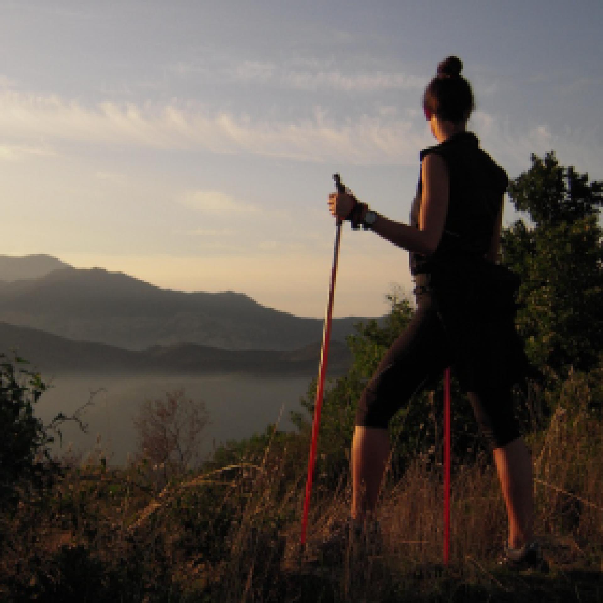
La camminata nordica o camminata con bastoni (in inglese nordic walking o pole walking) è attività fisica e sportiva che ben si coniuga con percorsi in bosco, in pianura o in vallate, lungo scogliere o spiagge.  La Rete dei sentieri della Sardegna offre tantissime occasioni per cimentarsi nella camminata nordica... 

Nordic-walking.png

Results

Lodine, Puddis. Un balcone panoramico sul lago

Accesso

Seppure il parco comunale di Puddis sia di proprietà del Comune di Lodine, esso appartiene territorialmente al Comune di Gavoi, ma il forte legame della comunità lodinese con questa montagna è dovuto anche alla sua vicinanza col piccolo centro montano. 

Si parte a piedi dunque dalla SP30 che costituisce anche la via principale, individuando le indicazioni per il Parco Comunale Puddis che portano ad imboccare la Via IV Novembre, in leggera discesa. 

La sorgente 

Dopo un breve tratto si svolta a destra, raggiungendo rapidamente la sorgente di s’Antana ‘e Bidda, posta leggermente sotto il piano stradale e sempre ottima e fresca. Lasciata la sorgiva alle spalle si prende a salire gradualmente per una rotabile fiancheggiata da muretti a secco, circondati da roverelle mature e rade, nel tipico ambiente della Barbagia di Ollolai. La strada procede rettilinea e dopo un primo tratto si spiana, rimanendo sempre cementata fino ad un grosso spiazzo dove termina il tratto pavimentato. Leggermente a sinistra rispetto alla direzione di arrivo si trova un cancello che è necessario richiudere, mentre un cartello in legno segnala che si è arrivati ormai al parco di Puddis.

Puddis

Si entra quindi nel grosso tancato, mirando ad una strada sterrata sulla sinistra. Sarebbe possibile, inoltre, visitare il castagneto che si trova ad una quota inferiore, oggetto attualmente di un governo a ceduo. Imboccata la strada si sale leggermente di quota, fiancheggiati da un bosco di roverelle piuttosto giovane, inframezzate da un fitto ericeto. Sulla zona si staglia il profilo di una grossa antenna che fa da ripetitore televisivo. 

La strada prosegue in direzione sudovest e poi piega bruscamente a destra in direzione delle antenne. Sulla sinistra si individua qui un esile sentierino che scende leggermente, mirando ad una vasta radura sovrastata da alcune rocce granitiche dalle belle forme tafonate. 

Vista lago 

Si risale cautamente sulle rocce, scoprendo un panorama di straordinaria vastità. 

Ai piedi del picco si apre la valle di Gusana, col suo lago montano circondato dai boschi ad occupare il ruolo di protagonista. Il Gennargentu e il Supramonte, sullo sfondo, coronano con le loro sagome montuose un dedalo di valloni boscosi, creste ondulate o rotte da picchi granitici, lontani paesi o forre profonde. Nei pressi del rocciaio, le case di Gavoi e le cime di San Basilio concludono questa straordinaria veduta su quest’angolo di Sardegna. 

Una volta ultimata la visita, si ritorna al paese per la strada seguita all’andata.

Lenght 2.800 m

lodine.gpx

Total elevation gain 116 metri

Meana, Ortuabis. The ancient crossroads

Access 

From the inhabited village of Meana, the Ortuabis plateau can be reached via the SS 128 road by car and bicycle, or by following the signs for the nuraghe Nolza at the exit of the village. This leads to a fine asphalt road that proceeds on a lonely descent into the valley, reaching below the forest, the first fork at the bottom of the valley, where you take a right turn. 

The vineyards and the Nuraghe 

You continue uphill, on a ridge from which there is a beautiful view of the village. The more wooded areas are behind you and you find yourself on rolling hillsides occupied by beautiful vineyards. High up on a raised hill is the massive silhouette of the nuraghe Nolza. You continue along this road, always lined with vineyards and following the signs until you reach the ticket office. The expert tour guides and the extraordinary view from the top of the nuraghe make it an extraordinary and essential visit to discover this corner of Sardinia. 

The forest 

Leaving the nuraghe, turn right onto the asphalt road, keeping slightly above the railway. The road becomes a dirt track, slightly uphill: here you take a left and then a right, in quick succession, to finally return to the asphalt road where you take another right, slightly uphill, passing by a disused quarry and then into a beautiful wood where the gradient drops. Here you meet the SS128 again and where you can arrive by car, skipping the first part of the itinerary. Follow the public road on the right until the sign km 74, where there is a sign indicating the hiking trail. Here you enter the forest, pass an open barrier and begin to follow a slightly downhill dirt road. 

The kilns 

The road keeps a firebreak on the right and winds along the same route as the aqueduct on a limestone plateau, formerly used for the production of lime, which was produced in large furnaces. The dirt road gradually deteriorates and you come to a barely noticeable fork where you keep to the right to visit a large lime kiln, located on a gentle slope. You resume heading north on a barely noticeable path, sometimes getting off your bike and soon reaching the area where the Ortuabis reception area is located, currently awaiting management. Take the dirt road that serves the area, turning left once you have passed the larger structures and entering the forest, which also has numerous charcoal burners' farmyards. When you come to a fork in the road, you can take a left to visit a large kiln, then right again returning to route SS128 and, by the known road, retracing the outward route to the village.

Lenght 33.100 m

meana.gpx

Total elevation gain 1 193 metri

Meana, Ortuabis. Le antiche crocevie

Accesso 

Dall’abitato di Meana, l’altopiano di Ortuabis si può raggiungere tramite la SS 128 in auto e in bicicletta, oppure seguendo le indicazioni per Nuraghe Nolza all’uscita del paese. Si imbocca così una bella strada asfaltata che procede solitaria e in discesa nella vallata, raggiungendo sotto il bosco un primo bivio nel fondovalle, dove si prende a destra. 

I vigneti e il nuraghe 

Si continua in salita, su un costone da cui si ammira un bel panorama sul paese. Le zone più boscate sono rimaste alle spalle e ci si trova su colline ondulate occupate da splendidi vigneti. In alto, su un colle rilevato, si staglia la sagoma massiccia del Nuraghe Nolza. Si continua sulla strada, sempre affiancati dai vigneti e seguendo le indicazioni fino a raggiungere la biglietteria. Le esperte guide turistiche e lo straordinario panorama che si vede dalla vetta del nuraghe rendono la sua visita straordinaria e fondamentale nella scoperta di quest’angolo di Sardegna. 

La foresta 

Lasciato il nuraghe si prende a destra sulla asfaltata, tenendosi poco più alti della ferrovia. La strada diviene sterrata, in leggera salita: qui si prende a sinistra e poi a destra, in rapida successione, ritornando infine su strada asfaltata dove si prende ancora a destra, in leggera salita, passando accanto ad una cava dismessa e poi in un bel bosco dove la pendenza si abbatte. 

Qui si incontra nuovamente la SS128 e qui si potrebbe arrivare in auto, saltando la prima parte dell’itinerario. Si segue la statale sulla destra fino al km 74 dove si individua un cartello che segnala l’itinerario escursionistico. Qui si entra nel bosco, superando una sbarra sempre aperta e cominciando a percorrere una sterrata in leggera discesa. 

Le fornaci 

La strada tiene sulla destra una striscia frangifuoco e si snoda seguendo lo stesso percorso dell’acquedotto su un altopiano calcareo, in passato usato per la produzione della calce che veniva prodotta in grandi fornaci. La sterrata peggiora gradualmente e si incontra un bivio appena accennato dove si tiene la destra per visitare una grande fornace della calce, posta su un declivio poco pronunciato. Si riprende la direzione nord su un sentiero poco accennato, talvolta scendendo dalla bicicletta e giungendo ben presto alla zona dove sorge l’area ricettiva di Ortuabis, al momento in attesa di una gestione. Si prende la sterrata che serve la zona, svoltando a sinistra una volta oltrepassate le strutture maggiori ed inoltrandosi nel bosco che presenta anche numerose aie dei carbonai. Quando si incontra un bivio, si può prendere a sinistra per visitare una grossa fornace, poi ancora a destra ritornando sulla 128 e, per strada nota, ripercorrendo il tracciato dell’andata fino al paese.

Lenght 33.100 m

meana.gpx

Total elevation gain 1 193 metri

Contiene carte
Spento

Olzai, Su Mulinu Vetzu. A jewel of industrial architecture

Access 

In the centre of Olzai, the outstanding predominant feature is granite. All the old houses and the canals that kept the mountain torrents at bay, are built with this hard stone and the streets of the beautiful historic centre are paved in the same way. You leave your car in the centre of the village, where Via Taloro intersects with Via Marconi, begin to climb the latter and keeping to the left the canal that captures the waters of the Riu Bisine. Drive up between the small houses of the centre until you reach a square on the right, where you will also find the signs for the House-Museum of Carmelo Floris, a famous painter born in Olzai: the museum is well worth a visit and arrangements can also be made here for a visit to the mill. 

Uphill 

You keep to the left, uphill, taking Via Anastasio and then following a small cemented road that leaves the last houses of the village behind. At the next fork, turn right again, uphill on the asphalt, plunging into a dense and silent Holm oak forest. The road climbs steeply, narrowing and gaining height with tight hairpin bends that are always paved. 

Mulinu Vetzu 

The road keeps to the left of the sunken valley of the Riu Bisine from which, in the rainy season, the roar of the torrent comes. A last uphill stretch leads to a widening where, under the forest trees, a few small tables have been set up for a rest. On the left, just below the road, some ancient buildings attract your attention. Su Mulinu Vetzu was mainly used for milling wheat and barley. In the main building was the large wooden wheel, set in motion by gravity from the water that was appropriately channelled. The mill dates back to the end of the 18th century and was renovated in the 2000s: today, the transmission shaft would need further restoration to make the gearing functional again. The old building retains intact the industrial charm of the times gone by; once the visit is over, you can stay and enjoy the coolness of the forest, before returning to the village by the road followed on the outward journey

Lenght 2.400 m

olzai.gpx

Total elevation gain 154 metri

Olzai, Su Mulinu Vetzu. Un gioiello di architettura industriale

Accesso 

Nel centro abitato di Olzai il protagonista assoluto è il granito. Tutte le vecchie case ed i canali che tenevano a bada i torrenti della montagna sono costruiti con questa dura pietra e anche le vie del bel centro storico sono pavimentate allo stesso modo. 

Si lascia l’auto nel centro del paese, dove la Via Taloro si interseca con Via Marconi, cominciando a salire per quest’ultima e tenendo a sinistra il canale che intrappola le acque del Riu Bisine. Si sale tra le casupole del centro fino ad una piazza sulla destra, dove si incontrano anche le indicazioni per la Casa - Museo di Carmelo Floris, celebre pittore nato proprio a Olzai: il museo val bene una visita e si potranno prendere qui accordi anche per la visita al Mulino. 

In salita 

Si tiene la sinistra, in salita, prendendo Via Anastasio e poi seguendo una stradina cementata che si lascia alle spalle le ultime casupole del paese. Al bivio successivo si prende ancora a destra, in salita su asfalto, immergendosi in una fitta e silenziosa lecceta. 

La strada si impenna ripida, restringendosi e prendendo quota con stretti tornanti sempre pavimentati. 

Mulinu Vetzu

La strada tiene sempre a sinistra la valle incassata del Riu Bisine da cui, nelle stagioni delle piogge, proviene lo scrosciare del torrente. Un ultimo strappo in salita porta ad uno slargo dove, sotto gli alberi del bosco, sono stati ricavati alcuni tavolini per la sosta. Sulla sinistra, poco sotto la strada, alcune antiche costruzioni attirano l’attenzione. 

Su Mulinu Vetzu era utilizzato prevalentemente per la molitura del grano e dell’orzo. Nell’edificio principale si trovava la grande ruota di legno, messa in moto per gravità dall’acqua che veniva opportunamente incanalata. Il mulino risale alla fine del Settecento ed è stato ristrutturato negli anni 2000: oggi l’asse di trasmissione avrebbe bisogno di un ulteriore restauro per rendere l’ingranaggio nuovamente funzionante. 

Il vecchio edificio conserva intatto il fascino industriale dei tempi che furono; una volta terminata la visita si può rimanere a godere della frescura del bosco, prima di ritornare al paese per la strada seguita all’andata.

Lenght 2.400 m

olzai.gpx

Total elevation gain 154 metri

Oniferi, Sas Concas. The Necropolis

Access 

The two archaeological sites visited by this simple tour can both be reached via the SS 128 road, directly from the village of Oniferi and following the signs for the SS 131. Leaving the last houses behind, you travel about 3.3 km and spot a tourist sign on the left indicating the necropolis. You will then park in a narrow space next to the main road. 

Sas Concas 

You pass a rudimentary wooden gate and descend along a gentle slope between some beautiful cork trees, passing a barely noticeable ford. On the left, a ridge of pyroclastites are clearly distinguishable, with a beautiful pinkish colour. The entire ridge is colonised by beautiful prickly pear plants, in sharp contrast to the orange lichens tenaciously attached to the rock: on these south-east-facing rocks the Neolithic inhabitants decided to find the final resting place for their loved ones, excavating one of the most extraordinary necropolises of their time. Wandering around the area, one can count up to twenty different tombs, often divided into several rooms. The domus de janas necropolis is also famous for the richness of the decorative elements in the burial chambers: ritual hearths, architectural elements relief carved and, above all, the mysterious graffiti symbolising stylised and upside-down men. The petroglyphs of Sas Concas are very similar to other depictions scattered in contemporary sites in Sardinia and represent an archaic and still mysterious symbolism: among the tombs of the necropolis, the best preserved ones are to be found in the large tomb of the hemicycle, preceded by a chamber excavated in the rock that is now largely eroded. 

Nuraghe Ola 

Once the visit to the necropolis is over, you can return to the car by continuing on the SS128, ignoring the detours for the SS 131 DCN and remaining on the old state road for about 3 km: on the left of the road, well signposted and visible, stands the magnificent Nuraghe Ola, at the centre of an area with a high density of archaeological monuments. The ancient nuragic tower, of a simple construction, can be reached by a short path from the car park. Immediately before the monument are two large huts, which have been the subject of archaeological investigation in recent times. The nuraghe was also recently restored. It consists of a large inner tholos chamber, where there are some alcoves, and a splendid intermural staircase that provides access to the upper floor. Here one notices a slab that closes the tholos and that, at the summer solstice, is sometimes removed to allow one to witness the suggestive phenomenon of the sun ray penetrating the darkness of the chamber below at midday. At the end of the visit, you can return to the village or visit the beautiful necropolis of Brodu, not far away, however its not signposted.

Lenght 11.200 m

oniferi.gpx

Total elevation gain 261 metri

Oniferi, Sas Concas. La necropoli

Accesso 

I due siti archeologici visitati da questo semplice itinerario si raggiungono entrambi tramite la SS 128, direttamente dal paese di Oniferi e seguendo le indicazioni per la SS 131. 

Lasciate le ultime case alle spalle si percorrono circa 3,3 km e si individua sulla sinistra un cartello turistico che indica la necropoli. Si posteggia così in un angusto spazio accanto alla statale. 

Sas Concas 

Si supera un rudimentale cancello fatto di legno e si scende un lieve declivio tra alcune belle sughere, superando un guado appena accennato. Sulla sinistra si distingue chiaramente un costone di piroclastiti, dal bel colore rosaceo. L’intero costone è colonizzato da belle piante di fichidindia, in forte contrasto con i licheni arancioni tenacemente attaccati alla roccia: su queste rocce esposte a sudest gli abitanti del Neolitico decisero di trovare l’estrema dimora per i propri cari, scavando una delle necropoli più straordinarie dei loro tempi. 

Girovagando per la zona si possono contare fino a venti tombe diverse, articolate spesso al loro interno in più vani. La necropoli a domus de janas è celebre inoltre per la ricchezza degli elementi decorativi nei vani funerari: si individuano focolari rituali, elementi architettonici scolpiti in rilievo e soprattutto i misteriosi graffiti che simboleggiano uomini stilizzati e capovolti. I petroglifi di Sas Concas sono assai simili ad altre raffigurazioni sparse in siti coevi in Sardegna e rappresentano una simbologia arcaica e ancora misteriosa: tra le tombe della necropoli, quelli meglio conservati si trovano nell’ampia tomba dell’emiciclo, preceduta da un vano scavato nella roccia oggi in gran parte eroso. 

Nuraghe Ola 

Terminata la visita alla necropoli si può tornare all’auto proseguendo sulla SS128, ignorando le deviazioni per la SS 131 DCN e rimanendo sulla vecchia statale per circa 3 km: sulla sinistra della strada, ben segnalato e visibile, si staglia il magnifico Nuraghe Ola, al centro di un’area ad alta densità di monumenti archeologici. 

L’antica torre nuragica, di tipo semplice, si raggiunge per un breve sentiero che si diparte dal parcheggio. Subito prima del monumento si incontrano due ampie capanne, oggetto di indagine archeologica in tempi recenti. Anche il nuraghe è stato recentemente restaurato. Si compone di un’ampia camera interna a tholos, dove sono presenti alcune nicchie, e da una splendida scala intermuraria che permette di accedere al piano superiore. Qui si nota una lastra che chiude la tholos e che, nel solstizio d’estate, viene talvolta rimossa per permettere di assistere al suggestivo fenomeno del raggio di sole che, a mezzogiorno, penetra nel buio della camera sottostante. 

Terminata la visita si può rientrare al paese o visitare la bella necropoli di Brodu, poco distante, ma non segnalata

Lenght 11.200 m

oniferi.gpx

Total elevation gain 261 metri

Ortueri town, GAL BMG itinerary starting point

GAL BMG itinerary starting point
 

How to get here

The easy tourist itinerary that visits the Mui Muscas oasis consists of a comfortable loop to be covered by bicycle on easy dirt roads and paved sections with little traffic. From the town, take the SS388, leaving the town and encountering, immediately after the last houses, the signs for the naturalistic oasis, where excursions and a panoramic point are indicated. Continue on the paved road, always following the signs and starting to climb a panoramic hill, flanked by a beautiful cork oak forest and a maquis shrubland of heather and strawberry trees.
 

Route location centro abitato

Rifugio, presidi abitati

Geographical area Guilcer-Barigadu-Mandrolisai

Abitato di Ortueri, partenza itinerario del GAL BMG

Punto di partenza dell'itinerario del GAL BMG

How to get here

Il facile itinerario turistico che visita l’oasi di Mui Muscas si compone di un comodo anello da percorrere in bicicletta su facili sterrate e tratti asfaltati con scarso traffico. Dal paese si prende la SS388, uscendo dal paese ed incontrando, subito dopo le ultime case, le indicazioni per l’oasi naturalistica, dove sono segnalate ecursioni e un punto panoramico. Si prosegue su strada asfaltata, seguendo sempre le indicazioni e cominciando a salire su una collina panoramica, affiancati da una bella sughereta e da una macchia evoluta ad erica e corbezzoli.

Route location centro abitato

Rifugio, presidi abitati

Geographical area Guilcer-Barigadu-Mandrolisai