Start website main content

Nordic Walking

51 pathways

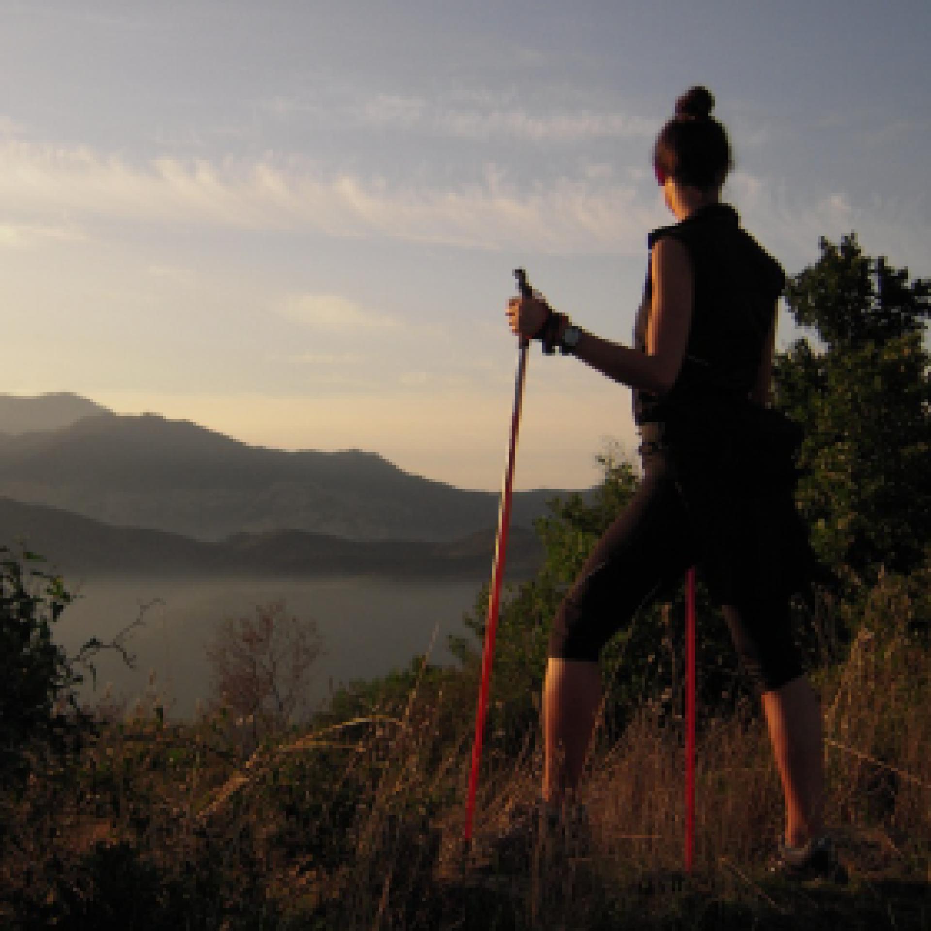
La camminata nordica o camminata con bastoni (in inglese nordic walking o pole walking) è attività fisica e sportiva che ben si coniuga con percorsi in bosco, in pianura o in vallate, lungo scogliere o spiagge.  La Rete dei sentieri della Sardegna offre tantissime occasioni per cimentarsi nella camminata nordica... 

Nordic-walking.png

Results

Gadoni, Foresta Corongia. Between breccas and disterrus

Access 

Depart from the centre of Gadoni along the SP2 in the direction of Seulo, then turning right onto the tarmac road in the direction of Funtana Raminosa. This beautiful road partly follows the miners' old route and runs alongside the allotments and orchards that they tended everyday, on their way to the mine, as they left the village. You gradually gain altitude, with increasingly broader views of the Flumendosa valleys, then you approach the buildings of the abandoned mine that occupies the Riu Saraxinus valley. The mining complex can be visited (www.visitgadoni.info) and a visit is highly recommended. Continue uphill for a few more kilometres until it ends, turning left and following the signs for Foresta Corongia on a partially unsurfaced road. When the road flattens out, you reach the Bauzzoni picnic area, where you leave the car. 

Su Campalini 

Continue on a dirt road on foot, ignoring some minor detours and turning left at the only obvious fork. Just below the road, reachable with some difficulty and unmarked, are the caves of Grutas de Perdu, with a scenic waterfall descending from the vault. The road you follow is now level, beneath a beautiful woodland area where you can identify the circular clearings, devoid of vegetation, where the charcoal burners built their threshing floors for the production of charcoal. Halfway along the long straight stretch, you come to a wooden signpost indicating Su Campalini: you leave the main dirt road and enter the woods, reaching the vertiginous edge of the Lartinatzu walls: here Foresta Corongia precipitates towards the Flumendosa riverbed and here stands a slender and bold rocky pinnacle, almost a bell tower, as its name in Sardinian seems to suggest.

Is Breccas 

After a long panaoramic rest andbreak, you return to the dirt road continuing in a southerly direction until you come to a large fork in the road: Here you turn right, uphill, past a gate and continue on the main road. Soon the road becomes flat again, on clay soil and begins to skirt some unique isolated rock towers that become more and more numerous, until they form a veritable labyrinth of walls, caves, crevices and diaclasas. The area is known as Is Breccas and was the kingdom of shepherds and the bandit Torracorti, who lived over a century ago. 

Su Pinneddu 

Exploring the labyrinth of Is Breccas is worth every minute spent and various floristic endemisms can be recognised in the walls, as you walk along the slender paths that follow the audacious conformations of the rock. You then continue along a dirt road until it emerges from the forest: here, on the right, stands an isolated tower known as Su Pinneddu. The road joins a main dirt track which you follow to the right, beginning to descend and reaching, after a long stretch in the forest, the first fork encountered on the way. Here you turn left, shortly reaching the Bauzzoni area and the car.

Itinerary roadbook

Lenght 25.600 m

Gadoni.gpx

Total elevation gain 1 022 metri

Gadoni, Foresta Corongia. Tra breccas e disterrus

Accesso 

Si parte dal centro abitato di Gadoni percorrendo la SP2 in direzione Seulo, prendendo poi a destra per strada asfaltata in direzione di Funtana Raminosa. La bella strada ricalca in parte la viabilità dei minatori e costeggia gli orti ed i frutteti che essi curavano recandosi alla miniera ogni giorno, partendo dal paese. Si guadagna gradualmente quota, con vista sempre più ampia sulle vallate del Flumendosa, addentrandosi poi tra gli edifici della miniera abbandonata che occupa la valle del Riu Saraxinus

Il complesso minerario è oggi visitabile (www.visitgadoni.info) e la sua visita è fortemente consigliata. Si procede ancora in salita per alcuni km finché essa termina, prendendo a sinistra e seguendo le indicazioni per Foresta Corongia su strada parzialmente sterrata. Quando la strada si spiana si raggiunge l’area attrezzata di Bauzzoni, dove si lascia l’auto. 

Su Campalini 

Si prosegue su strada sterrata a piedi, ignorando alcune deviazioni secondarie e prendendo a sinistra all’unico bivio evidente. Poco sotto la strada, raggiungibili con qualche difficoltà e non segnalate, si incontrerebbero le grotte di Grutas de Perdu, con una scenografica cascata che discende dalla volta. La strada che si percorre è ora in piano, sotto un bel bosco dove si riconoscono gli spiazzi circolari e privi di vegetazione dove i carbonai costruivano le loro aie per la produzione del carbone da legna. 

A metà del lungo rettilineo si incontra un cartello in legno che segnala Su Campalini: si abbandona la sterrata principale e ci si inoltra nel bosco, raggiungendo il ciglio vertiginoso delle pareti di Lartinatzu: qui Foresta Corongia precipita verso il greto del Flumendosa e qui si staglia un pinnacolo roccioso esile ed ardito, quasi un campanile, come il nome in sardo pare suggerire. 

Is Breccas 

Dopo una lunga sosta panoramica si ritorna sulla strada sterrata continuando in direzione sud finché si incontra un grosso bivio: qui si prende a destra, in salita, oltrepassando un cancello e proseguendo sulla strada principale. Ben presto la strada ritorna in piano, su terreno argilloso e comincia a costeggiare dei singolari torrioni isolati di roccia che divengono sempre più numerosi, fino a formare un vero e proprio labirinto di pareti, grotte, fenditure e diaclasi. La zona è nota come Is Breccas ed era il regno di pastori e del bandito Torracorti, vissuto oltre un secolo fa. 

Su Pinneddu 

L’esplorazione del labirinto di Is Breccas vale ogni minuto speso e nelle pareti si potranno riconoscere vari endemismi floristici, mentre si percorrono gli esili sentieri che seguono le ardite conformazioni della roccia. Si prosegue quindi ancora su sterrata finché essa esce dal bosco: qui, sulla destra, si staglia un torrione isolato noto come Su Pinneddu. La strada si congiunge ad una sterrata principale che si segue verso destra, cominciando a scendere ed raggiungendo dopo un lungo tratto nel bosco il primo bivio incontrato all’andata. Qui si prende a sinistra, raggiungendo in breve la zona di Bauzzoni e l’auto.

Itinerary roadbook

Lenght 25.600 m

Gadoni.gpx

Total elevation gain 1 022 metri

Teti, Abini. The sanctuary of the ancient Sardinians

Access 

From Teti, take the SP4 downhill towards Lake Cucchinadorza, one of the three large reservoirs used for the production of hydroelectric energy. Just before the dam, on the left of the road, there is a clearing where you can park. 

Il Taloro - The Taloro 

You turn back a few dozen metres, taking a dirt road that leads slightly downhill in a north-westerly direction, passing a gate that is always open. The road continues downhill, keeping to the right of the gorge of the Taloro river, interrupted upstream by the barrage of the dam of the Cucchinadorza. Soon you come across two gates side by side: take the one on the right, which is never locked and serves to regulate livestock traffic. Immediately, a dirt track begins, initially in good condition, then increasingly rutted. The path enters the Taloro gorge: the river, once stormy and impetuous, is often dried up due to the interruptions of the dams upstream, but it still flows with a roar in winter and spring. 

Abini 

The road bends slightly to the west, still within sight of the river. It climbs slightly over a wide ridge, flanked by a woodland and shrubland, then descends in narrow hairpin bends. The road goes just above a farmstead: ignore the first fork to the left and then, at a sharp right-hand bend that descends towards the farmsteads, take a left along the less obvious tracks (GPS useful), almost immediately taking up a good dirt track that heads towards the Abini agriturismo. You descend to lap the Taloro and here, in a vast meadowy area just below the agritourism, you come across the monumental huts of Abini. The proto-Sardinian village owes its fortune to the discovery of famous bronze statues, such as the warrior with two shields and four eyes, one of the finest examples of proto-Sardinian art. The monumentality of the buildings excavated so far suggests that it was undoubtedly a centre of great importance and it is surprising to come across it in such an evocative and isolated place. After visiting the site, return along the road travelled, perhaps taking advantage of the hospitality of the nearby agriturismo before setting off again.

Lenght 27.100 m

teti.gpx

Total elevation gain 1 252 metri

Teti, Abini. Il santuario degli antichi Sardi

Accesso 

Da Teti si prende la SP4 in discesa, in direzione del Lago di Cucchinadorza, uno dei tre grandi bacini utilizzati per la produzione di energia idroelettrica. Poco prima della diga, sulla sinistra della strada, si trova uno spiazzo dove è possibile posteggiare. 

Il Taloro 

Si ritorna indietro di poche decine di metri, imboccando una sterrata che si stacca in lieve discesa in direzione nordovest, superando un cancello sempre aperto. 

La strada prosegue in discesa, tenendo sulla destra la gola del Fiume Taloro, interrotta a monte dallo sbarramento della diga di Cucchinadorza

Ben presto si incontrano due cancelli affiancati: si prende quello a destra che non è mai sbarrato e serve a regimare il traffico del bestiame. Subito inizia una sterrata, inizialmente in buone condizioni, poi sempre più disastrata. Il percorso si inoltra nella gola del Taloro: il fiume, un tempo tempestoso e irruento, è spesso in secca a causa delle interruzioni delle dighe a monte, ma scorre ancora con fragore in inverno e primavera. 

Abini 

La strada piega leggermente ad ovest, sempre in vista del fiume. Si sale leggermente su un vasto costone, affiancati da bosco e macchia, poi si scende per stretti tornanti. La strada si porta poco più in alto di una azienda agricola: si ignora il primo bivio a sinistra e poi, in corrispondenza di un brusco tornante a destra che scende verso i caseggiati, si prende a sinistra per tracce meno evidenti (utile il GPS) riprendendo quasi subito una bella sterrata che si dirige verso l’agriturismo di Abini

Si scende a lambire il Taloro e qui, in una vasta area prativa proprio sotto l’agriturismo, si incontrano le monumentali capanne di Abini. Il villaggio protosardo deve la sua fortuna al ritrovamento di celebri bronzetti, come il guerriero con due scudi e quattro occhi, uno dei più begli esempi di arte protosarda. La monumentalità degli edifici finora scavati suggerisce che si trattasse indubbiamente di un centro di grande importanza e stupisce incontrarlo in un luogo oggi così suggestivo ed isolato. 

Dopo la visita al sito si ritorna per la strada percorsa, magari usufruendo dell’ospitalità del vicino agriturismo prima di rimettersi in cammino.

Lenght 27.100 m

teti.gpx

Total elevation gain 1 252 metri

Meana, Ortuabis. The ancient crossroads

Access 

From the inhabited village of Meana, the Ortuabis plateau can be reached via the SS 128 road by car and bicycle, or by following the signs for the nuraghe Nolza at the exit of the village. This leads to a fine asphalt road that proceeds on a lonely descent into the valley, reaching below the forest, the first fork at the bottom of the valley, where you take a right turn. 

The vineyards and the Nuraghe 

You continue uphill, on a ridge from which there is a beautiful view of the village. The more wooded areas are behind you and you find yourself on rolling hillsides occupied by beautiful vineyards. High up on a raised hill is the massive silhouette of the nuraghe Nolza. You continue along this road, always lined with vineyards and following the signs until you reach the ticket office. The expert tour guides and the extraordinary view from the top of the nuraghe make it an extraordinary and essential visit to discover this corner of Sardinia. 

The forest 

Leaving the nuraghe, turn right onto the asphalt road, keeping slightly above the railway. The road becomes a dirt track, slightly uphill: here you take a left and then a right, in quick succession, to finally return to the asphalt road where you take another right, slightly uphill, passing by a disused quarry and then into a beautiful wood where the gradient drops. Here you meet the SS128 again and where you can arrive by car, skipping the first part of the itinerary. Follow the public road on the right until the sign km 74, where there is a sign indicating the hiking trail. Here you enter the forest, pass an open barrier and begin to follow a slightly downhill dirt road. 

The kilns 

The road keeps a firebreak on the right and winds along the same route as the aqueduct on a limestone plateau, formerly used for the production of lime, which was produced in large furnaces. The dirt road gradually deteriorates and you come to a barely noticeable fork where you keep to the right to visit a large lime kiln, located on a gentle slope. You resume heading north on a barely noticeable path, sometimes getting off your bike and soon reaching the area where the Ortuabis reception area is located, currently awaiting management. Take the dirt road that serves the area, turning left once you have passed the larger structures and entering the forest, which also has numerous charcoal burners' farmyards. When you come to a fork in the road, you can take a left to visit a large kiln, then right again returning to route SS128 and, by the known road, retracing the outward route to the village.

Lenght 33.100 m

meana.gpx

Total elevation gain 1 193 metri

Meana, Ortuabis. Le antiche crocevie

Accesso 

Dall’abitato di Meana, l’altopiano di Ortuabis si può raggiungere tramite la SS 128 in auto e in bicicletta, oppure seguendo le indicazioni per Nuraghe Nolza all’uscita del paese. Si imbocca così una bella strada asfaltata che procede solitaria e in discesa nella vallata, raggiungendo sotto il bosco un primo bivio nel fondovalle, dove si prende a destra. 

I vigneti e il nuraghe 

Si continua in salita, su un costone da cui si ammira un bel panorama sul paese. Le zone più boscate sono rimaste alle spalle e ci si trova su colline ondulate occupate da splendidi vigneti. In alto, su un colle rilevato, si staglia la sagoma massiccia del Nuraghe Nolza. Si continua sulla strada, sempre affiancati dai vigneti e seguendo le indicazioni fino a raggiungere la biglietteria. Le esperte guide turistiche e lo straordinario panorama che si vede dalla vetta del nuraghe rendono la sua visita straordinaria e fondamentale nella scoperta di quest’angolo di Sardegna. 

La foresta 

Lasciato il nuraghe si prende a destra sulla asfaltata, tenendosi poco più alti della ferrovia. La strada diviene sterrata, in leggera salita: qui si prende a sinistra e poi a destra, in rapida successione, ritornando infine su strada asfaltata dove si prende ancora a destra, in leggera salita, passando accanto ad una cava dismessa e poi in un bel bosco dove la pendenza si abbatte. 

Qui si incontra nuovamente la SS128 e qui si potrebbe arrivare in auto, saltando la prima parte dell’itinerario. Si segue la statale sulla destra fino al km 74 dove si individua un cartello che segnala l’itinerario escursionistico. Qui si entra nel bosco, superando una sbarra sempre aperta e cominciando a percorrere una sterrata in leggera discesa. 

Le fornaci 

La strada tiene sulla destra una striscia frangifuoco e si snoda seguendo lo stesso percorso dell’acquedotto su un altopiano calcareo, in passato usato per la produzione della calce che veniva prodotta in grandi fornaci. La sterrata peggiora gradualmente e si incontra un bivio appena accennato dove si tiene la destra per visitare una grande fornace della calce, posta su un declivio poco pronunciato. Si riprende la direzione nord su un sentiero poco accennato, talvolta scendendo dalla bicicletta e giungendo ben presto alla zona dove sorge l’area ricettiva di Ortuabis, al momento in attesa di una gestione. Si prende la sterrata che serve la zona, svoltando a sinistra una volta oltrepassate le strutture maggiori ed inoltrandosi nel bosco che presenta anche numerose aie dei carbonai. Quando si incontra un bivio, si può prendere a sinistra per visitare una grossa fornace, poi ancora a destra ritornando sulla 128 e, per strada nota, ripercorrendo il tracciato dell’andata fino al paese.

Lenght 33.100 m

meana.gpx

Total elevation gain 1 193 metri

Contiene carte
Spento

Desulo, Girgini. The heart of the Gennargentu

Access 

This magnificent tour is partly on an asphalt road and partly on a dirt track: the use of mountain bikes is certainly the best means of appreciating it. From the village of Desulo you start to climb the SP7 in the direction of Fonni. The tough climb is about 7 km long and many prefer to reach the mountain pass by car, starting the cycle ride directly from Tascusì. Just as you reach the pass from the climb, you turn right, downhill on a asphalt and scenic road, with an increasingly uneven surface. After 5.6 km you arrive at Arcu Guddetorgiu and here you go left, downhill, following only at this fork the signs for the Girgini agriturismo. 

La sterrata -The dirt track 

Immediately below the fork you meet another one where you go right, then left, leaving the agriturismo on the opposite side. Immediately a wide, well-maintained road begins, winding its way through woodland, heather groves and monumental downy oaks in a wide and majestic environment. The asphalt gives way to a dirt road immediately after a bridge, The asphalt gives way to dirt road immediately after a bridge, as the route continues on a slight incline or uphill. You pass a building belonging to Agenzia Forestas, which look after the forest, often encountering grazing cows. 

Girgini 

At a sudden turn in the road, one can distinguish the unmistakable pyramidal shape of Su Toni de Girgini. The term 'Toni' indicates an isolated limestone elevation, surrounded only by different rocks: in this area in addition to the main one, you encounter that of Genna Eragas, which you can reach by continuing to cycle to the right at the first crossroads. Girgini has been a popular area since ancient times, as revealed by a giants' tomb and the presence of the remains of numerous villages. You can climb to the limestone peak by following a footpath along the ridge, starting right from the clearing where you arrived. From the summit the vast panorama sweeps across the majesty of the Gennargentu mountain range, which encircles the visitor with its vast ridges. You return to Desulo by the road followed on the outward journey.

Itinerary roadbook

Lenght 39.800 m

desulo.gpx

Total elevation gain 1 825 metri

Desulo, Girgini. Il cuore del Gennargentu

Accesso 

Questo magnifico itinerario si svolge in parte su strada asfaltata e in parte su sterrata: l’utilizzo delle mountain-bike è sicuramente il modo migliore per apprezzarlo. 

Dal paese di Desulo si comincia a risalire la SP7 in direzione di Fonni. La dura salita si snoda per circa 7 km e in molti preferiscono raggiungere il passo montano in auto, cominciando a pedalare proprio da Tascusì. Proprio quando si arriva al valico dalla salita si prende a destra, in discesa su strada asfaltata e panoramica, poi con fondo sempre più dissestato. Percorsi 5,6 km si arriva ad Arcu Guddetorgiu e qui si va a sinistra, in discesa, seguendo solo in questo bivio le indicazioni per l’agriturismo Girgini

La sterrata 

Subito sotto il bivio se ne incontra un altro dove si va a destra, poi a sinistra, lasciando dalla parte opposta l’agriturismo. Subito comincia una strada ampia e ben tenuta che si snoda tra bosco, ericeti e roverelle monumentali, in ambiente ampio a maestoso. 

L’asfalto cede posto allo sterrato subito dopo un ponte, mentre si prosegue con scarse pendenze o in leggera salita. Si passa accanto ad un edifico dell’Agenzia Forestas, che si occupa della cura del bosco, incontrando spesso delle vacche al pascolo.

Girgini 

Ad una improvvisa svolta della strada si distingue la sagoma piramidale, inconfondibile, di su toni de Girgini. Il termine “toni” indica un isolato rilievo calcareo, circondato solo da rocce differenti: in questa zona, oltre al principale, si incontra quello di Genna Eragas che si raggiungerebbe continuando a pedalare a destra al primo incrocio. 

Girgini era un’area molto frequentata fin dall’antichità, come rivelano una tomba dei giganti e la presenza di resti di numerosi villaggi. Si può salire sulla cima calcarea seguendo un accennato sentiero che tiene il crinale, con partenza proprio dallo spiazzo in cui si è giunti. Dalla cima, il vasto panorama spazia nella maestosità del massiccio del Gennargentu, che abbraccia il visitatore con i suoi vasti costoni. Si ritorna a Desulo per la strada seguita all’andata.

Itinerary roadbook

Lenght 39.800 m

desulo.gpx

Total elevation gain 1 825 metri