Start website main content

Results

Campidano di Oristano

Campidano di Oristano is a sub-region of western Sardinia, whose territory belonged in ancient times to the Kingdom of Arborea, and which corresponds to the curatorie or administrative areas of: Campidano di Milis, Campidano Maggiore (or di Cabras), Campidano di Simaxis, Usellus, Montis, Bonorzuli 
[source: Wikipedia].
The environmental structure of this territory is based on the system of coastal wetlands stretching from the centre of the Gulf of Oristano to the Sinis Peninsula, up to and including the sandy beach of Is Arenas.  The territory features three coastal plains, the Campidano of Oristano, and the Tirso river hydrographic system: the Campidano of Milis lies to the north, the Tirso forms the watershed between the Campidano di Milis and the Campidano Maggiore, and the Campidano of Simaxis.
The lagoon and pond environments found along the coastal strip between Capo Mannu and Capo Frasca (Is Benas, Mistras, Cabras, Santa Giusta, Pauli Maiori, S'Ena Arrubia, Corru s'Ittiri and Corru Mannu San Giovanni and Marceddì), not only represent the natural hydraulic expansion system of watercourses and a great natural and ecological resource, but are also home to important economic activities such as fish farming. 
The structure of the coastal settlements presents hybrid situations around the main centres: Oristano (seaside village of Torre Grande), Arborea (Colonie Marine), Cabras (seaside hamlets of San Giovanni di Sinis and Funtana Meiga), San Vero Milis (S'Arena Scoada, Putzu Idu, Mandriola, Su Pallosu, Sa Rocca Tunda), Terralba (fishing village of Marceddì).
The Gulf has been characterized by the founding of three separate urban centres during the Phoenician era, Neapolis, Othoca and Tharros. (source: Regional Landscape Plan, area sheet n.9)


 Campidano di Oristano is a sub-region of western Sardinia, whose territory belonged in ancient times to the Kingdom of Arborea, and which corresponds to the curatorie or administrative areas of: Campidano di Milis, Campidano Maggiore (or di Cabras), Campidano di Simaxis, Usellus, Montis, Bonorzuli 
[source: Wikipedia].
The environmental structure of this territory is based on the system of coastal wetlands stretching from the centre of the Gulf of Oristano to the Sinis Peninsula, up to and including the sandy beach of Is Arenas.  The territory features three coastal plains, the Campidano of Oristano, and the Tirso river hydrographic system: the Campidano of Milis lies to the north, the Tirso forms the watershed between the Campidano di Milis and the Campidano Maggiore, and the Campidano of Simaxis.
The lagoon and pond environments found along the coastal strip between Capo Mannu and Capo Frasca (Is Benas, Mistras, Cabras, Santa Giusta, Pauli Maiori, S'Ena Arrubia, Corru s'Ittiri and Corru Mannu San Giovanni and Marceddì), not only represent the natural hydraulic expansion system of watercourses and a great natural and ecological resource, but are also home to important economic activities such as fish farming. 
The structure of the coastal settlements presents hybrid situations around the main centres: Oristano (seaside village of Torre Grande), Arborea (Colonie Marine), Cabras (seaside hamlets of San Giovanni di Sinis and Funtana Meiga), San Vero Milis (S'Arena Scoada, Putzu Idu, Mandriola, Su Pallosu, Sa Rocca Tunda), Terralba (fishing village of Marceddì).
The Gulf has been characterized by the founding of three separate urban centres during the Phoenician era, Neapolis, Othoca and Tharros. (source: Regional Landscape Plan, area sheet n.9)


76992.jpg
slug
campidano-di-oristano

Campidano di Oristano

Il Campidano di Oristano è una sub-regione della Sardegna occidentale, il cui territrio apparteneva anticamente al Giudicato di Arborea, e corrisponde a quello delle curatorie: Campidano di Milis, Campidano Maggiore (o di Cabras), Campidano di Simaxis, Usellus, Montis, Bonorzuli  (fonte: Wikipedia).

La struttura ambientale di questo territorio si fonda sul sistema delle zone umide costiere che si estendono dal centro del Golfo di Oristano alla penisola del Sinis, fino a comprendere il compendio sabbioso di Is Arenas.
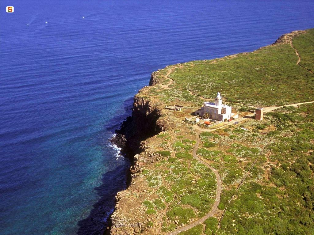
L’Ambito comprende il Golfo di Oristano dal promontorio di Capo San Marco a Capo Frasca, ed è delimitato a nord dalla regione del Montiferru e verso est dal sistema orografico del Monte Arci-Grighine. Si estende all’interno verso i Campidani centrali ed è definito a sud dall’arco costiero del sistema dell’Arcuentu e dal Capo Frasca, promontorio vulcanitico che rappresenta la sponda meridionale del Golfo, costituito da un tavolato basaltico, rilevato di circa 80 metri sul
livello del mare e delimitato da ripide scarpate scolpite dagli agenti meteo-marni, il cui territorio è attualmente soggetto ad esclusivi usi militari.

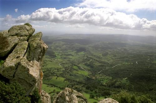
Questo territorio è articolato sui tre Campidani di Oristano e sul sistema idrografico del Tirso: il Campidano di Milis a nord, il Tirso come spartiacque fra il Campidano di Milis e il Campidano Maggiore, e il Campidano di Simaxis, che si estende dall’arco costiero alle pendici del Monte Arci.

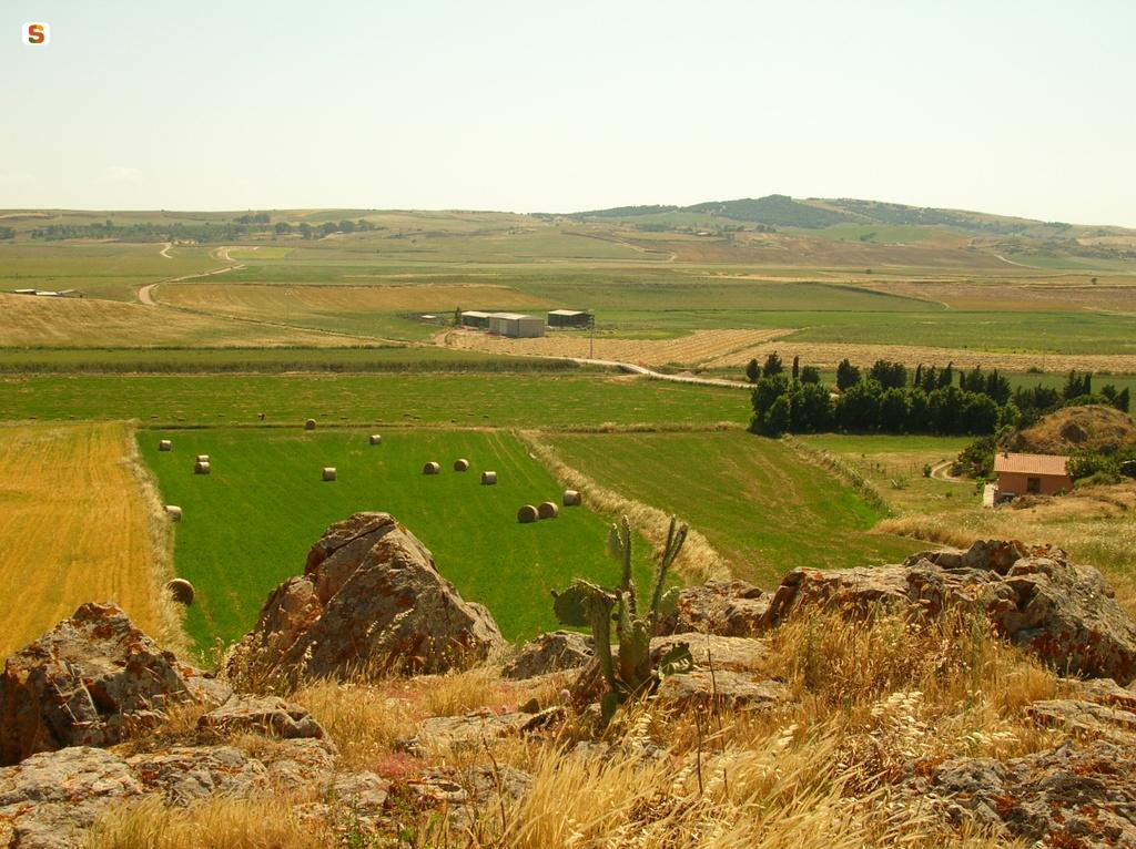
Gli ambienti lagunari e stagnali che si sviluppano lungo la fascia costiera compresa tra Capo Mannu e Capo Frasca (Is Benas, Mistras, Cabras, Santa Giusta, Pauli Maiori, S’Ena Arrubia, Corru s’Ittiri e Corru Mannu San Giovanni e Marceddì), oltre a costituire il naturale sistema di espansione idraulica dei corsi d’acqua ed avere rilevanza paesaggistica ed ecologica, sono sede di importanti attività economiche quale l’allevamento ittico. Questi sono ambienti
produttivi che periodicamente vengono compromessi dallo stato in cui vertono questi ecosistemi, che richiedono un coordinamento nella gestione ambientale dei bacini di alimentazione.
La struttura dell’insediamento costiero presenta situazioni ibride (stagionali e permanenti) intorno ai principali centri: Oristano (borgata marina di Torre Grande), Arborea (Colonie Marine), Cabras (località marine di San Giovanni di Sinis e Funtana Meiga), San Vero Milis (S’Arena Scoada, Putzu Idu, Mandriola, Su Pallosu, Sa Rocca Tunda), Terralba (villaggio di pescatori di Marceddì).
Il Golfo è stato caratterizzato, a causa della concentrazione di risorse, dalla fondazione di tre distinti centri urbani di epoca fenicia, Neapolis, Othoca e Tharros. La città di Oristano rappresenta dal medioevo la sostituzione di un unico centro urbano, con sistema portuale sul golfo (Lo Barchanir alle foci del Tirso e Portus Cuchusius a Torre Grande), al posto del policentrismo dell'antichità e dell'alto medioevo (fonte: Piano Paesaggistico Regionale, scheda ambito n.9)


 Campidano di Oristano is a sub-region of western Sardinia, whose territory belonged in ancient times to the Kingdom of Arborea, and which corresponds to the curatorie or administrative areas of: Campidano di Milis, Campidano Maggiore (or di Cabras), Campidano di Simaxis, Usellus, Montis, Bonorzuli 
[source: Wikipedia].
The environmental structure of this territory is based on the system of coastal wetlands stretching from the centre of the Gulf of Oristano to the Sinis Peninsula, up to and including the sandy beach of Is Arenas.  The territory features three coastal plains, the Campidano of Oristano, and the Tirso river hydrographic system: the Campidano of Milis lies to the north, the Tirso forms the watershed between the Campidano di Milis and the Campidano Maggiore, and the Campidano of Simaxis.
The lagoon and pond environments found along the coastal strip between Capo Mannu and Capo Frasca (Is Benas, Mistras, Cabras, Santa Giusta, Pauli Maiori, S'Ena Arrubia, Corru s'Ittiri and Corru Mannu San Giovanni and Marceddì), not only represent the natural hydraulic expansion system of watercourses and a great natural and ecological resource, but are also home to important economic activities such as fish farming. 
The structure of the coastal settlements presents hybrid situations around the main centres: Oristano (seaside village of Torre Grande), Arborea (Colonie Marine), Cabras (seaside hamlets of San Giovanni di Sinis and Funtana Meiga), San Vero Milis (S'Arena Scoada, Putzu Idu, Mandriola, Su Pallosu, Sa Rocca Tunda), Terralba (fishing village of Marceddì).
The Gulf has been characterized by the founding of three separate urban centres during the Phoenician era, Neapolis, Othoca and Tharros. (source: Regional Landscape Plan, area sheet n.9)


76992.jpg
slug
campidano-di-oristano

Arci Grighine

Mount Arci is an isolated massif of volcanic origin that straddles the territory of numerous municipalities of the Oristano area, on the Uras plain: Marrubiu, Santa Giusta, Villaurbana, Palmas Arborea, Usellus, Villaverde, Pau, Ales, Morgongiori, Masullas and Siris. It reaches a maximum height of 812 metres a.s.l. with the Trebina Longa peak, flanked by the Trebina Lada (703) and Corongiu de Sizoa (463) peaks. Historically, Mount Arci was always of enormous importance for its 
abundant obsidian deposits. This vitreous mineral was, in fact, extremely useful for the production of tools and prehistoric weapons. The obsidian deposits exploited over the millennia are still visible on the mountain slopes (Perdas Urias, S'Ennixeddu, Roja Cannas, Tzipaneas), as are the related collection centres and processing workshops. At Pau 
you can visit the Neolithic site of Su forru de is sintzurreddus, at Villaverde the nuragic complex of Brunc 'e s'omu and at Morgongiori the cave sanctuary of Sa domu de is coambus. In Pau, a
unique museum has been opened dedicated entirely to obsidian. There are also contemporary obsidian sculptures made from colossal-sized blocks displayed in the main area and throughout the country. Most of the surface of Mount Arci is covered with holm oaks, but there are also cork oaks, downy oaks and wide stretches of Mediterranean scrub. One of the largest and most beautiful holm oak forests is found at Acqua Frida in the territory of Ales, which is criss-crossed by numerous springs. 
The area boasts an abundance of fauna and recently deer and fallow deer have been reintroduced, while birds that nest here include peregrine falcons, sparrowhawks, goshawks, kestrels and lesser kestrels.

Il Monte Arci è un massiccio isolato di natura vulcanica che ricade nel territorio di numerosi comuni dell'oristanese, nella piana di Uras: Marrubiu, Santa Giusta, Villaurbana, Palmas Arborea, Usellus, Villaverde, Pau, Ales, Morgongiori, Masullas e Siris. Raggiunge un'altitudine massima di 812 con la punta Trebina Longa, a cui si affiancano la Trebina Lada ( 703 ) e Corongiu de Sizoa ( 463 ). Le tre vette richiamano alla mente l'idea di un treppiede e da qui è venuto il nome sardo delle due punte principali (trebina). Su un'ossatura di trachite si stende il mantello del Monte Arci, costituito da colate di lava basaltica, che si ergono nei due "" (le trebine appunto), gli antichi centri di emissione della lava dell'era plio-quaternaria. Dal punto di vista storico il Monte Arci ha sempre rivestito un'importanza enorme per i ricchissimi giacimenti di ossidiana. Questo minerale vetroso, infatti, estremamente utile per la produzione dell'utensileria e delle armi preistoriche, è raro nel Mediterraneo (oltre alla Sardegna, si trova nell'Arcipelago Ponziano, a Lipari, a Pantelleria e nelle isole dell'Egeo) e fu dunque un polo di attrazione molto forte sin dal Neolitico antico per le popolazioni mediterranee che giungevano in Sardegna ad approvvigionarsi del prezioso materiale. Questa situazione privilegiata determinò i più antichi contatti della Sardegna con i popoli delle terre che si affacciano sul Mediterraneo, che contribuirono così al formarsi delle civiltà della Sardegna. Sono ancora visibili sulle pendici del monte i giacimenti di ossidiana sfruttati nel corso dei millenni (Perdas Urias, S'Ennixeddu, Roja Cannas, Tzipaneas), ma anche i centri di raccolta e le officine di lavorazione. Naturalmente questa attività determinò un grande concentramento umano in quest'area, del quale rimangono ancor oggi numerose tracce sul territorio. A Pau è possibile visitare il sito neolitico di Su forru de is sintzurreddus, a Villaverde il complesso nuragico di Brunc'e s'omu e a Morgongiori il santuario in grotta di Sa domu de is coambus. A Pau è stato aperto un museo unico nel suo genere, dedicato interamente all'ossidiana e alle storie millenarie che ha contribuito a far nascere. Sono inoltre esposte nella sede principale e in tutto il paese sculture contemporanee in ossidiana, ricavate da blocchi di dimensioni colossali. La visita al museo, infine, comprende anche la possibilità di compiere delle escursioni sul monte alla ricerca degli antichi punti di cava. Il percorso è molto interessante tanto per i valori naturalistici, quanto per il gran numero di scaglie di ossidiana disseminate sul cammino: il generale La Marmora, quando a fine '800 visitò la Sardegna, affermò di non aver visto in alcun altro luogo una tale quantità della pietra nera e lucente. La maggior parte della superficie del Monte Arci è ricoperta da leccete, ma non mancano sughere, roverelle e ampi tratti di macchia mediterranea. Una delle leccete più ampie e belle è quella di Acqua Frida nel territorio di Ales, al cui interno si trovano numerose sorgenti. La fauna di quest'area è molto ricca e di recente sono stati reintrodotti cervi e daini, che erano scomparsi, mentre tra gli uccelli nidificano qui il falco pellegrino, lo sparviero, l'astore, il gheppio ed il falco grillaio.

arci web.jpg
slug
arci-grighine

Arci Grighine

Il Monte Arci è un massiccio isolato di natura vulcanica che ricade nel territorio di numerosi comuni dell'oristanese, nella piana di Uras: Marrubiu, Santa Giusta, Villaurbana, Palmas Arborea, Usellus, Villaverde, Pau, Ales, Morgongiori, Masullas e Siris. Raggiunge un'altitudine massima di 812 con la punta Trebina Longa, a cui si affiancano la Trebina Lada ( 703 ) e Corongiu de Sizoa ( 463 ). Le tre vette richiamano alla mente l'idea di un treppiede e da qui è venuto il nome sardo delle due punte principali (trebina). Su un'ossatura di trachite si stende il mantello del Monte Arci, costituito da colate di lava basaltica, che si ergono nei due "" (le trebine appunto), gli antichi centri di emissione della lava dell'era plioquaternaria. Dal punto di vista storico il Monte Arci ha sempre rivestito un'importanza enorme per i ricchissimi giacimenti di ossidiana. Questo minerale vetroso, infatti, estremamente utile per la produzione dell'utensileria e delle armi preistoriche, è raro nel Mediterraneo (oltre alla Sardegna, si trova nell'Arcipelago Ponziano, a Lipari, a Pantelleria e nelle isole dell'Egeo) e fu dunque un polo di attrazione molto forte sin dal Neolitico antico per le popolazioni mediterranee che giungevano in Sardegna ad approvvigionarsi del prezioso materiale. Questa situazione privilegiata determinò i più antichi contatti della Sardegna con i popoli delle terre che si affacciano sul Mediterraneo, che contribuirono così al formarsi delle civiltà della Sardegna. Sono ancora visibili sulle pendici del monte i giacimenti di ossidiana sfruttati nel corso dei millenni (Perdas Urias, S'Ennixeddu, Roja Cannas, Tzipaneas), ma anche i centri di raccolta e le officine di lavorazione. Naturalmente questa attività determinò un grande concentramento umano in quest'area, del quale rimangono ancor oggi numerose tracce sul territorio. A Pau è possibile visitare il sito neolitico di Su forru de is sintzurreddus, a Villaverde il complesso nuragico di Brunk' 'e s'omu e a Morgongiori il santuario in grotta di Sa domu de is coambus. A Pau è stato aperto un museo unico nel suo genere, dedicato interamente all'ossidiana e alle storie millenarie che ha contribuito a far nascere. Sono inoltre esposte nella sede principale e in tutto il paese sculture contemporanee in ossidiana, ricavate da blocchi di dimensioni colossali. La visita al museo, infine, comprende anche la possibilità di compiere delle escursioni sul monte alla ricerca degli antichi punti di cava. Il percorso è molto interessante tanto per i valori naturalistici, quanto per il gran numero di scaglie di ossidiana disseminate sul cammino: il generale La Marmora, quando a fine '800 visitò la Sardegna, affermò di non aver visto in alcun altro luogo una tale quantità della pietra nera e lucente. La maggior parte della superficie del Monte Arci è ricoperta da leccete, ma non mancano sughere, roverelle e ampi tratti di macchia mediterranea. Una delle leccete più ampie e belle è quella di Acqua Frida nel territorio di Ales, al cui interno si trovano numerose sorgenti. La fauna di quest'area è molto ricca e di recente sono stati reintrodotti cervi e daini, che erano scomparsi, mentre tra gli uccelli nidificano qui il falco pellegrino, lo sparviero, l'astore, il gheppio ed il falco grillaio.

Il Monte Arci è un massiccio isolato di natura vulcanica che ricade nel territorio di numerosi comuni dell'oristanese, nella piana di Uras: Marrubiu, Santa Giusta, Villaurbana, Palmas Arborea, Usellus, Villaverde, Pau, Ales, Morgongiori, Masullas e Siris. Raggiunge un'altitudine massima di 812 con la punta Trebina Longa, a cui si affiancano la Trebina Lada ( 703 ) e Corongiu de Sizoa ( 463 ). Le tre vette richiamano alla mente l'idea di un treppiede e da qui è venuto il nome sardo delle due punte principali (trebina). Su un'ossatura di trachite si stende il mantello del Monte Arci, costituito da colate di lava basaltica, che si ergono nei due "" (le trebine appunto), gli antichi centri di emissione della lava dell'era plio-quaternaria. Dal punto di vista storico il Monte Arci ha sempre rivestito un'importanza enorme per i ricchissimi giacimenti di ossidiana. Questo minerale vetroso, infatti, estremamente utile per la produzione dell'utensileria e delle armi preistoriche, è raro nel Mediterraneo (oltre alla Sardegna, si trova nell'Arcipelago Ponziano, a Lipari, a Pantelleria e nelle isole dell'Egeo) e fu dunque un polo di attrazione molto forte sin dal Neolitico antico per le popolazioni mediterranee che giungevano in Sardegna ad approvvigionarsi del prezioso materiale. Questa situazione privilegiata determinò i più antichi contatti della Sardegna con i popoli delle terre che si affacciano sul Mediterraneo, che contribuirono così al formarsi delle civiltà della Sardegna. Sono ancora visibili sulle pendici del monte i giacimenti di ossidiana sfruttati nel corso dei millenni (Perdas Urias, S'Ennixeddu, Roja Cannas, Tzipaneas), ma anche i centri di raccolta e le officine di lavorazione. Naturalmente questa attività determinò un grande concentramento umano in quest'area, del quale rimangono ancor oggi numerose tracce sul territorio. A Pau è possibile visitare il sito neolitico di Su forru de is sintzurreddus, a Villaverde il complesso nuragico di Brunc'e s'omu e a Morgongiori il santuario in grotta di Sa domu de is coambus. A Pau è stato aperto un museo unico nel suo genere, dedicato interamente all'ossidiana e alle storie millenarie che ha contribuito a far nascere. Sono inoltre esposte nella sede principale e in tutto il paese sculture contemporanee in ossidiana, ricavate da blocchi di dimensioni colossali. La visita al museo, infine, comprende anche la possibilità di compiere delle escursioni sul monte alla ricerca degli antichi punti di cava. Il percorso è molto interessante tanto per i valori naturalistici, quanto per il gran numero di scaglie di ossidiana disseminate sul cammino: il generale La Marmora, quando a fine '800 visitò la Sardegna, affermò di non aver visto in alcun altro luogo una tale quantità della pietra nera e lucente. La maggior parte della superficie del Monte Arci è ricoperta da leccete, ma non mancano sughere, roverelle e ampi tratti di macchia mediterranea. Una delle leccete più ampie e belle è quella di Acqua Frida nel territorio di Ales, al cui interno si trovano numerose sorgenti. La fauna di quest'area è molto ricca e di recente sono stati reintrodotti cervi e daini, che erano scomparsi, mentre tra gli uccelli nidificano qui il falco pellegrino, lo sparviero, l'astore, il gheppio ed il falco grillaio.

arci web.jpg
slug
arci-grighine

Linas - Monreale

The mountain area of Mount Linas is located in the heart of Iglesiente, in South East Sardinia. 
It comprises the municipalities of Cagliari, Domusnovas, Fluminimaggiore, Gonnosfanadiga, Iglesias and Villacidro. 
The geological morphology of this mountain, with a prevalence of granite and limestone, dates back to the Paleozoic period. Not especially high (the Perda de Sa Mesa reaches 1236 m), it stretches from mount Arcuentu as far as the Oridda mining area and the Cixerri plain. The mountain is essentially made up of two geomorphologically distinct areas: that of Mount Linas, where granite predominates, and that of Marganai, comprised of shale and limestone and featuring the peak of Punta Campu Spina. The two areas are joined by the Oridda plateau, which reaches an altitude of 600 metres above sea level. 
Where granite is predominant, the landscape is characterised by deep gorges broken by waterfalls; following the course of the Rio Oridda, in fact, you can reach the waterfalls of Sa Spendula, Riu Mannu and Piscina Irgas. The area is interesting from a botanical point of view: it is home to several medicinal plants such as chamomile, belladonna and calendula. The lush holm oak forest is populated by a varied fauna including the Sardinian deer, wild boar, mouflon, fallow deer and golden eagle. In the limestone areas of the mountain, underground rivers have led to the development over time of breathtaking caves, including that of San Giovanni, a few kilometres from Dosmusnovas. 
800 metres long, it can be explored by visitors equipped with a torch, with which it is possible to cut through the darkness and admire concretions such as stalactites and stalagmites.


linas.jpg
slug
linas-monreale

Linas - Monreale

L'area montuosa del Monte Linas si erge nel cuore dell'Iglesiente, nella Sardegna sud orientale. È compresa nei comuni di Cagliari, Domusnovas, Fluminimaggiore, Gonnosfanadiga, Iglesias e Villacidro. La morfologia geologica del monte, con prevalenza granitica e calcarea, risale al Paleozoico. Non molto elevato (la Perda de Sa Mesa raggiunge 1236 m), si estende dal monte Arcuentu fino alla zona mineraria di Oridda e alla piana del Cixerri. Il monte è costituito essenzialmente da due aree geomorfologicamente distinte: quella del Monte Linas, in cui predomina il granito, e quella di Marganai, formata da scisti e calcari su cui svetta la Punta Campu Spina. Le due zone sono congiunte dall'altopiano di Oridda, che raggiunge un'altitudine di 600 metri sul livello del mare. Dove è preminente il granito il paesaggio è caratterizzato da profonde gole interrotte da cascate; seguendo il corso del rio Oridda, infatti, è possibile raggiungere la cascata di Sa Spendula, di Riu Mannu e di Piscina Irgas. L'area è interessante sotto il profilo botanico: sono presenti alcune piante officinali come la camomilla, la belladonna e la calendula. Il rigoglioso bosco di leccio è popolato da una fauna variegata comprendente anche il cervo sardo, il cinghiale, il muflone, il daino e l'aquila reale. Lungo il corso del rio Linas si trova il corbezzolo gigante. Nelle aree calcaree del monte corrono fiumi sotterranei che nel tempo hanno fatto sviluppare grotte suggestive, fra cui quella di San Giovanni, a pochi chilometri da Dosmusnovas. Questa cavità fora il Monte Aqua: fino alla fine del XX secolo era utilizzata come galleria transitabile. Lunga 800 metri, può essere esplorata da visitatori muniti di torcia, con cui è possibile fendere l'oscurità e ammirare le concrezioni quali stalattiti e stalagmiti sopravvissute a millenni e il torrente che vi scorre all'interno. Nell'area di Oridda sono presenti i ruderi dello stabilimento minerario costruito nell'Ottocento per lo sfruttamento delle riserve minerarie di cui è ricca la zona. Una parte del Monte Linas ospita il Parco Culturale Giuseppe Dessì, scrittore sardo che nel 1972 vinse il prestigioso Premio Strega con il romanzo "Paese d'ombre" uno dei capolavori della letteratura sarda. Il Parco, istituito di recente, è compreso nei comuni di Villacidro, Buggerru, Arbus, Guspini, Fluminimaggiore e San Gavino Monreale.


The mountain area of Mount Linas is located in the heart of Iglesiente, in South East Sardinia. 
It comprises the municipalities of Cagliari, Domusnovas, Fluminimaggiore, Gonnosfanadiga, Iglesias and Villacidro. 
The geological morphology of this mountain, with a prevalence of granite and limestone, dates back to the Paleozoic period. Not especially high (the Perda de Sa Mesa reaches 1236 m), it stretches from mount Arcuentu as far as the Oridda mining area and the Cixerri plain. The mountain is essentially made up of two geomorphologically distinct areas: that of Mount Linas, where granite predominates, and that of Marganai, comprised of shale and limestone and featuring the peak of Punta Campu Spina. The two areas are joined by the Oridda plateau, which reaches an altitude of 600 metres above sea level. 
Where granite is predominant, the landscape is characterised by deep gorges broken by waterfalls; following the course of the Rio Oridda, in fact, you can reach the waterfalls of Sa Spendula, Riu Mannu and Piscina Irgas. The area is interesting from a botanical point of view: it is home to several medicinal plants such as chamomile, belladonna and calendula. The lush holm oak forest is populated by a varied fauna including the Sardinian deer, wild boar, mouflon, fallow deer and golden eagle. In the limestone areas of the mountain, underground rivers have led to the development over time of breathtaking caves, including that of San Giovanni, a few kilometres from Dosmusnovas. 
800 metres long, it can be explored by visitors equipped with a torch, with which it is possible to cut through the darkness and admire concretions such as stalactites and stalagmites.


linas.jpg
slug
linas-monreale

Trexenta

Trexenta is a historical region of Sardinia, located in the north of the province of Cagliari and including 13 municipalities (Barrali, Gesico, Guamaggiore, Guasila, Mandas, Ortacesus, Pimentel, Sant'Andrea Frius, San Basilio, Selegas, Senorbì, Siurgus Donigala, Suelli). The territory is mainly hilly and flatter to the west. The first settlements in the region date back to prehistoric times (evidence of which is the nuraghe Piscu di Suelli).  In the Middle Ages the Trexenta district was part of Kingdom of Calari one of the judicates of Sardinia.
The place name Trexenta is thought to derive from the neutral Latin plural "trecenta", indicating perhaps some agricultural measurement (for example trecenta iugera, equivalent to about 75 hectares, or some other larger measure) or the existence of three hundred entities (for example granaries, farms, fortresses or other). The name
Trexenta alludes to the thirty or three hundred villages that according to legend populated the area in ancient times, the names of most of those villages long lost (although evidence of some still exists, up to the great population crisis of 1300, when several towns were effectively abandoned). The current centres of habitation have the typical appearance of agricultural villages of southern Sardinia. The main agricultural activities  are the cultivation of cereals, grapes and olives. 
(source: Wikipedia)

 Trexenta is a historical region of Sardinia, located in the north of the province of Cagliari and including 13 municipalities (Barrali, Gesico, Guamaggiore, Guasila, Mandas, Ortacesus, Pimentel, Sant'Andrea Frius, San Basilio, Selegas, Senorbì, Siurgus Donigala, Suelli). The territory is mainly hilly and flatter to the west. The first settlements in the region date back to prehistoric times (evidence of which is the nuraghe Piscu di Suelli).  In the Middle Ages the Trexenta district was part of Kingdom of Calari one of the judicates of Sardinia.
The place name Trexenta is thought to derive from the neutral Latin plural "trecenta", indicating perhaps some agricultural measurement (for example trecenta iugera, equivalent to about 75 hectares, or some other larger measure) or the existence of three hundred entities (for example granaries, farms, fortresses or other). The name
Trexenta alludes to the thirty or three hundred villages that according to legend populated the area in ancient times, the names of most of those villages long lost (although evidence of some still exists, up to the great population crisis of 1300, when several towns were effectively abandoned). The current centres of habitation have the typical appearance of agricultural villages of southern Sardinia. The main agricultural activities  are the cultivation of cereals, grapes and olives. 
(source: Wikipedia)

136217.jpg
slug
trexenta

Trexenta

La Trexenta è una regione storica della Sardegna, situata nella parte settentrionale della provincia di Cagliari e comprendente 13 comuni (Barrali, Gesico, Guamaggiore, Guasila, Mandas, Ortacesus, Pimentel, Sant'Andrea Frius, San Basilio, Selegas, Senorbì, Siurgus Donigala, Suelli).  Territorio prevalentemente collinare e più pianeggiante verso Ovest.  I primi insediamenti nella regione risalgono alla preistoria (ne è testimonianza il nuraghe Piscu di Suelli).
Nel medioevo il distretto di Trexenta faceva parte del regno di Calari, uno dei giudicati della Sardegna.

Il toponimo Trexenta deriva probabilmente dal plurale neutro latino "trecenta", ad indicare forse qualche misura agricola (per esempio trecenta iugera, equivalente a circa 75 ettari, o a qualche altra misura maggiore) o l'esistenza di trecento entità (per esempio granai, aziende agricole, fortezze o altro). Il nome Trexenta ricorda i trenta o trecento villaggi che la leggenda dice la popolassero nei tempi antichi e della maggior parte dei quali si è perso anche il nome (ma di alcuni restano testimonianze, fino alla grande crisi demografica del 1300, quando diversi centri furono effettivamente abbandonati). I centri abitati attuali presentano il tipico aspetto dei centri agricoli del Sud della Sardegna. Le attività agricole prevalenti sono la coltivazione dei cereali, dei vigneti e delle olive.

(fonte: Wiipedia)

 Trexenta is a historical region of Sardinia, located in the north of the province of Cagliari and including 13 municipalities (Barrali, Gesico, Guamaggiore, Guasila, Mandas, Ortacesus, Pimentel, Sant'Andrea Frius, San Basilio, Selegas, Senorbì, Siurgus Donigala, Suelli). The territory is mainly hilly and flatter to the west. The first settlements in the region date back to prehistoric times (evidence of which is the nuraghe Piscu di Suelli).  In the Middle Ages the Trexenta district was part of Kingdom of Calari one of the judicates of Sardinia.
The place name Trexenta is thought to derive from the neutral Latin plural "trecenta", indicating perhaps some agricultural measurement (for example trecenta iugera, equivalent to about 75 hectares, or some other larger measure) or the existence of three hundred entities (for example granaries, farms, fortresses or other). The name
Trexenta alludes to the thirty or three hundred villages that according to legend populated the area in ancient times, the names of most of those villages long lost (although evidence of some still exists, up to the great population crisis of 1300, when several towns were effectively abandoned). The current centres of habitation have the typical appearance of agricultural villages of southern Sardinia. The main agricultural activities  are the cultivation of cereals, grapes and olives. 
(source: Wikipedia)

136217.jpg
slug
trexenta

Sulcis

Sulcis is a sub-region of Sardinia, in thesouth-west of the island, and forms an integral part ofthe historical and geographical region of Sulcis-Iglesiente. It takes its name from the ancient Punic city of Sulki or Sulci(the present-day Sant'Antioco). Sulcis propercorresponds to the south-western slope of the Sulcis Mountainsand to the plain below as far as the south-west coast thatoverlooks the Channel of Sardinia from Cape Altano tothe Gulf of Palmas and from here towards Cape Teulada.Due to political-geographical affinities,the Sulcis archipelago is considered part of the sulcitan territory, with the islands ofSan Pietro and Sant'Antioco.Sulcis has a unique characteras it is almost completely bounded by the sea andby the mountain massif of the same name, which isolate it from the restof the region. The border is physically demarcated by a watershedof medium altitude and rugged morphology, which divides Sulcisand Iglesiente and is interrupted by a narrow strip of alluvialdeposits that links Carbonia to Villamassargia.In the west, the morphology is characterised byfloodplains stretching all along the coastal strip,from Porto Pino (Sant'Anna Arresi) to Carbonia and Portoscuso, alternating with gentle hilly reliefs. To the north and east, the morphology is defined by reliefs that transform the landscape abruptly from flat-to-hilly to inaccessible and mountainous (source: Wikipedia).

Sulcis is a sub-region of Sardinia, in thesouth-west of the island, and forms an integral part ofthe historical and geographical region of Sulcis-Iglesiente. It takes its name from the ancient Punic city of Sulki or Sulci(the present-day Sant'Antioco). Sulcis propercorresponds to the south-western slope of the Sulcis Mountainsand to the plain below as far as the south-west coast thatoverlooks the Channel of Sardinia from Cape Altano tothe Gulf of Palmas and from here towards Cape Teulada.Due to political-geographical affinities,the Sulcis archipelago is considered part of the sulcitan territory, with the islands ofSan Pietro and Sant'Antioco.Sulcis has a unique characteras it is almost completely bounded by the sea andby the mountain massif of the same name, which isolate it from the restof the region. The border is physically demarcated by a watershedof medium altitude and rugged morphology, which divides Sulcisand Iglesiente and is interrupted by a narrow strip of alluvialdeposits that links Carbonia to Villamassargia.In the west, the morphology is characterised byfloodplains stretching all along the coastal strip,from Porto Pino (Sant'Anna Arresi) to Carbonia and Portoscuso, alternating with gentle hilly reliefs. To the north and east, the morphology is defined by reliefs that transform the landscape abruptly from flat-to-hilly to inaccessible and mountainous (source: Wikipedia).

402394.jpg
slug
sulcis