Accessible trails
Sentieri per tutti...in questa categoria rientrano i sentieri progettati o riadattati perchè il contatto con l'ambiente naturale sia sempre di stimolo al miglioramento della vita personale di chiunque, con attenzione alle condizioni di disabilità motoria, sensoriale o della sfera psichica e relazionale...

Image credits Sardegna Digital Library Regione Sardegna
Results
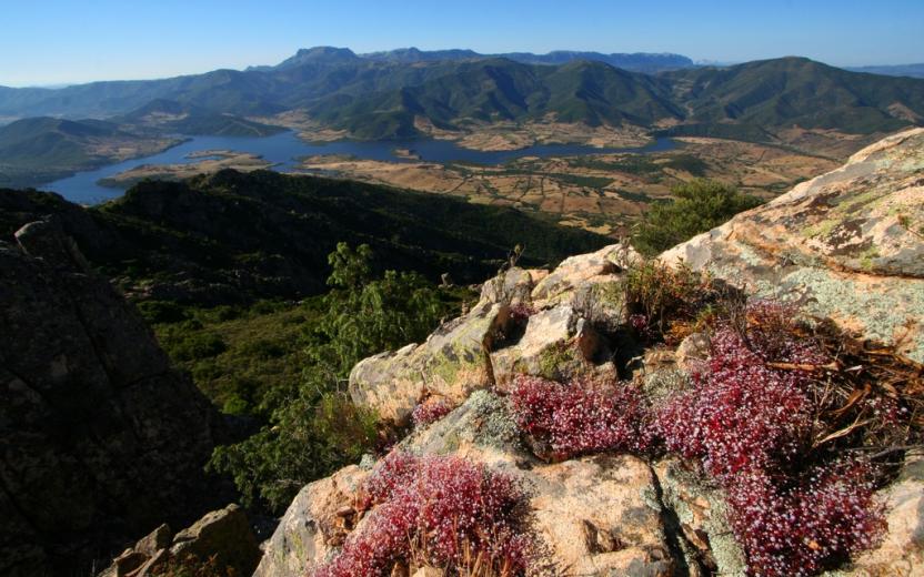
Sentiero Italia (Stage Z08) Alà dei Sardi – Caserma Giuanne Stuppa
Overview of the itinerary
Sentiero Italia runs the length of the island’s eastern side, covering its most important mountains, in 28 stages. Starting from the north: it flanks the Monte Limbara massif, crosses the limestones of Mont’Albo and Tuttavista, skirting the Gulf of Orosei, it crosses the Supramonte, Gennargentu and the Tacchi of Ogliastra and reaches Perdasdefogu. Further south, it passes through Armungia and the Gerrei sub-region. Lastly, it touches on the villages of Burcei and San Gregorio, continuing on the Sette Fratelli massif to the old prisons of Castiadas.
General information on Sentiero Italia (Grand Italian Trail)
Sentiero Italia, or Grand Italian Trail, as also explained on the official website, is a walking route that crosses the whole of Italy, using mainly but not exclusively “registered trails”.
In particular, in Sardinia, not all the stages of the Sentiero Italia of CAI (Italian Alpine Club) are made of trails already included in the registry of the Sardinia Trail Network (RES), either because they have not yet been tested and approved or simply because they cannot be registered as they do not meet the requirements. However, as a whole, the Sentiero Italia is the single longest walking route currently crossing Sardinia from the north (S. Teresa Gallura, stage Z 1) to the south (Castiadas, end of stage Z 28), touching on the most fascinating mountain areas in central-eastern Sardinia: the plateau of Buddusò, Tepilora, the Cedrino river valley, the ancient forests of Montes, Perda Liana and the regional forest of Montarbu, Monte Genis, and lastly the regional forest of Settefratelli (among the many crossed by the various stages of this long hiking itinerary).
Information on this stage of the trail
The last leg in the territory of Sassari leads to the nuraghe Boddò , strategically located on an imposing granite hill within sight of several other nuraghi in the surrounding area.
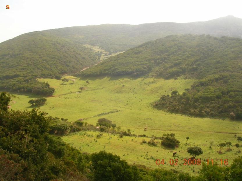
You will then cross the valley of Rio Altana with beautiful pools of clear water to be admired while searching for the river crossing point.
After passing through part of the Tepilora Regional Park, you will reach the Giuanne Stuppa forest ranger station where you can stay overnight.
Notes
The ford across the rio Altana can be challenging (it may be impassable in the winter months). At the Giuanne Stuppa stop point there is a Fo.Re.S.T.A.S. station, where it is currently only possible to stay overnight pitching a tent.
Informazioni utili
Tipologia itinerario
- Log in to post comments
Photogallery
Sentiero Italia (Tappa Z08) Alà dei Sardi – Caserma Giuanne Stuppa
In sintesi
Il Sentiero Italia attraversa in lunghezza il settore orientale dell’isola toccandone i sistemi montuosi più rilevanti, in 28 tappe. Partendo da nord: tocca il massiccio del Monte Limbara, attraversa i calcari del Mont'Albo e del Tuttavista sfiorando il Golfo di Orosei, attraversa il Supramonte, il Gennargentu, i Tacchi dell’Ogliastra e giunge a Perdasdefogu. Più a sud, transita da Armungia e dalla subregione del Gerrei. Infine tocca l’abitato di Burcei e San Gregorio, per continuare nel massiccio dei Sette Fratelli fino alle vecchie carceri di Castiadas.
Informazioni generali sull'itinerario sentiero Italia
Il Sentiero Italia, come spiegato anche nel sito ufficiale, è un itinerario (o Cammino) lungo tutta l'Italia, che utilizza prevalentemente ma non esclusivamente "sentieri accatastati".
In particolare, in Sardegna, non tutte le tappe del Sentiero Italia del CAI coincidono con sentieri già inseriti nel catasto della Rete Escursionistica della Sardegna (RES), perché non hanno ancora superato le verifiche di percorribilità oppure semplicemente perché non possono essere accatastati non avendone i requisiti. Tuttavia, nel suo insieme, il Sentiero Italia rappresenta l'unica, la più grande dorsale escursionistica che attraversa attualmente la nostra Isola da nord (S. Teresa Gallura, tappa Z 1) a sud (Castiadas, fine tappa Z 28) toccando le aree montane della Sardegna centro-Orientale più affascinanti: l'altopiano di Buddusò, Tepilora, la valle del Cedrino, i boschi vetusti di Montes, Perda Liana e la foresta demaniale di Montarbu, il Monte Genis, e infine la foresta demaniale di Settefratelli (tra le tante attraversate dal lungo itinerario escursionistico a tappe).
Info sul percorso di questa tappa
Quest'ultima tappa in terra sassarese ci porta inizialmente nei pressi del nuraghe Boddò situato in posizione strategica su un’imponente altura granitica a contatto visivo con una serie di altri nuraghe nel circondario.
Successivamente si attraversa la valle creata dal Rio Altana (entrando quindi nel Parco Naturale Regionale di Teipilora) con splendide pozze di acqua limpida da ammirare alla ricerca di un punto per il guado. NOTA: da questo punto, l'itinerario utilizza il sentiero RES accatastato come G-210 (dal guado sul rio Altana alla caserma Juanne Stuppa).
Dopo aver attraversato una parte del Parco Regionale di Tepilora si giunge alla caserma forestale Giuanne (Juanne) Stuppa - ove è possibile pernottare.
Note
Guado difficoltoso sul rio Altana nei mesi invernali. Nel posto tappa Jiuanne Stuppa è presente una caserma dell'Agenzia Regionale Fo.Re.S.T.A.S. (ceduta in parte in gestione al Parco Regionale di Tepilora) dove attualmente è possibile solo il bivacco con tenda.
Informazioni utili
Lungo il percorso non sarà sempre presente la copertura telefonica.
Non tutto il percorso di questa tappa del Sentiero Italia coincide con sentieri ufficiali della RES (Rete Escursionistica della Sardegna).
La tappa successiva (Z9) inizia da Juanne Stuppa proseguendo lungo vari sentieri della RES: il 220, il 230 e il 110 per giungere a Sant'Anna di Lodè.
Tipologia itinerario
- Log in to post comments
Photogallery
Contiene carte
Spento
Sentiero Italia (Stage Z20) Caserma Forestale Montarbu - Taquisara
Overview of the itinerary
Sentiero Italia runs the length of the island’s eastern side, covering its most important mountains, in 28 stages. Starting from the north: it flanks the Monte Limbara massif, crosses the limestones of Mont’Albo and Tuttavista, skirting the Gulf of Orosei, it crosses the Supramonte, Gennargentu and the Tacchi of Ogliastra and reaches Perdasdefogu. Further south, it passes through Armungia and the Gerrei sub-region. Lastly, it touches on the villages of Burcei and San Gregorio, continuing on the Sette Fratelli massif to the old prisons of Castiadas.
General information on Sentiero Italia (Grand Italian Trail)
Sentiero Italia, or Grand Italian Trail, as also explained on the official website, is a walking route that crosses the whole of Italy, using mainly but not exclusively “registered trails”.
In particular, in Sardinia, not all the stages of the Sentiero Italia of CAI (Italian Alpine Club) are made of trails already included in the registry of the Sardinia Trail Network (RES), either because they have not yet been tested and approved or simply because they cannot be registered as they do not meet the requirements. However, as a whole, the Sentiero Italia is the single longest walking route currently crossing Sardinia from the north (S. Teresa Gallura, stage Z 1) to the south (Castiadas, end of stage Z 28), touching on the most fascinating mountain areas in central-eastern Sardinia: the plateau of Buddusò, Tepilora, the Cedrino river valley, the ancient forests of Montes, Perda Liana and the regional forest of Montarbu, Monte Genis, and lastly the regional forest of Settefratelli (among the many crossed by the various stages of this long hiking itinerary).
Information on this stage of the trail
This stage starts at the Montarbu forest ranger station, a beautiful facility that the Forestas Agency makes available for overnight stays, booking a few days in advance with the relevant offices in Lanusei. The site is well equipped and here you can refill your water supply.
Walking along a dirt track, after about 800 m you will go through a gate and continue along a well-marked path until you have the railway on your right. Currently, the trenino verde (‘little green train’) that runs on that route is not operating due to maintenance work on the ‘su irtzioni’ bridge 800 m further ahead.
The path continues on a dirt track parallel to the railway, through the forest and after about 2 km, it emerges onto a large clearing with a picnic area and a pinnetto (traditional shepherd’s hut) in need of restoration. Further on, turning left for about 300 m, is the beautiful ‘funtana de sa berda’ spring. The path continues downhill, and with a couple of bends you will reach the 'Riu sa taula’ river. You can cross the river near a beautiful natural pool with a small waterfall. Continue uphill following the course of the river, which is full of interesting sights, including a large limestone formation in the shape of a tortoise. After about 1 km, you will arrive at another picnic area, in the ‘Tuvu Nieddu’ locality where there is an abundant spring. Cross the river and continue on a dirt track to the bar-restaurant where there is a beautiful picnic area (not open all year round) near which there is also a stop of the trenino verde (‘little green train’), called ‘Stazione di Niala’.
The Sentiero Italia continues to the left on a steep upward path with some paved sections. On the right, halfway up the slope, deviating from the trail, you will find a sculpture by famous artist Pinuccio Sciola depicting 6 limestone balls with a diameter of 80 cm. Here too you will find drinking water and a picnic area.
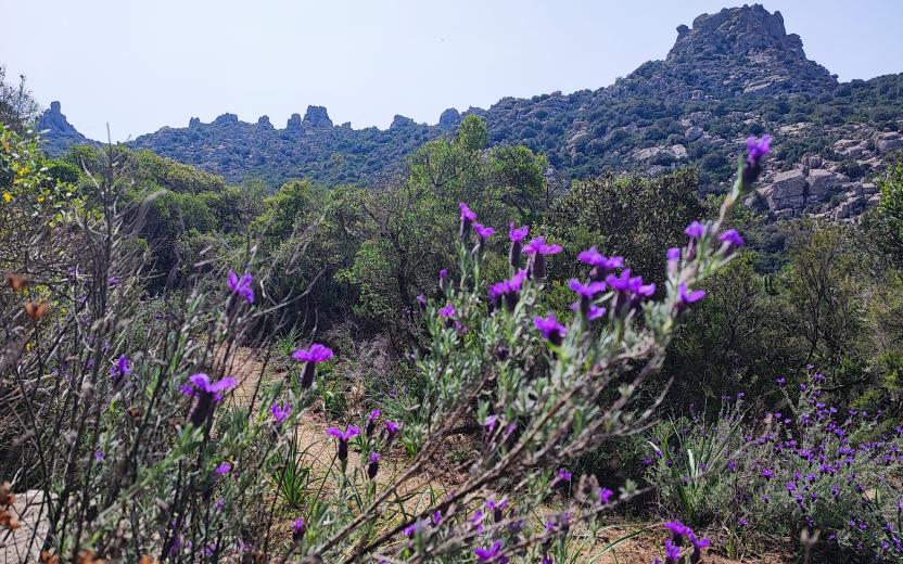
Returning to the route, still through the forest, you will come to a plateau where a dirt track leads, after about 5 km, to a fascinating archaeological site, ‘is Tostoinus’. Here you can admire a nuraghe (prehistoric stone fortress) and a tomb of the giants (megalithic communal tomb).
Further on, crossing a stream with a picturesque wooden bridge, you will reach a picnic area with drinking water and a very well maintained pinnetto (shepherd’s hut) that might be used as a camping facility in the future.
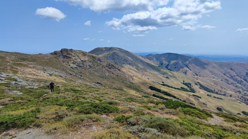
Leaving this area, which is very well maintained by Forestas, the ascent to the ridge begins. Here, the craggy and arid terrain makes the route particularly challenging during the summer. After about 4 km, the descent towards the end of the stage begins along a well-cleared and very scenic path that runs along the entire valley. Once in Gairo Taquisara, a picturesque small village with 300 inhabitants huddled at the bottom of a valley clothed in holm oaks and fir trees, you can stay overnight at a hotel or B&B or stop for refreshments at the bar.
A very beautiful, not very long, stage through the woods of ‘Tonneri di Ussasai-Seui’, a shaded area with several freshwater springs.
Informazioni utili
Tipologia itinerario
- Log in to post comments
Photogallery
Centro Servizi di Montarbu.jpg
Sentiero Montarbu - San Sebastiano.jpg
Strutture ricettive Montarbu.jpg
Ussassai, ponte in pietra tra Montarbu e Niala.jpg
Montarbu, muflone.jpg
Montarbu, pernice.jpg
Ussassai, ponte in pietra tra Montarbu e Niala.jpg
punta montarbu.jpg
Montarbu, daino.jpg
Trenino verde a Villanovatulo.jpg
Gairo, valle Taquisara.jpg
Gairo, panorama della frazione di Taquisara.jpg
Sentiero Italia (Tappa Z20) Caserma Forestale Montarbu - Taquisara
In sintesi
Il Sentiero Italia attraversa in lunghezza il settore orientale dell’isola toccandone i sistemi montuosi più rilevanti, in 28 tappe. Partendo da nord: tocca il massiccio del Monte Limbara, attraversa i calcari del Mont'Albo e del Tuttavista sfiorando il Golfo di Orosei, attraversa il Supramonte, il Gennargentu, i Tacchi dell’Ogliastra e giunge a Perdasdefogu. Più a sud, transita da Armungia e dalla subregione del Gerrei. Infine tocca l’abitato di Burcei e San Gregorio, per continuare nel massiccio dei Sette Fratelli fino alle vecchie carceri di Castiadas.
Informazioni generali sull'itinerario sentiero Italia
Il Sentiero Italia, come spiegato anche nel sito ufficiale, è un itinerario (o Cammino) lungo tutta l'Italia, che utilizza prevalentemente ma non esclusivamente "sentieri accatastati".
In particolare, in Sardegna, non tutte le tappe del Sentiero Italia del CAI coincidono con sentieri già inseriti nel catasto della Rete Escursionistica della Sardegna (RES), perché non hanno ancora superato le verifiche di percorribilità oppure semplicemente perché non possono essere accatastati non avendone i requisiti. Tuttavia, nel suo insieme, il Sentiero Italia rappresenta l'unica, la più grande dorsale escursionistica che attraversa attualmente la nostra Isola da nord (S. Teresa Gallura, tappa Z 1) a sud (Castiadas, fine tappa Z 28) toccando le aree montane della Sardegna centro-Orientale più affascinanti: l'altopiano di Buddusò, Tepilora, la valle del Cedrino, i boschi vetusti di Montes, Perda Liana e la foresta demaniale di Montarbu, il Monte Genis, e infine la foresta demaniale di Settefratelli (tra le tante attraversate dal lungo itinerario escursionistico a tappe).
Info sul percorso di questa tappa
Partenza dalla caserma della forestale di Montarbu, bellissimo posto che l'azienda Fo.Re.S.T.A.S. mette a disposizione per pernottamento, prenotando qualche giorno prima presso la direzione competente di Lanusei. Il sito è bene attrezzato, e tra le altre cose si può fare rifornimento d'acqua.
Si cammina su uno sterrato carrabile e dopo circa 800 metri si attraversa un cancello e si prosegue lungo un sentiero ben segnato fino ad avere la ferrovia alla nostra destra. Al momento il trenino verde che percorre quella tratta non è attivo per lavori di manutenzione sul ponte "su irtzioni" che si trova 800 metri più avanti.
Il sentiero prosegue su una sterrata parallela alla ferrovia, in mezzo al bosco e dopo circa 2 km, sbuca in un largo spiazzo dove c'è un area picnic ed un pinnetto da restaurare. Più avanti, deviando a sinistra per circa 300 metri, c'è la bella sorgente "funtana de sa berda". Il sentiero prosegue in discesa, e con un paio di tornanti si arriva al fiume "Riu sa taula”, lo si attraversa nei pressi di una bella piscina naturale con una piccola cascata. Si prosegue in salita lungo il corso del fiume ricco di particolarità, tra cui una grande formazione calcarea a forma di testuggine. Dopo circa 1 km si arriva ad una altra area picnic, in località "Tuvu Nieddu" dove sgorga una ricca sorgente d'acqua. Si attraversa il fiume e si prosegue su una sterrata carrabile fino al bar ristorante dove si trova una bella area attrezzata, non aperta tutto l'anno, nei cui pressi si trova anche una fermata del trenino verde, chiamata "Stazione di Niala”.
Il Sentiero Italia prosegue sulla sinistra in una salita ripida a tratti cementata. Sulla destra, a metà salita, deviando dal sentiero, c'è un opera di un famoso artista Pinuccio Sciola raffigurante 6 palle di calcare del diametro di 80 cm, anche qui c'è acqua e un'area picnic.
Rientrando sul percorso, sempre in mezzo al bosco, si arriva su un altopiano dove una sterrata carrabile ci porta, dopo circa 5 km, ad una zona archeologica di particolare interesse "is Tostoinus". Si possono ammirare un nuraghe ed una tomba dei giganti.
Più avanti, attraversando un rio con un ponte in legno molto bello, si raggiunge un area picnic con acqua ed un pinnetto molto bene tenuto che in futuro si potrebbe adibire a bivacco.
Uscendo da quest'area molto curata da Fo.Re.S.T.A.S., inizia la salita per raggiungere la cresta. Qui il terreno montuoso ed arido rende il percorso particolarmente impegnativo durante l'estate. Dopo circa 4 km inizia la discesa verso il fine tappa lungo un sentiero ben pulito e molto panoramico, che costeggia tutta la vallata. Arrivati a Gairo Taquisara, piccolo e bellissimo borgo con 300 abitanti situato ai piedi di una vallata piena di lecci e abeti, è possibile pernottare presso hotel o B&B o rifocillarsi al bar.
Tappa molto bella, non molto lunga, in mezzo ai boschi del "Tonneri di Ussasai-Seui", ombreggiata e ben fornita di sorgenti.
Informazioni utili
Lungo il percorso non sarà sempre presente la copertura telefonica
Tipologia itinerario
- Log in to post comments
Photogallery
Centro Servizi di Montarbu.jpg
Sentiero Montarbu - San Sebastiano.jpg
Strutture ricettive Montarbu.jpg
Ussassai, ponte in pietra tra Montarbu e Niala.jpg
Montarbu, muflone.jpg
Montarbu, pernice.jpg
Ussassai, ponte in pietra tra Montarbu e Niala.jpg
punta montarbu.jpg
Montarbu, daino.jpg
Trenino verde a Villanovatulo.jpg
Gairo, valle Taquisara.jpg
Gairo, panorama della frazione di Taquisara.jpg