Accessible trails
Sentieri per tutti...in questa categoria rientrano i sentieri progettati o riadattati perchè il contatto con l'ambiente naturale sia sempre di stimolo al miglioramento della vita personale di chiunque, con attenzione alle condizioni di disabilità motoria, sensoriale o della sfera psichica e relazionale...

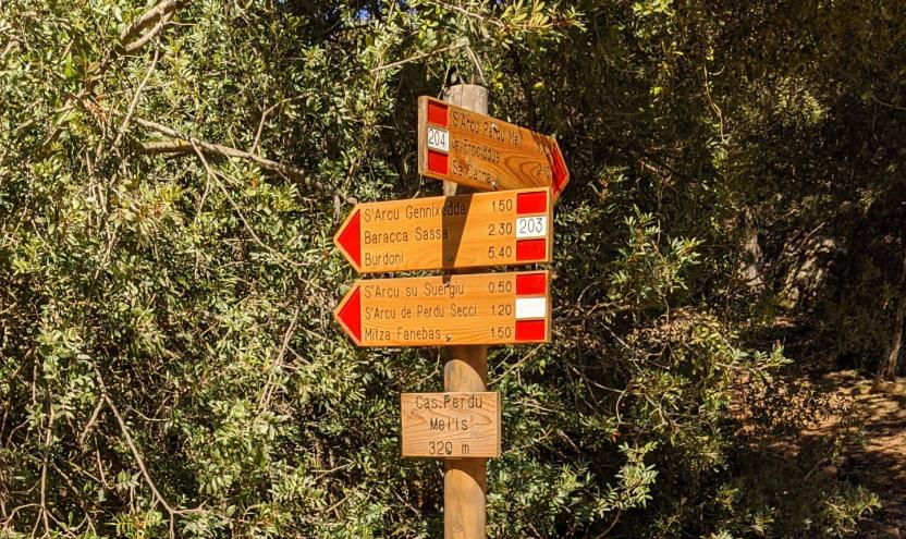
Image credits Sardegna Digital Library Regione Sardegna
Results
Teti, Abini. The sanctuary of the ancient Sardinians
Access
From Teti, take the SP4 downhill towards Lake Cucchinadorza, one of the three large reservoirs used for the production of hydroelectric energy. Just before the dam, on the left of the road, there is a clearing where you can park.
Il Taloro - The Taloro
You turn back a few dozen metres, taking a dirt road that leads slightly downhill in a north-westerly direction, passing a gate that is always open. The road continues downhill, keeping to the right of the gorge of the Taloro river, interrupted upstream by the barrage of the dam of the Cucchinadorza. Soon you come across two gates side by side: take the one on the right, which is never locked and serves to regulate livestock traffic. Immediately, a dirt track begins, initially in good condition, then increasingly rutted. The path enters the Taloro gorge: the river, once stormy and impetuous, is often dried up due to the interruptions of the dams upstream, but it still flows with a roar in winter and spring.
Abini
The road bends slightly to the west, still within sight of the river. It climbs slightly over a wide ridge, flanked by a woodland and shrubland, then descends in narrow hairpin bends. The road goes just above a farmstead: ignore the first fork to the left and then, at a sharp right-hand bend that descends towards the farmsteads, take a left along the less obvious tracks (GPS useful), almost immediately taking up a good dirt track that heads towards the Abini agriturismo. You descend to lap the Taloro and here, in a vast meadowy area just below the agritourism, you come across the monumental huts of Abini. The proto-Sardinian village owes its fortune to the discovery of famous bronze statues, such as the warrior with two shields and four eyes, one of the finest examples of proto-Sardinian art. The monumentality of the buildings excavated so far suggests that it was undoubtedly a centre of great importance and it is surprising to come across it in such an evocative and isolated place. After visiting the site, return along the road travelled, perhaps taking advantage of the hospitality of the nearby agriturismo before setting off again.
Tipologia itinerario
- Log in to post comments
Photogallery
teti - capanne di abini nel bosco.jpg
teti - abini.jpg
teti - lago di cucchinadorza.jpg
teti - capanne di abini nel bosco.jpg
teti - abini.jpg
teti_veduta_panoramica.jpg
Teti, area di sosta Monte Corte.jpg
Teti, santuario di Abini.jpg
Teti, selciato romano sul sentiero T-515.jpg
Teti, Museo Archeologico Comprensoriale.jpg
Teti, Museo Archeologico bronzetto.jpg
Teti, laghetto collinare.jpg
Teti, Abini. Il santuario degli antichi Sardi
Accesso
Da Teti si prende la SP4 in discesa, in direzione del Lago di Cucchinadorza, uno dei tre grandi bacini utilizzati per la produzione di energia idroelettrica. Poco prima della diga, sulla sinistra della strada, si trova uno spiazzo dove è possibile posteggiare.
Il Taloro
Si ritorna indietro di poche decine di metri, imboccando una sterrata che si stacca in lieve discesa in direzione nordovest, superando un cancello sempre aperto.
La strada prosegue in discesa, tenendo sulla destra la gola del Fiume Taloro, interrotta a monte dallo sbarramento della diga di Cucchinadorza.
Ben presto si incontrano due cancelli affiancati: si prende quello a destra che non è mai sbarrato e serve a regimare il traffico del bestiame. Subito inizia una sterrata, inizialmente in buone condizioni, poi sempre più disastrata. Il percorso si inoltra nella gola del Taloro: il fiume, un tempo tempestoso e irruento, è spesso in secca a causa delle interruzioni delle dighe a monte, ma scorre ancora con fragore in inverno e primavera.
Abini
La strada piega leggermente ad ovest, sempre in vista del fiume. Si sale leggermente su un vasto costone, affiancati da bosco e macchia, poi si scende per stretti tornanti. La strada si porta poco più in alto di una azienda agricola: si ignora il primo bivio a sinistra e poi, in corrispondenza di un brusco tornante a destra che scende verso i caseggiati, si prende a sinistra per tracce meno evidenti (utile il GPS) riprendendo quasi subito una bella sterrata che si dirige verso l’agriturismo di Abini.
Si scende a lambire il Taloro e qui, in una vasta area prativa proprio sotto l’agriturismo, si incontrano le monumentali capanne di Abini. Il villaggio protosardo deve la sua fortuna al ritrovamento di celebri bronzetti, come il guerriero con due scudi e quattro occhi, uno dei più begli esempi di arte protosarda. La monumentalità degli edifici finora scavati suggerisce che si trattasse indubbiamente di un centro di grande importanza e stupisce incontrarlo in un luogo oggi così suggestivo ed isolato.
Dopo la visita al sito si ritorna per la strada percorsa, magari usufruendo dell’ospitalità del vicino agriturismo prima di rimettersi in cammino.
Tipologia itinerario
- Log in to post comments
Photogallery
teti - capanne di abini nel bosco.jpg
teti - abini.jpg
teti - lago di cucchinadorza.jpg
teti - capanne di abini nel bosco.jpg
teti - abini.jpg
teti_veduta_panoramica.jpg
Teti, area di sosta Monte Corte.jpg
Teti, santuario di Abini.jpg
Teti, selciato romano sul sentiero T-515.jpg
Teti, Museo Archeologico Comprensoriale.jpg
Teti, Museo Archeologico bronzetto.jpg
Teti, laghetto collinare.jpg
Carta 1. Baronie e Montalbo
About the territory
The territory of the Baronie runs from the limestone chain of Montalbo to the massif of Tuttavista, an area marked by streams and rivers such as the Isalle and the Cedrino and wide alluvial plains.
Map No. 1 (Baronie) suggests an itinerary in the Baronie territory, based on three trails.
In this aera, the Montalbo range is especially important for its natural heritage. Thanks to its environmental characteristics and good conservation status, it is home to a number of rare and endemic animal and plant species, including the Santolina corsica, the Lactuca longidentata, the Monte Albo cave salamander, the red-billed chough, the golden eagle and the mouflon.
Along the walking routes proposed in this itinerary, you can also find ancient charcoal pits and make a stop at the old sheepfolds (pinnettos). You will also enjoy the stunning views offered by the numerous stretches at altitudes above 900m a.s.l. on the ridges of the Montalbo massif.
The Pinnetos
The Pinnettos are original stone and wood huts which for many centuries were the solitary shelters of the Sardinian shepherds, around which they raised their goats, sheep and pigs. These huts are a testimonial to the old life of the shepherds, governed by the rhythms of nature and the seasons. The main building, called Su Pinnettu or Su Barracu, according to the area, consists of a dry-stone circular wall surmounted by a cone-shaped roof made of holm oak and juniper planks and branches, lined with smaller branches and leaves. Inside, it has a central fireplace, probably very similar to the fireplaces of the ancient nNuragic huts, called Su Foghile, while a series of shelves along the wall served to store the shepherds’ tools and the products of their work, such as wheels of cheese and hams. Su Pinnettu is often flanked by a smaller hut used as a toolshed, surrounded by a dry stone pen for holding the sheep, called Sa corte; the pen also included smaller enclosures, called Cherinas, used to hold baby goats. The pigsty, on the other hand, consisted of a low rectangular hut with an enclosure.
Montalbo
A limestone bastion about 20 km long, Monte Albo with its distinctive long and imposing profile, overlooks the historical territory of the Baronie. This limestone massif dates back to the Mesozoic and is rich in white stone ravines and caves. Characterised by steep slopes, cut by deep ravines, it reaches its maximum height with the peaks of Punta Catirina and Punta Turuddò, which exceed 1050 m. a.s.l. The entire area preserves and maintains significant examples of the Mediterranean maquis and local endemic flora. The area is inhabited by many animal species such as the Montalbo cave salamander, the mouflon, the red-billed chough, the common raven, the wildcat and the marten. At certain times of the year, the golden eagle nests there. An impressive sight is the sinkhole of Tumba ’e Nurrai, located between Punta Catirina and Punta Turuddò. In the imposing summit of Punta Catirina opens the cave of Janna Manna, about 200 m long, which lies at a short distance from that of Omines Agrestes. On the Monte Albo, human presence has been documented since the Neolithic period, with the domus de janas of Mannu ‘e Gruris, rock-cut chamber tombs with a carved door frame and four cells. Throughout the massif there are many caves that were used in prehistoric times as natural shelters. One of these is the cave of Bona Fraule, in the municipality of Siniscola, where valuable objects such as swords and iron daggers have been found, suggesting that it was used as a place of worship. Monte Albo falls mainly within the municipalities of Siniscola and Lula, which can be reached via State Road 131 D.C.N. and following the road signs from there.
Allegati
Itinerary roadbook
Tipologia itinerario
Photogallery
Carta 1. Baronie e Montalbo
Premessa
Questo percorso rappresenta la concatenazione di 3 vecchi sentieri realizzati nel 2010, per i quali l'iscrizione nel catasto sentieri della R.E.S. potrebbe produrre delle variazioni al tracciato, che sono in corso. Resta tuttavia un discreto itinerario, impegnativo e lungo, per visitare il Montalbo
Inquadramento territoriale
Il territorio delle Baronie spazia dalla catena calcarea del Montalbo sino al massiccio del Tuttavista, in un’area caratterizzata da corsi d’acqua come l’Isalle e il Cedrino e vaste pianure alluvionali.
Nella carta n.1 (Baronie) è proposto un itinerario sul territorio delle Baronie, basato su tre sentieri.
In questo contesto il Montalbo riveste un ruolo di fondamentale importanza dal punto di vista naturalistico. Per le sue caratteristiche ambientali e per il suo buono stato di conservazione ospita numerose specie di flora e fauna rare ed endemiche tra cui la Santolina corsica, la Lactuca longidentata, il geotritone del Montalbo, il gracchio corallino, l’aquila reale e il muflone.
Lungo i sentieri proposti in questo itinerario, è possibile inoltre osservare i segni della presenza dei carbonai e sostare presso gli antichi ovili (pinnettos). Da segnalare, infine, le viste mozzafiato offerte dai numerosi tratti oltre quota 900m s.l.m. sulle creste del Montalbo.
I PINNETTOS
I Pinnettos sono originali costruzioni in pietra e legno che per secoli sono state le dimore solitarie dei pastori della Sardegna, attorno alle quali venivano allevati capre, pecore e maiali. Queste strutture ricordano quella che un tempo era la vita dei pastori, governata dal ritmo della natura e delle stagioni.
La struttura principale, chiamata Su Pinnettu o Su Barraccu, in base alla variante linguistica, era composta da un muro perimetrale a secco e sormontata da un tetto a cono rovesciato composto da travi, rami di leccio e ginepro, foderato con frasche e foglie. L'interno del Pinnettos è costituito da un focolare centrale, probabilmente su esempio del focolare delle capanne nuragiche, chiamato Su foghile, mentre alcuni ripiani laterali, servivano al pastore per riporre gli strumenti di lavoro e i prodotti tipici lavorati, come le forme di pecorino e il prosciutto. I Pinnettos sono spesso affiancati ad una piccola costruzione, utilizzata come ripostiglio per gli attrezzi più ingombranti, e da un recinto per il gregge chiamato Sa corte, a sua volta affiancato da piccoli spazi, chiamati Cherinas, utilizzati per il ricovero dei capretti. La porcilaia, invece, aveva la forma di una casetta rettangolare dotata di un recinto.
IL MONTALBO
Bastione calcareo lungo una ventina di chilometri, il Monte Albo ha una tipica forma allungata e imponente che domina il territorio storico delle Baronie. Il rilievo calcareo risale al mesozoico ed è ricco di bianche gole e grotte. Caratterizzato da versanti verticali, tagliato da burroni profondi, raggiunge la massima altezza con le vette di Punta Catirina e Punta Turuddò che superano i 1050 metri. Tutta la zona conserva e mantiene esempi significativi della macchia mediterranea ed endemismi tipici. Il territorio è abitato da diverse specie faunistiche come, il geotritone del Montalbo il muflone, il gracchio corallino, il corvo imperiale, il gatto selvatico e la martora. In alcuni periodi dell'anno vi nidifica anche l'aquila reale. Notevole è l'inghiottitoio di Tumba ‘e Nurrai che si trova fra Punta Catirina e Punta Turuddò.
Nell'imponente rilievo di Punta Catirina si apre la grotta di Janna Manna, lunga circa 200 m, che si trova a poca distanza da quella di Omines Agrestes. Nel Monte Albo è documentata la presenza umana a partire dal neolitico, con la domus de janas di Mannu 'e Gruris che presenta una porta scalpellata con quattro celle interne. Diverse sono le grotte presenti in tutto il massiccio che sono state utilizzate dall'uomo come rifugi naturali. Una di queste è la grotta di Bona Fraule nel comune di Siniscola, dove il ritrovamento di materiale pregiato come spade e pugnali di ferro fa pensare ad una sua utilizzazione come luogo di culto. Il Monte Albo ricade principalmente nei comuni di Siniscola e Lula, questi sono raggiungibili percorrendo la Strada statale n. 131 D.C.N. e seguendo le relative indicazioni.
Allegati
Itinerary roadbook
Tipologia itinerario
Contiene carte
Spento
Sentiero Italia (Stage Z26) Su Niu ‘e S’Achili – Burcei
Overview of the itinerary
Sentiero Italia runs the length of the island’s eastern side, covering its most important mountains, in 28 stages. Starting from the north: it flanks the Monte Limbara massif, crosses the limestones of Mont’Albo and Tuttavista, skirting the Gulf of Orosei, it crosses the Supramonte, Gennargentu and the Tacchi of Ogliastra and reaches Perdasdefogu. Further south, it passes through Armungia and the Gerrei sub-region. Lastly, it touches on the villages of Burcei and San Gregorio, continuing on the Sette Fratelli massif to the old prisons of Castiadas.
General information on Sentiero Italia (Grand Italian Trail)
Sentiero Italia, or Grand Italian Trail, as also explained on the official website, is a walking route that crosses the whole of Italy, using mainly but not exclusively “registered trails”.
In particular, in Sardinia, not all the stages of the Sentiero Italia of CAI (Italian Alpine Club) are made of trails already included in the registry of the Sardinia Trail Network (RES), either because they have not yet been tested and approved or simply because they cannot be registered as they do not meet the requirements. However, as a whole, the Sentiero Italia is the single longest walking route currently crossing Sardinia from the north (S. Teresa Gallura, stage Z 1) to the south (Castiadas, end of stage Z 28), touching on the most fascinating mountain areas in central-eastern Sardinia: the plateau of Buddusò, Tepilora, the Cedrino river valley, the ancient forests of Montes, Perda Liana and the regional forest of Montarbu, Monte Genis, and lastly the regional forest of Settefratelli (among the many crossed by the various stages of this long hiking itinerary).
Information on this stage of the trail
From Su Niu e S’Achili, the trail becomes challenging, alternating uphill and downhill stretches on Monte Carareddu through the Bruncu Muscadroxu plateau, and then on to Monte Genis and Monte Serpeddì.
This stage is challenging in terms of length and elevation gain and is mainly on paved, dirt and tarmac roads
It ends in Burcei, a small farmers’ town whose name derives from ‘burrei’, herd of oxen.
Informazioni utili
Tipologia itinerario
- Log in to post comments
Photogallery
Sentiero Italia (Tappa Z26) Su Niu ‘e S’Achili – Burcei
In sintesi
Il Sentiero Italia attraversa in lunghezza il settore orientale dell’isola toccandone i sistemi montuosi più rilevanti, in 28 tappe. Partendo da nord: tocca il massiccio del Monte Limbara, attraversa i calcari del Mont'Albo e del Tuttavista sfiorando il Golfo di Orosei, attraversa il Supramonte, il Gennargentu, i Tacchi dell’Ogliastra e giunge a Perdasdefogu. Più a sud, transita da Armungia e dalla subregione del Gerrei. Infine tocca l’abitato di Burcei e San Gregorio, per continuare nel massiccio dei Sette Fratelli fino alle vecchie carceri di Castiadas.
Informazioni generali sull'itinerario sentiero Italia
Il Sentiero Italia, come spiegato anche nel sito ufficiale, è un itinerario (o Cammino) lungo tutta l'Italia, che utilizza prevalentemente ma non esclusivamente "sentieri accatastati".
In particolare, in Sardegna, non tutte le tappe del Sentiero Italia del CAI coincidono con sentieri già inseriti nel catasto della Rete Escursionistica della Sardegna (RES), perché non hanno ancora superato le verifiche di percorribilità oppure semplicemente perché non possono essere accatastati non avendone i requisiti. Tuttavia, nel suo insieme, il Sentiero Italia rappresenta l'unica, la più grande dorsale escursionistica che attraversa attualmente la nostra Isola da nord (S. Teresa Gallura, tappa Z 1) a sud (Castiadas, fine tappa Z 28) toccando le aree montane della Sardegna centro-Orientale più affascinanti: l'altopiano di Buddusò, Tepilora, la valle del Cedrino, i boschi vetusti di Montes, Perda Liana e la foresta demaniale di Montarbu, il Monte Genis, e infine la foresta demaniale di Settefratelli (tra le tante attraversate dal lungo itinerario escursionistico a tappe).
Info sul percorso di questa tappa
Da Su Niu e S'Achili inizia un impegnativo saliscendi sul Monte Carareddu attraverso l’altipiano di Bruncu Muscadroxu, a seguire il Monte Genis e il Monte Serpeddì.
Si tratta di una tappa impegnativa per lunghezza e dislivello che si svolge prevalentemente su strade carrozzabili, bianche e asfaltate.
Conclusione a Burcei, paese a vocazione pastorale il cui nome deriva da “burrei”, branco di buoi.
Informazioni utili
Lungo il percorso non sarà sempre presente la copertura telefonica
Tipologia itinerario
- Log in to post comments
Photogallery
Sentiero Italia (Stage SI Z12) Orosei - Dorgali
Overview of the itinerary
Sentiero Italia runs the length of the island’s eastern side, covering its most important mountains, in 28 stages. Starting from the north: it flanks the Monte Limbara massif, crosses the limestones of Mont’Albo and Tuttavista, skirting the Gulf of Orosei, it crosses the Supramonte, Gennargentu and the Tacchi of Ogliastra and reaches Perdasdefogu. Further south, it passes through Armungia and the Gerrei sub-region. Lastly, it touches on the villages of Burcei and San Gregorio, continuing on the Sette Fratelli massif to the old prisons of Castiadas.
General information on Sentiero Italia (Grand Italian Trail)
Sentiero Italia, or Grand Italian Trail, as also explained on the official website, is a walking route that crosses the whole of Italy, using mainly but not exclusively “registered trails”.
In particular, in Sardinia, not all the stages of the Sentiero Italia of CAI (Italian Alpine Club) are made of trails already included in the registry of the Sardinia Trail Network (RES), either because they have not yet been tested and approved or simply because they cannot be registered as they do not meet the requirements. However, as a whole, the Sentiero Italia is the single longest walking route currently crossing Sardinia from the north (S. Teresa Gallura, stage Z 1) to the south (Castiadas, end of stage Z 28), touching on the most fascinating mountain areas in central-eastern Sardinia: the plateau of Buddusò, Tepilora, the Cedrino river valley, the ancient forests of Montes, Perda Liana and the regional forest of Montarbu, Monte Genis, and lastly the regional forest of Settefratelli (among the many crossed by the various stages of this long hiking itinerary).
Information on this stage of the trail
The first part of this stage links the town of Orosei to its beach (‘marina’), along the recently restored right bank of the Cedrino river. The second stretch on flat ground heads south between the beach and the wetland, reaching the small beach of Osala, which marks the boundary of the territory of Orosei. Next, you will reach Cartoe beach by circling the headland of Punta Nera, following the rocky coast, in some places quite close to the sea which may present some difficulties. An alternative is to climb over the headland on an easily visible path, but which is mostly on private land.
The south end of Cartoe beach marks the start of the third section of this stage, the more challenging one, which requires climbing the two peaks marked on the maps as Monte Irveri, 616 m asl, and Monte Bardia, 880 m asl, divided by a pass crossed by a paved road leading to the village of Cala Gonone. From Monte Bardia, which overlooks the town of Dorgali, you can descend quickly, along the ridge line, to the Buca Entu col. From here, a picturesque old mule track (Scala Omines) leads to a paved path that reaches the town of Dorgali.
While this stage has no water sources, it offers wonderful panoramic views of the Gulf of Orosei as well as some recently restored old sheepfolds
Informazioni utili
Tipologia itinerario
- Log in to post comments
Photogallery
Sentiero Italia (Tappa SI Z12) Orosei - Dorgali
In sintesi
Il Sentiero Italia attraversa in lunghezza il settore orientale dell’isola toccandone i sistemi montuosi più rilevanti, in 28 tappe. Partendo da nord: tocca il massiccio del Monte Limbara, attraversa i calcari del Mont'Albo e del Tuttavista sfiorando il Golfo di Orosei, attraversa il Supramonte, il Gennargentu, i Tacchi dell’Ogliastra e giunge a Perdasdefogu. Più a sud, transita da Armungia e dalla subregione del Gerrei. Infine tocca l’abitato di Burcei e San Gregorio, per continuare nel massiccio dei Sette Fratelli fino alle vecchie carceri di Castiadas.
Informazioni generali sull'itinerario sentiero Italia
Il Sentiero Italia, come spiegato anche nel sito ufficiale, è un itinerario (o Cammino) lungo tutta l'Italia, che utilizza prevalentemente ma non esclusivamente "sentieri accatastati".
In particolare, in Sardegna, non tutte le tappe del Sentiero Italia del CAI coincidono con sentieri già inseriti nel catasto della Rete Escursionistica della Sardegna (RES), perché non hanno ancora superato le verifiche di percorribilità oppure semplicemente perché non possono essere accatastati non avendone i requisiti. Tuttavia, nel suo insieme, il Sentiero Italia rappresenta l'unica, la più grande dorsale escursionistica che attraversa attualmente la nostra Isola da nord (S. Teresa Gallura, tappa Z 1) a sud (Castiadas, fine tappa Z 28) toccando le aree montane della Sardegna centro-Orientale più affascinanti: l'altopiano di Buddusò, Tepilora, la valle del Cedrino, i boschi vetusti di Montes, Perda Liana e la foresta demaniale di Montarbu, il Monte Genis, e infine la foresta demaniale di Settefratelli (tra le tante attraversate dal lungo itinerario escursionistico a tappe).
Info sul percorso di questa tappa
Tappa caratterizzata da un prima parte che collega il centro abitato di Orosei con la marina percorrendo l’argine destro, recentemente sistemato, del fiume Cedrino, seguita da una seconda parte sempre pianeggiante in direzione sud, che attraversa tutto l’arenile, tra lo stesso e lo stagno, fino alla spiaggetta di Osala, limite amministrativo di Orosei. Da qui si raggiunge la spiaggia successiva di Cartoe contornando il promontorio di Punta Nera praticamente sugli scogli, in alcun punti rasentando l’acqua che talvolta potrebbe condizionare il passaggio. Un’alternativa consiste nel superare il promontorio scollinando con un percorso facilmente intuibile ma che insiste per buona parte in una proprietà privata.
Dal limite sud della spiaggia di Cartoe inizia la terza parte del percorso, quella più impegnativa, che richiede il superamento dei due rilievi segnati sulle carte come Monte Irveri, 616 slm, e Monte Bardia, 880 slm, separati da un valico con strada cementata che conduce al centro di Cala Gonone. Da Monte Bardia, che domina l’abitato di Dorgali, si scende rapidamente, sul filo di cresta, fino alla sella di Buca Entu e da qui, con una suggestiva e antica mulattiera (Scala Omines) si raggiunge un vialetto lastricato che arriva fino al paese di Dorgali.
Da segnalare la mancanza di sorgenti per approvvigionamento idrico, mancanza compensata da stupendi e continui panorami sul Golfo di Orosei e dalla possibilità di apprezzare alcuni antichi insediamenti pastorali recentemente ristrutturati.
Note
Nota del 25/02/2022. Si segnala la momentanea inagibilità del ponticello che supera l'uscita a mare dello stagno retrodunale di su Barone di Orosei. Per aggirare la problematica, prendere il passaggio sullo stagno prima del molo di Marina di Orosei, seguire la strada verso l’entroterra fino a quando si arriva ad un incrocio. Qui seguire l’insegna “Su Barone”, proseguire su strada asfalta e rientrare sul percorso originale dopo aver riattraversato lo stagno.
Informazioni utili
Lungo il percorso non sarà sempre presente la copertura telefonica
Tipologia itinerario
- Log in to post comments