Start website main content

Accessible trails

1 pathway

Sentieri per tutti...in questa categoria rientrano i sentieri progettati o riadattati perchè il contatto con l'ambiente naturale sia sempre di stimolo al miglioramento della vita personale di chiunque, con attenzione alle condizioni di disabilità motoria, sensoriale o della sfera psichica e relazionale...

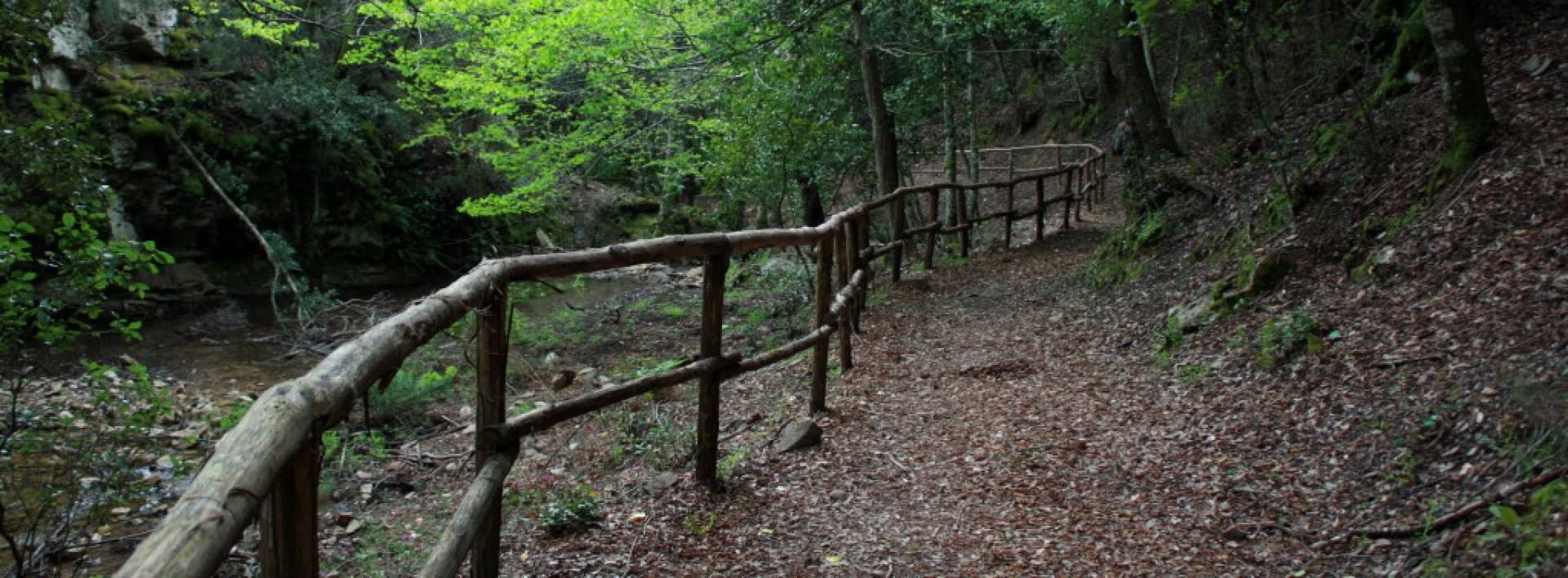
Rio Ermolinos.jpg

Results

Sentiero Italia (Stage Z09) Caserma Forestale Gianni Stuppa – Vecchia Cantoniera di Sant’Anna

Overview of the itinerary

Sentiero Italia runs the length of the island’s eastern side, covering its most important mountains, in 28 stages.  Starting from the north: it flanks the Monte Limbara massif, crosses the limestones of Mont’Albo and Tuttavista, skirting the Gulf of Orosei, it crosses the Supramonte, Gennargentu and the Tacchi of Ogliastra and reaches Perdasdefogu.  Further south, it passes through Armungia and the Gerrei sub-region. Lastly, it touches on the villages of Burcei and San Gregorio, continuing on the Sette Fratelli massif to the old prisons of Castiadas.

General information on Sentiero Italia (Grand Italian Trail)

Sentiero Italia, or Grand Italian Trail, as also explained on the official website, is a walking route that crosses the whole of Italy, using mainly but not exclusively “registered trails”.   
In particular, in Sardinia, not all the stages of the Sentiero Italia of CAI (Italian Alpine Club) are made of trails already included in the registry of the Sardinia Trail Network (RES), either because they have not yet been tested and approved or simply because they cannot be registered as they do not meet the requirements.  However, as a whole, the Sentiero Italia is the single longest walking route currently crossing Sardinia from the north (S. Teresa Gallura, stage Z 1) to the south (Castiadas, end of stage Z 28), touching on the most fascinating mountain areas in central-eastern Sardinia: the plateau of Buddusò, Tepilora, the Cedrino river valley, the ancient forests of Montes, Perda Liana and the regional forest of Montarbu, Monte Genis, and lastly the regional forest of Settefratelli (among the many crossed by the various stages of this long hiking itinerary).

Information on this stage of the trail

Athis fairly long leg of the trail crosses the Tepilora Park, starting on an easy dirt road leading to the slopes of Mount Tepilora, where it continues on paths and old mule tracks until it fords Rio Mannu. The trail then begins to climb fairly steeply, including a few stretches of blacktop road, reaching the highest part of the route, with an east-northeast direction and wide-ranging views of the countryside round PosadaMaccheronis Lake and the sea in the distance. 

The route continues on a short stretch of provincial road, then on recently restored paths and stretches of forest track until it reaches S. Anna di Lodè, with elevations varying between 400 and 625 m asl. 

This route offers expansive views and frequent freshwater springs, sparing hikers from having to carry a heavy load of water.

Notes

Note of 30/08/2021. At the Juanne Stuppa forest ranger station, it is currently only possible to stay pitching a tent. Along the trail, there is also a natural stop point suitable for pitching a tent. At the end of this leg of the trail, in the S. Anna di Lodè locality there are a few B&Bs.

Lenght 26.200 m

SI Z09.gpx

Total elevation gain 1 678 metri

Geographical area Baronie e Montalbo

Sentiero Italia (Tappa Z09) Caserma Forestale Gianni Stuppa – Vecchia Cantoniera di Sant’Anna

In sintesi

Il Sentiero Italia attraversa in lunghezza il settore orientale dell’isola toccandone i sistemi montuosi più rilevanti, in 28 tappe.  Partendo da nord: tocca il massiccio del Monte Limbara, attraversa i calcari del Mont'Albo e del Tuttavista sfiorando il Golfo di Orosei,  attraversa il Supramonte, il Gennargentu, i Tacchi dell’Ogliastra e giunge a Perdasdefogu.  Più a sud, transita da Armungia e dalla subregione del Gerrei. Infine tocca l’abitato di Burcei e San Gregorio, per continuare nel massiccio dei Sette Fratelli fino alle vecchie carceri di Castiadas.

Informazioni generali sull'itinerario sentiero Italia

Il Sentiero Italia, come spiegato anche nel sito ufficiale, è un itinerario (o Cammino) lungo tutta l'Italia, che utilizza prevalentemente ma non esclusivamente "sentieri accatastati".   
In particolare, in Sardegna, non tutte le tappe del Sentiero Italia del CAI coincidono con sentieri già inseriti nel catasto della Rete Escursionistica della Sardegna (RES), perché non hanno ancora superato le verifiche di percorribilità oppure semplicemente perché non possono essere accatastati non avendone i requisiti.  Tuttavia, nel suo insieme, il Sentiero Italia rappresenta l'unica, la più grande dorsale escursionistica che attraversa attualmente la nostra Isola da nord (S. Teresa Gallura, tappa Z 1) a sud (Castiadas, fine tappa Z 28) toccando le aree montane della Sardegna centro-Orientale più affascinanti: l'altopiano di Buddusò, Tepilora, la valle del Cedrino, i boschi vetusti di Montes, Perda Liana e la foresta demaniale di Montarbu, il Monte Genis, e infine la foresta demaniale di Settefratelli (tra le tante attraversate dal lungo itinerario escursionistico a tappe).

Info sul percorso di questa tappa

Tappa piuttosto lunga che attraversa il Parco di Tepilora, inizialmente su comoda sterrata, fino alle pendici del Monte Tepilora da dove prosegue su sentieri e antiche mulattiere fino a guadare il rio Mannu. Si comincia a salire decisamente, anche con qualche tratto di strada bitumata, fino alla parte più alta del percorso con orientamento est-nord-est con ampie visuali sulla baronia di Posada, il lago Maccheronis e il mare sullo sfondo. 

Si prosegue alternando, dopo una breve bretella di strada provinciale, sentieri recentemente ripristinati e tratte di pista forestale fino all’arrivo a S. Anna di Lodè, con quote variabili tra i 400 e i 625 slm. 

Da evidenziare la godibilità di ampi panorami e la presenza frequente di acque sorgive che risparmiano agli escursionisti pesanti approvvigionamenti.

Note

Nota del 30/08/2021. Presso la Caserma Forestale Juanne Stuppa attualmente è possibile sostare solo con la tenda. Lungo il tracciato è comunque presente un bivacco naturale che può essere utilizzato per eventuali necessità. A fine tappa in località S. Anna di Lodè sono presenti dei B&B.

Informazioni utili

Lungo il percorso non sarà sempre presente la copertura telefonica

Lenght 26.200 m

SI Z09.gpx

Total elevation gain 1 678 metri

Geographical area Baronie e Montalbo

Contiene carte
Spento

Sentiero Italia (Stage Z10A) Vecchia Cantoniera di Sant’Anna – Norghio

Overview of the itinerary

Sentiero Italia runs the length of the island’s eastern side, covering its most important mountains, in 28 stages.  Starting from the north: it flanks the Monte Limbara massif, crosses the limestones of Mont’Albo and Tuttavista, skirting the Gulf of Orosei, it crosses the Supramonte, Gennargentu and the Tacchi of Ogliastra and reaches Perdasdefogu.  Further south, it passes through Armungia and the Gerrei sub-region. Lastly, it touches on the villages of Burcei and San Gregorio, continuing on the Sette Fratelli massif to the old prisons of Castiadas.

General information on Sentiero Italia (Grand Italian Trail)

Sentiero Italia, or Grand Italian Trail, as also explained on the official website, is a walking route that crosses the whole of Italy, using mainly but not exclusively “registered trails”.   
In particular, in Sardinia, not all the stages of the Sentiero Italia of CAI (Italian Alpine Club) are made of trails already included in the registry of the Sardinia Trail Network (RES), either because they have not yet been tested and approved or simply because they cannot be registered as they do not meet the requirements.  However, as a whole, the Sentiero Italia is the single longest walking route currently crossing Sardinia from the north (S. Teresa Gallura, stage Z 1) to the south (Castiadas, end of stage Z 28), touching on the most fascinating mountain areas in central-eastern Sardinia: the plateau of Buddusò, Tepilora, the Cedrino river valley, the ancient forests of Montes, Perda Liana and the regional forest of Montarbu, Monte Genis, and lastly the regional forest of Settefratelli (among the many crossed by the various stages of this long hiking itinerary).

Information on this stage of the trail

This is a long and very varied section, which involves crossing the Montalbo ridge, walking for a good stretch on the ridge in typically karst environments with sweeping 360° views, and crossing the entire southern slope, densely wooded, down to the bottom of the valley, which is crossed by provincial road SP 45 and state road SS 131 DCN, near Monte Pizzinnu

After passing these main roads, and still in a densely wooded environment, the route climbs up the northern slope of the Remulis Mountains to an elevation of 500 m asl, then continues north to the Janna pass, from where a stretch of blacktop road leads to the Norghio stop point. 

This stage alternates paths, livestock trails, forest tracks and stretches of blacktop road, making it very varied but, given the differences in elevation, also quite challenging. Given its length, you may choose to split the stage into two or more days, with wild camping overnight at suitable points in the Altudè (N 40.48638° E 9.56507°) and Talachè localities (N 40.48356° E 9.62311°) or booking accommodation with Tonino Taras (mobile: 3496351871) at the Ammentos inn (N 40.54168° E 9.60236°), former Cantoniera Guzzurra on SP 3, which can be reached via a short detour on CAI numbered paths; please note that the inn is closed in winter.

We recommend extreme caution in the event of fog, which is frequent on high ground. Please also be mindful that there are very few water fountains along the route.

Itinerary roadbook

Lenght 33.400 m

SI Z10A.gpx

Total elevation gain 1 947 metri

Geographical area Baronie e Montalbo

Sentiero Italia (Tappa Z10A) Vecchia Cantoniera di Sant’Anna – Norghio

In sintesi

Il Sentiero Italia attraversa in lunghezza il settore orientale dell’isola toccandone i sistemi montuosi più rilevanti, in 28 tappe.  Partendo da nord: tocca il massiccio del Monte Limbara, attraversa i calcari del Mont'Albo e del Tuttavista sfiorando il Golfo di Orosei,  attraversa il Supramonte, il Gennargentu, i Tacchi dell’Ogliastra e giunge a Perdasdefogu.  Più a sud, transita da Armungia e dalla subregione del Gerrei. Infine tocca l’abitato di Burcei e San Gregorio, per continuare nel massiccio dei Sette Fratelli fino alle vecchie carceri di Castiadas.

Informazioni generali sull'itinerario sentiero Italia

Il Sentiero Italia, come spiegato anche nel sito ufficiale, è un itinerario (o Cammino) lungo tutta l'Italia, che utilizza prevalentemente ma non esclusivamente "sentieri accatastati".   
In particolare, in Sardegna, non tutte le tappe del Sentiero Italia del CAI coincidono con sentieri già inseriti nel catasto della Rete Escursionistica della Sardegna (RES), perché non hanno ancora superato le verifiche di percorribilità oppure semplicemente perché non possono essere accatastati non avendone i requisiti.  Tuttavia, nel suo insieme, il Sentiero Italia rappresenta l'unica, la più grande dorsale escursionistica che attraversa attualmente la nostra Isola da nord (S. Teresa Gallura, tappa Z 1) a sud (Castiadas, fine tappa Z 28) toccando le aree montane della Sardegna centro-Orientale più affascinanti: l'altopiano di Buddusò, Tepilora, la valle del Cedrino, i boschi vetusti di Montes, Perda Liana e la foresta demaniale di Montarbu, il Monte Genis, e infine la foresta demaniale di Settefratelli (tra le tante attraversate dal lungo itinerario escursionistico a tappe).

Info sul percorso di questa tappa

Tappa piuttosto lunga e molto articolata che prevede il superamento della dorsale del Montalbo percorrendolo per un buon tratto sulle creste in ambienti tipicamente carsici e con panorami di ampio respiro a 360° e attraversandone tutto il versante meridionale fortemente boscato fino al fondovalle attraversato dalla S.P.45 e dalla S.S 131 DCN in prossimità di Monte Pizzinnu

Superate le arterie di grande comunicazione, sempre in ambienti fortemente boscati, si risale il versante settentrionale dei Monti Remulis fino alla quota di 500 slm, proseguendo in direzione nord fino al valico Janna da cui con un tratto di strada bitumata si raggiunge il posto tappa di Norghio

Si tratta di una tappa che alterna sentieri, tratturi, piste forestali e tratti di strade bitumate che la rendono molto variegata ma  visti i dislivelli  anche decisamente molto impegnativa. Data la lunghezza è possibile, per chi lo ritiene necessario, frazionare la tappa in due o più giorni con la possibilità di bivacchi in autonomia nelle aree idonee in località Altudè (N 40.48638° E 9.56507°) e in località Talachè (N 40.48356° E9.62311°) oppure  contattando preventivamente Tonino Taras (cell. 3496351871) presso la struttura Ammentos (N 40.54168° E 9.60236°), ex Cantoniera Guzzurra sulla SP. 3,   che è raggiungibile con una breve deviazione su sentieri numerati CAI;  si ricorda che la struttura rimane chiusa nel periodo invernale.

In caso di nebbia, frequente in quota, si raccomanda la massima attenzione; inoltre è necessario considerare la scarsità di fonti di approvvigionamento di acqua durante il percorso.

Informazioni utili

Lungo il percorso non sarà sempre presente la copertura telefonica

Itinerary roadbook

Lenght 33.400 m

SI Z10A.gpx

Total elevation gain 1 947 metri

Geographical area Baronie e Montalbo

Sentiero Italia (Stage Z14) Sa Barva Loc. Surtana - Monte Maccione

Overview of the itinerary

Sentiero Italia runs the length of the island’s eastern side, covering its most important mountains, in 28 stages.  Starting from the north: it flanks the Monte Limbara massif, crosses the limestones of Mont’Albo and Tuttavista, skirting the Gulf of Orosei, it crosses the Supramonte, Gennargentu and the Tacchi of Ogliastra and reaches Perdasdefogu.  Further south, it passes through Armungia and the Gerrei sub-region. Lastly, it touches on the villages of Burcei and San Gregorio, continuing on the Sette Fratelli massif to the old prisons of Castiadas.

General information on Sentiero Italia (Grand Italian Trail)

Sentiero Italia, or Grand Italian Trail, as also explained on the official website, is a walking route that crosses the whole of Italy, using mainly but not exclusively “registered trails”.   
In particular, in Sardinia, not all the stages of the Sentiero Italia of CAI (Italian Alpine Club) are made of trails already included in the registry of the Sardinia Trail Network (RES), either because they have not yet been tested and approved or simply because they cannot be registered as they do not meet the requirements.  However, as a whole, the Sentiero Italia is the single longest walking route currently crossing Sardinia from the north (S. Teresa Gallura, stage Z 1) to the south (Castiadas, end of stage Z 28), touching on the most fascinating mountain areas in central-eastern Sardinia: the plateau of Buddusò, Tepilora, the Cedrino river valley, the ancient forests of Montes, Perda Liana and the regional forest of Montarbu, Monte Genis, and lastly the regional forest of Settefratelli (among the many crossed by the various stages of this long hiking itinerary).

Information on this stage of the trail

The stage begins by tracing your steps back from the reception facility (book logistical support with Mr. Salvatore Fancello, aka Baddore, at 3470086640) about 800 m from Surtana

After climbing the steep path known as scala di Surtana the path continues (after passing several forks with other trails, on the right Sos Mojos and further on the left scala Cuccuttos) along a valley in the direction of Tiscali.

After visiting the archaeological site, in spring and summer with local guides, and after crossing a narrow gap in the rock, the trail leads downhill to the Lanaitto valleya place renowned for its numerous hiking opportunities. 

After visiting the Nuragic village Sa Sedda e Sos Carros, with the possibility of a guided tour, continue north to visit some sheepfolds (cuili) including Su Vicu, s’Uscradu, Orthini

The next destination is towards Punta Cusidore, via the steep uphill path known as Scala di Sovana , at the foot of the peak, head down heading north, stopping at the recently renovated Intro Ishalas cuile (sheepfold)

Upon reaching the fork with trail 406, head west towards trail 401, which leads to the Monte Maccione stop point.

Itinerary roadbook

Lenght 20.300 m

SI Z14.gpx

Total elevation gain 1 950 metri

Geographical area Supramontes

Sentiero Italia (Tappa Z14) Sa Barva Loc. Surtana - Monte Maccione

In sintesi

Il Sentiero Italia attraversa in lunghezza il settore orientale dell’isola toccandone i sistemi montuosi più rilevanti, in 28 tappe.  Partendo da nord: tocca il massiccio del Monte Limbara, attraversa i calcari del Mont'Albo e del Tuttavista sfiorando il Golfo di Orosei,  attraversa il Supramonte, il Gennargentu, i Tacchi dell’Ogliastra e giunge a Perdasdefogu.  Più a sud, transita da Armungia e dalla subregione del Gerrei. Infine tocca l’abitato di Burcei e San Gregorio, per continuare nel massiccio dei Sette Fratelli fino alle vecchie carceri di Castiadas.

Informazioni generali sull'itinerario sentiero Italia

Il Sentiero Italia, come spiegato anche nel sito ufficiale, è un itinerario (o Cammino) lungo tutta l'Italia, che utilizza prevalentemente ma non esclusivamente "sentieri accatastati".   
In particolare, in Sardegna, non tutte le tappe del Sentiero Italia del CAI coincidono con sentieri già inseriti nel catasto della Rete Escursionistica della Sardegna (RES), perché non hanno ancora superato le verifiche di percorribilità oppure semplicemente perché non possono essere accatastati non avendone i requisiti.  Tuttavia, nel suo insieme, il Sentiero Italia rappresenta l'unica, la più grande dorsale escursionistica che attraversa attualmente la nostra Isola da nord (S. Teresa Gallura, tappa Z 1) a sud (Castiadas, fine tappa Z 28) toccando le aree montane della Sardegna centro-Orientale più affascinanti: l'altopiano di Buddusò, Tepilora, la valle del Cedrino, i boschi vetusti di Montes, Perda Liana e la foresta demaniale di Montarbu, il Monte Genis, e infine la foresta demaniale di Settefratelli (tra le tante attraversate dal lungo itinerario escursionistico a tappe).

Info sul percorso di questa tappa

La tappa inizia percorrendo a ritroso il breve tratto dalla struttura di accoglienza (concordare preventivamente il supporto logistico col Sig. Salvatore Fancello, noto Baddore, al n. 3470086640) distante da Surtana circa 800 m. 

Si affronta la cosiddetta “scala” di Surtana per proseguire (dopo aver superato alcuni bivi di altri sentieri, sulla destra Sos Mojos e più avanti sulla sinistra scala Cuccuttos) in una valle in direzione di Tiscali.

Dopo aver visitato il sito, nel periodo primaverile ed estivo la visita sarà accompagnata da guide del posto, ed attraversato la stretta fessura si percorre il sentiero in discesa che porterà alla valle di Lanaitto, località rinomata per le numerose possibilità escursionistiche. 

Dopo aver visitato il villaggio nuragico Sa Sedda e Sos Carros, con possibilità di visita accompagnata, si prosegue in direzione nord per visitare alcuni ovili (cuili) fra i quali Su Vicu, s’Uscradu, Orthini

La prossima meta è in direzione di Punta Cusidore e tramite la Scala di Sovana, ai piedi della vetta, si scende in direzione nord senza mancare di fare una sosta nel cuile Intro Ishalas, recentemente ristrutturato. 

Arrivato al bivio del sentiero 406 si svolta ad ovest in direzione del sentiero 401 che porta al posto tappa Monte Maccione.

Informazioni utili

Lungo il percorso non sarà sempre presente la copertura telefonica

Itinerary roadbook

Lenght 20.300 m

SI Z14.gpx

Total elevation gain 1 950 metri

Geographical area Supramontes