Start website main content

Nordic Walking

51 pathways

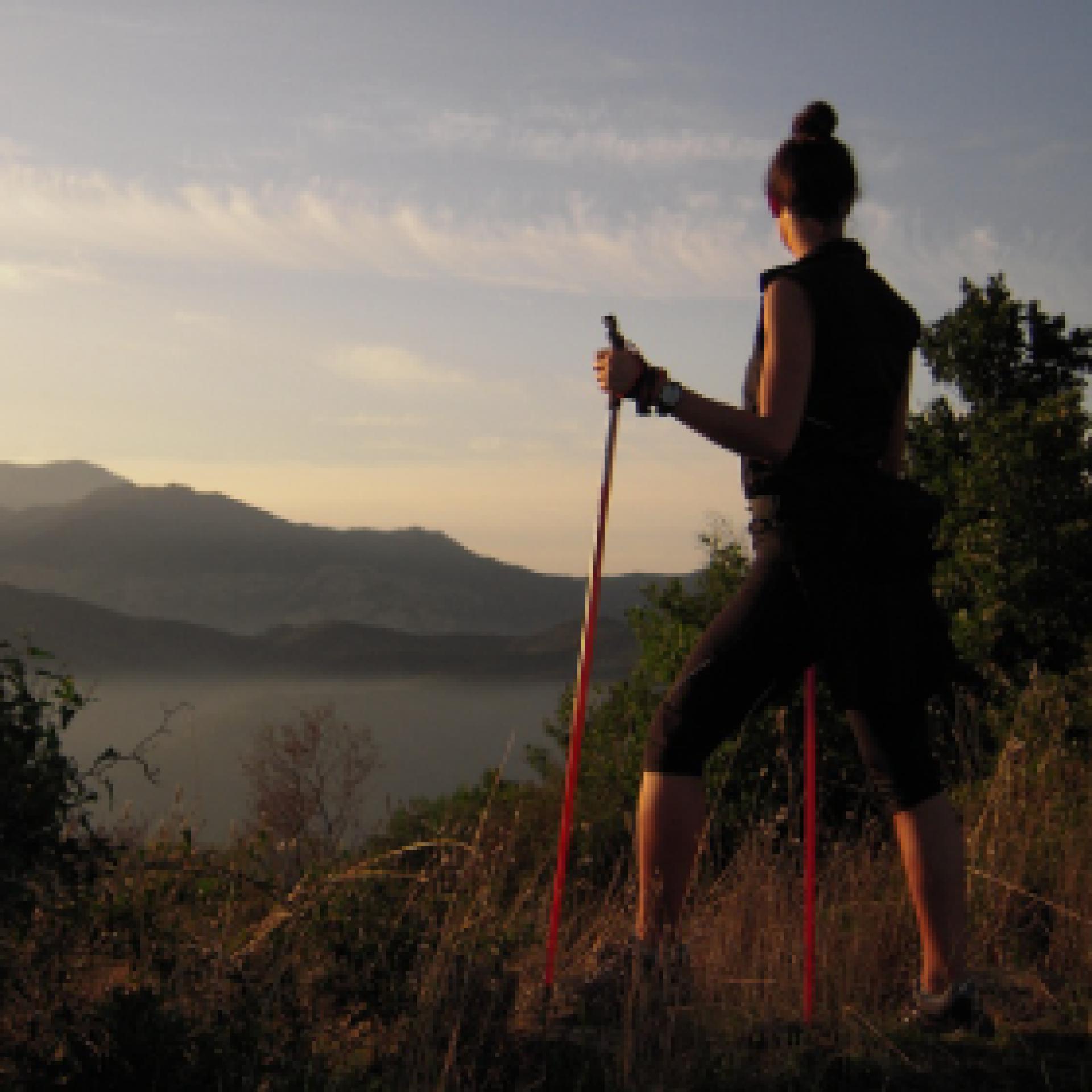
La camminata nordica o camminata con bastoni (in inglese nordic walking o pole walking) è attività fisica e sportiva che ben si coniuga con percorsi in bosco, in pianura o in vallate, lungo scogliere o spiagge.  La Rete dei sentieri della Sardegna offre tantissime occasioni per cimentarsi nella camminata nordica... 

Nordic-walking.png

Results

Sentiero Italia (Stage Z27) Burcei – Valico Sette Fratelli

Overview of the itinerary

Sentiero Italia runs the length of the island’s eastern side, covering its most important mountains, in 28 stages.  Starting from the north: it flanks the Monte Limbara massif, crosses the limestones of Mont’Albo and Tuttavista, skirting the Gulf of Orosei, it crosses the Supramonte, Gennargentu and the Tacchi of Ogliastra and reaches Perdasdefogu.  Further south, it passes through Armungia and the Gerrei sub-region. Lastly, it touches on the villages of Burcei and San Gregorio, continuing on the Sette Fratelli massif to the old prisons of Castiadas.

General information on Sentiero Italia (Grand Italian Trail)

Sentiero Italia, or Grand Italian Trail, as also explained on the official website, is a walking route that crosses the whole of Italy, using mainly but not exclusively “registered trails”.   
In particular, in Sardinia, not all the stages of the Sentiero Italia of CAI (Italian Alpine Club) are made of trails already included in the registry of the Sardinia Trail Network (RES), either because they have not yet been tested and approved or simply because they cannot be registered as they do not meet the requirements.  However, as a whole, the Sentiero Italia is the single longest walking route currently crossing Sardinia from the north (S. Teresa Gallura, stage Z 1) to the south (Castiadas, end of stage Z 28), touching on the most fascinating mountain areas in central-eastern Sardinia: the plateau of Buddusò, Tepilora, the Cedrino river valley, the ancient forests of Montes, Perda Liana and the regional forest of Montarbu, Monte Genis, and lastly the regional forest of Settefratelli (among the many crossed by the various stages of this long hiking itinerary).

Information on this stage of the trail

From the town of Burcei, the rout is mainly on dirt tracks towards the old cantoniera (roadside house) of Campu Omu. This marks the start of the route towards the Sette Fratelli, the last mountain massif you will encounter on your journey across the island. 

The trail falls within the Sette Fratelli (seven brothers) park which, with ten thousand hectares of forest stretching over the mountains, is one of the greenest and most stunning places in Sardinia, a nature reserve offering lush nature and breathtaking views

The trail, which is of medium difficulty, ends at the Campu Omu forest ranger station.

Note

You can camp at the ‘Campu Omu’ station of the Forestas Agency, about 3 km from Su Baccu Malu

Lenght 13.700 m

SI Z27.gpx

Total elevation gain 828 metri

Geographical area Gerrei Sarrabus-Sette Fratelli

Sentiero Italia (Tappa Z27) Burcei – Valico Sette Fratelli

In sintesi

Il Sentiero Italia attraversa in lunghezza il settore orientale dell’isola toccandone i sistemi montuosi più rilevanti, in 28 tappe.  Partendo da nord: tocca il massiccio del Monte Limbara, attraversa i calcari del Mont'Albo e del Tuttavista sfiorando il Golfo di Orosei,  attraversa il Supramonte, il Gennargentu, i Tacchi dell’Ogliastra e giunge a Perdasdefogu.  Più a sud, transita da Armungia e dalla subregione del Gerrei. Infine tocca l’abitato di Burcei e San Gregorio, per continuare nel massiccio dei Sette Fratelli fino alle vecchie carceri di Castiadas.

Informazioni generali sull'itinerario sentiero Italia

Il Sentiero Italia, come spiegato anche nel sito ufficiale, è un itinerario (o Cammino) lungo tutta l'Italia, che utilizza prevalentemente ma non esclusivamente "sentieri accatastati".   
In particolare, in Sardegna, non tutte le tappe del Sentiero Italia del CAI coincidono con sentieri già inseriti nel catasto della Rete Escursionistica della Sardegna (RES), perché non hanno ancora superato le verifiche di percorribilità oppure semplicemente perché non possono essere accatastati non avendone i requisiti.  Tuttavia, nel suo insieme, il Sentiero Italia rappresenta l'unica, la più grande dorsale escursionistica che attraversa attualmente la nostra Isola da nord (S. Teresa Gallura, tappa Z 1) a sud (Castiadas, fine tappa Z 28) toccando le aree montane della Sardegna centro-Orientale più affascinanti: l'altopiano di Buddusò, Tepilora, la valle del Cedrino, i boschi vetusti di Montes, Perda Liana e la foresta demaniale di Montarbu, il Monte Genis, e infine la foresta demaniale di Settefratelli (tra le tante attraversate dal lungo itinerario escursionistico a tappe).

Info sul percorso di questa tappa

Dall’abitato di Burcei ci si avvia prevalentemente per strade bianche verso la cantoniera di Campu Omu da cui inizia il percorso verso i Sette Fratelli, l’ultimo massiccio montuoso che si incontrerà nella traversata dell’isola. 

Il territorio fa parte dell’omonimo parco che con diecimila ettari di foresta distesa sulle montagne è uno dei luoghi più verdi e affascinanti della Sardegna, una riserva naturale piena di piacevoli sorprese e panorami mozzafiato

L’arrivo è situato presso la caserma forestale di Campu Omu dopo una tappa di media difficoltà.

Informazioni utili

Lungo il percorso non sarà sempre presente la copertura telefonica

Lenght 13.700 m

SI Z27.gpx

Total elevation gain 828 metri

Geographical area Gerrei Sarrabus-Sette Fratelli

Sentiero Italia (Stage Z24) Cuile Is Arrantas - Armungia

Overview of the itinerary

Sentiero Italia runs the length of the island’s eastern side, covering its most important mountains, in 28 stages.  Starting from the north: it flanks the Monte Limbara massif, crosses the limestones of Mont’Albo and Tuttavista, skirting the Gulf of Orosei, it crosses the Supramonte, Gennargentu and the Tacchi of Ogliastra and reaches Perdasdefogu.  Further south, it passes through Armungia and the Gerrei sub-region. Lastly, it touches on the villages of Burcei and San Gregorio, continuing on the Sette Fratelli massif to the old prisons of Castiadas.

General information on Sentiero Italia (Grand Italian Trail)

Sentiero Italia, or Grand Italian Trail, as also explained on the official website, is a walking route that crosses the whole of Italy, using mainly but not exclusively “registered trails”.   
In particular, in Sardinia, not all the stages of the Sentiero Italia of CAI (Italian Alpine Club) are made of trails already included in the registry of the Sardinia Trail Network (RES), either because they have not yet been tested and approved or simply because they cannot be registered as they do not meet the requirements.  However, as a whole, the Sentiero Italia is the single longest walking route currently crossing Sardinia from the north (S. Teresa Gallura, stage Z 1) to the south (Castiadas, end of stage Z 28), touching on the most fascinating mountain areas in central-eastern Sardinia: the plateau of Buddusò, Tepilora, the Cedrino river valley, the ancient forests of Montes, Perda Liana and the regional forest of Montarbu, Monte Genis, and lastly the regional forest of Settefratelli (among the many crossed by the various stages of this long hiking itinerary).

Information on this stage of the trail

From Escalaplano, following paved and dirt tracks, this is a 20-km stage, first heading towards Marcasua, then following the Rio Su Ruaxiu stream and the Sentiero dei Carbonai (charcoal burners’ path) to the Sa Mola plateau with its characteristic rocks shaped by the elements. 

The route then descends into the Flumendosa valley and ends in Armungia, the home town of writer and politician Emilio Lussu

Don’t miss the nuraghe (prehistoric stone fortress) in the centre of Armungia dating back to the Bronze Age, around 1500-1400 BC.

Lenght 23.200 m

SI Z24.gpx

Total elevation gain 915 metri

Geographical area Gerrei Sarrabus-Sette Fratelli

Sentiero Italia (Tappa Z24) Cuile Is Arrantas - Armungia

In sintesi

Il Sentiero Italia attraversa in lunghezza il settore orientale dell’isola toccandone i sistemi montuosi più rilevanti, in 28 tappe.  Partendo da nord: tocca il massiccio del Monte Limbara, attraversa i calcari del Mont'Albo e del Tuttavista sfiorando il Golfo di Orosei,  attraversa il Supramonte, il Gennargentu, i Tacchi dell’Ogliastra e giunge a Perdasdefogu.  Più a sud, transita da Armungia e dalla subregione del Gerrei. Infine tocca l’abitato di Burcei e San Gregorio, per continuare nel massiccio dei Sette Fratelli fino alle vecchie carceri di Castiadas.

Informazioni generali sull'itinerario sentiero Italia

Il Sentiero Italia, come spiegato anche nel sito ufficiale, è un itinerario (o Cammino) lungo tutta l'Italia, che utilizza prevalentemente ma non esclusivamente "sentieri accatastati".   
In particolare, in Sardegna, non tutte le tappe del Sentiero Italia del CAI coincidono con sentieri già inseriti nel catasto della Rete Escursionistica della Sardegna (RES), perché non hanno ancora superato le verifiche di percorribilità oppure semplicemente perché non possono essere accatastati non avendone i requisiti.  Tuttavia, nel suo insieme, il Sentiero Italia rappresenta l'unica, la più grande dorsale escursionistica che attraversa attualmente la nostra Isola da nord (S. Teresa Gallura, tappa Z 1) a sud (Castiadas, fine tappa Z 28) toccando le aree montane della Sardegna centro-Orientale più affascinanti: l'altopiano di Buddusò, Tepilora, la valle del Cedrino, i boschi vetusti di Montes, Perda Liana e la foresta demaniale di Montarbu, il Monte Genis, e infine la foresta demaniale di Settefratelli (tra le tante attraversate dal lungo itinerario escursionistico a tappe).

Info sul percorso di questa tappa

Da Escalaplano per carrarecce asfaltate e bianche, una tappa di una ventina di chilometri dapprima verso Marcasua, poi lungo il torrente Rio Su Ruaxiu e il sentiero dei carbonai fino all’altipiano di Sa Mola con le sue caratteristiche rocce modellate dagli agenti atmosferici. 

Si scende nella valle del Flumendosa e si conclude ad Armungia, il paese che diede i natali al grande scrittore e politico Emilio Lussu

Di particolare interesse il nuraghe che sorge proprio al centro di Armungia risalente all’età del bronzo, circa 1500-1400 a. C..


Informazioni utili

Lungo il percorso non sarà sempre presente la copertura telefonica

Lenght 23.200 m

SI Z24.gpx

Total elevation gain 915 metri

Geographical area Gerrei Sarrabus-Sette Fratelli

Ovodda - Antriocu Soddu

This is a short itinerary, but of great naturalistic and technical value. Good driving skills are required for the long stony descent from an altitude of 1060 m to an altitude of 700 m. The soil is granitic, washed out, resulting in many deep furrows, loose stone and gravelly and sandy surfaces. Plan the hike with caution, always bearing in mind your abilities and available time, because at high altitudes a change in the weather can become problematic if it catches you in a precarious condition. Adding to the sporting value of the itinerary is the historical interest with the Pedras Fitas menhirs in the stream valley and the domus de janas of Sos Forros. The latter are in a state of disrepair, partially buried, yet they are easily recognisable and worth a visit.

Informazioni utili

The LEADER Territory of the Local Action Group (GAL) Rural District Barbagia Mandrolisai Gennargentu (BMG)

Consisting of the Union of Municipalities of Barbagia and the Mountain Community of Gennargentu Mandrolisai. The GAL BMG, therefore, includes 19 municipalities, with a total area of 854.30 sq km and a resident population of approximately 22,000 inhabitants: Aritzo, Atzara, Austis, Belvì, Desulo, Gadoni, Gavoi, Lodine, Meana Sardo, Ollolai, Oniferi, Olzai, Ortueri, Ovodda, Sarule, Sorgono, Teti, Tiana, Tonara.

The GAL Rural District BMG, established in 2009, is a participation foundation composed of 22 public members and over 200 private members, representing the main institutional, economic, and social components of the territory. The foundation aims to improve the quality of life and well-being of communities in the historical regions of Barbagia, Mandrolisai, and Gennargentu by enhancing local resources. The main thematic and intervention areas identified by the GAL BMG for the definition of its Local Development Strategy 2014-2022 are the development and innovation of local production chains and systems, social inclusion, and sustainable tourism.

THE OAST PROJECT: OUTDOOR ACTIVITIES FOR SUSTAINABLE TOURISM

The project, coordinated by the GAL BMG in partnership with the GAL Sisteron-Buëch (France) and the GAL Kilkenny (Ireland), aims to promote sustainable and active tourism in rural areas of Europe. The specific objective of the project was to enhance and develop the tourist attractiveness of the inland waters of Barbagia, through outdoor sports and water activities, in line with the thematic area "sustainable tourism" chosen in the GAL BMG's PDA. The three territories involved boast a rich and varied natural, landscape, and cultural heritage with strong identity traits and enormous potential for the development of active tourism. However, some problems common to all partners have been highlighted, such as: insufficient enhancement and tourist promotion of inland areas, isolation, the absence of an international network useful for the exchange of good practices, and insufficient diversification, delocalization, deseasonalization, and internationalization of tourist flows. The OAST Project was created to respond to these critical issues, as active tourism and sustainable tourism represent the basis for the revival of territories characterized by enormous problems of depopulation, lack of services, unemployment, and school dropout. The idea, therefore, is to promote forms of sustainable, active, responsible, and experiential tourism, as well as to offer diversified and deseasonalized solutions suitable for a constantly growing number of active tourists. The specific action involved the georeferencing and description, in Italian and English, of 19 GAL BMG itineraries related to the theme of water. The itinerary tracks are available and downloadable, in Gpx format, on these pages and also on the GAL BMG's Wikiloc account.

Lenght 18.600 m

Ovodda - Antiocru Soddu.gpx

Total elevation gain 789 metri

Geographical area Barbagia

Contiene carte
Spento

Ovodda - Antriocu Soddu

AVVERTENZE

QUESTO ITINERARIO è riportato "tal quale" a titolo informativo e di mera recensione/ricognizione degli itinerari presenti nel territorio  -  come fornito e recensito dal progetto OAST condotto dal GAL BMG nel 2024. 
NOTA: Molti itinerari sono composti da percorsi stretti e richiedono una cura periodica della vegetazione, al momento non assicurata da una gestione  di tipo  ufficiale, non essendo il tracciato inserito nella"rete escursionistica della Sardegna".  
Nota 2: Prima di recarvi sul posto si consiglia di raccogliere informazioni sullo stato di fruibilità, presso il comune competente, per avere certezza dell'effettiva percorribilità dell'itinerario scelto.

IL PERCORSO IN PILLOLE (elementi informativi essenziali)

Itinerario breve ma di grande valore naturalistico e tecnico, occorre una buona capacità di guida per la lunga discesa che dal valico a sud-ovest della cima Antriocu Soddu a quota 1060 m conduce fino a quota 700 m. La discesa continua ancora fino al rio Pedras Fitas, chiamato anche rio Aratu, ma in questa parte è scorrevole e ci consente di rilassarci, in vista dei successivi tratti tecnici di salita e discesa prima di concludere il giro. Il suolo è granitico, dilavato, col risultato di tanti solchi profondi, pietra smossa e superfici ghiaiose e sabbiose. Se quota massima, lunghezza e dislivello vi sembrassero insufficienti, l’estremità di questo itinerario, a quota 1060 m, si lega facilmente agli anelli degli itinerari di Tiana, che includono a loro volta il lago Torrei. L’anello del giro corto di Tiana vi porterebbe più in alto di altri 100 m di quota mentre l’anello del giro lungo di Tiana arriva al valico di Tascusì, a quota 1245 m, includendo in questa zona anche due bar ristoranti. Lasciamo a voi il gusto di scoprire dislivelli e chilometraggi ulteriori con questi anelli consecutivi, in ogni caso programmate l’escursione con prudenza, tenendo sempre ben presenti le vostre capacità e il vostro tempo a disposizione, perché alle alte quote un cambiamento delle condizioni atmosferiche può diventare problematico se ci coglie in condizioni precarie. Il lago di Zuzesso, che le persone del posto chiamano “la dighetta”, si trova nel tratto lineare dell’itinerario vicino al paese, è recintato ma il cancello è aperto: prestate la massima attenzione avvicinandovi allo specchio d’acqua perché le rive sono da subito profonde.

A fine escursione può essere una buona risorsa l’area picnic a 1,2 km dal paese perché, oltre a tavoli e panche, vi si trova anche un grande barbeque e scorre un torrente a pochi metri di distanza. Il cancello sembra essere sempre aperto ma per portare dentro la macchina o un piccolo furgone (l’accesso è un po’ stretto) è meglio informarsi prima presso il Comune, ancora di più per una eventuale permanenza notturna.

Informazioni utili

Il territorio LEADER del Gruppo di Azione Locale (GAL) Distretto Rurale Barbagia Mandrolisai Gennargentu (BMG) 

Costituito dall'Unione dei Comuni Barbagia e dalla Comunità Montana Gennargentu Mandrolisai. Il GAL BMG comprende, quindi, 19 comuni, per una superficie complessiva di 854,30 kmq e una popolazione residente pari a circa 22.000 abitanti: 

Aritzo, Atzara, Austis, Belvì, Desulo, Gadoni, Gavoi, Lodine, Meana Sardo, Ollolai, Oniferi, Olzai, Ortueri, Ovodda, Sarule, Sorgono, Teti, Tiana, Tonara.


Il GAL Distretto Rurale BMG, costituito nel 2009, è una Fondazione di partecipazione composta da 22 soci pubblici e oltre 200 privati, rappresentativi delle principali componenti istituzionali, economiche e sociali del territorio. La fondazione ha lo scopo di migliorare la qualità della vita e il benessere delle comunità nelle regioni storiche Barbagia, Mandrolisai e Gennargentu mediante la valorizzazione delle risorse locali.
I principali ambiti tematici e di intervento individuati dal GAL BMG per la definizione della propria Strategia di Sviluppo Locale 2014-2022 sono lo sviluppo e l’innovazione delle filiere e dei sistemi produttivi locali, l’inclusione sociale ed il turismo sostenibile.


IL PROGETTO OAST: OUTDOOR ACTIVITIES FOR SUSTAINABLE TOURISM

Il progetto, coordinato dal GAL BMG in partenariato con il GAL Sisteron-Buëch (Francese) e
il GAL Kilkenny (Irelanda), intende promuovere un turismo sostenibile e attivo nelle aree
rurali d’Europa.
L’obiettivo specifico del progetto è stato potenziare e sviluppare l’attrattività turistica delle acque
interne della Barbagia, attraverso gli sport all’aria aperta e le attività acquatiche, in coerenza con l’ambito tematico “turismo sostenibile” prescelto nel PDA del GAL BMG.
I tre territori coinvolti vantano un patrimonio naturalistico, paesaggistico e culturale ricco e variegato con forti caratteri identitari ed enormi potenzialità di sviluppo di turismo attivo
Tuttavia, sono stati evidenziati alcuni problemi comuni a tutti i partner, quali: l’insufficiente valorizzazione e promozione turistica delle aree interne, l’isolamento, l’assenza di un network internazionale utile per lo scambio di buone prassi, e l’insufficiente diversificazione, delocalizzazione, destagionalizzazione e l’internazionalizzazione dei flussi turistici. Il Progetto OAST nasce per rispondere a queste criticità, in quanto il turismo attivo ed il turismo sostenibile rappresentano la base di rilancio dei territori caratterizzati da enormi problemi di spopolamento, carenza di servizi, disoccupazione e dispersione scolastica.
L’idea, quindi è promuovere forme di turismo sostenibile, attivo, responsabile ed esperienziale, nonché
offrire soluzioni diversificate e destagionalizzate adatte ad un numero di turisti attivi in continua crescita.
L’azione specifica ha previsto la georeferenziazione e descrizione, in lingua italiana e inglese, di
19 itinerari del GAL BMG legati al tema dell’acqua. Le tracce degli itinerari sono disponibili e scaricabili, in formato Gpx, in queste pagine e anche nell’account Wikiloc del GAL BMG

Lenght 18.600 m

Ovodda - Antiocru Soddu.gpx

Total elevation gain 789 metri

Geographical area Barbagia

Contiene carte
Spento

Genna 'e Crecu - Sorgono

An itinerary of great naturalistic value that allows you to appreciate both the dense native woods, dominated by holm oaks and downy oaks, and the pine afforestation of the high-altitude part, in which they are perfectly integrated. The route is rather smooth and does not present any particular tech-nical difficulties. Among the attractions of the route, at an altitude of 920 m, is the country church of Sa Ìtria, one of the highest in the whole of Sardinia, and a small house with a fireplace available for hikers, in a splendid panoramic position, for which the rules always apply: keep clean, close well be-fore leaving and leave a good supply of wood, both fine and coarse, inside. In the last few kilometres there is also a railway tollgate, which provides an insight into the life and work of a tollman on moun-tain railway lines dating back to the end of the 19th century.

Informazioni utili

The LEADER Territory of the Local Action Group (GAL) Rural District Barbagia Mandrolisai Gennargentu (BMG)

Consisting of the Union of Municipalities of Barbagia and the Mountain Community of Gennargentu Mandrolisai. The GAL BMG, therefore, includes 19 municipalities, with a total area of 854.30 sq km and a resident population of approximately 22,000 inhabitants: Aritzo, Atzara, Austis, Belvì, Desulo, Gadoni, Gavoi, Lodine, Meana Sardo, Ollolai, Oniferi, Olzai, Ortueri, Ovodda, Sarule, Sorgono, Teti, Tiana, Tonara.

The GAL Rural District BMG, established in 2009, is a participation foundation composed of 22 public members and over 200 private members, representing the main institutional, economic, and social components of the territory. The foundation aims to improve the quality of life and well-being of communities in the historical regions of Barbagia, Mandrolisai, and Gennargentu by enhancing local resources. The main thematic and intervention areas identified by the GAL BMG for the definition of its Local Development Strategy 2014-2022 are the development and innovation of local production chains and systems, social inclusion, and sustainable tourism.

THE OAST PROJECT: OUTDOOR ACTIVITIES FOR SUSTAINABLE TOURISM

The project, coordinated by the GAL BMG in partnership with the GAL Sisteron-Buëch (France) and the GAL Kilkenny (Ireland), aims to promote sustainable and active tourism in rural areas of Europe. The specific objective of the project was to enhance and develop the tourist attractiveness of the inland waters of Barbagia, through outdoor sports and water activities, in line with the thematic area "sustainable tourism" chosen in the GAL BMG's PDA. The three territories involved boast a rich and varied natural, landscape, and cultural heritage with strong identity traits and enormous potential for the development of active tourism. However, some problems common to all partners have been highlighted, such as: insufficient enhancement and tourist promotion of inland areas, isolation, the absence of an international network useful for the exchange of good practices, and insufficient diversification, delocalization, deseasonalization, and internationalization of tourist flows. The OAST Project was created to respond to these critical issues, as active tourism and sustainable tourism represent the basis for the revival of territories characterized by enormous problems of depopulation, lack of services, unemployment, and school dropout. The idea, therefore, is to promote forms of sustainable, active, responsible, and experiential tourism, as well as to offer diversified and deseasonalized solutions suitable for a constantly growing number of active tourists. The specific action involved the georeferencing and description, in Italian and English, of 19 GAL BMG itineraries related to the theme of water. The itinerary tracks are available and downloadable, in Gpx format, on these pages and also on the GAL BMG's Wikiloc account.

Lenght 16.100 m

Sorgono - Genna 'e Crecu.gpx

Total elevation gain 630 metri

Geographical area Barbagia Nuorese

Contiene carte
Spento

Genna 'e Crecu - Sorgono

AVVERTENZE

QUESTO ITINERARIO è riportato "tal quale" a titolo informativo e di mera recensione/ricognizione degli itinerari presenti nel territorio  -  come fornito e recensito dal progetto OAST condotto dal GAL BMG nel 2024. 
NOTA: Molti itinerari sono composti da percorsi stretti e richiedono una cura periodica della vegetazione, al momento non assicurata da una gestione  di tipo  ufficiale, non essendo il tracciato inserito nella"rete escursionistica della Sardegna".  
Nota 2: Prima di recarvi sul posto si consiglia di raccogliere informazioni sullo stato di fruibilità, presso il comune competente, per avere certezza dell'effettiva percorribilità dell'itinerario scelto.

IL PERCORSO IN PILLOLE (elementi informativi essenziali)

Itinerario di grande valore naturalistico che consente di apprezzare sia i fitti boschi autoctoni, in cui dominano il leccio e la roverella, sia i rimboschimenti di pini della parte in quota, nella quale risultano perfettamente integrati. A parte qualche tratto da manutenere nella prima parte, dopo l’iniziale tratto asfaltato, in generale il percorso è piuttosto scorrevole e non presenta particolari difficoltà tecniche. 

Variante

Chi trovasse chilometraggio e/o dislivello eccessivi può usufruire di una variante che dal valico della Strada Provinciale 31, presso il sugherificio Mandrolisai, torna a Sorgono su una ripida mulattiera in discesa che passa per il quartiere della Comunità Montana. Questa variante si può percorrere anche in salita, per creare altre combinazioni, perché a piedi si può anche invertire il senso di tutto l’itinerario. 

Un’ulteriore possibilità, per i camminatori che non se la sentissero di affrontare da subito tutto l’itinerario, è l’attraversamento della Strada Statale 128, al km 106,8. È una buona via di accesso o una buona via di fuga, percorribile in macchina, che consente di dividere l’itinerario in un ulteriore segmento. 
Purtroppo non risulta una fermata dell’autobus, neanche nel vicino valico di S’Isca ‘e sa Mela, appena 1 km più a monte. Tra le attrattive del percorso, a quota 920 m la chiesa campestre di Sa Ìtria, una delle più alte di tutta la Sardegna e una casetta con camino in splendida posizione panoramica, per la quale valgono sempre le regole di tenere pulito, di chiudere bene prima di andare via e di lasciare all’interno una buona scorta di legna, sia fine che grossa. 
 

Ciclabilità

Nella percorrenza in mountain bike è consigliabile tenere il senso orario, in modo da trovare in discesa la ripida strada di Serra Longa, vicina alla zona più alta dell’itinerario, oltre i 1000 m di quota. Sono le stesse località attraversate dall’itinerario di Tonara e chi ritenesse i 16 km troppo brevi per la mountain bike può facilmente aggregare i due itinerari, descrivendo una forma a otto con l’intersezione proprio in questo tratto, arrivando a un totale di 33 km e 1040 m di dislivello.

Informazioni utili

Il territorio LEADER del Gruppo di Azione Locale (GAL) Distretto Rurale Barbagia Mandrolisai Gennargentu (BMG) 

Costituito dall'Unione dei Comuni Barbagia e dalla Comunità Montana Gennargentu Mandrolisai. Il GAL BMG comprende, quindi, 19 comuni, per una superficie complessiva di 854,30 kmq e una popolazione residente pari a circa 22.000 abitanti: 

Aritzo, Atzara, Austis, Belvì, Desulo, Gadoni, Gavoi, Lodine, Meana Sardo, Ollolai, Oniferi, Olzai, Ortueri, Ovodda, Sarule, Sorgono, Teti, Tiana, Tonara.


Il GAL Distretto Rurale BMG, costituito nel 2009, è una Fondazione di partecipazione composta da 22 soci pubblici e oltre 200 privati, rappresentativi delle principali componenti istituzionali, economiche e sociali del territorio. La fondazione ha lo scopo di migliorare la qualità della vita e il benessere delle comunità nelle regioni storiche Barbagia, Mandrolisai e Gennargentu mediante la valorizzazione delle risorse locali.
I principali ambiti tematici e di intervento individuati dal GAL BMG per la definizione della propria Strategia di Sviluppo Locale 2014-2022 sono lo sviluppo e l’innovazione delle filiere e dei sistemi produttivi locali, l’inclusione sociale ed il turismo sostenibile.


IL PROGETTO OAST: OUTDOOR ACTIVITIES FOR SUSTAINABLE TOURISM

Il progetto, coordinato dal GAL BMG in partenariato con il GAL Sisteron-Buëch (Francese) e
il GAL Kilkenny (Irelanda), intende promuovere un turismo sostenibile e attivo nelle aree
rurali d’Europa.
L’obiettivo specifico del progetto è stato potenziare e sviluppare l’attrattività turistica delle acque
interne della Barbagia, attraverso gli sport all’aria aperta e le attività acquatiche, in coerenza con l’ambito tematico “turismo sostenibile” prescelto nel PDA del GAL BMG.
I tre territori coinvolti vantano un patrimonio naturalistico, paesaggistico e culturale ricco e variegato con forti caratteri identitari ed enormi potenzialità di sviluppo di turismo attivo
Tuttavia, sono stati evidenziati alcuni problemi comuni a tutti i partner, quali: l’insufficiente valorizzazione e promozione turistica delle aree interne, l’isolamento, l’assenza di un network internazionale utile per lo scambio di buone prassi, e l’insufficiente diversificazione, delocalizzazione, destagionalizzazione e l’internazionalizzazione dei flussi turistici. Il Progetto OAST nasce per rispondere a queste criticità, in quanto il turismo attivo ed il turismo sostenibile rappresentano la base di rilancio dei territori caratterizzati da enormi problemi di spopolamento, carenza di servizi, disoccupazione e dispersione scolastica.
L’idea, quindi è promuovere forme di turismo sostenibile, attivo, responsabile ed esperienziale, nonché
offrire soluzioni diversificate e destagionalizzate adatte ad un numero di turisti attivi in continua crescita.
L’azione specifica ha previsto la georeferenziazione e descrizione, in lingua italiana e inglese, di
19 itinerari del GAL BMG legati al tema dell’acqua. Le tracce degli itinerari sono disponibili e scaricabili, in formato Gpx, in queste pagine e anche nell’account Wikiloc del GAL BMG
 

Lenght 16.100 m

Sorgono - Genna 'e Crecu.gpx

Total elevation gain 630 metri

Geographical area Barbagia Nuorese

Contiene carte
Spento

Ispadula - Tonara

This route allows you to admire the high-altitude woods of the Tonara mountains and enjoy the pano-rama of the entire surrounding area. Due to the general smoothness of the terrain, it is suitable for cycling even when there is snow, thus increasing the charm of the excursion. Although short in terms of kilometres, at least by cycling standards, it winds through an environment of great naturalistic val-ue, such that it is a rewarding experience, also in view of the difference in height and altitude. At the Isca 'e sa Mela road pass, the route intercepts State Road 128, which connects Sorgono to the town of Tonara. This point can be useful to connect the itinerary to other villages or to lengthen the excursion towards the surrounding mountains.

Informazioni utili

The LEADER Territory of the Local Action Group (GAL) Rural District Barbagia Mandrolisai Gennargentu (BMG)

Consisting of the Union of Municipalities of Barbagia and the Mountain Community of Gennargentu Mandrolisai. The GAL BMG, therefore, includes 19 municipalities, with a total area of 854.30 sq km and a resident population of approximately 22,000 inhabitants: Aritzo, Atzara, Austis, Belvì, Desulo, Gadoni, Gavoi, Lodine, Meana Sardo, Ollolai, Oniferi, Olzai, Ortueri, Ovodda, Sarule, Sorgono, Teti, Tiana, Tonara.

The GAL Rural District BMG, established in 2009, is a participation foundation composed of 22 public members and over 200 private members, representing the main institutional, economic, and social components of the territory. The foundation aims to improve the quality of life and well-being of communities in the historical regions of Barbagia, Mandrolisai, and Gennargentu by enhancing local resources. The main thematic and intervention areas identified by the GAL BMG for the definition of its Local Development Strategy 2014-2022 are the development and innovation of local production chains and systems, social inclusion, and sustainable tourism.

THE OAST PROJECT: OUTDOOR ACTIVITIES FOR SUSTAINABLE TOURISM

The project, coordinated by the GAL BMG in partnership with the GAL Sisteron-Buëch (France) and the GAL Kilkenny (Ireland), aims to promote sustainable and active tourism in rural areas of Europe. The specific objective of the project was to enhance and develop the tourist attractiveness of the inland waters of Barbagia, through outdoor sports and water activities, in line with the thematic area "sustainable tourism" chosen in the GAL BMG's PDA. The three territories involved boast a rich and varied natural, landscape, and cultural heritage with strong identity traits and enormous potential for the development of active tourism. However, some problems common to all partners have been highlighted, such as: insufficient enhancement and tourist promotion of inland areas, isolation, the absence of an international network useful for the exchange of good practices, and insufficient diversification, delocalization, deseasonalization, and internationalization of tourist flows. The OAST Project was created to respond to these critical issues, as active tourism and sustainable tourism represent the basis for the revival of territories characterized by enormous problems of depopulation, lack of services, unemployment, and school dropout. The idea, therefore, is to promote forms of sustainable, active, responsible, and experiential tourism, as well as to offer diversified and deseasonalized solutions suitable for a constantly growing number of active tourists. The specific action involved the georeferencing and description, in Italian and English, of 19 GAL BMG itineraries related to the theme of water. The itinerary tracks are available and downloadable, in Gpx format, on these pages and also on the GAL BMG's Wikiloc account.

Lenght 16.500 m

Tonara. Ispadula.gpx

Total elevation gain 538 metri

Geographical area Gennargentu

Contiene carte
Spento