Start website main content

Horse

48 pathways

Ippovia è un itinerario percorribile a cavallo, raramente asfaltato, che attraversa riserve naturali, boschi, colline e vallate, talvolta costeggiando corsi d'acqua e spiagge, attraversando evidenze storiche-culturali o borghi. L'ippovia consente la pratica dell'equiturismo ma può anche essere percorsa a piedi.  Lungo il percorso si prevedono tappe, distanti non più di 20 km, dove cavaliere e cavallo possano trovare assistenza, ristoro ed eventuale pernottamento...

Ippoturismo.png

Results

Is Pauceris end of point D-209

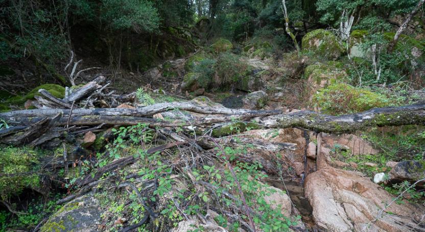
Turn right, detaching from trail 205 at Arcu de Perdu Secci, at a widening of the dirt road where you turn left into an arbutus grove. Traverse at the same altitude or with a slight descent, gradually bending eastward and keeping a deep hollow on your left. The trail soon becomes a beautiful mule track that descends very gradually. You reach the valley floor near what was a large cart track, on the right hydrographic side of the stream. The cart track continues on level ground, in an area characterized by maquis shrubland and without changing direction, finally rejoining trail 208.

How to get here

Following trail 208 which starts from Gutturu Mannu - Gambarussa Barracks

Route location Is Pauceris

trekking - waypoint

Geographical area Gutturu Mannu

Is Pauceris punto di arrivo D-209

Si prende a destra, staccandosi dal sentiero 205 in località Arcu de Perdu Secci, presso uno slargo della sterrata dove si prende a sinistra in un corbezzolaio. Si traversa in quota o leggera discesa, piegando gradualmente verso est e tenendo sulla sinistra un profondo impluvio. Il Sentiero diviene ben presto una bella mulattiera che scende con grande gradualità. Si raggiunge il fondovalle nei pressi di quella che era una grande carrareccia, sul lato destro idrografico del torrente. La carrareccia prosegue in piano, in una zona contraddistinta dalla macchia e senza cambiare direzione, riunendosi infine al sentiero 208.

How to get here

Seguendo il sentiero 208 che parte da Gutturu Mannu - Caserma Gambarussa

Route location Is Pauceris

trekking - waypoint

Geographical area Gutturu Mannu

Is Allineddus - end of point D210

End point of trail 210 and crossroads for trails 202 and 207. From the summit, descend gradually on open terrain. To the left, trail 207 runs parallel and can be reached in a few steps under the strawberry trees. Upon reaching a wooded saddle, the trail turns sharply right, descending steeply northwest along a mule track that reaches the ridge of a wide slope in the Murdegus de Maxias area. Various paths intersect in the woods, where signage is crucial for navigation. At approximately 730 meters, descend to the left, still on a mule track, turning left again and beginning a rapid ascent, followed by a more gradual climb. Traverse the rocky slopes of Monte Maxia diagonally, gradually ascending until you reach s’Arcu ‘e S’Arena, where the trail ends and reconnects with itinerary 207. Here, you also reach the long-distance trail 200, which runs from Pixinamanna to Pantaleo.

How to get here

"Starting from Monte Nieddu, the route initially follows a forest track for a long stretch, before leaving it at a large hairpin bend and soon reaching the structures of Porcili Mannu (410 m a.s.l.), originally sheepfolds now renovated. A dirt road through the woods, very popular with wild boars, leads in a slight ascent to S’Arcu de S’Arena (633 m a.s.l.). At the pass, it is possible to proceed along several routes: therefore, continue westwards, in a steep ascent, leaving the woods at its highest point near P.ta Matta Sola (961 m a.s.l.). The trail follows the ridge line, continuing on the higher M.te Maxia (1017 m a.s.l.), before re-entering the underlying strawberry tree wood and following a mule track, in a steep descent, which allows you to visit the Murdegu de Maxias area. Another mule track, this time uphill, allows you to return to the ridge line that was abandoned near the peak and then reach the destination. (This last section can be avoided by continuing along the ridge, along the dirt road also used by trail 207).

Route location Is allineddus

trekking - waypoint

Geographical area Gutturu Mannu

Is Allineddus - punto di arrivo D210

Punto di arrivo del sentiero 210 e crocevia per il sentiero 202 e 207. Dalla cima si scende gradualmente sempre su terreno aperto. Sulla sinistra corre parallelo il 207 che, anche in questo punto, si raggiungerebbe in pochi passi sotto i corbezzoli. Giunti a una sella boscata il sentiero si butta sulla destra, in ripida pendenza ed in direzione nordovest, scendendo ripidamente di quota e imboccando una mulattiera che raggiunge la schiena di un largo costone in località Murdegus de Maxias. Si incontrano vari sentieri nel bosco, dove la segnaletica è fondamentale per orientarsi negli incroci. A quota 730 circa si scende sulla sinistra, sempre su mulattiera, svoltando ancora a sinistra e cominciando a risalire rapidamente, poi con maggiore gradualità. Si tagliano obliquando i versanti rocciosi di Monte Maxia, risalendo gradualmente fino ad arrivare a s’Arcu ‘e S’Arena, dove il sentiero ha termine e si incontra nuovamente l’itinerario 207. In questo luogo si raggiunge anche il sentiero 200, di lunga percorrenza, che porta da Pixinamanna a Pantaleo.

How to get here

Partendo da Monte Nieddu, si segue inizialmente, per un lungo tratto, la pista forestale, per abbandonarla in corrispondenza di un grosso tornante e raggiungere in breve le strutture di Porcili Mannu (410 m s.l.m.), in origine ovili ora ristrutturati. Una carrareccia in mezzo al bosco, frequentatissima dai cinghiali, porta in leggera salita a S’Arcu de S’Arena (633 m s.l.m.). Nel valico è possibile procedere per diversi itinerari: si prosegue dunque in direzione ovest, in forte salita, uscendo dal bosco al suo culmine presso P.ta Matta Sola (961 m s.l.m.). Il sentiero segue la linea di cresta, proseguendo sul più alto M.te Maxia (1017 m s.l.m.), per poi rientrare nel corbezzolaio sottostante e seguire una mulattiera, in forte discesa, che permette di visitare la zona di Murdegu de Maxias. Ancora una mulattiera, questa volta in salita, permette invece di tornare sulla linea di cresta che si aveva abbandonata nei pressi della punta e giungere quindi alla meta. (quest’ultimo tratto è evitabile proseguendo sulla cresta, lungo la sterrata percorsa anche dal sentiero 207).

Route location Is allineddus

trekking - waypoint

Geographical area Gutturu Mannu

Porcili Mannu - Starting Point Trail D-209

The route begins from the severely damaged dirt road in the Trunconi area, heading towards the ancient pastoral settlement known as Porcili Isidori (marked on the map as Porcili Mannu). The dirt road, in poor condition, leads there in a slight descent, ending in a clearing near a large wild pear tree felled by the wind. The area is an archaeological site, and terracotta remains can be found scattered in the vegetation.

How to get here

Reachable from trail 208 or the convenient forest track that starts from the SP 1 road in the Trunconeddu area.

Route location Porcili Isidori

trekking - waypoint

Geographical area Gutturu Mannu

Porcili Mannu punto di partenza D-209

Si parte dalla sterrata disastrata in località Trunconi, diretti all’antico insediamento pastorale noto come Porcili Isidori (in carta Porcili Mannu). La sterrata, in cattive condizioni, vi giunge in lieve discesa, terminando in uno slargo presso un grosso perastro abbattuto dal vento. La zona è un’area archeologica e si possono rinvenire resti fittili sparsi nella vegetazione.

How to get here

Raggiungibile dal sentiero 208 o dalla comoda pista forestale che parte dalla SP 1 nella località Trunconeddu. 

Route location Porcili Isidori

trekking - waypoint

Geographical area Gutturu Mannu

Sa Spindula - Starting Point D-211

Start of trail 211, in the locality of Sa Spindula (210 m a.s.l.): we proceed along a path that runs alongside the fence of a sheepfold.

How to get here

From Cagliari - by car - follow the State Road 130 until taking the exit for the Industrial Zone. After 9.3 km, turn left, and then slightly left again, continuing straight until you find a large area where it is possible to park your car to begin route 211 (follow the signs leading to the "Monte Arcosu" hotel).

Route location Sa Spindula

trekking - waypoint

Geographical area Gutturu Mannu