Start website main content

Hiking

205 pathways

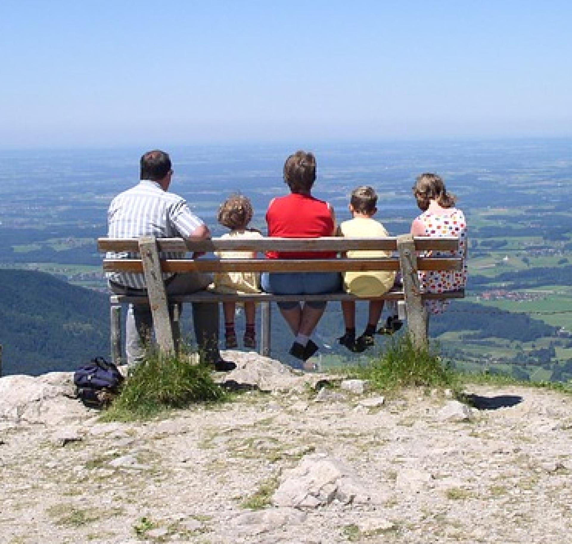
Hiking è una camminata en plain air della durata massima di una giornata (dall’inglese to hike).  Un’esperienza simile trekking (to trek: fare un lungo viaggio, dunque durata maggiore dell'hiking, anche più giorni) che enfatizza il gesto tecnico-sportivo del camminare.  Molti sentieri della R.E.S. sono particolarmente semplici e ben raggiungibili, quindi adatti per fare hiking e trascorrere qualche ora in Natura: lungo questi percorsi di breve-media lunghezza, anche i più piccoli potranno scoprire l’Isola dei sentieri...

Da-fare-in-famiglia2.png

Results

Sorgono, the plateau of the Nuraghes. Between history and nature

Access 

Take the SS 128, which is the main road of the inhabited centre of Sorgono. At the same level of the Cantina Sociale del Mandrolisai, on the opposite side of the road, wooden signs indicate some archaeological sites. You then follow Via Emilia, turning left at a large fork where you come to another signpost indicating Sentiero Escursionistico (Hiking Trail). Continue along the asphalt road for about 4 km until you come to a sign on the right indicating the Nuraghe Lò. You can park the car here. 

Nuraghe Lò 

You turn right uphill along a small dirt road, immersed in an Oak forest. After a short stretch, on the left, the beautiful nuragic tower stands out, built on a rocky outcrop formation and placed in a n elevated position. The plan of the structure is slightly elliptical and has the peculiarity of having an architraved window placed at the end of a slightly curved corridor that is in a mirror-image position to the entrance. 

Santu Loisu 

You descend back to the asphalt road, soon encountering a sign marking the entrance to the forestry yard, which also houses a beautiful nursery. You are now in the locality of Santu Loisu and enter a plot of land to the left of the road, where there are two buildings belonging to a mountain colony and a natual spring. On the right, a small path leads to the domus de Janas of Santu Loisu, consisting of two small chambers at ground level and immersed in a beautiful wood. You return to the tarmac road, continuing for a few hundred metres until you come to an imperceptible bend to the left. On the left of the road, immersed in the woods, is the beautiful tower of Nuraghe Bardacolo, set in a dominant position. Although extremely high, from its summit you can enjoy a wide panorama. 

Nuraghe Orrubiu 

The route continues on the main road, now slightly downhill. On the right-hand side of the road after a long stretch through the beautiful oak forest. Just before an electrical transformer cabin you come to the sign for Nuraghe Orrubiu, on the right. The beautiful single tower is slightly raised on a ploughed field and owes its name to the reddish mosses that have colonised its beautiful granite stones. Continuing along the main road, you will come across another sign, also on the right, that would allow you to visit a giants' tomb. 

S’Incodine 

On the left-hand side of the road, before turning back, you will come across a ladder type style that provides access to a vast pastureland. Behind it, near a rocky prominence stands the monument known as S'Incodine (The Anvil), due to its characteristic shape. Not far away, but difficult to find, are the Domus de Janas of Perdonigheddu and the Cherbos nuraghe. You return to the car by the road followed on the outward journey.

Lenght 17.000 m

Sorgono.gpx

Total elevation gain 485 metri

Sorgono, l’altopiano dei Nuraghes. Tra storia e natura

Accesso 

Si percorre la SS 128 che costituisce la via principale del centro abitato di Sorgono. All’altezza della Cantina Sociale del Mandrolisai, sul lato opposto della strada, si individuano i cartelli in legno che indicano alcuni siti archeologici. Si percorre quindi la Via Emilia, prendendo poi a sinistra ad un grosso bivio dove si incontra un altro cartello che indica “Sentiero Escursionistico”. 

Si prosegue su strada asfaltata per circa 4 km, fino ad incontrare, sulla destra, il cartello che indica il nuraghe Lò

Qui si posteggia. 

Nuraghe Lò 

Si prende a destra in salita per una stradina bianca, immersi nel bosco di querce. Dopo un breve tratto, sulla sinistra, spicca la bella torre nuragica, costruita su uno spuntone roccioso e posto in posizione rilevata. La pianta del monumento è leggermente ellittica ed ha la particolarità di possedere una finestra architravata, posta al termine di un corridoio leggermente curvo che si trova in posizione speculare rispetto all’entrata. 

Santu Loisu 

Si ridiscende alla strada asfaltata, incontrando in breve un cartello che segna l’ingresso del cantiere forestale che ospita anche un bel vivaio. Si è in località Santu Loisu e si entra in un terreno alla sinistra della strada, dove si trovano due edifici appartenenti ad una colonia montana ed una sorgente. Sulla destra, un piccolo sentierino porta alle Domus de Janas di Santu Loisu, costituite da due piccole celle all’altezza del terreno ed immerse in un bel bosco. Si ritorna alla strada asfaltata, proseguendo per poche centinaia di metri fino ad incontrare una impercettibile curva a sinistra. Sulla sinistra della strada, immersa nel bosco, si trova la bella torre di Nuraghe Bardacolo, posta in posizione dominante. Anche se svettata, dalla sua cima si gode di un ampio panorama. 

Nuraghe Orrubiu 

Si riprende ancora sulla strada principale che va a sterrarsi, ora leggermente in discesa. Sulla destra della strada, dopo un lungo tratto nel bel querceto. Poco prima di una cabina di trasformazione elettrica si incontra il segnale per Nuraghe Orrubiu, sulla destra. Il bel mono-torre è leggermente rilevato su un campo arato e deve il suo nome ai muschi rossicci che ne hanno colonizzato le belle pietre granitiche. Continuando sulla strada principale si incontra un’altra indicazione, sempre sulla destra, che permetterebbe di visitare una tomba dei giganti

S’Incodine 

A sinistra della strada, prima di tornare indietro, si incontra uno scalandrino che permette di accedere a un vasto pascolo. Alle sue spalle, presso un risalto roccioso, si trova il monumento noto come S’Incodine, per la sua forma caratteristica. Non lontane, ma di difficile reperimento, si trovano le Domus de Janas di Perdonigheddu ed il nuraghe Cherbos. Si ritorna all’auto per la strada seguita all’andata

Lenght 17.000 m

Sorgono.gpx

Total elevation gain 485 metri

CMSB - STAGE 06 – FROM PISCINAS TO MONTEVECCHIO

The stage is mostly uphill with an initial climb to reach the village of Ingurtosu.

You will discover some amazing examples of industrial archaeology in the disused mines of Ingurtosu and Montevecchio.

From the dune complex of Piscinas, you move on to the holm oak woods and to the Mediterranean scrub, where it is common to observe the Sardinian deer that populates this area.

Safety and useful tips

The stage does not present any particular difficulties, even though the route follows the SP04, which is an accessible dirt road.

In the first section, you have to cross twice the Rio Irvi, which flows alongside the road. If this watercourse is in flood and fording is not easy, it is advisable to take the main road, which in any case proceeds in the same direction as the route.

It is only when you reach the Church of Santa Barbara of Ingurtosu that you can take the SP04.18, an asphalted road where, despite the presence of few vehicles, you must pay attention when passing through, especially because of the turns that you find along the way. You will then reach the Management building after which you proceed following the SP 66, which is again a dirt road.

All along the way, you will come across several buildings dating back to the old mining activity, many of which are closed and secured; some others are not, but they are all in a state of disrepair and precarious stability. In order to avoid any problems or accidents, do not cross the fences and/or venture inside the ruined buildings of the old mining plants, but always admire them from a distance without leaving the Trail.

Informazioni utili

The stage presents a medium difficulty due to its mainly uphill development. The route has a length of 18.8 km, which can be covered in 6 hours and 30 minutes and has an altitude difference of 890 m uphill and downhill of 532 m.

FOR UPDATED INFORMATION, CONSULT THE STAGE SHEET ON THE OFFICIAL WEBSITE

Lenght 18.900 m

Links

tappa-06-da-piscinas-montevecchio.gpx

Total elevation gain 927 metri

Geographical area Iglesiente

Elevation gain 890 metri

Negative elevation 532 metri

CMSB - TAPPA 6: DA PISCINAS A MONTEVECCHIO

La tappa si sviluppa in prevalenza in salita con uno strappo iniziale per raggiungere il villaggio di Ingurtosu.

Durante il percorso si passa dal sistema dunale di Piscinas ai boschi di leccio e alla macchia mediterranea  nei quali è frequente l’incontro con esemplari del cervo sardo, animale molto presente in questo territorio.

La tappa si articola all'interno dell'incredibile patrimonio rappresentato dai monumenti di archeologia industriale presenti nelle miniere dismesse di Ingurtosu e Montevecchio.


Informazioni utili

La tappa presenta una difficoltà media a causa del suo sviluppo in prevalenza in salita. Il percorso ha una lunghezza di 18,8 km, percorribili in 6 ore e 30 minuti e un  dislivello  in salita di 890 m e in discesa  di 532 m.
PER LE INFORMAZIONI AGGIORNATE, CONSULTA LA SCHEDA DELLA TAPPA, SUL SITO UFFICIALE 

Il Cammino Minerario di Santa Barbara

Si tratta del primo, tra i cammini sardi, ad essere stato iscritto al registro istituito dalla Regione Sarda nel 2012 con DGR48/9 ("Registro dei cammini di Sardegna, degli itinerari religiosi e dello spirito"). Attualmente è gestito dall'omonima Fondazione.

LA STORIA DEL PROGETTO

L’idea di costruire un itinerario nell’area più estesa e rappresentativa del Parco Geominerario Storico Ambientale della Sardegna, il Sulcis-Iglesiente-Guspinese, riscoprendo gli antichi cammini minerari oggi in gran parte abbandonati, è nata dai volontari dell’Associazione ONLUS Pozzo Sella Per il Parco Geominerario a seguito della grande partecipazione dei cittadini alle escursioni organizzate dalla stessa associazione dopo aver reso fruibili numerosi percorsi minerari.

Con il Cammino Minerario di Santa Barbara si vuole perseguire l’obiettivo di tramandare la memoria degli uomini che nei secoli e nei millenni passati hanno realizzato e percorso gli antichi cammini minerari con il piacere di riscoprire a passo lento la bellezza del territorio.

Un Protocollo d’intesa è stato sottoscritto tra i Comuni di Iglesias, Buggerru, Fluminimaggiore, Arbus, Guspini, Gonnosfanadiga, Villacidro, Domusnovas, Musei, Villamassargia. Narcao, Nuxis, Santadi, Piscinas, Giba, Masainas, San Giovanni Suergiu, Sant’Antioco, Carbonia e Gonnesa, le Diocesi di Iglesias e di Ales Terralba, le Province di Carbonia Iglesias e del Medio Campidano, il Consorzio del Parco Geominerario Storico Ambientale della Sardegna, l’ANCI SARDEGNA e l’Associazione Pozzo Sella: si tratta di un  partenariato per la costruzione e la gestione dell’itinerario storico, culturale, ambientale e religioso denominato “Cammino Minerario di Santa Barbara”.

PER MAGGIORI INFORMAZIONI, DETTAGLI E INFO AGGIORNATE SULLE TAPPE

Si consiglia di consultare il sito ufficiale del cammino: www.camminominerariodisantabarbara.org/

Lenght 18.900 m

Links

tappa-06-da-piscinas-montevecchio.gpx

Total elevation gain 927 metri

Roadbook

Dal sistema dunale di Piscinas si passa ai boschi di leccio e alla macchia mediterranea, dove è frequente l’incontro con il cervo sardo che popola numeroso  questo territorio.

Geographical area Iglesiente

Elevation gain 890 metri

Negative elevation 532 metri

CMSB - STAGE 07 – FROM MONTEVECCHIO TO ARBUS

Through the ancient path of the miners, you will descend from the metalliferous hills of the Guspinese-Arburese area down to the Campidano plain, where you will see basalt flows deriving from Tertiary volcanism thanks to the spectacular geological site of the basalt columns, and then climb the hill by walking on granite rocks to reach the town of Arbus.

The typical landscape of agricultural and livestock activities. Then you enter the Linas mountain range with its large forests and rich variety of mineral deposits.

Safety and useful tips

The downhill from Montevecchio involves crossing the SP04 road from Montevecchio towards Guspini several times. Watch out for crossings of the asphalted road, which often occur near curves and hairpin turns.

Once in Guspini, you have to follow an urban route, therefore pay attention to the urban traffic.

You will finally arrive in Arbus and once again you have to follow an urban route, so watch out for vehicular traffic.

During the downhill from Montevecchio, and also in the small village itself, you will come across several disused buildings and mining structures in an obvious state of disrepair, with the exception of those for which a passageway or a specially guided tour has been created. Avoid crossing the fences and/or venturing inside them, but always admire them from a distance without leaving the Trail.

Informazioni utili

The stage presents a medium difficulty. The route is 16 km long and can be covered in 5 hours and has a height difference of 541 m uphill and 609 m downhill.

FOR UPDATED INFORMATION, CONSULT THE STAGE SHEET ON THE OFFICIAL WEBSITE

Lenght 16.000 m

Links

tappa-07-da-montevecchio-arbus.gpx

Total elevation gain 483 metri

Geographical area Iglesiente

Elevation gain 541 metri

Negative elevation 609 metri

CMSB - TAPPA 7: DA MONTEVECCHIO AD ARBUS

Attraverso l’antico sentiero dei minatori si scende dalle colline metallifere del Guspinese-Arburese verso la pianura del Campidano per poi risalire in collina camminando su rocce granitiche fino al centro abitato di Arbus. Il percorso offre la vista di colate basaltiche del vulcanismo terziario con lo spettacolare geo-sito dei basalti colonnari.

Il paesaggio che si incontra in questa tappa è quello tipico delle aree con un'alta concentrazione di attività agricole e zootecniche. Inoltre si entra nel complesso montuoso del Linas, con le sue grandi foreste e una ricca varietà di giacimenti minerari.

Informazioni utili

La tappa presenta una difficoltà media. Il percorso ha una lunghezza di 16 km percorribili in 5 ore  e un  dislivello in salita di 541 m e in discesa  di 609 m.
PER LE INFORMAZIONI AGGIORNATE, CONSULTA LA SCHEDA DELLA TAPPA, SUL SITO UFFICIALE 

Il Cammino Minerario di Santa Barbara

Si tratta del primo, tra i cammini sardi, ad essere stato iscritto al registro istituito dalla Regione Sarda nel 2012 con DGR48/9 ("Registro dei cammini di Sardegna, degli itinerari religiosi e dello spirito"). Attualmente è gestito dall'omonima Fondazione.

LA STORIA DEL PROGETTO

L’idea di costruire un itinerario nell’area più estesa e rappresentativa del Parco Geominerario Storico Ambientale della Sardegna, il Sulcis-Iglesiente-Guspinese, riscoprendo gli antichi cammini minerari oggi in gran parte abbandonati, è nata dai volontari dell’Associazione ONLUS Pozzo Sella Per il Parco Geominerario a seguito della grande partecipazione dei cittadini alle escursioni organizzate dalla stessa associazione dopo aver reso fruibili numerosi percorsi minerari.

Con il Cammino Minerario di Santa Barbara si vuole perseguire l’obiettivo di tramandare la memoria degli uomini che nei secoli e nei millenni passati hanno realizzato e percorso gli antichi cammini minerari con il piacere di riscoprire a passo lento la bellezza del territorio.

Un Protocollo d’intesa è stato sottoscritto tra i Comuni di Iglesias, Buggerru, Fluminimaggiore, Arbus, Guspini, Gonnosfanadiga, Villacidro, Domusnovas, Musei, Villamassargia. Narcao, Nuxis, Santadi, Piscinas, Giba, Masainas, San Giovanni Suergiu, Sant’Antioco, Carbonia e Gonnesa, le Diocesi di Iglesias e di Ales Terralba, le Province di Carbonia Iglesias e del Medio Campidano, il Consorzio del Parco Geominerario Storico Ambientale della Sardegna, l’ANCI SARDEGNA e l’Associazione Pozzo Sella: si tratta di un  partenariato per la costruzione e la gestione dell’itinerario storico, culturale, ambientale e religioso denominato “Cammino Minerario di Santa Barbara”.

PER MAGGIORI INFORMAZIONI, DETTAGLI E INFO AGGIORNATE SULLE TAPPE

Si consiglia di consultare il sito ufficiale del cammino: www.camminominerariodisantabarbara.org/

Lenght 16.000 m

Links

tappa-07-da-montevecchio-arbus.gpx

Total elevation gain 483 metri

Roadbook

Seguendo l’antico sentiero dei minatori - in un'area  dominata dalle colate basaltiche del vulcanismo terziario che offrono lo spettacolare geo-sito dei basalti colonnari - si scende dalle colline metallifere del Guspinese-Arburese  verso la pianura del Campidano.

Geographical area Iglesiente

Elevation gain 541 metri

Negative elevation 609 metri

CMSB – STAGE 08 - FROM ARBUS TO PERD'E PIBERA

The first part of the stage reaches the Campidano plain, where you can see the typical landscape of agricultural and livestock activities characterised by olive groves, almond groves and vast expanses of pasture land. You then enter the Linas mountain range, with its large forests and rich variety of mineral deposits.

Safety and useful tips

The initial section runs along an urban route in Arbus, therefore watch out for vehicular traffic.

Immediately after the archaeological site of the Giants’ Grave of San Cosimo, the route proceeds to a ford on the Rio Terra Maistus. If weather conditions are bad and/or if the river course is in flood and fording is difficult, it is recommended to follow the alternative route (in red) that leads to the SP04 road.

The passage allows to bypass the ford and resume the route shortly afterwards. While crossing the SP04, make sure to pay attention to vehicular traffic.

Halfway along the route you have to pass through Gonnosfanadiga, where you also must pay attention to urban vehicular traffic.

WE RECOMMEND STAYING TO SLEEP IN GONNOSFANADIGA

This stage also includes a variation to the main route.

Informazioni utili

The stage presents a medium difficulty. The route has a length of 15.4 km, which can be covered in 5 hours and an uphill difference in height of 498 m and a downhill difference of 375 m.

FOR UPDATED INFORMATION, CONSULT THE STAGE SHEET ON THE OFFICIAL WEBSITE

Lenght 15.400 m

Links

CMSB tappa-08-da-arbus-perde-pibera.gpx

Total elevation gain 405 metri

Geographical area Iglesiente

Elevation gain 498 metri

Negative elevation 375 metri

CMSB – TAPPA 8: DA ARBUS A PERD’E PIBERA

La prima parte della tappa raggiunge la pianura del Campidano, dove si incontra il paesaggio tipico delle attività agricole e zootecniche caratterizzato da uliveti, mandorleti e da vaste distese a pascolo.

Nella seconda parte si entra nel complesso montuoso del Linas, con le sue grandi foreste e una ricca varietà di giacimenti minerari.

SI CONSIGLIA IL PERNOTTAMENTO A GONNOSFANADIGA

Questa tappa prevede anche una variante al percorso  principale. 

Informazioni utili

La tappa presenta una difficoltà media. Il percorso ha una lunghezza di 15,4 km, percorribili in 5 ore e un  dislivello  in salita di 498 m e in discesa  di 375 m.
PER LE INFORMAZIONI AGGIORNATE, CONSULTA LA SCHEDA DELLA TAPPA, SUL SITO UFFICIALE 

Il Cammino Minerario di Santa Barbara

Si tratta del primo, tra i cammini sardi, ad essere stato iscritto al registro istituito dalla Regione Sarda nel 2012 con DGR48/9 ("Registro dei cammini di Sardegna, degli itinerari religiosi e dello spirito"). Attualmente è gestito dall'omonima Fondazione.

LA STORIA DEL PROGETTO

L’idea di costruire un itinerario nell’area più estesa e rappresentativa del Parco Geominerario Storico Ambientale della Sardegna, il Sulcis-Iglesiente-Guspinese, riscoprendo gli antichi cammini minerari oggi in gran parte abbandonati, è nata dai volontari dell’Associazione ONLUS Pozzo Sella Per il Parco Geominerario a seguito della grande partecipazione dei cittadini alle escursioni organizzate dalla stessa associazione dopo aver reso fruibili numerosi percorsi minerari.

Con il Cammino Minerario di Santa Barbara si vuole perseguire l’obiettivo di tramandare la memoria degli uomini che nei secoli e nei millenni passati hanno realizzato e percorso gli antichi cammini minerari con il piacere di riscoprire a passo lento la bellezza del territorio.

Un Protocollo d’intesa è stato sottoscritto tra i Comuni di Iglesias, Buggerru, Fluminimaggiore, Arbus, Guspini, Gonnosfanadiga, Villacidro, Domusnovas, Musei, Villamassargia. Narcao, Nuxis, Santadi, Piscinas, Giba, Masainas, San Giovanni Suergiu, Sant’Antioco, Carbonia e Gonnesa, le Diocesi di Iglesias e di Ales Terralba, le Province di Carbonia Iglesias e del Medio Campidano, il Consorzio del Parco Geominerario Storico Ambientale della Sardegna, l’ANCI SARDEGNA e l’Associazione Pozzo Sella: si tratta di un  partenariato per la costruzione e la gestione dell’itinerario storico, culturale, ambientale e religioso denominato “Cammino Minerario di Santa Barbara”.

PER MAGGIORI INFORMAZIONI, DETTAGLI E INFO AGGIORNATE SULLE TAPPE

Si consiglia di consultare il sito ufficiale del cammino: www.camminominerariodisantabarbara.org/

Lenght 15.400 m

Links

CMSB tappa-08-da-arbus-perde-pibera.gpx

Total elevation gain 405 metri

Roadbook

Nella prima parte della tappa si raggiunge la pianura del Campidano, dove si incontra il paesaggio tipico delle attività agricole e zootecniche caratterizzato da uliveti, mandorleti e da vaste distese a pascolo.

Geographical area Iglesiente

Elevation gain 498 metri

Negative elevation 375 metri

CMSB - STAGE 10 – FROM VILLACIDRO TO MONTI MANNU

ATTENTION: in this stage, after passing the city of Villacidro there is no phone line, wi-fi network is available in the Posada di Monti Mannu.

This stage is not too long and fairly easy to walk.

The only challenging stretch is the abrupt climb from the church of San Sisinnio (229 metres above sea level) to the junction with the Cariatzu asphalted municipal road (384 metres above sea level).

Otherwise, it is a pleasant walk along the right bank of the lake and then of the Rio Leni, from which you gradually ascend towards the Monti Mannu plant nursery and the Posada nearby.

Safety and useful tips

Initially, you have to walk through the residential area of Villacidro, therefore in this urban area you must pay attention to vehicular traffic.

When you reach the dam on the Rio Leni, take the road that runs alongside the reservoir, do not venture off the track (road) and do not try to reach the banks of the reservoir to avoid the risk of falling in.

As you get closer to the reservoir, telephones will start to present connection issues. Therefore, make sure to download the tracks in offline format.

Informazioni utili

The stage presents a low difficulty. The route has a length of 18.1 km, which can be done in 6 hours and an uphill difference in height of 571 m and a downhill difference of 502 m.

FOR UPDATED INFORMATION, CONSULT THE STAGE SHEET ON THE OFFICIAL WEBSITE

Lenght 18.100 m

Links

CMSB tappa-10-da-villacidro-monti-mannu.gpx

Total elevation gain 645 metri

Geographical area Iglesiente

Elevation gain 571 metri

Negative elevation 502 metri