Start website main content

Accessible trails

1 pathway

Sentieri per tutti...in questa categoria rientrano i sentieri progettati o riadattati perchè il contatto con l'ambiente naturale sia sempre di stimolo al miglioramento della vita personale di chiunque, con attenzione alle condizioni di disabilità motoria, sensoriale o della sfera psichica e relazionale...

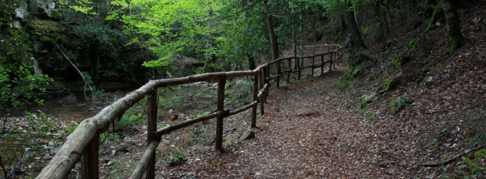
Rio Ermolinos.jpg

Results

CMSB – STAGE 21 - FROM IS ZUDDAS TO MASAINAS

This stage will lead you to barite quarries and several archaeological sites (Domus de janas of Su Cungiau de Tuttui, Nuraghi Moddizzi, Murrecci and Corongius Longus).

Lush vegetation with beautiful juniper trees covers the hills above the urban centre of Masainas.

You will have occasional glimpses of the landscape, where you can admire the sea in the distance.

The uphill slope that must be climbed at the start of the route to come up from the Is Zuddas caves (102 m above sea level) and reach the pass of Monte Moddizzi (374 m above sea level) is quite challenging.

Safety and useful tips

Upon leaving Is Zuddas, follow the SP 70 road for about 500 m to arrive in Su BenatzuPay attention to vehicular traffic and to the crossing in order to reach the correct side of the road.

Afterwards, you can proceed quite easily along the signed dirt roads that characterise the itinerary. However, it must be said that the stage is very long, therefore it is necessary to prepare adequately.

As you arrive in Piscinas, you will walk through the main street of the village, which is in fact the SS 293 road, therefore pay attention to urban traffic.

Also when you reach Giba, you will find the same situation as before, as you have to cross part of the town on the main road which is still the SS 293. Therefore, pay attention to urban traffic and any crossings.

Upon arriving in Masainas, just before reaching the memorial stone, you have to cross the southern outskirts of the village while passing through Via Roma, which is none other than the urban route of the SS 195; therefore make sure to pay attention when crossing and passing along the streets of the village.

Informazioni utili

The stage is considered among the easy ones. The route has a length of 28.1 km, which can be covered in 8 hours and an uphill difference in height of 826 m and downhill of 873 m.

FOR UPDATED INFORMATION, CONSULT THE STAGE SHEET ON THE OFFICIAL WEBSITE

Lenght 28.100 m

Links

CMSB tappa-21-da-zuddas-masainas.gpx

Total elevation gain 747 metri

Geographical area Iglesiente

Elevation gain 826 metri

Negative elevation 873 metri

CMSB – Tappa 21: DA IS ZUDDAS A MASAINAS

Questa tappa è caratterizzata dalle cave di barite e dai  numerosi siti archeologici che si trovano nel territorio come la domus de janas di Su Cungiau de Tuttui e i nuraghi di Moddizzi, Murrecci e Corongius Longus.

Un lussureggiante manto vegetale con bellissimi esemplari di ginepro copre i rilievi che sovrastano il centro urbano di Masainas e a tratti si aprono squarci di paesaggio, dove la vista arriva fino al mare.

Si tratta di una tappa abbastanza impegnativa considerato lo strappo in salita da affrontare all’inizio del percorso per risalire dalle grotte Is Zuddas (102 m/slm) alla sella del Monte Moddizzi (374 m/slm)

Informazioni utili

La tappa è considerata  tra quelle facili. Il percorso ha una lunghezza di 28,1  km, percorribili in 8 ore e un  dislivello  in salita di 826  m e in discesa  di 873 m.
PER LE INFORMAZIONI AGGIORNATE, CONSULTA LA SCHEDA DELLA TAPPA, SUL SITO UFFICIALE 

Il Cammino Minerario di Santa Barbara

Si tratta del primo, tra i cammini sardi, ad essere stato iscritto al registro istituito dalla Regione Sarda nel 2012 con DGR48/9 ("Registro dei cammini di Sardegna, degli itinerari religiosi e dello spirito"). Attualmente è gestito dall'omonima Fondazione.

LA STORIA DEL PROGETTO

L’idea di costruire un itinerario nell’area più estesa e rappresentativa del Parco Geominerario Storico Ambientale della Sardegna, il Sulcis-Iglesiente-Guspinese, riscoprendo gli antichi cammini minerari oggi in gran parte abbandonati, è nata dai volontari dell’Associazione ONLUS Pozzo Sella Per il Parco Geominerario a seguito della grande partecipazione dei cittadini alle escursioni organizzate dalla stessa associazione dopo aver reso fruibili numerosi percorsi minerari.

Con il Cammino Minerario di Santa Barbara si vuole perseguire l’obiettivo di tramandare la memoria degli uomini che nei secoli e nei millenni passati hanno realizzato e percorso gli antichi cammini minerari con il piacere di riscoprire a passo lento la bellezza del territorio.

Un Protocollo d’intesa è stato sottoscritto tra i Comuni di Iglesias, Buggerru, Fluminimaggiore, Arbus, Guspini, Gonnosfanadiga, Villacidro, Domusnovas, Musei, Villamassargia. Narcao, Nuxis, Santadi, Piscinas, Giba, Masainas, San Giovanni Suergiu, Sant’Antioco, Carbonia e Gonnesa, le Diocesi di Iglesias e di Ales Terralba, le Province di Carbonia Iglesias e del Medio Campidano, il Consorzio del Parco Geominerario Storico Ambientale della Sardegna, l’ANCI SARDEGNA e l’Associazione Pozzo Sella: si tratta di un  partenariato per la costruzione e la gestione dell’itinerario storico, culturale, ambientale e religioso denominato “Cammino Minerario di Santa Barbara”.

PER MAGGIORI INFORMAZIONI, DETTAGLI E INFO AGGIORNATE SULLE TAPPE

Si consiglia di consultare il sito ufficiale del cammino: www.camminominerariodisantabarbara.org/

Lenght 28.100 m

Links

CMSB tappa-21-da-zuddas-masainas.gpx

Total elevation gain 747 metri

Geographical area Iglesiente

Elevation gain 826 metri

Negative elevation 873 metri

Sentiero Italia (Stage Z10A) Vecchia Cantoniera di Sant’Anna – Norghio

Overview of the itinerary

Sentiero Italia runs the length of the island’s eastern side, covering its most important mountains, in 28 stages.  Starting from the north: it flanks the Monte Limbara massif, crosses the limestones of Mont’Albo and Tuttavista, skirting the Gulf of Orosei, it crosses the Supramonte, Gennargentu and the Tacchi of Ogliastra and reaches Perdasdefogu.  Further south, it passes through Armungia and the Gerrei sub-region. Lastly, it touches on the villages of Burcei and San Gregorio, continuing on the Sette Fratelli massif to the old prisons of Castiadas.

General information on Sentiero Italia (Grand Italian Trail)

Sentiero Italia, or Grand Italian Trail, as also explained on the official website, is a walking route that crosses the whole of Italy, using mainly but not exclusively “registered trails”.   
In particular, in Sardinia, not all the stages of the Sentiero Italia of CAI (Italian Alpine Club) are made of trails already included in the registry of the Sardinia Trail Network (RES), either because they have not yet been tested and approved or simply because they cannot be registered as they do not meet the requirements.  However, as a whole, the Sentiero Italia is the single longest walking route currently crossing Sardinia from the north (S. Teresa Gallura, stage Z 1) to the south (Castiadas, end of stage Z 28), touching on the most fascinating mountain areas in central-eastern Sardinia: the plateau of Buddusò, Tepilora, the Cedrino river valley, the ancient forests of Montes, Perda Liana and the regional forest of Montarbu, Monte Genis, and lastly the regional forest of Settefratelli (among the many crossed by the various stages of this long hiking itinerary).

Information on this stage of the trail

This is a long and very varied section, which involves crossing the Montalbo ridge, walking for a good stretch on the ridge in typically karst environments with sweeping 360° views, and crossing the entire southern slope, densely wooded, down to the bottom of the valley, which is crossed by provincial road SP 45 and state road SS 131 DCN, near Monte Pizzinnu

After passing these main roads, and still in a densely wooded environment, the route climbs up the northern slope of the Remulis Mountains to an elevation of 500 m asl, then continues north to the Janna pass, from where a stretch of blacktop road leads to the Norghio stop point. 

This stage alternates paths, livestock trails, forest tracks and stretches of blacktop road, making it very varied but, given the differences in elevation, also quite challenging. Given its length, you may choose to split the stage into two or more days, with wild camping overnight at suitable points in the Altudè (N 40.48638° E 9.56507°) and Talachè localities (N 40.48356° E 9.62311°) or booking accommodation with Tonino Taras (mobile: 3496351871) at the Ammentos inn (N 40.54168° E 9.60236°), former Cantoniera Guzzurra on SP 3, which can be reached via a short detour on CAI numbered paths; please note that the inn is closed in winter.

We recommend extreme caution in the event of fog, which is frequent on high ground. Please also be mindful that there are very few water fountains along the route.

Itinerary roadbook

Lenght 33.400 m

SI Z10A.gpx

Total elevation gain 1 947 metri

Geographical area Baronie e Montalbo

Sentiero Italia (Tappa Z10A) Vecchia Cantoniera di Sant’Anna – Norghio

In sintesi

Il Sentiero Italia attraversa in lunghezza il settore orientale dell’isola toccandone i sistemi montuosi più rilevanti, in 28 tappe.  Partendo da nord: tocca il massiccio del Monte Limbara, attraversa i calcari del Mont'Albo e del Tuttavista sfiorando il Golfo di Orosei,  attraversa il Supramonte, il Gennargentu, i Tacchi dell’Ogliastra e giunge a Perdasdefogu.  Più a sud, transita da Armungia e dalla subregione del Gerrei. Infine tocca l’abitato di Burcei e San Gregorio, per continuare nel massiccio dei Sette Fratelli fino alle vecchie carceri di Castiadas.

Informazioni generali sull'itinerario sentiero Italia

Il Sentiero Italia, come spiegato anche nel sito ufficiale, è un itinerario (o Cammino) lungo tutta l'Italia, che utilizza prevalentemente ma non esclusivamente "sentieri accatastati".   
In particolare, in Sardegna, non tutte le tappe del Sentiero Italia del CAI coincidono con sentieri già inseriti nel catasto della Rete Escursionistica della Sardegna (RES), perché non hanno ancora superato le verifiche di percorribilità oppure semplicemente perché non possono essere accatastati non avendone i requisiti.  Tuttavia, nel suo insieme, il Sentiero Italia rappresenta l'unica, la più grande dorsale escursionistica che attraversa attualmente la nostra Isola da nord (S. Teresa Gallura, tappa Z 1) a sud (Castiadas, fine tappa Z 28) toccando le aree montane della Sardegna centro-Orientale più affascinanti: l'altopiano di Buddusò, Tepilora, la valle del Cedrino, i boschi vetusti di Montes, Perda Liana e la foresta demaniale di Montarbu, il Monte Genis, e infine la foresta demaniale di Settefratelli (tra le tante attraversate dal lungo itinerario escursionistico a tappe).

Info sul percorso di questa tappa

Tappa piuttosto lunga e molto articolata che prevede il superamento della dorsale del Montalbo percorrendolo per un buon tratto sulle creste in ambienti tipicamente carsici e con panorami di ampio respiro a 360° e attraversandone tutto il versante meridionale fortemente boscato fino al fondovalle attraversato dalla S.P.45 e dalla S.S 131 DCN in prossimità di Monte Pizzinnu

Superate le arterie di grande comunicazione, sempre in ambienti fortemente boscati, si risale il versante settentrionale dei Monti Remulis fino alla quota di 500 slm, proseguendo in direzione nord fino al valico Janna da cui con un tratto di strada bitumata si raggiunge il posto tappa di Norghio

Si tratta di una tappa che alterna sentieri, tratturi, piste forestali e tratti di strade bitumate che la rendono molto variegata ma  visti i dislivelli  anche decisamente molto impegnativa. Data la lunghezza è possibile, per chi lo ritiene necessario, frazionare la tappa in due o più giorni con la possibilità di bivacchi in autonomia nelle aree idonee in località Altudè (N 40.48638° E 9.56507°) e in località Talachè (N 40.48356° E9.62311°) oppure  contattando preventivamente Tonino Taras (cell. 3496351871) presso la struttura Ammentos (N 40.54168° E 9.60236°), ex Cantoniera Guzzurra sulla SP. 3,   che è raggiungibile con una breve deviazione su sentieri numerati CAI;  si ricorda che la struttura rimane chiusa nel periodo invernale.

In caso di nebbia, frequente in quota, si raccomanda la massima attenzione; inoltre è necessario considerare la scarsità di fonti di approvvigionamento di acqua durante il percorso.

Informazioni utili

Lungo il percorso non sarà sempre presente la copertura telefonica

Itinerary roadbook

Lenght 33.400 m

SI Z10A.gpx

Total elevation gain 1 947 metri

Geographical area Baronie e Montalbo

Sentiero Italia (Stage Z05) Calangianus – Monti

Overview of the itinerary

Sentiero Italia runs the length of the island’s eastern side, covering its most important mountains, in 28 stages.  Starting from the north: it flanks the Monte Limbara massif, crosses the limestones of Mont’Albo and Tuttavista, skirting the Gulf of Orosei, it crosses the Supramonte, Gennargentu and the Tacchi of Ogliastra and reaches Perdasdefogu.  Further south, it passes through Armungia and the Gerrei sub-region. Lastly, it touches on the villages of Burcei and San Gregorio, continuing on the Sette Fratelli massif to the old prisons of Castiadas.

General information on Sentiero Italia (Grand Italian Trail)

Sentiero Italia, or Grand Italian Trail, as also explained on the official website, is a walking route that crosses the whole of Italy, using mainly but not exclusively “registered trails”.   
In particular, in Sardinia, not all the stages of the Sentiero Italia of CAI (Italian Alpine Club) are made of trails already included in the registry of the Sardinia Trail Network (RES), either because they have not yet been tested and approved or simply because they cannot be registered as they do not meet the requirements.  However, as a whole, the Sentiero Italia is the single longest walking route currently crossing Sardinia from the north (S. Teresa Gallura, stage Z 1) to the south (Castiadas, end of stage Z 28), touching on the most fascinating mountain areas in central-eastern Sardinia: the plateau of Buddusò, Tepilora, the Cedrino river valley, the ancient forests of Montes, Perda Liana and the regional forest of Montarbu, Monte Genis, and lastly the regional forest of Settefratelli (among the many crossed by the various stages of this long hiking itinerary).

Information on this stage of the trail

After a stop at the interesting Museo del Sughero (Cork Museum), leave the town of Calangianus to visit the tomb of the giants (megalithic communal tomb) of ‘Pascaredda’. This is a beautiful, well-maintained site that is easily reached as it is well-signposted. 

Retrace your steps for about 500 m and return to the path to see the church of ‘Le Grazie’. The church, built in granite stone, can be visited through the side door, which is open. Inside, it has a beautiful altar. 

After this stop, continue on your way towards Monte Limbara. Before taking the dirt road leading to the top of the mountain at 1025 m asl, you will cross the cycle path built on the former Calangianus-Monti railway line. The crossing point with the cycling path is fully signposted. Worthy of note at li Conchi is the presence of valuable tafoni (rock cavities), which have been used as natural shelters since ancient times.

If you wish to avoid the climb up Monte Limbara, you can follow the cycle path that leads in the direction of the Monti railway station. On Monte Limbara, at the Li Conchi locality, there are two wooden huts, the first privately owned (hunting company), the second owned by the municipality of Calangianus and managed by the Fo.Re.S.T.A.S. Regional Agency. This hut can be used, upon request, as an intermediate stop point, since the trail stage from Calangianus to Monti is 37.80 km long. 

There are also two fountains, one along the route at the Li Conchi locality and the other, the Crispoli fountain, which can be reached by a diversion of just over 1 km. The area is very beautiful and is dotted with caves. 

After a short stretch, still on a dirt road, you must turn left in a south-southeasterly direction, in the direction of Monti, passing alongside Punta Cupuneddi. From this fork towards Vallicciola (a charming locality with some sequoia trees), if you intend to stay for one or two days, you can walk the paths of Monte Limbara for more than 60 km. 

After reaching the locality of Piandiscopa (indicated by an old signpost), continue along a livestock trail and then, after walking on a recently created path, follow a downhill livestock trail for more than 700 m ending near the ‘lu rustu stazzo (farmhouse). After crossing the stazzo or, alternatively, after following the cycling path, pass the provincial road (SP) that turns right to Berchidda and left to Calangianus, continue on a dirt road that after a few kms, just before the former Sa Corona agritourism farm, becomes a tarmac road. After crossing, via underpasses, the railway tracks and the state road (SS), you will reach Monti.

Notes

Fairly long stage, about 38 km. An intermediate overnight camp is planned on Monte Limbara in the Li Conchi locality, where however, the accommodation facility is not currently available.

Lenght 34.800 m

SI Z05.gpx

Total elevation gain 1 130 metri

Geographical area Gallura

Sentiero Italia (Tappa Z05) Calangianus – Monti

In sintesi

Il Sentiero Italia attraversa in lunghezza il settore orientale dell’isola toccandone i sistemi montuosi più rilevanti, in 28 tappe.  Partendo da nord: tocca il massiccio del Monte Limbara, attraversa i calcari del Mont'Albo e del Tuttavista sfiorando il Golfo di Orosei,  attraversa il Supramonte, il Gennargentu, i Tacchi dell’Ogliastra e giunge a Perdasdefogu.  Più a sud, transita da Armungia e dalla subregione del Gerrei. Infine tocca l’abitato di Burcei e San Gregorio, per continuare nel massiccio dei Sette Fratelli fino alle vecchie carceri di Castiadas.

Informazioni generali sull'itinerario sentiero Italia

Il Sentiero Italia, come spiegato anche nel sito ufficiale, è un itinerario (o Cammino) lungo tutta l'Italia, che utilizza prevalentemente ma non esclusivamente "sentieri accatastati".   
In particolare, in Sardegna, non tutte le tappe del Sentiero Italia del CAI coincidono con sentieri già inseriti nel catasto della Rete Escursionistica della Sardegna (RES), perché non hanno ancora superato le verifiche di percorribilità oppure semplicemente perché non possono essere accatastati non avendone i requisiti.  Tuttavia, nel suo insieme, il Sentiero Italia rappresenta l'unica, la più grande dorsale escursionistica che attraversa attualmente la nostra Isola da nord (S. Teresa Gallura, tappa Z 1) a sud (Castiadas, fine tappa Z 28) toccando le aree montane della Sardegna centro-Orientale più affascinanti: l'altopiano di Buddusò, Tepilora, la valle del Cedrino, i boschi vetusti di Montes, Perda Liana e la foresta demaniale di Montarbu, il Monte Genis, e infine la foresta demaniale di Settefratelli (tra le tante attraversate dal lungo itinerario escursionistico a tappe).

Info sul percorso di questa tappa

Si parte, dopo aver fatto una visita all'interessante Museo del Sughero, dal centro abitato di Calangianus per andare a visitare la tomba dei giganti di "Pascaredda". Un sito molto bello e ben tenuto che si raggiunge facilmente grazie ai cartelli che ne indicano la direzione. 

Ritorniamo sui nostri passi per circa 500 m e riprendiamo il percorso che ci porta a vedere la chiesa "Le Grazie". La chiesa, completamente in granito, si può visitare grazie alla porta laterale chè aperta e che ci permette di ammirare un bellissimo altare. 

Continuiamo il nostro "Camino" in direzione del Monte Limbara. Prima di prendere la sterrata che ci porterà in cima a 1025 mt.,  incrociamo la pista ciclabile realizzata nella ex sede ferroviaria della linea Calangianus-Monti. Questo punto di "interscambio" con la pista ciclabile è segnalato in modo esaustivo con apposita segnaletica. Da segnalare in località li Conchi la presenza di pregevoli  tafoni  che fino dai tempi antichi sono stati utilizzati come riparo naturale.

Chi non intende affrontare l’ascesa verso il Monte Limbara può optare per la pista ciclabile che porta in direzione della stazione ferroviaria di Monti. Sul Monte Limbara, in località li Conchi sono presenti due costruzioni in legno, la prima di proprietà privata (compagnia di cacciatori), la seconda di proprietà del comune di Calangianus data in gestione all'Agenzia Regionale Fo.Re.S.T.A.S. che può essere utilizzata, previa richiesta, come sosta intermedia  in quanto la tappa fra Calangianus e Monti è lunga 37,80 km. 

Sono presenti anche due fontane, una lungo il percorso in località Li Conchi e l'altra, fonte Crispoli, che si raggiunge con deviazione di poco più di 1 km. La località è molto bella ed accogliente con la presenza di molte grotte

Dopo un breve tratto, sempre su sterrata, prendiamo sulla sinistra in direzione sud-sud-est, che porta in direzione di Monti costeggiando Punta Cupuneddi. Da questo bivio in direzione di Vallicciola (ridente località dove sono presenti alcuni sequoia), per chi intende sostare uno o due giorni, si possono percorrere i sentieri del Monte Limbara per oltre 60 km. 

Arrivati in località Piandiscopa (indicato da un vecchio cartello) si prosegue su un tratturo e dopo aver percorso un sentiero, di recente realizzazione, si ritrova un tratturo che ci porta in discesa per oltre 700 m. di dislivello per arrivare in prossimità dello stazzo "lu rustu". Attraversato lo stazzo e/o in alternativa percorso la pista ciclabile, si supera la strada provinciale che porta a destra a Berchidda e a sinistra a Calangianus, per continuare su una sterrata che dopo qualche chilometro, poco prima dell’ex agriturismo Sa Corona, diventa asfaltata. Attraversato, con sottopassi, la ferrovia e la S.S. si arriva a Monti.

Note

Tappa abbastanza lunga, circa 38 km.. Prevista la possibilità di bivacco intermedio sul Monte Limbara in località Li Conchi, che tuttavia non è  attualmente fruibile.

Informazioni utili

Lungo il percorso non sarà sempre presente la copertura telefonica

Lenght 34.800 m

SI Z05.gpx

Total elevation gain 1 130 metri

Geographical area Gallura