Start website main content

Accessible trails

1 pathway

Sentieri per tutti...in questa categoria rientrano i sentieri progettati o riadattati perchè il contatto con l'ambiente naturale sia sempre di stimolo al miglioramento della vita personale di chiunque, con attenzione alle condizioni di disabilità motoria, sensoriale o della sfera psichica e relazionale...

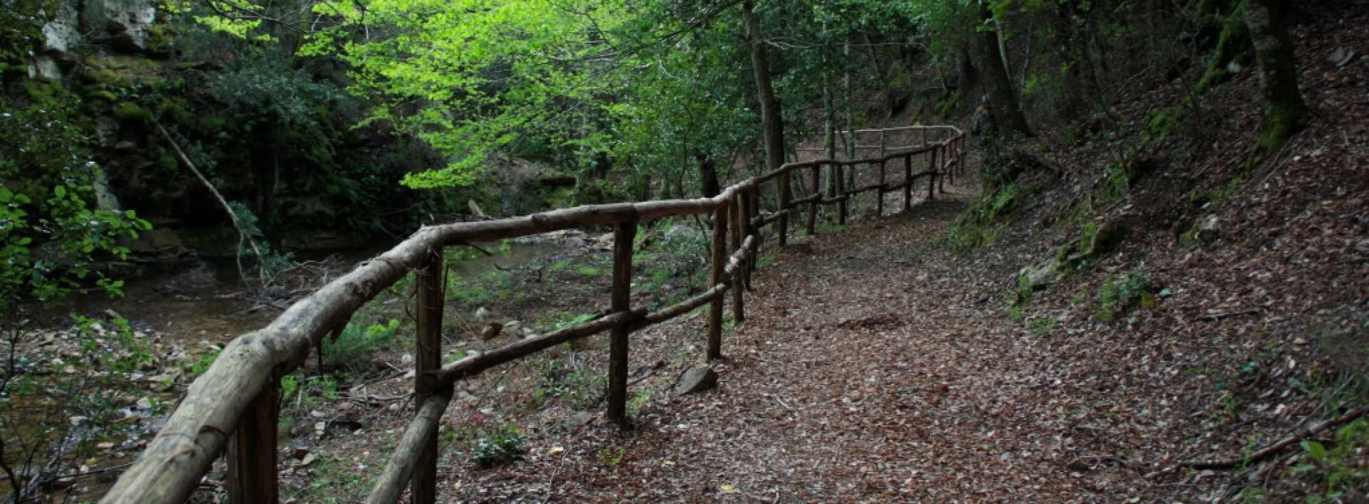
Rio Ermolinos.jpg

Results

Pirasteddu - Lodine

The itinerary is mainly on asphalt and the dominant theme is archaeology, with the domu de janas of Tiandria, the Castrulongu nuraghe and again the domus de janas of Uniai. These are monuments that can be visited freely, the access is on the route itself. They stand on private land with gates without padlocks that you must take care to close. You also pass the entrance to the nuragic village of Soroeni, but this is closed and would be difficult to understand anyway, because there has not been a com-plete excavation campaign yet. At km 13, we arrive at the entrance to the only cart track of the itin-erary: bordered by two dry stone walls, it is fairly smooth with a few rocky banks from time to time. Further on, the road widens into a dirt track and then crosses the asphalt and ends with the return to the village.

Informazioni utili

The LEADER Territory of the Local Action Group (GAL) Rural District Barbagia Mandrolisai Gennargentu (BMG)

Consisting of the Union of Municipalities of Barbagia and the Mountain Community of Gennargentu Mandrolisai. The GAL BMG, therefore, includes 19 municipalities, with a total area of 854.30 sq km and a resident population of approximately 22,000 inhabitants: Aritzo, Atzara, Austis, Belvì, Desulo, Gadoni, Gavoi, Lodine, Meana Sardo, Ollolai, Oniferi, Olzai, Ortueri, Ovodda, Sarule, Sorgono, Teti, Tiana, Tonara.

The GAL Rural District BMG, established in 2009, is a participation foundation composed of 22 public members and over 200 private members, representing the main institutional, economic, and social components of the territory. The foundation aims to improve the quality of life and well-being of communities in the historical regions of Barbagia, Mandrolisai, and Gennargentu by enhancing local resources. The main thematic and intervention areas identified by the GAL BMG for the definition of its Local Development Strategy 2014-2022 are the development and innovation of local production chains and systems, social inclusion, and sustainable tourism.

THE OAST PROJECT: OUTDOOR ACTIVITIES FOR SUSTAINABLE TOURISM

The project, coordinated by the GAL BMG in partnership with the GAL Sisteron-Buëch (France) and the GAL Kilkenny (Ireland), aims to promote sustainable and active tourism in rural areas of Europe. The specific objective of the project was to enhance and develop the tourist attractiveness of the inland waters of Barbagia, through outdoor sports and water activities, in line with the thematic area "sustainable tourism" chosen in the GAL BMG's PDA. The three territories involved boast a rich and varied natural, landscape, and cultural heritage with strong identity traits and enormous potential for the development of active tourism. However, some problems common to all partners have been highlighted, such as: insufficient enhancement and tourist promotion of inland areas, isolation, the absence of an international network useful for the exchange of good practices, and insufficient diversification, delocalization, deseasonalization, and internationalization of tourist flows. The OAST Project was created to respond to these critical issues, as active tourism and sustainable tourism represent the basis for the revival of territories characterized by enormous problems of depopulation, lack of services, unemployment, and school dropout. The idea, therefore, is to promote forms of sustainable, active, responsible, and experiential tourism, as well as to offer diversified and deseasonalized solutions suitable for a constantly growing number of active tourists. The specific action involved the georeferencing and description, in Italian and English, of 19 GAL BMG itineraries related to the theme of water. The itinerary tracks are available and downloadable, in Gpx format, on these pages and also on the GAL BMG's Wikiloc account.

Lenght 15.500 m

Lodine - Cucchinadorza.gpx

Total elevation gain 398 metri

Geographical area Barbagia Nuorese

Contiene carte
Spento

Pirasteddu - Lodine

AVVERTENZE

QUESTO ITINERARIO è riportato "tal quale" a titolo informativo e di mera recensione/ricognizione degli itinerari presenti nel territorio  -  come fornito e recensito dal progetto OAST condotto dal GAL BMG nel 2024. 
NOTA: Molti itinerari sono composti da percorsi stretti e richiedono una cura periodica della vegetazione, al momento non assicurata da una gestione  di tipo  ufficiale, non essendo il tracciato inserito nella"rete escursionistica della Sardegna".  
Nota 2: Prima di recarvi sul posto si consiglia di raccogliere informazioni sullo stato di fruibilità, presso il comune competente, per avere certezza dell'effettiva percorribilità dell'itinerario scelto.

IL PERCORSO IN PILLOLE (elementi informativi essenziali)

Il punto di partenza si trova nella strada principale di Lodine, chiamata Largo Dante, al bivio con via Quattro novembre, ll’altezza del civico 50 (bar Il nuraghe). È anche la Strada Provinciale 30, che si percorre in discesa all’inizio ell’itinerario.

Descrizione

L’itinerario si sviluppa prevalentemente su asfalto, a causa del particolare assetto fondiario dei paesi dell’area, costituito a vasti pascoli recintati e da strade rurali asfaltate. Tema dominante è l’archeologia, con la domu de janas di Tiandria, il nuraghe Castrulongu e nuovamente le domus de janas di Uniai. Si tratta di monumenti liberamente visitabili, il cui accesso è sul percorso stesso. Insistono su terreni privati con dei cancelletti senza lucchetto che dovete avere cura di richiudere. La domu de janas di Tiandria si trova sotto la sede stradale, quindi dopo avere parcheggiato nella piazzola bisogna scendere nella scaletta a destra che conduce al piano sottostante. Purtroppo la parte posteriore è andata  istrutta ma vale comunque una sosta, vista l’estrema facilità d’accesso. Il nuraghe Castrulongu è costruito in modo integrato su una rocca di granito e, sebbene sia parzialmente crollato, si conserva bene la suggestiva facciata ell’ingresso. Le domus de janas di Uniai risultano in territorio di Gavoi, come il nuraghe Castrulongu, se ne trova una molto vicina all’ingresso del terreno e un’altra più lontana, ma per raggiungerla basterà seguire i cartelli e/o la traccia gps. L'itinerario passa anche nei pressi del villaggio nuragico di Soroeni e del Santuario di Sa Itria, dove è presente anche un'area pic-nic. Al km 13 si arriva all’accesso dell’unica mulattiera dell’itinerario. Delimitata tra due muretti a secco, è abbastastanza scorrevole con qualche banco roccioso di tanto in tanto. Nel tratto centrale si fa più stretta e dai muretti a secco numerosi ciuffi di rovi si protendono verso il centro della mulattiera. Più avanti la strada si allarga in sterrato per poi incrociare l’asfalto e concludere col rientro in paese.

Camminabilità e ciclabilità su strada

Il tratto su mulattiera è lungo soltanto 2 km e, per questa ragione, l’itinerario non si presta al trekking, perché 14 km di asfalto sono troppi anche per i camminatori più versatili. Chi avesse la bici da strada può considerare che all’ingresso della mulattiera si può continuare sull’asfalto, al bivio successivo girare a sinistra, sempre su asfalto, e arrivare in questo modo in paese con un itinerario di circa 20 km complessivi interamente su asfalto.

Informazioni utili

Il territorio LEADER del Gruppo di Azione Locale (GAL) Distretto Rurale Barbagia Mandrolisai Gennargentu (BMG) 

Costituito dall'Unione dei Comuni Barbagia e dalla Comunità Montana Gennargentu Mandrolisai. Il GAL BMG comprende, quindi, 19 comuni, per una superficie complessiva di 854,30 kmq e una popolazione residente pari a circa 22.000 abitanti: 

Aritzo, Atzara, Austis, Belvì, Desulo, Gadoni, Gavoi, Lodine, Meana Sardo, Ollolai, Oniferi, Olzai, Ortueri, Ovodda, Sarule, Sorgono, Teti, Tiana, Tonara.


Il GAL Distretto Rurale BMG, costituito nel 2009, è una Fondazione di partecipazione composta da 22 soci pubblici e oltre 200 privati, rappresentativi delle principali componenti istituzionali, economiche e sociali del territorio. La fondazione ha lo scopo di migliorare la qualità della vita e il benessere delle comunità nelle regioni storiche Barbagia, Mandrolisai e Gennargentu mediante la valorizzazione delle risorse locali.
I principali ambiti tematici e di intervento individuati dal GAL BMG per la definizione della propria Strategia di Sviluppo Locale 2014-2022 sono lo sviluppo e l’innovazione delle filiere e dei sistemi produttivi locali, l’inclusione sociale ed il turismo sostenibile.


IL PROGETTO OAST: OUTDOOR ACTIVITIES FOR SUSTAINABLE TOURISM

Il progetto, coordinato dal GAL BMG in partenariato con il GAL Sisteron-Buëch (Francese) e
il GAL Kilkenny (Irelanda), intende promuovere un turismo sostenibile e attivo nelle aree
rurali d’Europa.
L’obiettivo specifico del progetto è stato potenziare e sviluppare l’attrattività turistica delle acque
interne della Barbagia, attraverso gli sport all’aria aperta e le attività acquatiche, in coerenza con l’ambito tematico “turismo sostenibile” prescelto nel PDA del GAL BMG.
I tre territori coinvolti vantano un patrimonio naturalistico, paesaggistico e culturale ricco e variegato con forti caratteri identitari ed enormi potenzialità di sviluppo di turismo attivo
Tuttavia, sono stati evidenziati alcuni problemi comuni a tutti i partner, quali: l’insufficiente valorizzazione e promozione turistica delle aree interne, l’isolamento, l’assenza di un network internazionale utile per lo scambio di buone prassi, e l’insufficiente diversificazione, delocalizzazione, destagionalizzazione e l’internazionalizzazione dei flussi turistici. Il Progetto OAST nasce per rispondere a queste criticità, in quanto il turismo attivo ed il turismo sostenibile rappresentano la base di rilancio dei territori caratterizzati da enormi problemi di spopolamento, carenza di servizi, disoccupazione e dispersione scolastica.
L’idea, quindi è promuovere forme di turismo sostenibile, attivo, responsabile ed esperienziale, nonché
offrire soluzioni diversificate e destagionalizzate adatte ad un numero di turisti attivi in continua crescita.
L’azione specifica ha previsto la georeferenziazione e descrizione, in lingua italiana e inglese, di
19 itinerari del GAL BMG legati al tema dell’acqua. Le tracce degli itinerari sono disponibili e scaricabili, in formato Gpx, in queste pagine e anche nell’account Wikiloc del GAL BMG

Lenght 15.500 m

Lodine - Cucchinadorza.gpx

Total elevation gain 398 metri

Geographical area Barbagia Nuorese

Contiene carte
Spento

Genna 'e Crecu - Sorgono

An itinerary of great naturalistic value that allows you to appreciate both the dense native woods, dominated by holm oaks and downy oaks, and the pine afforestation of the high-altitude part, in which they are perfectly integrated. The route is rather smooth and does not present any particular tech-nical difficulties. Among the attractions of the route, at an altitude of 920 m, is the country church of Sa Ìtria, one of the highest in the whole of Sardinia, and a small house with a fireplace available for hikers, in a splendid panoramic position, for which the rules always apply: keep clean, close well be-fore leaving and leave a good supply of wood, both fine and coarse, inside. In the last few kilometres there is also a railway tollgate, which provides an insight into the life and work of a tollman on moun-tain railway lines dating back to the end of the 19th century.

Informazioni utili

The LEADER Territory of the Local Action Group (GAL) Rural District Barbagia Mandrolisai Gennargentu (BMG)

Consisting of the Union of Municipalities of Barbagia and the Mountain Community of Gennargentu Mandrolisai. The GAL BMG, therefore, includes 19 municipalities, with a total area of 854.30 sq km and a resident population of approximately 22,000 inhabitants: Aritzo, Atzara, Austis, Belvì, Desulo, Gadoni, Gavoi, Lodine, Meana Sardo, Ollolai, Oniferi, Olzai, Ortueri, Ovodda, Sarule, Sorgono, Teti, Tiana, Tonara.

The GAL Rural District BMG, established in 2009, is a participation foundation composed of 22 public members and over 200 private members, representing the main institutional, economic, and social components of the territory. The foundation aims to improve the quality of life and well-being of communities in the historical regions of Barbagia, Mandrolisai, and Gennargentu by enhancing local resources. The main thematic and intervention areas identified by the GAL BMG for the definition of its Local Development Strategy 2014-2022 are the development and innovation of local production chains and systems, social inclusion, and sustainable tourism.

THE OAST PROJECT: OUTDOOR ACTIVITIES FOR SUSTAINABLE TOURISM

The project, coordinated by the GAL BMG in partnership with the GAL Sisteron-Buëch (France) and the GAL Kilkenny (Ireland), aims to promote sustainable and active tourism in rural areas of Europe. The specific objective of the project was to enhance and develop the tourist attractiveness of the inland waters of Barbagia, through outdoor sports and water activities, in line with the thematic area "sustainable tourism" chosen in the GAL BMG's PDA. The three territories involved boast a rich and varied natural, landscape, and cultural heritage with strong identity traits and enormous potential for the development of active tourism. However, some problems common to all partners have been highlighted, such as: insufficient enhancement and tourist promotion of inland areas, isolation, the absence of an international network useful for the exchange of good practices, and insufficient diversification, delocalization, deseasonalization, and internationalization of tourist flows. The OAST Project was created to respond to these critical issues, as active tourism and sustainable tourism represent the basis for the revival of territories characterized by enormous problems of depopulation, lack of services, unemployment, and school dropout. The idea, therefore, is to promote forms of sustainable, active, responsible, and experiential tourism, as well as to offer diversified and deseasonalized solutions suitable for a constantly growing number of active tourists. The specific action involved the georeferencing and description, in Italian and English, of 19 GAL BMG itineraries related to the theme of water. The itinerary tracks are available and downloadable, in Gpx format, on these pages and also on the GAL BMG's Wikiloc account.

Lenght 16.100 m

Sorgono - Genna 'e Crecu.gpx

Total elevation gain 630 metri

Geographical area Barbagia Nuorese

Contiene carte
Spento