Start website main content

Accessible trails

1 pathway

Sentieri per tutti...in questa categoria rientrano i sentieri progettati o riadattati perchè il contatto con l'ambiente naturale sia sempre di stimolo al miglioramento della vita personale di chiunque, con attenzione alle condizioni di disabilità motoria, sensoriale o della sfera psichica e relazionale...

Rio Ermolinos.jpg

Results

Lodine, Puddis. A panoramic balcony overlooking the lake

Access 

Although the municipal park of Puddis is owned by the Municipality of Lodine, it belongs territorially to the Municipality of Gavoi, but the strong bond of the Lodinese community with this mountain is also due to its proximity, to the small mountain centre of Gavoi. You therefore set off on foot from the SP30, which is also the main road, spotting the signs for the Puddis Municipal Park that lead to the slightly downhill Via IV Novembre. 

The Natural Spring 

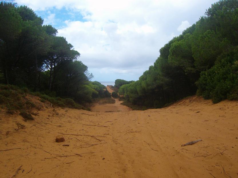
After a short stretch, turn right, quickly reaching the natural spring of S’Antana 'e Bidda, located slightly below street level and always a fresh, pleasant ambience. With the spring situated behind your shoulder, begin to climb gradually onto a rolling road, flanked by dry stone walls, surrounded by mature and sparse downy oaks, in the distinctive environment of the Barbagia di Ollolai. The road goes on straight and after the first stretch it flattens out, remaining cemented up to a large clearing, where the paved section ends. Slightly to the left, in respect to the direction of arriving, there is located a gate that must be closed, whilst a wooden sign indicates that you have arrived at the park of Puddis

Puddis 

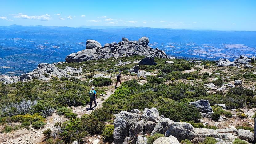
One then enters the large tancato, aiming for a dirt road on the left. It would also be possible to visit the chestnut grove, located at a lower altitude, which is currently being coppiced by the local government. Having taken the dirt road, you start climbing slightly, flanked by a wood of rather young downy oaks, interspersed with dense heather. The profile of a large antenna that acts as a television repeater stands out over the area. The road continues in a south westerly direction and then bends sharply to the right in the direction of the antenna. On the left here is a narrow path that descends slightly, which heads towards a large clearing overlooked and dominated by some beautifully shaped granite rocks, decorated with beautiful tafonate. 

Lake view 

One cautiously climbs up the rocks, to discover a panorama of extraordinary vastness. At the foot of the peak, the valley of Gusana opens up, with its mountain lake surrounded by woods taking centre stage. Gennargentu and Supramonte, in the background, crown with their mountainous silhouettes a maze of wooded valleys, undulating ridges, broken by granite peaks, distant mountain villages or deep gorges. Near the cliff, the houses of Gavoi and the peaks of San Basilio conclude this extraordinary view of this corner of Sardinia. Once the visit is complete, you return to the village by the road you followed on the outward journey.

Lenght 2.800 m

lodine.gpx

Total elevation gain 116 metri

Lodine, Puddis. Un balcone panoramico sul lago

Accesso

Seppure il parco comunale di Puddis sia di proprietà del Comune di Lodine, esso appartiene territorialmente al Comune di Gavoi, ma il forte legame della comunità lodinese con questa montagna è dovuto anche alla sua vicinanza col piccolo centro montano. 

Si parte a piedi dunque dalla SP30 che costituisce anche la via principale, individuando le indicazioni per il Parco Comunale Puddis che portano ad imboccare la Via IV Novembre, in leggera discesa. 

La sorgente 

Dopo un breve tratto si svolta a destra, raggiungendo rapidamente la sorgente di s’Antana ‘e Bidda, posta leggermente sotto il piano stradale e sempre ottima e fresca. Lasciata la sorgiva alle spalle si prende a salire gradualmente per una rotabile fiancheggiata da muretti a secco, circondati da roverelle mature e rade, nel tipico ambiente della Barbagia di Ollolai. La strada procede rettilinea e dopo un primo tratto si spiana, rimanendo sempre cementata fino ad un grosso spiazzo dove termina il tratto pavimentato. Leggermente a sinistra rispetto alla direzione di arrivo si trova un cancello che è necessario richiudere, mentre un cartello in legno segnala che si è arrivati ormai al parco di Puddis.

Puddis

Si entra quindi nel grosso tancato, mirando ad una strada sterrata sulla sinistra. Sarebbe possibile, inoltre, visitare il castagneto che si trova ad una quota inferiore, oggetto attualmente di un governo a ceduo. Imboccata la strada si sale leggermente di quota, fiancheggiati da un bosco di roverelle piuttosto giovane, inframezzate da un fitto ericeto. Sulla zona si staglia il profilo di una grossa antenna che fa da ripetitore televisivo. 

La strada prosegue in direzione sudovest e poi piega bruscamente a destra in direzione delle antenne. Sulla sinistra si individua qui un esile sentierino che scende leggermente, mirando ad una vasta radura sovrastata da alcune rocce granitiche dalle belle forme tafonate. 

Vista lago 

Si risale cautamente sulle rocce, scoprendo un panorama di straordinaria vastità. 

Ai piedi del picco si apre la valle di Gusana, col suo lago montano circondato dai boschi ad occupare il ruolo di protagonista. Il Gennargentu e il Supramonte, sullo sfondo, coronano con le loro sagome montuose un dedalo di valloni boscosi, creste ondulate o rotte da picchi granitici, lontani paesi o forre profonde. Nei pressi del rocciaio, le case di Gavoi e le cime di San Basilio concludono questa straordinaria veduta su quest’angolo di Sardegna. 

Una volta ultimata la visita, si ritorna al paese per la strada seguita all’andata.

Lenght 2.800 m

lodine.gpx

Total elevation gain 116 metri