Accessible trails
Sentieri per tutti...in questa categoria rientrano i sentieri progettati o riadattati perchè il contatto con l'ambiente naturale sia sempre di stimolo al miglioramento della vita personale di chiunque, con attenzione alle condizioni di disabilità motoria, sensoriale o della sfera psichica e relazionale...
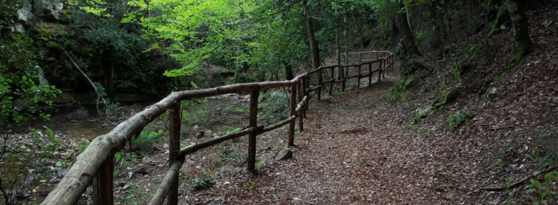
Image credits Sardegna Digital Library Regione Sardegna
Results
Pathways Ballao - Sentiero Italia (C 211)
Austis, Sa Crabarissa. The rock of legend
Access
From the village, follow the signs for Sa Crabarissa, following Via Gramsci, which soon turns into a country lane. you leave the beautiful sanctuary of S. Antonio on the right, still on an asphalted road, descending slightly to an obvious fork where you turn left, still following the signs.
Bortamelone
The area is overlooked by the gentle prominence of Monte Bortamelone, recognisable by its impressive reforestation. The road runs between pastures and scrubland. On the left is the rock of Nodu Pertuntu, not signposted, with its characteristic perforated summit. You continue along the main road, surrounded by arbutus trees, until the asphalt ends and the road proceeds, unpaved, always in excellent condition and slightly downhill, and now very scenic.
Sa Crabarissa
You reach a wide dirt clearing, keeping Bortamelone behind you, and after parking, take a right onto an clear path that heads toward the soaring, elegant silhouette of Sa Crabarissa. This extraordinary natural monument owes its name to a legend: a woman from Cabras (a crabarissa) who fell in love with a shepherd from Austis who was in her village for transhumance. The two swore eternal love to each other, but when she went to visit him, she discovered that he was already married and had a family. The girl went back, but the terrible pain turned her into stone: her form still resembles that of a girl from Cabras in typical costume. The rock is set in an extraordinary environmental context and can be reached along the beautiful path, keeping to the left.
Ring in the bush
Continue along the path, with a little slope, spotting a fork on the right that, once taken, leads uphill to a small artificial lake. Here, turn right onto a dirt track, still keeping to the right and returning to the car in a short time.
- Log in to post comments
Photogallery
Austis, Sa Crabarissa La roccia della leggenda
Accesso
Dall’abitato si seguono le indicazioni per Sa Crabarissa, percorrendo la via Gramsci che si tramuta ben presto in un viottolo di campagna. Si lascia a destra il bel santuario di S. Antonio, sempre su strada asfaltata, scendendo leggermente fino ad un bivio evidente dove si prende a sinistra, sempre seguendo le indicazioni.
Bortamelone
La zona è dominata dal morbido rilievo del Monte Bortamelone, riconoscibile dagli imponenti rimboschimenti. La strada corre tra pascoli e zone a macchia. Sulla sinistra si cela la roccia di Nodu Pertuntu, non segnalata, dalla caratteristica sommità forata.
Si prosegue sempre sulla strada principale, circondati dai corbezzoli, finché l’asfalto termina e la strada procede, sterrata, sempre in ottime condizioni e in leggera discesa, ora molto panoramica.
Sa Crabarissa
Si raggiunge un vasto spiazzo sterrato, tenendo alle spalle Bortamelone e dopo aver parcheggiato si prende a destra per un sentiero evidente che si dirige verso la sagoma slanciata ed elegante di Sa Crabarissa.
Questo straordinario monumento naturale deve il suo nome ad una leggenda: una donna di Cabras (una crabarissa) si innamorò di un pastore di Austis che si trovava nel paese di lei per la transumanza. I due si giurarono eterno amore ma, quando lei andò a trovarlo, scoprì che lui era già sposato ed aveva una famiglia. La ragazza tornò indietro, ma il terribile dolore la tramutò in pietra: ancora le sue forme ricordano quelle di una ragazza di Cabras col tipico costume.
La roccia è posta in un contesto ambientale straordinario e si raggiunge per il bel sentiero, tenendola sulla sinistra.
Anello nella macchia
Si prosegue sul sentiero, con poche pendenze, individuando un bivio sulla destra che, una volta imboccato, porta in salita ad un piccolo laghetto artificiale. Qui si prende a destra, su sterrata, tenendo ancora la destra e ritornando in breve all’auto.
- Log in to post comments
Photogallery
Pathways Genna Salbene - Teletotes (B 183)
CMSB – STAGE 16 - FROM DOMUSNOVAS-MUSEI TO ORBAI
While crossing the Cixerri valley, you walk through the agro-pastoral farms of this fertile plain to reach the S'Ortu Mannu natural park, where you can admire some majestic centuries-old olive trees.
The climb up the hills takes you to the Monte Cadelano forest complex, which houses the mining village of Orbai and the abandoned plants of the old mining activity.
Safety and useful tips
After you go past Musei and arrive at the Station of Villamassargia, you need to cross the SP87 road after the overpass to the SS 130. Pay attention to vehicular traffic.
As you arrive in Villamassargia, you have to walk through the residential area, therefore make sure to pay attention to urban traffic.
The route then proceeds to Orbai without any particular difficulties.
If it is not possible to spend the night in Orbai (the Posada is still being set up), you can proceed towards Rosas (arrival of the next stage) by taking the alternative route, which considerably shortens the route of Stage 17.
If you are willing to take this alternative route, it should be remembered that, if you start from Musei, it becomes challenging in any case, given the length to be covered in order to arrive directly in Rosas (24.4 Km), therefore it is advisable to prepare adequately or decide to stay overnight and start from Villamassargia.
HOSPITALITY INFORMATION
The mining village of Orbai has been restored and the old miners' houses will soon be used to host hikers-pilgrims.
For updates on the availability of the structure, contact the Santa Barbara Mining Path Foundation (0781 24132).
While waiting for this service to be activated, two possibilities are suggested:
- continue on the same day for the next stage, which can be reached in about 5 hours, finding hospitality in the mining village of Rosas;
- interrupt the stage in S'Ortu Mannu dedicating the afternoon to a stop in the homonymous Natural Park.
The stage presents a medium difficulty due to its mainly uphill development. The route has a length of 16.8 km which can be covered in 5 hours and 30 minutes and an uphill difference in height of 530 m and a downhill difference of 323 m.
FOR UPDATED INFORMATION, CONSULT THE STAGE SHEET ON THE OFFICIAL WEBSITE
- Log in to post comments

