Start website main content

Accessible trails

1 pathway

Sentieri per tutti...in questa categoria rientrano i sentieri progettati o riadattati perchè il contatto con l'ambiente naturale sia sempre di stimolo al miglioramento della vita personale di chiunque, con attenzione alle condizioni di disabilità motoria, sensoriale o della sfera psichica e relazionale...

Rio Ermolinos.jpg

Results

CMSB - STAGE 06 – FROM PISCINAS TO MONTEVECCHIO

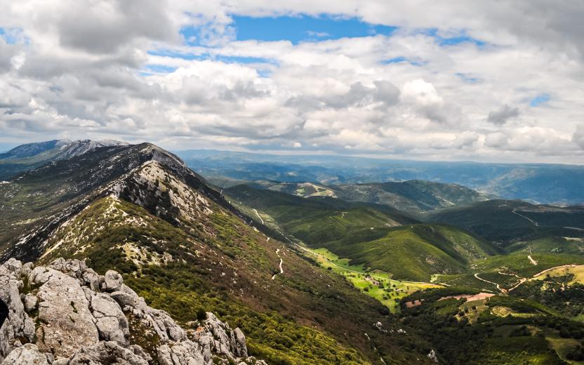
The stage is mostly uphill with an initial climb to reach the village of Ingurtosu.

You will discover some amazing examples of industrial archaeology in the disused mines of Ingurtosu and Montevecchio.

From the dune complex of Piscinas, you move on to the holm oak woods and to the Mediterranean scrub, where it is common to observe the Sardinian deer that populates this area.

Safety and useful tips

The stage does not present any particular difficulties, even though the route follows the SP04, which is an accessible dirt road.

In the first section, you have to cross twice the Rio Irvi, which flows alongside the road. If this watercourse is in flood and fording is not easy, it is advisable to take the main road, which in any case proceeds in the same direction as the route.

It is only when you reach the Church of Santa Barbara of Ingurtosu that you can take the SP04.18, an asphalted road where, despite the presence of few vehicles, you must pay attention when passing through, especially because of the turns that you find along the way. You will then reach the Management building after which you proceed following the SP 66, which is again a dirt road.

All along the way, you will come across several buildings dating back to the old mining activity, many of which are closed and secured; some others are not, but they are all in a state of disrepair and precarious stability. In order to avoid any problems or accidents, do not cross the fences and/or venture inside the ruined buildings of the old mining plants, but always admire them from a distance without leaving the Trail.

Informazioni utili

The stage presents a medium difficulty due to its mainly uphill development. The route has a length of 18.8 km, which can be covered in 6 hours and 30 minutes and has an altitude difference of 890 m uphill and downhill of 532 m.

FOR UPDATED INFORMATION, CONSULT THE STAGE SHEET ON THE OFFICIAL WEBSITE

Lenght 18.900 m

Links

tappa-06-da-piscinas-montevecchio.gpx

Total elevation gain 927 metri

Geographical area Iglesiente

Elevation gain 890 metri

Negative elevation 532 metri

CMSB - TAPPA 6: DA PISCINAS A MONTEVECCHIO

La tappa si sviluppa in prevalenza in salita con uno strappo iniziale per raggiungere il villaggio di Ingurtosu.

Durante il percorso si passa dal sistema dunale di Piscinas ai boschi di leccio e alla macchia mediterranea  nei quali è frequente l’incontro con esemplari del cervo sardo, animale molto presente in questo territorio.

La tappa si articola all'interno dell'incredibile patrimonio rappresentato dai monumenti di archeologia industriale presenti nelle miniere dismesse di Ingurtosu e Montevecchio.


Informazioni utili

La tappa presenta una difficoltà media a causa del suo sviluppo in prevalenza in salita. Il percorso ha una lunghezza di 18,8 km, percorribili in 6 ore e 30 minuti e un  dislivello  in salita di 890 m e in discesa  di 532 m.
PER LE INFORMAZIONI AGGIORNATE, CONSULTA LA SCHEDA DELLA TAPPA, SUL SITO UFFICIALE 

Il Cammino Minerario di Santa Barbara

Si tratta del primo, tra i cammini sardi, ad essere stato iscritto al registro istituito dalla Regione Sarda nel 2012 con DGR48/9 ("Registro dei cammini di Sardegna, degli itinerari religiosi e dello spirito"). Attualmente è gestito dall'omonima Fondazione.

LA STORIA DEL PROGETTO

L’idea di costruire un itinerario nell’area più estesa e rappresentativa del Parco Geominerario Storico Ambientale della Sardegna, il Sulcis-Iglesiente-Guspinese, riscoprendo gli antichi cammini minerari oggi in gran parte abbandonati, è nata dai volontari dell’Associazione ONLUS Pozzo Sella Per il Parco Geominerario a seguito della grande partecipazione dei cittadini alle escursioni organizzate dalla stessa associazione dopo aver reso fruibili numerosi percorsi minerari.

Con il Cammino Minerario di Santa Barbara si vuole perseguire l’obiettivo di tramandare la memoria degli uomini che nei secoli e nei millenni passati hanno realizzato e percorso gli antichi cammini minerari con il piacere di riscoprire a passo lento la bellezza del territorio.

Un Protocollo d’intesa è stato sottoscritto tra i Comuni di Iglesias, Buggerru, Fluminimaggiore, Arbus, Guspini, Gonnosfanadiga, Villacidro, Domusnovas, Musei, Villamassargia. Narcao, Nuxis, Santadi, Piscinas, Giba, Masainas, San Giovanni Suergiu, Sant’Antioco, Carbonia e Gonnesa, le Diocesi di Iglesias e di Ales Terralba, le Province di Carbonia Iglesias e del Medio Campidano, il Consorzio del Parco Geominerario Storico Ambientale della Sardegna, l’ANCI SARDEGNA e l’Associazione Pozzo Sella: si tratta di un  partenariato per la costruzione e la gestione dell’itinerario storico, culturale, ambientale e religioso denominato “Cammino Minerario di Santa Barbara”.

PER MAGGIORI INFORMAZIONI, DETTAGLI E INFO AGGIORNATE SULLE TAPPE

Si consiglia di consultare il sito ufficiale del cammino: www.camminominerariodisantabarbara.org/

Lenght 18.900 m

Links

tappa-06-da-piscinas-montevecchio.gpx

Total elevation gain 927 metri

Roadbook

Dal sistema dunale di Piscinas si passa ai boschi di leccio e alla macchia mediterranea, dove è frequente l’incontro con il cervo sardo che popola numeroso  questo territorio.

Geographical area Iglesiente

Elevation gain 890 metri

Negative elevation 532 metri

Sentiero Italia (Tappa Z11) Galtellì - Orosei

Overview of the itinerary

Sentiero Italia runs the length of the island’s eastern side, covering its most important mountains, in 28 stages.  Starting from the north: it flanks the Monte Limbara massif, crosses the limestones of Mont’Albo and Tuttavista, skirting the Gulf of Orosei, it crosses the Supramonte, Gennargentu and the Tacchi of Ogliastra and reaches Perdasdefogu.  Further south, it passes through Armungia and the Gerrei sub-region. Lastly, it touches on the villages of Burcei and San Gregorio, continuing on the Sette Fratelli massif to the old prisons of Castiadas.

General information on Sentiero Italia (Grand Italian Trail)

Sentiero Italia, or Grand Italian Trail, as also explained on the official website, is a walking route that crosses the whole of Italy, using mainly but not exclusively “registered trails”.   
In particular, in Sardinia, not all the stages of the Sentiero Italia of CAI (Italian Alpine Club) are made of trails already included in the registry of the Sardinia Trail Network (RES), either because they have not yet been tested and approved or simply because they cannot be registered as they do not meet the requirements.  However, as a whole, the Sentiero Italia is the single longest walking route currently crossing Sardinia from the north (S. Teresa Gallura, stage Z 1) to the south (Castiadas, end of stage Z 28), touching on the most fascinating mountain areas in central-eastern Sardinia: the plateau of Buddusò, Tepilora, the Cedrino river valley, the ancient forests of Montes, Perda Liana and the regional forest of Montarbu, Monte Genis, and lastly the regional forest of Settefratelli (among the many crossed by the various stages of this long hiking itinerary).

Information on this stage of the trail

This is a medium-length but fairly challenging stage that connects the two towns on the plains by crossing Monte Tuttavista, which, after an initially gentle climb, reaches a height of 764 m near the Bronze Cross with stunning views over the plains below.

After about two km on an easy dirt road, you will arrive at the fire lookout, another impressive viewpoint over the coastline of Orosei. Next, head down towards Orosei, first along a relatively easy gully through the woods and then a rocky section known as Sa Fraicata with a steep slope. 

Finally, you will reach the bottom of the valley on an easy dirt road that, passing by some disused lime kilns, will lead you to the bypass leading to Orosei and the Rimedio sanctuary at the entrance to the town. 

Please note there are no water sources along the route.

Itinerary roadbook

Lenght 13.100 m

SI Z11.gpx

Total elevation gain 969 metri

Geographical area Baronie e Montalbo

Sentiero Italia (Tappa Z11) Galtellì - Orosei

In sintesi

Il Sentiero Italia attraversa in lunghezza il settore orientale dell’isola toccandone i sistemi montuosi più rilevanti, in 28 tappe.  Partendo da nord: tocca il massiccio del Monte Limbara, attraversa i calcari del Mont'Albo e del Tuttavista sfiorando il Golfo di Orosei,  attraversa il Supramonte, il Gennargentu, i Tacchi dell’Ogliastra e giunge a Perdasdefogu.  Più a sud, transita da Armungia e dalla subregione del Gerrei. Infine tocca l’abitato di Burcei e San Gregorio, per continuare nel massiccio dei Sette Fratelli fino alle vecchie carceri di Castiadas.

Informazioni generali sull'itinerario sentiero Italia

Il Sentiero Italia, come spiegato anche nel sito ufficiale, è un itinerario (o Cammino) lungo tutta l'Italia, che utilizza prevalentemente ma non esclusivamente "sentieri accatastati".   
In particolare, in Sardegna, non tutte le tappe del Sentiero Italia del CAI coincidono con sentieri già inseriti nel catasto della Rete Escursionistica della Sardegna (RES), perché non hanno ancora superato le verifiche di percorribilità oppure semplicemente perché non possono essere accatastati non avendone i requisiti.  Tuttavia, nel suo insieme, il Sentiero Italia rappresenta l'unica, la più grande dorsale escursionistica che attraversa attualmente la nostra Isola da nord (S. Teresa Gallura, tappa Z 1) a sud (Castiadas, fine tappa Z 28) toccando le aree montane della Sardegna centro-Orientale più affascinanti: l'altopiano di Buddusò, Tepilora, la valle del Cedrino, i boschi vetusti di Montes, Perda Liana e la foresta demaniale di Montarbu, il Monte Genis, e infine la foresta demaniale di Settefratelli (tra le tante attraversate dal lungo itinerario escursionistico a tappe).

Info sul percorso di questa tappa

Tappa di media lunghezza, ma abbastanza impegnativa, che collega i due centri di pianura superando il Monte Tuttavista che, dopo un avvicinamento iniziale in leggera pendenza, arriva ai 764 mt.  in prossimità della grande croce del Cristo Bronzeo con notevole panorama della pianura sottostante.

Percorsi circa due km su comoda sterrata si arriva alla vedetta dell’antincendio, altro notevole punto panoramico su tutta la marina di Orosei. Si scende ora verso Orosei prima in un canale boscato relativamente facile e successivamente affrontare un tratto roccioso conosciuto come Sa Fraicata con notevole pendenza. 

Si arriva, infine, al fondovalle su facile sterrata che, superati diversi forni di calce ormai in disuso, ci conduce alla nuova circonvallazione del centro abitato di Orosei e al santuario del Rimedio all’ingresso del paese. 

Da segnalare l’assenza di acqua lungo il percorso.


Informazioni utili

Lungo il percorso non sarà sempre presente la copertura telefonica

Itinerary roadbook

Lenght 13.100 m

SI Z11.gpx

Total elevation gain 969 metri

Geographical area Baronie e Montalbo

Contiene carte
Spento