S'Ena Manna (1019 mslm)
Punto di snodo nel collegamento tra il Lattias (cime) ed il Caravius (arcu Sarbutzus). Dista 10 da Arcu Sarbutzus e 40' circa dal Lattias, lungo il 221-A
Sentieri per tutti...in questa categoria rientrano i sentieri progettati o riadattati perchè il contatto con l'ambiente naturale sia sempre di stimolo al miglioramento della vita personale di chiunque, con attenzione alle condizioni di disabilità motoria, sensoriale o della sfera psichica e relazionale...

Image credits Sardegna Digital Library Regione Sardegna
Punto di snodo nel collegamento tra il Lattias (cime) ed il Caravius (arcu Sarbutzus). Dista 10 da Arcu Sarbutzus e 40' circa dal Lattias, lungo il 221-A
Medau Mancas - Medau Pilisi (390 meters above sea level)
On the SS 293 highway, at kilometer marker 49.1 (231 meters above sea level), take the old mining road on the left (if proceeding south towards Nuxis and Santadi). This road gains altitude with a couple of hairpin turns and, after approximately 2 kilometers, reaches Medau Pilisi (397 meters above sea level), and after another 3 kilometers or so, Arcu de Sa Mossa.
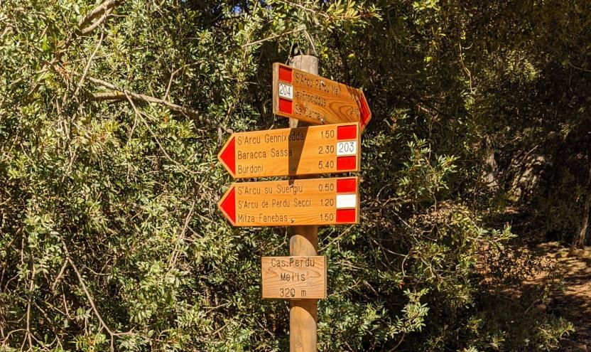
From all these points, you can begin the route on foot, as they are also accessible by car.
Medau Mancas - Medau Pilisi (390 metri slm)
Sulla SS 293, al km 49,1 (m 231 s.l.m.), si imbocca sulla sinistra (se si procede in direzione Sud verso Nuxis e Santadi) una vecchia rotabile mineraria che, con una coppia di tornanti, guadagna quota e, dopo 2 km circa, raggiunge il Medau Pilisi (m 397 s.l.m.), e dopo ulteriori 3 km circa Arcu de Sa Mossa.
Da tutti questi punti si può iniziare il percorso a piedi, essendo raggiungibili anche in auto
This is a very vast area, a crossroads of small roads and cart tracks, panoramic enough to give an idea of the entire surrounding territory. It's a crucial junction for the hiking trails in this area of Gutturu Mannu.
From Arcu de sa Mossa, take the mining road again (in worse condition) and follow it in a S-SE direction for about 1 km, descending towards the valley floor. Then, turn left onto another road (which would lead back to Arcu de Sa Mossa) in a NE direction until you reach the Cuile Giriadroxiu (469 m, 0.20 hours – 2.10 total). From the sheepfold, a mule track initially heading north branches off, which would lead to crossing the Riu Mannu and, skirting Punta s’Eni su Pani (481 m), to reach the ruins of the Medau di Conca Carrogas (440 m) after a long detour. We reach those ruins by following a shorter path that branches off to the right of the mule track, immediately downstream from the Giriadroxiu sheepfold, and leads to crossing the Riu Mannu upstream from the confluence of the Riu Matzeu Matta (0.10 hours – 2.20 total). Then, heading east and fording the stream a couple of times, you reach the aforementioned ruins (0.20 hours – 2.40 total).
Si tratta di un'area molto vasta, crocevia di stradelli e carrarecce, panoramico abbastanza da dare un'idea di tutto il territorio circostante. Snodo cruciale dei tracciati escursionistici di quest'area del Gutturu Mannu.
Da Arcu de sa Mossa si riprende la rotabile mineraria (in peggiori condizioni) e la si percorre in direzione S-SE per circa 1 km, scendendo verso il fondovalle, quindi si svolta a sn su altra rotabile (che riporterebbe ad Arcu de Sa Mossa) in direzione NE fino al Cuile Giriadroxiu (m 469, h 0.20 – 2.10). Dall’ovile si stacca, inizialmente diretta a N, una mulattiera che porterebbe a traversare il Riu Mannu e, contornando la Punta s’Eni su Pani (m 481), a raggiungere dopo un lungo giro i ruderi del Medau di Conca Carrogas (m 440). Noi raggiungiamo quei ruderi seguendo un sentiero più breve che si innesta sulla destra della mulattiera, immediatamente a valle dell’ovile Giriadroxiu, e che porta ad attraversare il Riu Mannu a monte della confluenza del Riu Matzeu Matta (h 0.10 – 2.20). Quindi, con direzione E, guadato un paio di volte il rio, si raggiungono i ruderi predetti (h 0.20 – 2.40).
The Gutturu Mannu State Forest is located in the southern part of the province of Cagliari.
The entire forest is included in the proposed Sulcis Natural Park pursuant to Regional Law 31/89 as ‘Extensive western area of the Sardinian deer. Paleozoic granite massifs with tormented morphology with valleys alternating with plateaus. High peaks over a thousand meters. Very rich in holm oak woods with frequent yews and hollies in the most remote ravines; cork oaks, strawberry trees, tree-like phillyreas and lentisks. Mediterranean maquis with heather and arborescent strawberry trees. Important from a faunal point of view for the seasonal migrations of the Sardinian deer and wild boar. Also present are the fox, the Sardinian wild cat, the marten, the woodcock, the 1 wood pigeon and red woodpeckers. Doubtful presence of the fallow deer. Mining settlements (Pantaleo) and archaeological settlements and those of ancient peasant culture’.
Furthermore, it falls within the SCI area I.T.B. 001105 – ‘Monte Arcosu Forest’ for approximately 70% of its surface and for a large part of its surface within the permanent wildlife protection oasis ‘Gutturu Mannu - Monte Arcosu’ as per decrees No. 102 of 20.07.78 and No. 1240 of 15.11.88.
It can be accessed from the town center of Santadi or from Cagliari, by taking the S.P. Macchiareddu-Santadi road which divides the forest complex into two parts. The forest is also connected to the F.D. Tamara Tiricu and Pantaleo to the west and to the F.D. Is Cannoneris and F.D. Monte Nieddu to the south.
La Foresta Demaniale di Gutturu Mannu è situata nella parte sud della provincia di Cagliari.
L'intera foresta è compresa nella proposta di Parco naturale del Sulcis ai sensi della L.R. 31/89 in quanto ‘Esteso areale occidentale del cervo sardo. Massicci granitici del Paleozoico dalla tormentata morfologia con valloni alternati a pianori. Vette elevate oltre i mille metri. Ricchissimo di boschi di lecci con frequenza di tassi e agrifogli negli anfratti più remoti; sughere, corbezzoli, filliree arborescenti e lentischi. Macchia mediterranea con erica e corbezzolo arborescente. Importante sotto l’aspetto faunistico per le migrazioni stagionali del cervo sardo e del cinghiale. Presenti anche la volpe, il gatto selvatico sardo, la martora, la beccaccia, il colombaccio e picchi rossi. Dubbia presenza del daino. Insediamenti minerari (Pantaleo) e insediamenti archeologici e di antica cultura contadina’.
Inoltre ricade nell’area S.I.C. I.T.B. 001105 –‘Foresta di Monte Arcosu’ per circa il 70% della sua superficie e per gran parte della sua superficie nell’ Oasi permanente di protezione faunistica ‘Gutturu Mannu - Monte Arcosu’ come da decreti n°102 del 20.07.78 e n°1240 del 15.11.88.
Vi si accede dal centro abitato di Santadi o da Cagliari, percorrendo la strada S.P. Macchiareddu-Santadi che divide in due parti il complesso forestale. La foresta è inoltre collegata con la F.D. Tamara Tiricu e Pantaleo ad ovest e con la F.D. Is Cannoneris e F.D. Monte Nieddu a sud.