Start website main content

Accessible trails

1 pathway

Sentieri per tutti...in questa categoria rientrano i sentieri progettati o riadattati perchè il contatto con l'ambiente naturale sia sempre di stimolo al miglioramento della vita personale di chiunque, con attenzione alle condizioni di disabilità motoria, sensoriale o della sfera psichica e relazionale...

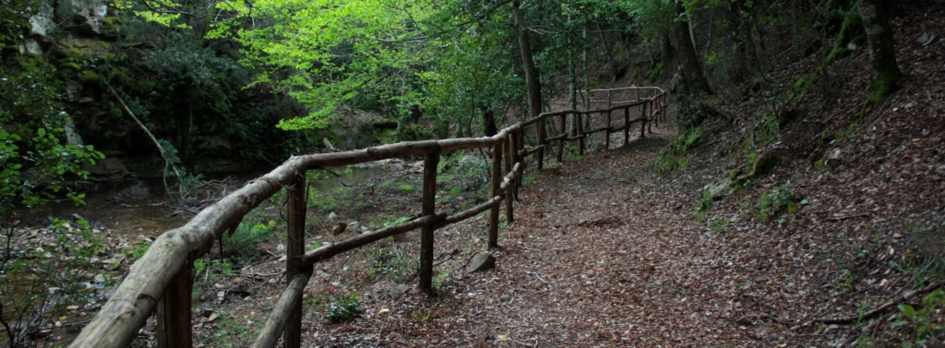
Rio Ermolinos.jpg

Results

Meana town center, GAL BMG itinerary arrival point

GAL BMG itinerary arrival point


How to get here

Having reached the Ortuabis reception area, take the dirt road that serves the zone, turning left once past the main structures and entering the woods, which also feature numerous charcoal burners' areas. When you reach a fork in the road, you can turn left to visit a large kiln, then turn right again, returning to the 128 and, via a known road, retracing the outward route back to the village.

Route location centro abitato

Rifugio, presidi abitati

Geographical area Barbagia

Abitato di Meana, arrivo itinerario del GAL BMG

Punto di arrivo dell'itinerario del GAL BMG

How to get here

Raggiunta l'area ricettiva di Ortuabis, si prende la sterrata che serve la zona, svoltando a sinistra una volta oltrepassate le strutture maggiori ed inoltrandosi nel bosco che presenta anche numerose aie dei carbonai. Quando si incontra un bivio, si può prendere a sinistra per visitare una grossa fornace, poi ancora a destra ritornando sulla 128 e, per strada nota, ripercorrendo il tracciato dell’andata fino al paese

Route location centro abitato

Rifugio, presidi abitati

Geographical area Barbagia

Meana, Ortuabis. The ancient crossroads

Access 

From the inhabited village of Meana, the Ortuabis plateau can be reached via the SS 128 road by car and bicycle, or by following the signs for the nuraghe Nolza at the exit of the village. This leads to a fine asphalt road that proceeds on a lonely descent into the valley, reaching below the forest, the first fork at the bottom of the valley, where you take a right turn. 

The vineyards and the Nuraghe 

You continue uphill, on a ridge from which there is a beautiful view of the village. The more wooded areas are behind you and you find yourself on rolling hillsides occupied by beautiful vineyards. High up on a raised hill is the massive silhouette of the nuraghe Nolza. You continue along this road, always lined with vineyards and following the signs until you reach the ticket office. The expert tour guides and the extraordinary view from the top of the nuraghe make it an extraordinary and essential visit to discover this corner of Sardinia. 

The forest 

Leaving the nuraghe, turn right onto the asphalt road, keeping slightly above the railway. The road becomes a dirt track, slightly uphill: here you take a left and then a right, in quick succession, to finally return to the asphalt road where you take another right, slightly uphill, passing by a disused quarry and then into a beautiful wood where the gradient drops. Here you meet the SS128 again and where you can arrive by car, skipping the first part of the itinerary. Follow the public road on the right until the sign km 74, where there is a sign indicating the hiking trail. Here you enter the forest, pass an open barrier and begin to follow a slightly downhill dirt road. 

The kilns 

The road keeps a firebreak on the right and winds along the same route as the aqueduct on a limestone plateau, formerly used for the production of lime, which was produced in large furnaces. The dirt road gradually deteriorates and you come to a barely noticeable fork where you keep to the right to visit a large lime kiln, located on a gentle slope. You resume heading north on a barely noticeable path, sometimes getting off your bike and soon reaching the area where the Ortuabis reception area is located, currently awaiting management. Take the dirt road that serves the area, turning left once you have passed the larger structures and entering the forest, which also has numerous charcoal burners' farmyards. When you come to a fork in the road, you can take a left to visit a large kiln, then right again returning to route SS128 and, by the known road, retracing the outward route to the village.

Lenght 33.100 m

meana.gpx

Total elevation gain 1 193 metri

Meana, Ortuabis. Le antiche crocevie

Accesso 

Dall’abitato di Meana, l’altopiano di Ortuabis si può raggiungere tramite la SS 128 in auto e in bicicletta, oppure seguendo le indicazioni per Nuraghe Nolza all’uscita del paese. Si imbocca così una bella strada asfaltata che procede solitaria e in discesa nella vallata, raggiungendo sotto il bosco un primo bivio nel fondovalle, dove si prende a destra. 

I vigneti e il nuraghe 

Si continua in salita, su un costone da cui si ammira un bel panorama sul paese. Le zone più boscate sono rimaste alle spalle e ci si trova su colline ondulate occupate da splendidi vigneti. In alto, su un colle rilevato, si staglia la sagoma massiccia del Nuraghe Nolza. Si continua sulla strada, sempre affiancati dai vigneti e seguendo le indicazioni fino a raggiungere la biglietteria. Le esperte guide turistiche e lo straordinario panorama che si vede dalla vetta del nuraghe rendono la sua visita straordinaria e fondamentale nella scoperta di quest’angolo di Sardegna. 

La foresta 

Lasciato il nuraghe si prende a destra sulla asfaltata, tenendosi poco più alti della ferrovia. La strada diviene sterrata, in leggera salita: qui si prende a sinistra e poi a destra, in rapida successione, ritornando infine su strada asfaltata dove si prende ancora a destra, in leggera salita, passando accanto ad una cava dismessa e poi in un bel bosco dove la pendenza si abbatte. 

Qui si incontra nuovamente la SS128 e qui si potrebbe arrivare in auto, saltando la prima parte dell’itinerario. Si segue la statale sulla destra fino al km 74 dove si individua un cartello che segnala l’itinerario escursionistico. Qui si entra nel bosco, superando una sbarra sempre aperta e cominciando a percorrere una sterrata in leggera discesa. 

Le fornaci 

La strada tiene sulla destra una striscia frangifuoco e si snoda seguendo lo stesso percorso dell’acquedotto su un altopiano calcareo, in passato usato per la produzione della calce che veniva prodotta in grandi fornaci. La sterrata peggiora gradualmente e si incontra un bivio appena accennato dove si tiene la destra per visitare una grande fornace della calce, posta su un declivio poco pronunciato. Si riprende la direzione nord su un sentiero poco accennato, talvolta scendendo dalla bicicletta e giungendo ben presto alla zona dove sorge l’area ricettiva di Ortuabis, al momento in attesa di una gestione. Si prende la sterrata che serve la zona, svoltando a sinistra una volta oltrepassate le strutture maggiori ed inoltrandosi nel bosco che presenta anche numerose aie dei carbonai. Quando si incontra un bivio, si può prendere a sinistra per visitare una grossa fornace, poi ancora a destra ritornando sulla 128 e, per strada nota, ripercorrendo il tracciato dell’andata fino al paese.

Lenght 33.100 m

meana.gpx

Total elevation gain 1 193 metri

Contiene carte
Spento

Ollolai town, GAL BMG itinerary starting point

GAL BMG itinerary starting point
 

How to get here

San Basilio Park is well signposted, and from the town center of Ollolai, you take a comfortable, uphill asphalt road, very panoramic, which leaves the town behind, soon diving into a holm oak forest.
 

Route location centro abitato

Rifugio, presidi abitati

Geographical area Barbagia

Abitato di Ollolai, partenza itinerario del GAL BMG

Punto di partenza dell'itinerario del GAL BMG

How to get here

Il Parco di San Basilio è ben indicato e dal centro abitato di Ollolai si prende una comoda strada asfaltata in salita, molto panoramica, che si lascia il paese alle spalle tuffandosi ben presto in un bosco di leccio.

Route location centro abitato

Rifugio, presidi abitati

Geographical area Barbagia

Ollolai, San Basilio, GAL BMG itinerary arrival point

GAL BMG itinerary arrival point

How to get here

After passing the small church of San Basilio, you'll find a fairly obvious small path that starts to climb steeply through the woods, marked by the passage of people and bicycles, but without trail markers. This leads to a wide ridge in the middle of the woods where you'll find a more distinct track, the remains of a ruined dirt road. Take it to the right, and you'll soon reach the repeater that overlooks the area. Numerous archaeological sites of interest can be found in the vicinity, although poorly signposted. After visiting the panoramic rocks near the antenna, take the white road on the right, losing altitude and soon returning to the asphalt road that leads back to the village.

Route location centro abitato

Rifugio, presidi abitati

Geographical area Barbagia

Ollolai, San Basilio, arrivo itinerario del GAL BMG

Punto di arrivo dell'itinerario del GAL BMG

How to get here

 Superata la chiesina di  San Basilio si incontra un sentierino abbastanza evidente che prende a salire deciso in mezzo al bosco, segnato dal passaggio delle persone e delle biciclette, ma privo di segnavia. Si raggiunge così un largo crinale in mezzo al bosco dove si incontra una traccia più marcata, quanto resta di una sterrata disastrata. La si prende sulla destra, giungendo in breve nei pressi del ripetitore che sovrasta la zona. Nei dintorni si trovano numerosi siti di interesse archeologico, anche se mal segnalati. Dopo una visita alle panoramiche rocce nei pressi dell’antenna si prende la strada bianca sulla destra, perdendo quota e ritornando in breve alla strada asfaltata che ritorna al paese

Route location centro abitato

Rifugio, presidi abitati

Geographical area Barbagia

Ollolai, San Basilio. A kingdom of granite

Access 

The San Basilio Park is well signposted and from the inhabited centre of Ollolai you take a convenient uphill asphalt road, very panoramic, which leaves the village behind and soon plunges into a forest of Holm oaks. From the asphalt road you change to concrete, soon passing the astronomical observatory of San Basilio, and the Planetarium of Ollolai, located on the right-hand side of the road. You continue for a short distance over a few slopes until you reach a large clearing after which the rolling road begins to descend with tight hairpin bends. 

San Basilio 

The mountain overlooking the village of Ollolai, once one of the most important centres in the area, is dedicated to San Basilio Magno, and the small road leads to the church dedicated to the saint, built in Byzantine era and then renovated several times, in front of which, are the ruins of the convent that once belonged to the Franciscans, and is the theatre of many legends. Just below the church and a spring, often dry in the hottest summers, there is a vast clearing surrounded by a dense Holm oak forest and an impressive series of granite peaks which are incredibly broken and varied. On the left, at the top of Sa Punta Manna, which you could reach via a route marked with some ropes, however it requires experience of short climbs along a path, to be tackled only if you are an experienced mountaineer and the rocks are dry. 

The sign of history 

The area of San Basilio was, however, inhabited in much earlier times than the church and convent can testify. The numerous caverns carved out by erosion in the granite tafoni have been inhabited, with certainty, since the Neolithic period, as many archaeological investigations testify. Hollowed-out rock shelters are scattered throughout the area, and to get an idea of the territory in which the proto-Sardinians operated, it is worth spotting, just below the small church, a fence that one meets on the right, towards the direction of the field. Beyond it, you come to a fairly obvious little path that begins to climb steeply in the middle of the wood, marked by the passage of people and bicycles, but with no trail signs or markings. You then reach a wide ridge in the middle of the forest where you come across a more visible track, the remains of a disused dirt road. Take it to the right, soon arriving near the communication mast that towers above the area. There are numerous sites of archaeological interest in the vicinity, although they are poorly signposted. After a visit to the scenic rocks near the antenna, you take the dirt road to the right, going downhill and soon returning to the tarmac road that leads back to the village.

Lenght 5.600 m

ollolai.gpx

Total elevation gain 224 metri

Geographical area Barbagia Gennargentu Supramontes