Start website main content

Nordic Walking

51 pathways

La camminata nordica o camminata con bastoni (in inglese nordic walking o pole walking) è attività fisica e sportiva che ben si coniuga con percorsi in bosco, in pianura o in vallate, lungo scogliere o spiagge.  La Rete dei sentieri della Sardegna offre tantissime occasioni per cimentarsi nella camminata nordica... 

Nordic-walking.png

Results

Meana, Ortuabis. The ancient crossroads

Access 

From the inhabited village of Meana, the Ortuabis plateau can be reached via the SS 128 road by car and bicycle, or by following the signs for the nuraghe Nolza at the exit of the village. This leads to a fine asphalt road that proceeds on a lonely descent into the valley, reaching below the forest, the first fork at the bottom of the valley, where you take a right turn. 

The vineyards and the Nuraghe 

You continue uphill, on a ridge from which there is a beautiful view of the village. The more wooded areas are behind you and you find yourself on rolling hillsides occupied by beautiful vineyards. High up on a raised hill is the massive silhouette of the nuraghe Nolza. You continue along this road, always lined with vineyards and following the signs until you reach the ticket office. The expert tour guides and the extraordinary view from the top of the nuraghe make it an extraordinary and essential visit to discover this corner of Sardinia. 

The forest 

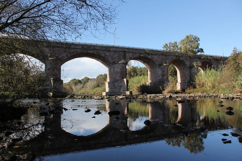
Leaving the nuraghe, turn right onto the asphalt road, keeping slightly above the railway. The road becomes a dirt track, slightly uphill: here you take a left and then a right, in quick succession, to finally return to the asphalt road where you take another right, slightly uphill, passing by a disused quarry and then into a beautiful wood where the gradient drops. Here you meet the SS128 again and where you can arrive by car, skipping the first part of the itinerary. Follow the public road on the right until the sign km 74, where there is a sign indicating the hiking trail. Here you enter the forest, pass an open barrier and begin to follow a slightly downhill dirt road. 

The kilns 

The road keeps a firebreak on the right and winds along the same route as the aqueduct on a limestone plateau, formerly used for the production of lime, which was produced in large furnaces. The dirt road gradually deteriorates and you come to a barely noticeable fork where you keep to the right to visit a large lime kiln, located on a gentle slope. You resume heading north on a barely noticeable path, sometimes getting off your bike and soon reaching the area where the Ortuabis reception area is located, currently awaiting management. Take the dirt road that serves the area, turning left once you have passed the larger structures and entering the forest, which also has numerous charcoal burners' farmyards. When you come to a fork in the road, you can take a left to visit a large kiln, then right again returning to route SS128 and, by the known road, retracing the outward route to the village.

Lenght 33.100 m

meana.gpx

Total elevation gain 1 193 metri

Meana, Ortuabis. Le antiche crocevie

Accesso 

Dall’abitato di Meana, l’altopiano di Ortuabis si può raggiungere tramite la SS 128 in auto e in bicicletta, oppure seguendo le indicazioni per Nuraghe Nolza all’uscita del paese. Si imbocca così una bella strada asfaltata che procede solitaria e in discesa nella vallata, raggiungendo sotto il bosco un primo bivio nel fondovalle, dove si prende a destra. 

I vigneti e il nuraghe 

Si continua in salita, su un costone da cui si ammira un bel panorama sul paese. Le zone più boscate sono rimaste alle spalle e ci si trova su colline ondulate occupate da splendidi vigneti. In alto, su un colle rilevato, si staglia la sagoma massiccia del Nuraghe Nolza. Si continua sulla strada, sempre affiancati dai vigneti e seguendo le indicazioni fino a raggiungere la biglietteria. Le esperte guide turistiche e lo straordinario panorama che si vede dalla vetta del nuraghe rendono la sua visita straordinaria e fondamentale nella scoperta di quest’angolo di Sardegna. 

La foresta 

Lasciato il nuraghe si prende a destra sulla asfaltata, tenendosi poco più alti della ferrovia. La strada diviene sterrata, in leggera salita: qui si prende a sinistra e poi a destra, in rapida successione, ritornando infine su strada asfaltata dove si prende ancora a destra, in leggera salita, passando accanto ad una cava dismessa e poi in un bel bosco dove la pendenza si abbatte. 

Qui si incontra nuovamente la SS128 e qui si potrebbe arrivare in auto, saltando la prima parte dell’itinerario. Si segue la statale sulla destra fino al km 74 dove si individua un cartello che segnala l’itinerario escursionistico. Qui si entra nel bosco, superando una sbarra sempre aperta e cominciando a percorrere una sterrata in leggera discesa. 

Le fornaci 

La strada tiene sulla destra una striscia frangifuoco e si snoda seguendo lo stesso percorso dell’acquedotto su un altopiano calcareo, in passato usato per la produzione della calce che veniva prodotta in grandi fornaci. La sterrata peggiora gradualmente e si incontra un bivio appena accennato dove si tiene la destra per visitare una grande fornace della calce, posta su un declivio poco pronunciato. Si riprende la direzione nord su un sentiero poco accennato, talvolta scendendo dalla bicicletta e giungendo ben presto alla zona dove sorge l’area ricettiva di Ortuabis, al momento in attesa di una gestione. Si prende la sterrata che serve la zona, svoltando a sinistra una volta oltrepassate le strutture maggiori ed inoltrandosi nel bosco che presenta anche numerose aie dei carbonai. Quando si incontra un bivio, si può prendere a sinistra per visitare una grossa fornace, poi ancora a destra ritornando sulla 128 e, per strada nota, ripercorrendo il tracciato dell’andata fino al paese.

Lenght 33.100 m

meana.gpx

Total elevation gain 1 193 metri

Contiene carte
Spento

Tiana, la gualchiera. Waterways

Access 

From the centre of Tiana, continue in the direction of Tonara on the SS 128, slightly downhill and high above the wooded valley. You soon reach a small rocky lay-by where, on the right, you will find the signs for reaching the Gualchiera, sa cracchera de tziu Bellu, which is today a museum of industrial archaeology

La Gualchiera - The Fullers 

Tiana is the symbolic village of orbace (rough wool), the fabric obtained by a mechanical process of felting wool. For the energy required in this proto-industrial process, there were the Fullers, structures similar to hydraulic mills that used by the power of water to drive the machinery. The one in Tiana has been beautifully restored, unique among the many once present in the area, and is located in an area surrounded by greenery, on the terraces suspended around the Tino stream at the point it merges with the Torrei. It can be visited only by appointment

Il Rio Torrei - The Torrei Stream 

Once you have visited the river, you can continue along a short nature trail along the hazel groves bordering the river, or take a route through the heart of the area. You then return to route 128 for a few hundred metres where, before a bridge turn left onto a cobbled road and then a dirt road, following the signs for the Ospitone path. The road runs along the hydrographic right bank of the Rio Torrei, in a mountainous environment, overhung by large rocks and often flanked by dense woodland. On the right, some rocks allow splendid panoramic views of the surroundings. 

The Path 

As you continue, you gain altitude, temporarily moving away from the river bed and then returning to it near a spring. The road becomes a narrow path that cuts through the vegetation, immersed in a beautiful forest broken only by sudden scree and rocks. At an altitude of 750 metres, you come to a ford on the right, after which you follow a dirt road uphill that soon leads back to the asphalt road serving the dam on the Rio Torrei, located a few kilometres further upstream. From here it is possible to retrace your steps or, especially if equipped with a mountain bike, to return by road to the village, taking a right and then another right once one reaches the public road.

Lenght 9.200 m

tiana.gpx

Total elevation gain 403 metri

Tiana, la gualchiera. Le vie dell’acqua

Accesso 

Dal centro abitato di Tiana si prosegue in direzione Tonara sulla SS 128, in lieve discesa e alti sopra la vallata boscosa. In breve si raggiunge un piccolo slargo dove, sulla destra, si trovano le indicazioni per raggiungere la Gualchiera, sa cracchera de tziu Bellu, oggi un museo di archeologia industriale

La Gualchiera 

Tiana è il paese simbolo dell’orbace, il tessuto ottenuto con un procedimento meccanico grazie all’infeltrimento della lana. Per l’energia richiesta in questo processo proto-industriale esistevano le Gualchiere, strutture simili ai mulini idraulici che utilizzavano la forza dei torrenti per il funzionamento dei macchinari. Quella di Tiana è stata splendidamente restaurata, unica tra la molte presenti un tempo nella zona e si trova in un’area immersa nel verde, sulle terrazze sospese intorno al torrente Tino presso la conlfuenza col Torrei. Si può visitare previo appuntamento. 

Il rio Torrei 

Una volta effettuata la visita si può proseguire per un breve sentiero naturalistico lungo i noccioleti che costeggiano il fiume, oppure proseguire per un itinerario nel cuore del territorio. Si riprende quindi la 128 per poche centinaia di metri dove, prima di un ponte, si prende a sinistra per una strada selciata e poi sterrata, seguendo le indicazioni per il cammino di Ospitone. La strada si inoltra sul fianco destro idrografico del Rio Torrei, in ambiente montano, sovrastata da grossi rocciai e affiancata spesso da un bosco fitto. Sulla destra, alcune rocce permettono splendide viste panoramiche d’intorno. 

Il sentiero 

Man mano che si prosegue si guadagna quota, allontanandosi temporaneamente dal greto del torrente e poi ritornandovi nei pressi di una sorgente. La strada diviene uno stretto sentiero che fora la vegetazione, immerso in un bel bosco rotto soltanto da improvvisi ghiaioni e rocciai. Giunti a quota 750 si incontra, sulla destra, un guado, superato il quale si percorre una strada sterrata in salita che in breve riconduce alla strada asfaltata che serve la diga sul Rio Torrei, posta qualche km più a monte. Da qui è possibile tornare sui propri passi oppure, soprattutto se muniti di una mountain bike, ritornare via strada al paese prendendo a destra e poi nuovamente a destra una volta giunti alla statale.

Lenght 9.200 m

tiana.gpx

Total elevation gain 403 metri