Start website main content

Nordic Walking

51 pathways

La camminata nordica o camminata con bastoni (in inglese nordic walking o pole walking) è attività fisica e sportiva che ben si coniuga con percorsi in bosco, in pianura o in vallate, lungo scogliere o spiagge.  La Rete dei sentieri della Sardegna offre tantissime occasioni per cimentarsi nella camminata nordica... 

Nordic-walking.png

Results

Aritzo, Texile. The natural monument

Itinerary

Access 

You commence the walk from the centre of Aritzo by taking Via Garibaldi, easily reached in the lower part of the village, then turning left once you reach the small panoramic square of Sant'Antonio, from which you can clearly distinguish the rocky taccu of Texile on the other side of the valley, the destination of the excursion. You continue down a narrow lane that leaves the last houses behind, immediumtely entering terraced allotments, dense hazelnut groves and tall walnut trees, splendid in autumn for their intense foliage.

The springs 

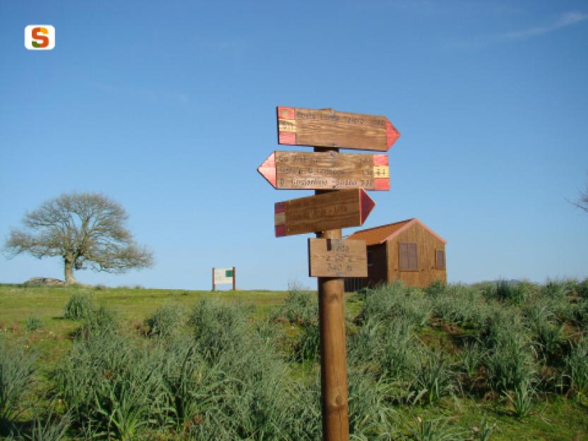
The descent is interrupted at an opening near the Giaria spring. Here, the route continues initially slightly uphill and on a sometimes concreted road always in a beautiful wooded environment despite its proximity to the village. In addition, to the essences already observed, there are dense holly trees and splendid specimens of chestnut and alder. You come to a fork where you turn right, slightly downhill on a cobbled road, following the signs for the Funtana de Zia Albara. Another stretch through hazel groves and terraced allotments separates this junction from the beautiful spring. Take a right here, also meeting the signs for Texile. Gradually descend, first encountering a picnic area near which the monumental Addalcia pine, which unfortunately recently fell to the ground. At a ford, a last spring is finally encountered. 

Texile 

Once past the ford, the dirt road worsens slightly and begins to climb, making a wide hairpin bend but always remaining defined. Ignore minor detours occasionally encountering some signs for Texile and keeping to the south-west direction until one can clearly distinguish the limestone peak above, which is reached at the top of the ascent. The geological peculiarity of Texile is that, similar to many taccos in Ogliastra and the Barbagia di Belvì and Seulo, it is completely isolated from similar rocks and is an island completely unique to its surroundings, consisting as it does of limestone and resting on Palaeozoic schists. This has allowed a rare and peculiar flora to vegetate only on its walls, making Texile a treasure chest of biodiversity, which has therefore become an SCI area (Site of Community Importance) and strictly protected. For the more intrepid, a rocky gully allows access to the summit, from which an extraordinary view of Aritzo, Belvì, the Gennargentu peaks and the Uatzo valley can be admired. On the summit of the peak one can also find numerous ceramics from the proto-historic period, which testifies to ancient settlements or places of worship on the mountain. After a long panoramic rest, you finally return to the village by the same route as the outward journey.

Lenght 7.800 m

aritzo.gpx

Total elevation gain 420 metri

Aritzo, Texile, Il monumento naturale

Accesso

Si inizia a camminare dal centro abitato di Aritzo si prende la via Garibaldi, facilmente raggiungibile nella parte bassa del paese, svoltando poi a sinistra una volta raggiunta la piazzetta panoramica di Sant’Antonio, dalla quale si distingue chiaramente il taccu roccioso di Texile dall’altra parte della vallata, meta dell’escursione.

Si prosegue scendendo per uno stretto viottolo che si lascia le ultime case alle spalle, inoltrandosi subito tra orti terrazzati, fitti noccioleti o alti noci, splendidi in autunno per il loro intenso foliage.


Le sorgenti

La discesa si interrompe in uno slargo presso la sorgente di Giaria. Qui si prosegue inizialmente in leggera salita e su fondo talvolta pavimentato, sempre in bell’ambiente boscoso pur nella sua vicinanza al paese ed alle essenze già osservate si aggiungono i fitti agrifogli e splendidi esemplari di castagno ed ontano. Si incontra un bivio dove si prende a destra, in leggera discesa su strada selciata, seguendo le indicazioni per la Funtana de Zia Albara.

Ancora un tratto tra i noccioleti e gli orti terrazzati separa questo incrocio dalla bella sorgente. Qui si prende a destra, incontrando anche le indicazioni per Texile. Si scende gradualmente, incontrando prima un’area pic nic presso la quale era presente il pino monumentale di Addalcia, purtroppo rovinato al suolo recentemente. Presso un guado si incontra infine un’ultima sorgente.

Texile

Superato il guado la sterrata peggiora leggermente e comincia a salire, compiendo un ampio tornante ma rimanendo sempre evidente. Si trascurano deviazioni minori, incontrando saltuariamente alcune indicazioni per Texile e tenendo la direzione sudovest fino a distinguere chiaramente il picco calcareo soprastante che si raggiunge al culmine della salita.

La particolarità geologica di Texile è quella, simile a molti taccos dell’Ogliastra e della Barbagia di Belvì e Seulo, di essere completamente isolato da rocce simili, costituito com’è da calcari e poggiante sugli scisti paleozoici. Questo ha permesso ad una flora rara e peculiare di vegetare solo sulle sue pareti, rendendo Texile uno scrigno di biodiversità, divenuto perciò area SIC e rigorosamente protetto.

Per i più intrepidi, un canalino roccioso permette di accedere alla sommità da cui si ammira una vista straordinaria su Aritzo, Belvì, le vette del Gennargentu e la vallata di Uatzo. Sulla sommità del picco si ritrovano inoltre numerose ceramiche di epoca protostorica a segnalare antichissimi insediamenti o luoghi di culto sulla montagna.

Dopo una lunga sosta panoramica si ritorna infine in paese per la stessa via dell’andata.

Lenght 7.800 m

aritzo.gpx

Total elevation gain 420 metri

Belvì, Pitzu ‘e Pranu. Overlooking the valley

Access 

From the inhabited centre of Belvì, the excursion begins by reaching the square in front of the church and from here take Via Marconi, where you descend slightly downhill, then turning right along a country lane into the countryside, indicated by a wooden signpost that points the way to some domus de Janas. You continue downhill, embraced by thick hazel tree groves that clutter the small road. This was once an important cart-track, as indicated by the ancient paving and the care with which the dry-stone walls bordering it were built. 

Uphill 

You lose altitude until you reach a bridge that crosses a noisy stream, in the map as Riu Salasi. Looming over the area are the walls of Pitzu 'e Pranu, the destination of the itinerary, while to the right is the beautiful arched bridge of the railway along which the Trenino verde (The little green train) now travels. Having crossed the bridge, you keep to the right at the next fork and begin to climb rapidly between the various fenced allotments that occupy the valley. The cart-track is still very evident, albeit slightly more ruined: at the top of the climb you come out on asphalt, on the SP 61 bis. Here the cart track continued, but is now overgrown by brambles. 

Towards the summit 

You then turn left, travelling about 200 metres downhill on the main road and finding a dirt road that turns right, uphill, immediately meeting a fork with a wider dirt road where you turn right. You are now at altitude, skirting the walls of Pitzu 'e Pranu in a counter-clockwise direction. The road is flanked by some large wooden poles and has been built precisely on the geological discontinuity between the limestone that makes up the mountain above and the schists of the ancient basement on which one has walked so far. You flank some allotments and soon reach a crossroads with a paved road, where you take a left, uphill, surrounded by Holm oak forest. At the next hairpin bend, not far from the road, is a beautiful lime kiln, used for processing limestone. 

Pitzu ‘and Pranu 

A final uphill stretch leads to a windswept, very scenic saddle, where there is a large crossroads. Here, one turns left, uphill, entering the reforestation that occupies the summit of Pitzu 'e Pranu and on which an adventure park, now disused, was built. Vetta del taccu (limestone formation), as its name suggests, is occupied by a vast plateau where small depressions betray the presence of several chasms, attributable to the karstic nature of the area. At the highest point, you reach a Virgin Mary, statue located on the edge of the walls. Here one literally overlooks the village and the neighbouring village of Aritzo, letting one's gaze wander as far as the Gennargentu and the wide surrounding valleys. You return to the village along the path followed on the outward journey.

Lenght 5.900 m

belvi.gpx

Total elevation gain 269 metri

Belvì, Pitzu ‘e Pranu. A picco sulla valle

Accesso

Dal centro abitato di Belvì si inizia l’escursione raggiungendo la piazza antistante la chiesa e da qui la via Marconi, dove si scende leggermente di quota prendendo poi a destra per un viottolo di campagna, indicato da un cartello di legno che segnala la direzione per raggiungere alcune Domus de Janas.
Si prosegue in discesa, abbracciati da fitti noccioleti che ingombrano la stradina. Questa era in passato una importante carrareccia, come segnala l’antico selciato e la cura con cui erano realizzati i muretti a secco che la delimitano.

In salita

Si perde quota fino a raggiungere un ponte che supera un rumoroso torrente, in carta come Riu Salasi. Sulla zona incombono le pareti di Pitzu ‘e Pranu, meta dell’itinerario, mentre sulla destra si individua il bel ponte ad arcate della ferrovia lungo la quale transita oggi il Trenino verde. Superato il ponte, si tiene la destra al bivio successivo e si comincia a salire rapidamente tra i vari orti recintati che occupano la vallata. La carrareccia è sempre ben evidente, pur se leggermente più rovinata: al culmine della salita si sbuca su asfalto, nella SP 61 bis. Qui la carrareccia continuava, ma è oggi invasa dai rovi.

Verso la cima

Si prende quindi a sinistra, percorrendo circa 200 metri in discesa sulla statale ed individuando una strada sterrata che si discosta a destra, in salita, incontrando subito un bivio con una sterrata più ampia dove si prende a destra. Si sta ora in quota, costeggiando in senso antiorario le pareti di Pitzu ‘e Pranu. La strada è affiancata da alcuni grossi pali in legno ed è stata costruita proprio sulla discontinuità geologica tra i calcari che costituiscono la montagna soprastante e gli scisti dell’antico basamento su cui si è finora camminato. Si fiancheggiano alcuni orti raggiungendo in breve un incrocio con una strada pavimentata, dove si prende a sinistra, in salita, circondati dalla lecceta. Al tornante successivo, poco discosta dalla strada, si trova una bella fornace della calce, usata per la trasformazione della pietra calcarea.

Pitzu ‘e Pranu

Un ultimo tratto in salita porta a guadagnare una sella spazzata dai venti, assai panoramica, dove si trova un grosso incrocio. Qui si prende a sinistra, in salita, entrando nel rimboschimento che occupa la parte sommitale di Pitzu ‘e Pranu e sul quale era stato costruito un parco avventura, ora in disuso. La vetta del taccu, come suggerisce il nome, è occupata da un vasto pianoro dove piccole depressioni tradiscono la presenza di alcune voragini, imputabili alla natura carsica della zona. Nel punto più alto si raggiunge una madoninna, posta sull’orlo delle pareti. Qui si domina letteralmente il paese e quello vicino di Aritzo, lasciando lo sguardo spaziare fino al Gennargentu ed alle ampie vallate circostanti. Si ritorna al paese per il sentiero seguito all’andata.

Lenght 5.900 m

belvi.gpx

Total elevation gain 269 metri

Ortueri, Mui Muscas. The kingdom of the donkeys

Access 

The easy tourist itinerary that visits the Mui Muscas oasis consists of a convenient track to be cycled, on easy dirt tracks, asphalted stretches and little traffic. From the village, take the SS388, leaving the village and encountering, immediately after the last houses, the signs for the nature oasis, where ecursions and a viewpoint are signposted. You continue along the asphalt road, always following the signs and begin to climb a scenic hill, flanked by a beautiful cork oak forest and scrub with heather and artubus trees. 

Mui Muscas 

When the slope ends, you find yourself in the Mui Muscas area, surrounded by the beautiful municipal park that occupies a large area of cork oak or sparse reforestation. You reach some structures currently awaiting management. On the right, after opening and closing a gate for pedestrian transit, where some picnic areas could be reached in the woods. Instead, turn left immediately before the structures, following a dirt road. On the right of the road, a gate allows access to the Parco degli Asinelli (Donkley Park), one of the most extraordinary attractions in this area. 

The Donkeys 

The Donkey Park was created in the mid-1990s to preserve the pure Sardinian breed, characterised by its grey coat, the obvious black cross on its rump and a particularly petite size. Today the beautiful forest is home to just over fifty specimens and where there have been numerous collaborations and genetic and veterinary studies undertaken. You return to the dirt track, continuing in a north-westerly direction and gradually beginning to descend, always following the more defined road. At a large fork, you keep to the left, climbing slightly up a small hill and then descending again to a fork where you find the tarmac road again. Following it to the left, you soon return to the village.

Lenght 7.700 m

ortueri.gpx

Total elevation gain 235 metri

Ortueri, Mui Muscas. Il regno degli asinelli

Accesso 

Il facile itinerario turistico che visita l’oasi di Mui Muscas si compone di un comodo anello da percorrere in bicicletta su facili sterrate e tratti asfaltati con scarso traffico. 

Dal paese si prende la SS388, uscendo dal paese ed incontrando, subito dopo le ultime case, le indicazioni per l’oasi naturalistica, dove sono segnalate escursioni e un punto panoramico. 

Si prosegue su strada asfaltata, seguendo sempre le indicazioni e cominciando a salire su una collina panoramica, affiancati da una bella sughereta e da una macchia evoluta ad erica e corbezzoli

Mui Muscas 

Quando la pendenza termina ci si trova nella zona di Mui Muscas, circondati dal bel parco comunale che occupa una vasta area a sugherete o a scarsi rimboschimenti. Si raggiungono alcune strutture attualmente in attesa di gestione: sulla destra, aperto e richiuso un cancello per il transito pedonale, sarebbero raggiungibili nel bosco alcune aree pic nic

Si prende invece a sinistra subito prima delle strutture, percorrendo una strada sterrata. Sulla destra della strada, un cancello permette l’accesso al Parco degli Asinelli, una delle attrazioni più straordinarie di questa zona. 

Gli asinelli 

Il Parco degli Asinelli è nato a metà degli anni ‘90 per preservare la pura razza sarda, caratterizzata dal manto grigio, l’evidente croce nera sul groppone e da una taglia particolarmente minuta. Oggi il bel bosco ospita poco più di cinquanta esemplari e sono state attivate numerose collaborazioni e studi genetici e veterinari. 

Si ritorna sulla sterrata, proseguendo ancora in direzione nordovest e cominciando gradualmente a scendere, seguendo sempre la strada maggiormente evidente. Giunti ad un grosso bivio si tiene la sinistra, salendo leggermente su un piccolo colle e poi scendendo ancora fino a un bivio dove si ritrova la strada asfaltata. 

Seguendola a sinistra si torna presto al paese

Lenght 7.700 m

ortueri.gpx

Total elevation gain 235 metri

Tiana, la gualchiera. Waterways

Access 

From the centre of Tiana, continue in the direction of Tonara on the SS 128, slightly downhill and high above the wooded valley. You soon reach a small rocky lay-by where, on the right, you will find the signs for reaching the Gualchiera, sa cracchera de tziu Bellu, which is today a museum of industrial archaeology

La Gualchiera - The Fullers 

Tiana is the symbolic village of orbace (rough wool), the fabric obtained by a mechanical process of felting wool. For the energy required in this proto-industrial process, there were the Fullers, structures similar to hydraulic mills that used by the power of water to drive the machinery. The one in Tiana has been beautifully restored, unique among the many once present in the area, and is located in an area surrounded by greenery, on the terraces suspended around the Tino stream at the point it merges with the Torrei. It can be visited only by appointment

Il Rio Torrei - The Torrei Stream 

Once you have visited the river, you can continue along a short nature trail along the hazel groves bordering the river, or take a route through the heart of the area. You then return to route 128 for a few hundred metres where, before a bridge turn left onto a cobbled road and then a dirt road, following the signs for the Ospitone path. The road runs along the hydrographic right bank of the Rio Torrei, in a mountainous environment, overhung by large rocks and often flanked by dense woodland. On the right, some rocks allow splendid panoramic views of the surroundings. 

The Path 

As you continue, you gain altitude, temporarily moving away from the river bed and then returning to it near a spring. The road becomes a narrow path that cuts through the vegetation, immersed in a beautiful forest broken only by sudden scree and rocks. At an altitude of 750 metres, you come to a ford on the right, after which you follow a dirt road uphill that soon leads back to the asphalt road serving the dam on the Rio Torrei, located a few kilometres further upstream. From here it is possible to retrace your steps or, especially if equipped with a mountain bike, to return by road to the village, taking a right and then another right once one reaches the public road.

Lenght 9.200 m

tiana.gpx

Total elevation gain 403 metri

Tiana, la gualchiera. Le vie dell’acqua

Accesso 

Dal centro abitato di Tiana si prosegue in direzione Tonara sulla SS 128, in lieve discesa e alti sopra la vallata boscosa. In breve si raggiunge un piccolo slargo dove, sulla destra, si trovano le indicazioni per raggiungere la Gualchiera, sa cracchera de tziu Bellu, oggi un museo di archeologia industriale

La Gualchiera 

Tiana è il paese simbolo dell’orbace, il tessuto ottenuto con un procedimento meccanico grazie all’infeltrimento della lana. Per l’energia richiesta in questo processo proto-industriale esistevano le Gualchiere, strutture simili ai mulini idraulici che utilizzavano la forza dei torrenti per il funzionamento dei macchinari. Quella di Tiana è stata splendidamente restaurata, unica tra la molte presenti un tempo nella zona e si trova in un’area immersa nel verde, sulle terrazze sospese intorno al torrente Tino presso la conlfuenza col Torrei. Si può visitare previo appuntamento. 

Il rio Torrei 

Una volta effettuata la visita si può proseguire per un breve sentiero naturalistico lungo i noccioleti che costeggiano il fiume, oppure proseguire per un itinerario nel cuore del territorio. Si riprende quindi la 128 per poche centinaia di metri dove, prima di un ponte, si prende a sinistra per una strada selciata e poi sterrata, seguendo le indicazioni per il cammino di Ospitone. La strada si inoltra sul fianco destro idrografico del Rio Torrei, in ambiente montano, sovrastata da grossi rocciai e affiancata spesso da un bosco fitto. Sulla destra, alcune rocce permettono splendide viste panoramiche d’intorno. 

Il sentiero 

Man mano che si prosegue si guadagna quota, allontanandosi temporaneamente dal greto del torrente e poi ritornandovi nei pressi di una sorgente. La strada diviene uno stretto sentiero che fora la vegetazione, immerso in un bel bosco rotto soltanto da improvvisi ghiaioni e rocciai. Giunti a quota 750 si incontra, sulla destra, un guado, superato il quale si percorre una strada sterrata in salita che in breve riconduce alla strada asfaltata che serve la diga sul Rio Torrei, posta qualche km più a monte. Da qui è possibile tornare sui propri passi oppure, soprattutto se muniti di una mountain bike, ritornare via strada al paese prendendo a destra e poi nuovamente a destra una volta giunti alla statale.

Lenght 9.200 m

tiana.gpx

Total elevation gain 403 metri