Start website main content

Nordic Walking

51 pathways

La camminata nordica o camminata con bastoni (in inglese nordic walking o pole walking) è attività fisica e sportiva che ben si coniuga con percorsi in bosco, in pianura o in vallate, lungo scogliere o spiagge.  La Rete dei sentieri della Sardegna offre tantissime occasioni per cimentarsi nella camminata nordica... 

Nordic-walking.png

Results

Vallicciola

The Vallicciola locality has a large park mostly with conifers, and is surrounded by wooden fences.

Information boards and signposts provide information on the various trails, which start from here, and on the area’s vegetation and wildlife.

The splendid large sequoia trees are a much-photographed attraction.

Route location Vallicciola

Alberi monumentali Fabbricati/case forestali trekking - waypoint

Geographical area Gallura

Vallicciola

La località di Vallicciola è caratterizzata dall'esteso parco con prevalenza di conifere, recintato da staccionate in legno.
Cartelli esplicativi e indicatori informano sui diversi itinerari, che da qui si dipartono, e sulla vegetazione e fauna della zona.
Notevole l'imponenza degli alberi più fotografati, che attirano indubbiamente l’attenzione: splendidi esemplari di sequoia.

Route location Vallicciola

Alberi monumentali Fabbricati/case forestali trekking - waypoint

Geographical area Gallura

Berritta Peak - Arch Suprappare Natural Monument

The monument is located at the Punta Sa Berritta site, Supràppare Valley, the summit area of the Monte Limbara massif, entirely within the municipal territory of Berchidda (SS).

Description and General Information

It consists of two units located a short distance from each other:

  1. Punta Sa Berritta (also known as Rocca Manna Supràppare on the Berchidda side) characterized by a rock block shaped like an irregular parallelepiped (approximately 10 x 15 m base and 6 m high) located in incredible balance on a narrow peak. The peak is easily recognizable from a great distance (even from the Sassari-Olbia highway) while its access from the northern side is masked by the pine forest and other outcropping rocks.
  2. The monumental Rock Arch, also made of granite (approximately 14 m long, 6 m maximum height and 3.5 m thick); granite formations of similar dimensions are extremely rare, if not unique, in Sardinia.

The attraction of the place is not only its undeniable landscape value, but also its botanical and faunal interest: in fact, it hosts characteristic Sardinian flora and fauna species with numerous endemisms of conservation interest such as the Bedriaga's lizard, the Mediterranean house gecko, the golden eagle, the peregrine falcon, thyme and endemic brooms.

WHERE IT IS LOCATED, HOW TO REACH IT

The site can be reached from the State Road 392 Tempio-Oschiri via Provincial Road n.51 which ascends the northwest side of Monte Limbara leading to its summit (Punta Balistreri 1359 m a.s.l.) and passing through the town of Vallicciola (1052 m a.s.l.). Near Punta Sa Berritta, the Sentiero Italia and a further temporarily numbered trail 1B pass by, marked and managed by the Forestas Agency, which has placed it in pre-registration according to the new regional regulation for the RES. This is the route normally followed by hikers to visit the peak, while the rock arch, located lower and less visible, is less known, but can still be reached on the trail with a short detour from the Forestas trail junction, indicated by stone cairns, descending a channel west of Punta Sa Berritta characterized by large blocks, stacked one on top of the other, evidence of erosion that occurred during the ice age.

Links

Route location Suprappare

Wonders of nature...

Geographical area Gallura

Monumento naturale Punta Berritta-Arco Suprappare

Il monumento si trova nel sito Punta Sa Berritta, Valle Supràppare, zona sommitale del massiccio del Monte Limbara interamente compresa nei confini del territorio comunale di Berchidda (SS).

Descrizione ed informazioni generali

Costituito da due unità situate a breve distanza una dall’altra: 

1. Punta Sa Berritta (nota anche come Rocca Manna Supràppare nel versante berchiddese) caratterizzata da un blocco di roccia conformata come un parallelepipedo irregolare (indicativamente 10 x 15 m di base e 6 m di altezza) sito in incredibile equilibrio su una stretta cima. La cima è ben riconoscibile a grande distanza (anche dall’arteria stradale Sassari-Olbia) mentre il suo accesso dal versante settentrionale è mascherato dalla pineta e da altre rocce affioranti.

2. il monumentale Arco di roccia, anche esso di granito (indicativamente 14 m di lunghezza, 6 m di altezza massima e 3,5 m di spessore); formazioni di granito con simili dimensioni sono estremamente rare, per non dire uniche, in Sardegna.

Il richiamo del luogo non è solo quello innegabile di tipo paesaggistico, ma anche quello botanico-faunistico: infatti ospita specie di flora e fauna caratteristiche della Sardegna con numerosi endemismi di interesse conservazionistico come ad esempio la lucertola del Bedriaga, il tarantolino, l’aquila reale, il falco pellegrino, timo e ginestre endemiche.

DOVE SI TROVA, COME RAGGIUNGERLO

Il sito è raggiungibile dalla Statale 392 Tempio-Oschiri mediante la Provinciale n.51 che risale il versante nord-ovest del Monte Limbara conducendo alla sua sommità (Punta Balistreri 1359 m s.l.m.) e passando per la località Vallicciola (1052 m s.l.m.).  In prossimità di Punta Sa Berritta passa tra l'altro il Sentiero Italia ed un ulteriore sentiero provvisoriamente numerato 1B, segnato e gestito dall’Agenzia Forestas, che lo ha posto in pre-accatastamento ai sensi del nuovo regolamento regionale per la RES.  È questo il percorso normalmente seguito dagli escursionisti per visitare la punta, mentre l’arco di roccia, posto più in basso e meno visibile, risulta meno noto, ma è comunque raggiungibile sul sentiero con un breve dal bivio il sentiero Forestas, indicato con ometti di pietra, percorrendo in discesa un canale posto ad ovest di Punta Sa Berritta caratterizzato da grossi blocchi, accatastati uno sull’altro, testimoni dell’erosione avvenuta in epoca glaciale.


Links

Route location Suprappare

Meraviglie della Natura...

Geographical area Gallura

Sentiero Italia (Stage Z06) Monti – Caserma Forestale Bolostiu

Overview of the itinerary

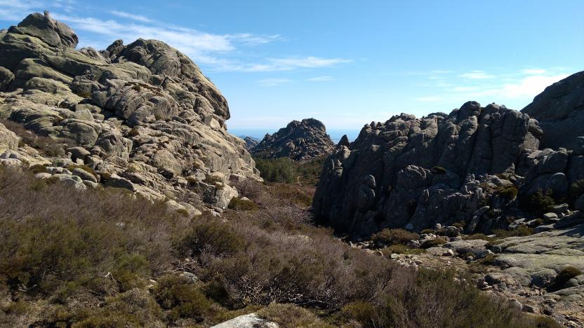
Sentiero Italia runs the length of the island’s eastern side, covering its most important mountains, in 28 stages.  Starting from the north: it flanks the Monte Limbara massif, crosses the limestones of Mont’Albo and Tuttavista, skirting the Gulf of Orosei, it crosses the Supramonte, Gennargentu and the Tacchi of Ogliastra and reaches Perdasdefogu.  Further south, it passes through Armungia and the Gerrei sub-region. Lastly, it touches on the villages of Burcei and San Gregorio, continuing on the Sette Fratelli massif to the old prisons of Castiadas.

General information on Sentiero Italia (Grand Italian Trail)

Sentiero Italia, or Grand Italian Trail, as also explained on the official website, is a walking route that crosses the whole of Italy, using mainly but not exclusively “registered trails”.   
In particular, in Sardinia, not all the stages of the Sentiero Italia of CAI (Italian Alpine Club) are made of trails already included in the registry of the Sardinia Trail Network (RES), either because they have not yet been tested and approved or simply because they cannot be registered as they do not meet the requirements.  However, as a whole, the Sentiero Italia is the single longest walking route currently crossing Sardinia from the north (S. Teresa Gallura, stage Z 1) to the south (Castiadas, end of stage Z 28), touching on the most fascinating mountain areas in central-eastern Sardinia: the plateau of Buddusò, Tepilora, the Cedrino river valley, the ancient forests of Montes, Perda Liana and the regional forest of Montarbu, Monte Genis, and lastly the regional forest of Settefratelli (among the many crossed by the various stages of this long hiking itinerary).

Information on this stage of the trail

The starting point is the village of Monti, near the Vermentino winery. After walking a little less than 2 km on a blacktop road, used by local traffic, a 2.3 km stretch on a livestock trail begins. From here the route is on a path, for about 1 km, to the Sos Sambinzos locality (in this stretch there are two fords on the rio Crasta), from where the trail will take you back to a livestock trail that will lead you, through private land (with stiles to pass over the boundary wall) to the Monte Olia regional forest. The forest is crossed by several tracks, which are used by the Forest Rangers also for wildfire control. In this stretch, you can deviate slightly from the route to stop at the ‘Pedra Bianca’ spring and the nearby hut, fairly comfortable and freely accessible, used by the staff of Fo.Re.S.T.A.S. 

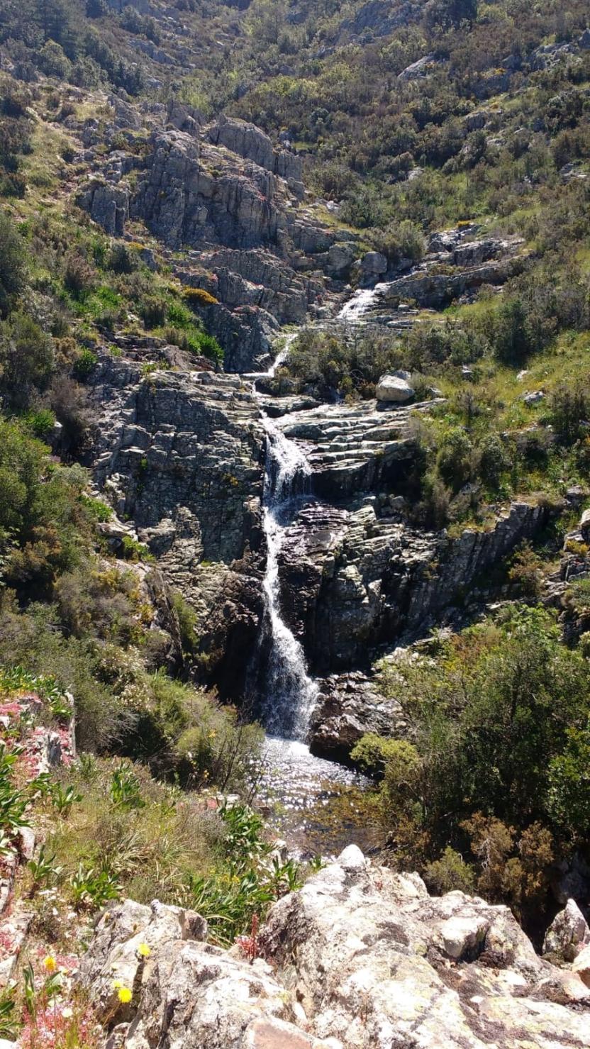
After retracing your steps back from the spring, to the main trail, continue on a dirt road towards the ford on the Seleme river.  Along its course, the river forms beautiful natural pools known as ‘Salomone’, some of which are near the ford. 

After crossing the river, the route climbs up a trail that follows a firebreak, and then continues on a dirt road to the ‘Bolostiu’ forest ranger station. If the Seleme river is impassable, you must head, within the regional forest, towards the forest ranger station of Monte Olia, bordering road SS 389, which connects Monti with Alà dei Sardi, and return to the path from the blacktop road heading to the village of Badde Suelzu.

Notes

The ford across the Seleme river can be challenging (it may be impassable in the winter months but you can take an alternative route via SS 389). 

At the Bolostiu stop point there is a station of the Fo.Re.S.T.A.S. Regional Agency.. At present, accommodation is not available but hikers can pitch their tent.

Lenght 15.600 m

SI Z06.gpx

Total elevation gain 818 metri

Geographical area Gallura