Nordic Walking
La camminata nordica o camminata con bastoni (in inglese nordic walking o pole walking) è attività fisica e sportiva che ben si coniuga con percorsi in bosco, in pianura o in vallate, lungo scogliere o spiagge. La Rete dei sentieri della Sardegna offre tantissime occasioni per cimentarsi nella camminata nordica...

Results
Pathways Galtelli - Orosei (B-200)
Sentiero Italia (Tappa Z11) Galtellì - Orosei
Overview of the itinerary
Sentiero Italia runs the length of the island’s eastern side, covering its most important mountains, in 28 stages. Starting from the north: it flanks the Monte Limbara massif, crosses the limestones of Mont’Albo and Tuttavista, skirting the Gulf of Orosei, it crosses the Supramonte, Gennargentu and the Tacchi of Ogliastra and reaches Perdasdefogu. Further south, it passes through Armungia and the Gerrei sub-region. Lastly, it touches on the villages of Burcei and San Gregorio, continuing on the Sette Fratelli massif to the old prisons of Castiadas.
General information on Sentiero Italia (Grand Italian Trail)
Sentiero Italia, or Grand Italian Trail, as also explained on the official website, is a walking route that crosses the whole of Italy, using mainly but not exclusively “registered trails”.
In particular, in Sardinia, not all the stages of the Sentiero Italia of CAI (Italian Alpine Club) are made of trails already included in the registry of the Sardinia Trail Network (RES), either because they have not yet been tested and approved or simply because they cannot be registered as they do not meet the requirements. However, as a whole, the Sentiero Italia is the single longest walking route currently crossing Sardinia from the north (S. Teresa Gallura, stage Z 1) to the south (Castiadas, end of stage Z 28), touching on the most fascinating mountain areas in central-eastern Sardinia: the plateau of Buddusò, Tepilora, the Cedrino river valley, the ancient forests of Montes, Perda Liana and the regional forest of Montarbu, Monte Genis, and lastly the regional forest of Settefratelli (among the many crossed by the various stages of this long hiking itinerary).
Information on this stage of the trail
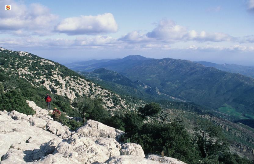
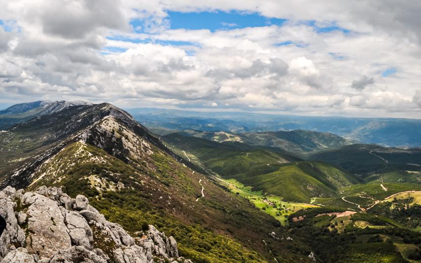
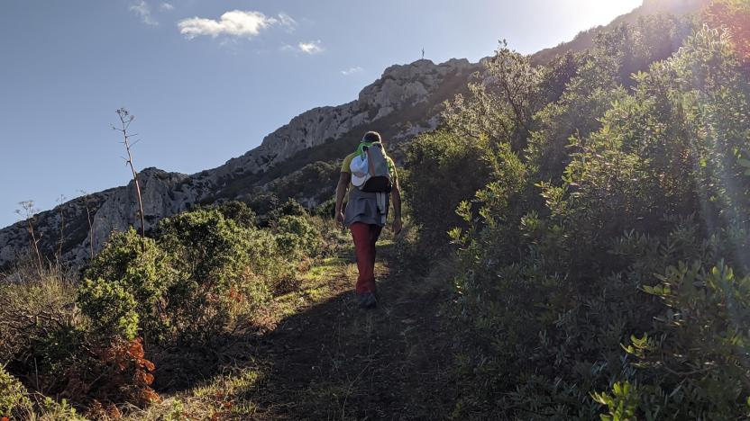
This is a medium-length but fairly challenging stage that connects the two towns on the plains by crossing Monte Tuttavista, which, after an initially gentle climb, reaches a height of 764 m near the Bronze Cross with stunning views over the plains below.
After about two km on an easy dirt road, you will arrive at the fire lookout, another impressive viewpoint over the coastline of Orosei. Next, head down towards Orosei, first along a relatively easy gully through the woods and then a rocky section known as Sa Fraicata with a steep slope.
Finally, you will reach the bottom of the valley on an easy dirt road that, passing by some disused lime kilns, will lead you to the bypass leading to Orosei and the Rimedio sanctuary at the entrance to the town.
Please note there are no water sources along the route.
Informazioni utili
Itinerary roadbook
Tipologia itinerario
- Log in to post comments
Photogallery
Sentiero Italia (Tappa Z11) Galtellì - Orosei
In sintesi
Il Sentiero Italia attraversa in lunghezza il settore orientale dell’isola toccandone i sistemi montuosi più rilevanti, in 28 tappe. Partendo da nord: tocca il massiccio del Monte Limbara, attraversa i calcari del Mont'Albo e del Tuttavista sfiorando il Golfo di Orosei, attraversa il Supramonte, il Gennargentu, i Tacchi dell’Ogliastra e giunge a Perdasdefogu. Più a sud, transita da Armungia e dalla subregione del Gerrei. Infine tocca l’abitato di Burcei e San Gregorio, per continuare nel massiccio dei Sette Fratelli fino alle vecchie carceri di Castiadas.
Informazioni generali sull'itinerario sentiero Italia
Il Sentiero Italia, come spiegato anche nel sito ufficiale, è un itinerario (o Cammino) lungo tutta l'Italia, che utilizza prevalentemente ma non esclusivamente "sentieri accatastati".
In particolare, in Sardegna, non tutte le tappe del Sentiero Italia del CAI coincidono con sentieri già inseriti nel catasto della Rete Escursionistica della Sardegna (RES), perché non hanno ancora superato le verifiche di percorribilità oppure semplicemente perché non possono essere accatastati non avendone i requisiti. Tuttavia, nel suo insieme, il Sentiero Italia rappresenta l'unica, la più grande dorsale escursionistica che attraversa attualmente la nostra Isola da nord (S. Teresa Gallura, tappa Z 1) a sud (Castiadas, fine tappa Z 28) toccando le aree montane della Sardegna centro-Orientale più affascinanti: l'altopiano di Buddusò, Tepilora, la valle del Cedrino, i boschi vetusti di Montes, Perda Liana e la foresta demaniale di Montarbu, il Monte Genis, e infine la foresta demaniale di Settefratelli (tra le tante attraversate dal lungo itinerario escursionistico a tappe).
Info sul percorso di questa tappa
Tappa di media lunghezza, ma abbastanza impegnativa, che collega i due centri di pianura superando il Monte Tuttavista che, dopo un avvicinamento iniziale in leggera pendenza, arriva ai 764 mt. in prossimità della grande croce del Cristo Bronzeo con notevole panorama della pianura sottostante.
Percorsi circa due km su comoda sterrata si arriva alla vedetta dell’antincendio, altro notevole punto panoramico su tutta la marina di Orosei. Si scende ora verso Orosei prima in un canale boscato relativamente facile e successivamente affrontare un tratto roccioso conosciuto come Sa Fraicata con notevole pendenza.
Si arriva, infine, al fondovalle su facile sterrata che, superati diversi forni di calce ormai in disuso, ci conduce alla nuova circonvallazione del centro abitato di Orosei e al santuario del Rimedio all’ingresso del paese.
Da segnalare l’assenza di acqua lungo il percorso.
Informazioni utili
Lungo il percorso non sarà sempre presente la copertura telefonica
Itinerary roadbook
Tipologia itinerario
- Log in to post comments
Photogallery
Contiene carte
Spento
Sentiero Italia (Stage Z10B) Norghio - Galtellì
Overview of the itinerary
Sentiero Italia runs the length of the island’s eastern side, covering its most important mountains, in 28 stages. Starting from the north: it flanks the Monte Limbara massif, crosses the limestones of Mont’Albo and Tuttavista, skirting the Gulf of Orosei, it crosses the Supramonte, Gennargentu and the Tacchi of Ogliastra and reaches Perdasdefogu. Further south, it passes through Armungia and the Gerrei sub-region. Lastly, it touches on the villages of Burcei and San Gregorio, continuing on the Sette Fratelli massif to the old prisons of Castiadas.
General information on Sentiero Italia (Grand Italian Trail)
Sentiero Italia, or Grand Italian Trail, as also explained on the official website, is a walking route that crosses the whole of Italy, using mainly but not exclusively “registered trails”.
In particular, in Sardinia, not all the stages of the Sentiero Italia of CAI (Italian Alpine Club) are made of trails already included in the registry of the Sardinia Trail Network (RES), either because they have not yet been tested and approved or simply because they cannot be registered as they do not meet the requirements. However, as a whole, the Sentiero Italia is the single longest walking route currently crossing Sardinia from the north (S. Teresa Gallura, stage Z 1) to the south (Castiadas, end of stage Z 28), touching on the most fascinating mountain areas in central-eastern Sardinia: the plateau of Buddusò, Tepilora, the Cedrino river valley, the ancient forests of Montes, Perda Liana and the regional forest of Montarbu, Monte Genis, and lastly the regional forest of Settefratelli (among the many crossed by the various stages of this long hiking itinerary).
Information on this stage of the trail
This stage is significantly less demanding than the previous Z 10A stage. It starts with a short stretch going back from Norghio to Janna (approx. 2.7 km). From this fork, a dirt road leads to the Abba Vritta ridge (754 m asl). The trail continues on the ridge to the col that separates it from Punta Su Grabbellu. When you reach point N40.46928° E9.61228°, leave the dirt road to your right (in a south-west direction) and, following the contour line towards the south-east, over rocks and through bushy vegetation, cross an area without a clear path (but easy to guess and very scenic) to reach the Tanarghè area N40.46456° E9.61046° where you will find a water fountain. Alternatively, you could stay on the dirt road to the Tanarghè area but with the landscape is not as beautiful.
From here, the route crosses the ancient settlement of Pontesu. Next, after passing a fence with a ladder and down a steep livestock trail, at about 740 m asl, you will join a forest track that links the southern and northern slopes of the mountain. Follow the entire forest track (about 6.2 km) going east to the bottom of the valley, which is crossed by a blacktop local road that leads to the town of Irgoli.
After passing through the village and before the bridge over provincial road SP 25, which crosses a tributary of the Cedrino river, follow the right bank to where it flows into the main river and then walk upstream along the true left bank to the bridge at the entrance of Galtellì.
An easy stage with limited elevation gain and gentle (apart from a short stretch) downhill stretches, mainly on dirt tracks and blacktop roads due to the proximity to small towns.
Informazioni utili
Tipologia itinerario
- Log in to post comments
Photogallery
Galtellì, castello di Pontes.jpg
Galtellì, panorama 2.jpg
Galtellì, casa delle Dame Pintor.jpg
Galtellì, Museo Etnografico Sa domo de Marras.jpg
Valle del cedrino (2).jpg
Irgoli, costume tradizionale femminile.jpg
Irgoli, scorcio del centro storico.jpg
Irgoli, santuario di Janna 'e Pruna.jpg
Galtellì, fiume Cedrino.jpg
Sentiero Italia (Tappa Z10B) Norghio - Galtellì
In sintesi
Il Sentiero Italia attraversa in lunghezza il settore orientale dell’isola toccandone i sistemi montuosi più rilevanti, in 28 tappe. Partendo da nord: tocca il massiccio del Monte Limbara, attraversa i calcari del Mont'Albo e del Tuttavista sfiorando il Golfo di Orosei, attraversa il Supramonte, il Gennargentu, i Tacchi dell’Ogliastra e giunge a Perdasdefogu. Più a sud, transita da Armungia e dalla subregione del Gerrei. Infine tocca l’abitato di Burcei e San Gregorio, per continuare nel massiccio dei Sette Fratelli fino alle vecchie carceri di Castiadas.
Informazioni generali sull'itinerario sentiero Italia
Il Sentiero Italia, come spiegato anche nel sito ufficiale, è un itinerario (o Cammino) lungo tutta l'Italia, che utilizza prevalentemente ma non esclusivamente "sentieri accatastati".
In particolare, in Sardegna, non tutte le tappe del Sentiero Italia del CAI coincidono con sentieri già inseriti nel catasto della Rete Escursionistica della Sardegna (RES), perché non hanno ancora superato le verifiche di percorribilità oppure semplicemente perché non possono essere accatastati non avendone i requisiti. Tuttavia, nel suo insieme, il Sentiero Italia rappresenta l'unica, la più grande dorsale escursionistica che attraversa attualmente la nostra Isola da nord (S. Teresa Gallura, tappa Z 1) a sud (Castiadas, fine tappa Z 28) toccando le aree montane della Sardegna centro-Orientale più affascinanti: l'altopiano di Buddusò, Tepilora, la valle del Cedrino, i boschi vetusti di Montes, Perda Liana e la foresta demaniale di Montarbu, il Monte Genis, e infine la foresta demaniale di Settefratelli (tra le tante attraversate dal lungo itinerario escursionistico a tappe).
Info sul percorso di questa tappa
Si tratta di una tappa decisamente meno impegnativa della precedente Z 10A, che prevede di ripercorrere un breve tratto, in senso inverso da Norghio a Janna (circa 2,7 Km). Da questo bivio, su sterrata carrabile si raggiunge la cresta di Abba Vritta (754 slm) e la si percorre fino alla sella che la separa da punta Su Grabbellu. Arrivati al punto N40.46928° E9.61228° si abbandona la pista sterrata alla n/s destra (in senso di marcia direzione Sud-Ovest) e seguendo la curva di livello, in direzione Sud-Est, su rocce e con vegetazione cespugliosa si attraversa una zona ancora priva di un evidente sentiero (ma facilmente intuibile e molto panoramico) per arrivare alla zona di Tanarghè N40.46456° E9.61046° dove di trova un abbeveratoio e acqua. In tutti i casi la pista sterrata porta alla zona di Tanarghè ma paesaggisticamente è meno interessante.
Proseguendo si attraversa gli antichi insediamenti di Pontesu da dove, superata una rete con scalandrino e disceso un tratturo in forte pendenza ci si innesta, a circa 740 slm, su una pista forestale che collega i versanti meridionale e settentrionale della montagna. Si percorre tutta la pista forestale (circa 6,2 Km) in direzione est fino al fondovalle attraversato da una strada comunale bitumata che porta al centro abitato di Irgoli.
Attraversato il paese e prima del ponte sulla SP 25, che supera un affluente del fiume Cedrino, si percorre l’argine destro fino alla sua confluenza sul fiume principale e lo si risale sull’orografica sinistra fino al ponte all’ingresso di Galtellì.
Tappa senza difficoltà con scarsi dislivelli in salita e abbastanza graduali (a parte un breve tratto) in discesa con prevalenza di percorsi su piste e strade bitumate dovute alla vicinanza dei centri abitati.
Informazioni utili
Lungo il percorso non sarà sempre presente la copertura telefonica
Tipologia itinerario
- Log in to post comments
Photogallery
Galtellì, castello di Pontes.jpg
Galtellì, panorama 2.jpg
Galtellì, casa delle Dame Pintor.jpg
Galtellì, Museo Etnografico Sa domo de Marras.jpg
Valle del cedrino (2).jpg
Irgoli, costume tradizionale femminile.jpg
Irgoli, scorcio del centro storico.jpg
Irgoli, santuario di Janna 'e Pruna.jpg
Galtellì, fiume Cedrino.jpg