Start website main content

Horse

48 pathways

Ippovia è un itinerario percorribile a cavallo, raramente asfaltato, che attraversa riserve naturali, boschi, colline e vallate, talvolta costeggiando corsi d'acqua e spiagge, attraversando evidenze storiche-culturali o borghi. L'ippovia consente la pratica dell'equiturismo ma può anche essere percorsa a piedi.  Lungo il percorso si prevedono tappe, distanti non più di 20 km, dove cavaliere e cavallo possano trovare assistenza, ristoro ed eventuale pernottamento...

Ippoturismo.png

Results

Burdoni - end of point D-203

Travelling along State Road 293 from Siliqua to Nuxis, about 13 km from Siliqua on the left is the start of trail 203 and a short distance away is the picnic area, in the "Burdoni" locality, in the territory of Siliqua. Here there is a well-equipped and comfortable picnic area.

How to get here

GPS Coordinates: Lat. 39° 12' 46.54", Long. 8° 47' 20.74 

A PIEDI (lungo il sentiero 203)

  • From Cagliari, arriving by car at the WWF visitor center: Follow the SS 195 towards Pula, turn after 12 km onto the consortium road (towards Macchiareddu) and take the second road west to continue until the rural church of S. Lucia. From here, follow the WWF signs until you reach the "Sa Canna" visitor center. At this point, it is not possible to continue by car, as the historic forest track that allowed access from the WWF to the splendid "Perdu Melis" guesthouse has been seriously damaged by recent, catastrophic floods of the Rio Guttureddu, which have literally destroyed two vehicle bridges and, in several places, the road surface itself, essential for reaching the destination. Therefore, the only option is to walk, backpack on, the entire old road for about 7 km to Perdu Melis, from where the original route of trail 203 begins. Along trail 203, Burdoni is over 20 km from Sa Canna. From the former P. Melis guesthouse (304 m a.s.l.), continue until the 203/204 junction which indicates route 203, with final destinations Barracca Sassa-Burdoni.
    The route begins with a comfortable dirt road that runs alongside the "Perdu Melis" Canal. On the left, you leave the 220A trail that leads back to the 220 and 217 trails, going respectively to Lattias and Sa Canna (Aroni sheepfold). After about 50 minutes of walking, turn left and follow a path (through the vegetation) that offers panoramic views in some sections. It is possible to observe the valley dominated by the Lattias peaks, with a continuous display of small waterfalls on the right. Continue uphill until S'Arcu Gennixedda (739 m above sea level). Proceeding further, descend towards a path that leads to the WWF refuge of Barracca Sassa on the Riu Camboni (340 m above sea level). Leaving the refuge, ascend to Punta Tintillu (664 m above sea level) where you can observe unique granite rocks in various shapes. At this point, the itinerary continues downhill, running alongside the Riu de sa Perda: it is quite possible to spot some deer. The path then turns into an easy forest track that, after Punta Su Suergiu (529 m above sea level), leads to the "Burdoni" area, in the territory of Siliqua. Here, there is a well-equipped and comfortable picnic area.
     
  • From Siliqua to Nuxis: a few minutes from the SS. 293 (Siliqua-Nuxis), at the start of trail 203, 13 km from Siliqua.


BY CAR

Traveling along State Road 293 from Siliqua to Nuxis, about 13 km from Siliqua on the left, you will find the start of trail 203. Nearby, but on the right side of the same state road, the entrance to the Campana Sissa forest area is also indicated.

Route location Burdoni

trekking - waypoint

Geographical area Gutturu Mannu

Burdoni - punto di arrivo D-203

Percorrendo la Strada Statale 293 da Siliqua a Nuxis, a circa 13 km da Siliqua sulla sinistra si trova l'imbocco del sentiero 203 e si trova a breve distanza l'area pic-nic, in località "Burdoni", agro di Siliqua.   Qui è presente un’attrezzata e comoda area pic-nic.

How to get here

​Coordinate GPS: Lat. 39° 12' 46.54", Long. 8° 47' 20.74"
 

A PIEDI (lungo il sentiero 203)

  • Da Cagliari, arrivando in automobile al centro visite WWF: seguire la Statale 195 per Pula, girare dopo 12 km per la dorsale consortile (in direzione Macchiareddu) e imboccare la seconda strada ovest per proseguire fino alla chiesa campestre di S. Lucia. Di qui seguire la segnaletica WWF fino ad arrivare al Centro visite di "Sa Canna". A questo punto, non è possibile proseguire in auto, poichè la storica pista forestale che dal WWF permetteva di raggiungere la splendida foresteria "Perdu Melis" è stata seriamente danneggiata da recenti, catastrofiche alluvioni del rio Guttureddu, che hanno letteralmente distrutto due ponti carrabili e in diversi punti lo stesso piano stradale, fondamentali per raggiungere la destinazione. Dunque non resta che percorrere, zaino in spalla, tutta la vecchia strada per circa 7 km sino a Perdu Melis, da cui poi parte l'originario tracciato del sentiero 203.  Lungo il sentiero 203 Burdoni dista oltre 20 km da Sa Canna. Dalla ex-foresteria P. Melis (304 m s.l.m.),  si proseguirà fino all'incrocio 203/204 che indica il percorso 203, con mete finali Barracca Sassa-Burdoni. 
    Il percorso inizia con una comoda carrareccia che costeggia il Canale "Perdu Melis", si lascia sulla sinistra il sentiero 220A che riporta al 220 e al 217, diretti rispettivamente al Lattias e a Sa Canna (stazzu Aroni). Dopo circa 50 minuti di cammino si gira a sinistra e si percorre un sentiero (in mezzo alla vegetazione) che in alcuni tratti presenta punti panoramici. È possibile osservare la vallata dominata dalle guglie del Lattias, in un continuo trionfo di cascatelle sulla destra. Si prosegue - a salire - fino a S'Arcu Gennixedda (739 m s.l.s.). Procedendo si scende verso un sentiero che porta al rifugio WWF di Barracca Sassa sul Riu Camboni (340 m s.l.s.). Lasciato il rifugio si risale fino alla località Punta Tintillu (664 m s.l.s.) dove è possibile osservare particolari rocce granitiche, dalle forme più svariate. L’itinerario a questo punto prosegue in discesa costeggiando il Riu de sa Perda: non sarà improbabile osservare qualche esemplare di cervo. Il sentiero si trasforma poi in un’agevole pista forestale che dopo Punta Su Suergiu (529 m s.l.s.) conduce alla località "Burdoni", in agro di Siliqua. Qui è presente un’attrezzata e comoda area pic-nic.
     
  • Da Siliqua-Nuxis: a pochi minuti dalla SS. 293 (Siliqua-Nuxis), all'imbocco del sentiero 203, a 13 km da Siliqua.


IN AUTO

Percorrendo la Strada Statale 293 da Siliqua a Nuxis, a circa 13 km da Siliqua sulla sinistra si trova l'imbocco del sentiero 203.  Nei pressi, ma sulla destra rispetto alla stessa strada statale, è indicato anche l'ingresso per l'area forestale di Campana Sissa

Route location Burdoni

trekking - waypoint

Geographical area Gutturu Mannu

S'Arcugennixedda

Punto panoramico posto a 739 m. sul livello del mare.

How to get here

Da Cagliari, in automobile, seguire la Statale 195 per Pula, girare dopo 12 km per la dorsale consortile (in direzione Macchiareddu) e imboccare la seconda strada ovest per proseguire fino alla chiesa campestre di S. Lucia. Di qui seguire la segnaletica WWF fino ad arrivare al Centro visite di "Sa Canna"; proseguire nella strada bianca - per circa 6 km - verso la Foresteria di P. Melis (304 m s.l.m.). Dopo avere parcheggiato la vettura nell’area antistante alla foresteria, si prosegue fino all'incrocio che indica (sulla destra) il percorso 203, itinerario molto impegnativo, consigliato a persone allenate poiché la percorrenza totale del sentiero è di 5 ore con pendenze impegnative. Risulta essenziale portare con sé una buona riserva d'acqua. Il percorso inizia con una comoda carrareccia che costeggia il Canale "Perdu Melis", si lasciano sulla sinistra i sentieri 217 e 205. Dopo circa 50 minuti di cammino si gira a sinistra e si percorre un sentiero (in mezzo alla vegetazione) che in alcuni tratti presenta punti panoramici. È possibile osservare la vallata. Si prosegue - a salire - fino a S'Arcugennixedda (739 m s.l.s.).

Route location S'arcugennixedda

Geographical area Gutturu Mannu

Gutturu Mannu - Gambarussa Barracks

The Gutturu Mannu State-owned Forest is located in the southern part of the province of Cagliari.

The entire forest is included in the proposed Sulcis Natural Park under Regional Law 31/89 as it is the 'Extensive western area of the Sardinian deer. Paleozoic granite massifs with a tormented morphology with valleys alternating with plateaus. Peaks rising above a thousand meters. 
Very rich in holm oak woods with frequent yews and hollies in the most remote ravines; cork oaks, strawberry trees, arborescent mock privets and lentisks. Mediterranean scrub with heather and arborescent strawberry trees. Important from a faunal point of view for the seasonal migrations of the Sardinian deer and wild boar. Also present are the fox, the Sardinian wild cat, the marten, the woodcock, the 1 stock dove and red woodpeckers. Doubtful presence of the fallow deer. Mining settlements (Pantaleo) and archaeological sites and ancient agricultural culture settlements.

Furthermore, it falls within the Site of Community Importance (SIC) I.T.B. 001105 – ‘Monte Arcosu Forest’ for approximately 70% of its surface area and for a large part of its surface within the ‘Gutturu Mannu - Monte Arcosu’ Permanent Wildlife Protection Oasis as per decrees No. 102 of 20.07.78 and No. 1240 of 15.11.88.
 

Links

How to get here

It can be accessed from the town of Santadi or from Cagliari, by taking the S.P. Macchiareddu-Santadi road which divides the forest complex into two parts. The forest is also connected to the F.D. Tamara Tiricu and Pantaleo to the west and to the F.D. Is Cannoneris and F.D. Monte Nieddu to the south. 

Route location Gutturu Mannu

Fabbricati/case forestali

Geographical area Gutturu Mannu

Gutturu Mannu - Caserma Gambarussa

La Foresta Demaniale di Gutturu Mannu è situata nella parte sud della provincia di Cagliari. 
L'intera foresta è compresa nella proposta di Parco naturale del Sulcis ai sensi della L.R. 31/89 in quanto ‘Esteso areale occidentale del cervo sardo. Massicci granitici del Paleozoico dalla tormentata morfologia con valloni alternati a pianori. Vette elevate oltre i mille metri. Ricchissimo di boschi di lecci con frequenza di tassi e agrifogli negli anfratti più remoti; sughere, corbezzoli, filliree arborescenti e lentischi. Macchia mediterranea con erica e corbezzolo arborescente. Importante sotto l’aspetto faunistico per le migrazioni stagionali del cervo sardo e del cinghiale. Presenti anche la volpe, il gatto selvatico sardo, la martora, la beccaccia, il colombaccio e picchi rossi. Dubbia presenza del daino. Insediamenti minerari (Pantaleo) e insediamenti archeologici e di antica cultura contadina’. 
Inoltre ricade nell’area S.I.C. I.T.B. 001105 –‘Foresta di Monte Arcosu’ per circa il 70% della sua superficie e per gran parte della sua superficie nell’ Oasi permanente di protezione faunistica ‘Gutturu Mannu - Monte Arcosu’ come da decreti n°102 del 20.07.78 e n°1240 del 15.11.88. 
 

Links

How to get here

Vi si accede dal centro abitato di Santadi o da Cagliari, percorrendo la strada S.P. Macchiareddu-Santadi che divide in due parti il complesso forestale. La foresta è inoltre collegata con la F.D. Tamara Tiricu e Pantaleo ad ovest e con la F.D. Is Cannoneris e F.D. Monte Nieddu a sud. 
 

Route location Gutturu Mannu

Fabbricati/case forestali

Geographical area Gutturu Mannu

Gambarussa Pantry - starting point D-206

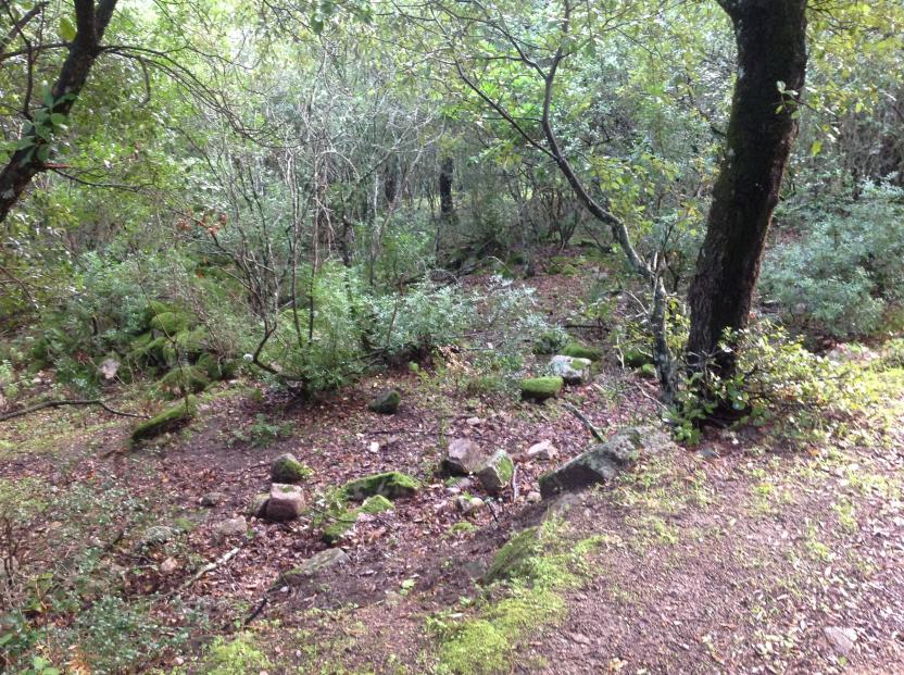
The trail begins in the valley floor on the gravel bed of the Riu Bidda Mores. The path, quite wide, is sometimes disrupted by past floods, and one can clearly perceive that it was once a wide cart track. Near some wild olive trees on the right, the remains of a sheepfold can be observed. Continue along the valley floor, gradually beginning to ascend while keeping the Tuvus Canal on the left.

How to get here

It can be accessed from the town of Santadi or from Cagliari, by taking the S.P. Macchiareddu-Santadi road which divides the forest complex into two parts. The forest is also connected to the Tamara Tiricu and Pantaleo State Forest to the west and to the Is Cannoneris and Monte Nieddu State Forest to the south.

Route location Gutturu Mannu

Sentieristica (punti di snodo)

Geographical area Gutturu Mannu

Dispensa Gambarussa - punto di partenza D-206

Si imbocca il fondovalle sul greto del riu Bidda Mores. il sentiero, pittosto largo, è talvolta sconvolto dalle alluvioni passate e si percepisce bene quanto in realtà si trattasse di un’ampia carreggiabile. Presso alcuni olivastri sulla destra si osservano i resti di un ovile. Si prosegue sul fondovalle, cominciando a salire gradualmente e tenendo sulla sinistra il Canale Tuvus.

How to get here

Vi si accede dal centro abitato di Santadi o da Cagliari, percorrendo la strada S.P. Macchiareddu-Santadi che divide in due parti il complesso forestale. La foresta è inoltre collegata con la F.D. Tamara Tiricu e Pantaleo ad ovest e con la F.D. Is Cannoneris e F.D. Monte Nieddu a sud. 

Route location Gutturu Mannu

Sentieristica (punti di snodo)

Geographical area Gutturu Mannu