Horse
Ippovia è un itinerario percorribile a cavallo, raramente asfaltato, che attraversa riserve naturali, boschi, colline e vallate, talvolta costeggiando corsi d'acqua e spiagge, attraversando evidenze storiche-culturali o borghi. L'ippovia consente la pratica dell'equiturismo ma può anche essere percorsa a piedi. Lungo il percorso si prevedono tappe, distanti non più di 20 km, dove cavaliere e cavallo possano trovare assistenza, ristoro ed eventuale pernottamento...

Results
Pathways Galtelli - Orosei (B-200)
Sentiero Italia (Tappa Z11) Galtellì - Orosei
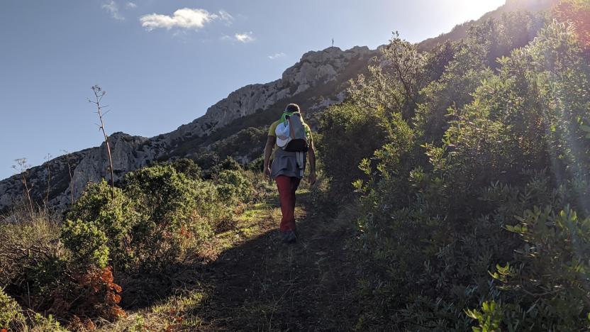
Overview of the itinerary
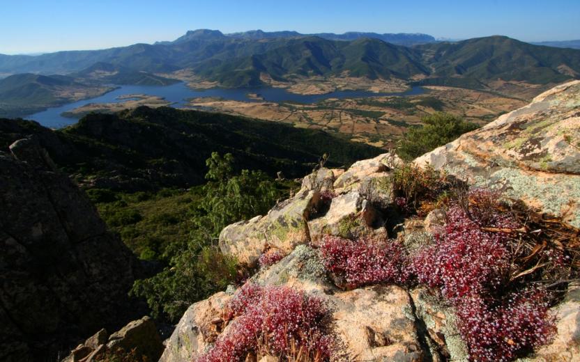
Sentiero Italia runs the length of the island’s eastern side, covering its most important mountains, in 28 stages. Starting from the north: it flanks the Monte Limbara massif, crosses the limestones of Mont’Albo and Tuttavista, skirting the Gulf of Orosei, it crosses the Supramonte, Gennargentu and the Tacchi of Ogliastra and reaches Perdasdefogu. Further south, it passes through Armungia and the Gerrei sub-region. Lastly, it touches on the villages of Burcei and San Gregorio, continuing on the Sette Fratelli massif to the old prisons of Castiadas.
General information on Sentiero Italia (Grand Italian Trail)
Sentiero Italia, or Grand Italian Trail, as also explained on the official website, is a walking route that crosses the whole of Italy, using mainly but not exclusively “registered trails”.
In particular, in Sardinia, not all the stages of the Sentiero Italia of CAI (Italian Alpine Club) are made of trails already included in the registry of the Sardinia Trail Network (RES), either because they have not yet been tested and approved or simply because they cannot be registered as they do not meet the requirements. However, as a whole, the Sentiero Italia is the single longest walking route currently crossing Sardinia from the north (S. Teresa Gallura, stage Z 1) to the south (Castiadas, end of stage Z 28), touching on the most fascinating mountain areas in central-eastern Sardinia: the plateau of Buddusò, Tepilora, the Cedrino river valley, the ancient forests of Montes, Perda Liana and the regional forest of Montarbu, Monte Genis, and lastly the regional forest of Settefratelli (among the many crossed by the various stages of this long hiking itinerary).
Information on this stage of the trail
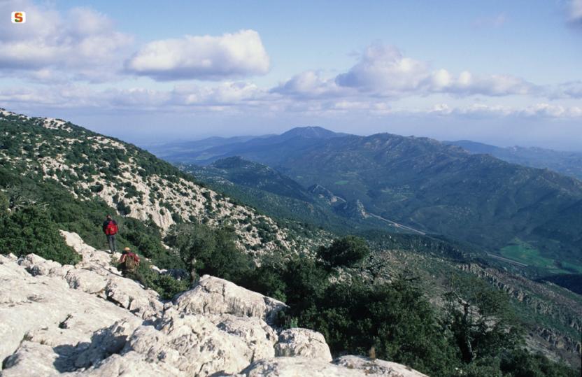
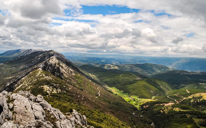
This is a medium-length but fairly challenging stage that connects the two towns on the plains by crossing Monte Tuttavista, which, after an initially gentle climb, reaches a height of 764 m near the Bronze Cross with stunning views over the plains below.
After about two km on an easy dirt road, you will arrive at the fire lookout, another impressive viewpoint over the coastline of Orosei. Next, head down towards Orosei, first along a relatively easy gully through the woods and then a rocky section known as Sa Fraicata with a steep slope.
Finally, you will reach the bottom of the valley on an easy dirt road that, passing by some disused lime kilns, will lead you to the bypass leading to Orosei and the Rimedio sanctuary at the entrance to the town.
Please note there are no water sources along the route.
Informazioni utili
Itinerary roadbook
Tipologia itinerario
- Log in to post comments
Photogallery
Sentiero Italia (Tappa Z11) Galtellì - Orosei
In sintesi
Il Sentiero Italia attraversa in lunghezza il settore orientale dell’isola toccandone i sistemi montuosi più rilevanti, in 28 tappe. Partendo da nord: tocca il massiccio del Monte Limbara, attraversa i calcari del Mont'Albo e del Tuttavista sfiorando il Golfo di Orosei, attraversa il Supramonte, il Gennargentu, i Tacchi dell’Ogliastra e giunge a Perdasdefogu. Più a sud, transita da Armungia e dalla subregione del Gerrei. Infine tocca l’abitato di Burcei e San Gregorio, per continuare nel massiccio dei Sette Fratelli fino alle vecchie carceri di Castiadas.
Informazioni generali sull'itinerario sentiero Italia
Il Sentiero Italia, come spiegato anche nel sito ufficiale, è un itinerario (o Cammino) lungo tutta l'Italia, che utilizza prevalentemente ma non esclusivamente "sentieri accatastati".
In particolare, in Sardegna, non tutte le tappe del Sentiero Italia del CAI coincidono con sentieri già inseriti nel catasto della Rete Escursionistica della Sardegna (RES), perché non hanno ancora superato le verifiche di percorribilità oppure semplicemente perché non possono essere accatastati non avendone i requisiti. Tuttavia, nel suo insieme, il Sentiero Italia rappresenta l'unica, la più grande dorsale escursionistica che attraversa attualmente la nostra Isola da nord (S. Teresa Gallura, tappa Z 1) a sud (Castiadas, fine tappa Z 28) toccando le aree montane della Sardegna centro-Orientale più affascinanti: l'altopiano di Buddusò, Tepilora, la valle del Cedrino, i boschi vetusti di Montes, Perda Liana e la foresta demaniale di Montarbu, il Monte Genis, e infine la foresta demaniale di Settefratelli (tra le tante attraversate dal lungo itinerario escursionistico a tappe).
Info sul percorso di questa tappa
Tappa di media lunghezza, ma abbastanza impegnativa, che collega i due centri di pianura superando il Monte Tuttavista che, dopo un avvicinamento iniziale in leggera pendenza, arriva ai 764 mt. in prossimità della grande croce del Cristo Bronzeo con notevole panorama della pianura sottostante.
Percorsi circa due km su comoda sterrata si arriva alla vedetta dell’antincendio, altro notevole punto panoramico su tutta la marina di Orosei. Si scende ora verso Orosei prima in un canale boscato relativamente facile e successivamente affrontare un tratto roccioso conosciuto come Sa Fraicata con notevole pendenza.
Si arriva, infine, al fondovalle su facile sterrata che, superati diversi forni di calce ormai in disuso, ci conduce alla nuova circonvallazione del centro abitato di Orosei e al santuario del Rimedio all’ingresso del paese.
Da segnalare l’assenza di acqua lungo il percorso.
Informazioni utili
Lungo il percorso non sarà sempre presente la copertura telefonica
Itinerary roadbook
Tipologia itinerario
- Log in to post comments
Photogallery
Contiene carte
Spento