Monteleone Rocca Doria - Romana (Trail E 205)
Image credits Sardegna Digital Library
The pathway
Roadbook
You start from the center of Monteleone Roccadoria, following the signs that quickly lead to the northeastern part of the village, near the Binza 'e Susu spring, where an ancient and important washhouse once stood. The site is reached by a gentle descent into the area that once hosted the walls of the Doria castle. Near the washhouse, which is fed by a karst spring, is also the junction with trail 205A.
You descend along an ancient path immersed among the abandoned gardens of the village, where vegetation is rapidly reclaiming space. Among dry stone walls and small rocky outcrops, you come to a fork beneath a large downy oak and take the right-hand path, then plunge into the woods: the ancient trail is partially damaged but still visible, and you pass by a large limestone block eroded from above, where a rock-hewn wine press can be recognized.
The ancient path emerges into a grassy area and ends abruptly at the roadside embankment leading to the dam, which has interrupted its original course. The Temo Valley is now near, and on the left, the structure of the barrier that forms the lake of the same name can be seen.
You descend steeply to the road, then turn right and follow it for a few hundred meters before leaving it after the water treatment plant on the left, passing through a blue gate. In this area, there are signs informing hikers of the behavior to follow in case the sluice gates are opened. In fact, you are downstream of the reservoir, and it is important to carefully follow the instructions posted on the notices.
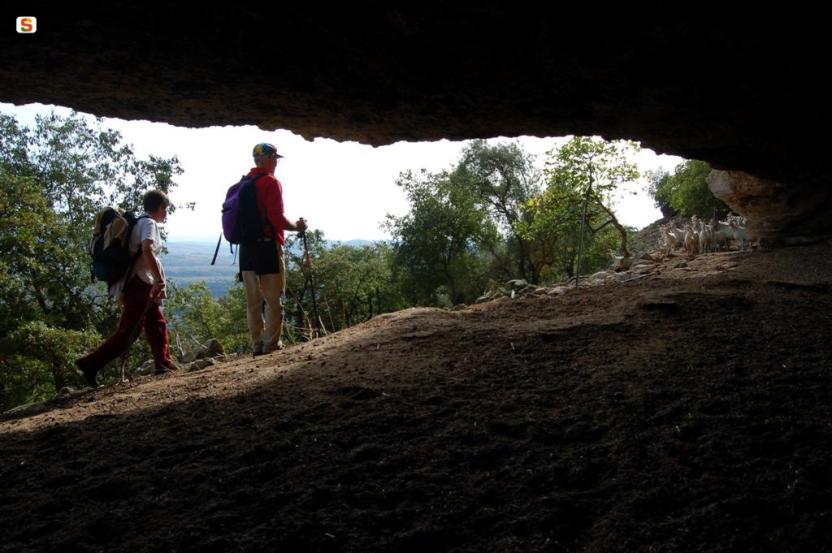
After passing through the gate, continue along a road that crosses the dry riverbed of the Temo, climbing up to a pumping station. From here, follow the ridge that ascends steeply toward the Monte Airadu hill, which dominates the area to the north. The trail is faint and follows the tracks left by livestock.
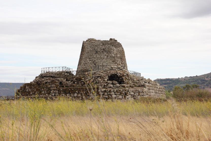
At an altitude of 255 meters, a true gem reveals itself to the left of the trail: the domus de janas of Monte Airadu. It is a small funerary chamber richly decorated, one of the finest examples of Neolithic funerary art, a worthy representative of the wonders that have made the ancient necropolises of the Proto-Sardinians famous throughout this area of Sardinia.
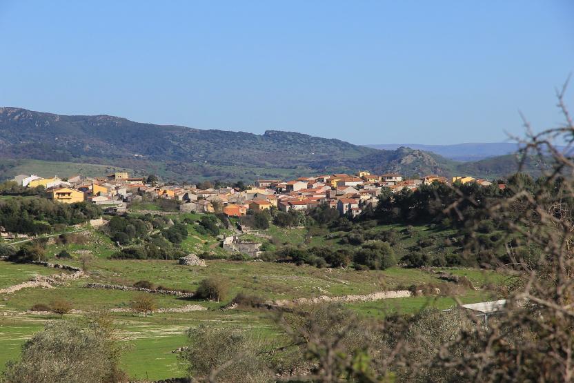
After passing the tomb, take a slight right, skirting a pumping station and continuing again on a dirt road with a gentle uphill slope until reaching a gate, where you come across a rural access road. Follow it to the left, slightly uphill for a few dozen meters, then leave it again to the right for a beautiful and ancient cart track that leads into the countryside. In the direction of travel, beyond the valley furrow marked on the map as Riu S. Lussurgiu, the last houses of Romana can be seen.
You descend along the ancient road, and on the walking surface, made of soft marl rock, the grooves left by carts that passed through here for centuries can still be seen. The beautiful cart track leads to a ford where the remains of a now-ruined bridge can be recognized: a large pool of water sometimes makes the crossing inconvenient, and in that case, one must climb slightly uphill for a few dozen meters, or be prepared to remove shoes and pants to continue. In case of heavy rain, the passage may become impassable.
After crossing the ford, the path climbs again along the beautiful and ancient cart track, which made a wide hairpin turn, supported on the downhill side by an ingenious dry-stone embankment. You are now close to Romana, and the ascent ends on a paved road which, if followed in the same direction, quickly leads to the town center. From the northern outskirts of Romana, you can also reconnect with trails 201 and 203, thus continuing your journey.
Trail data and altimetry

Download trail documentation
Related pathways
Skip Pathways slider and jump to the next section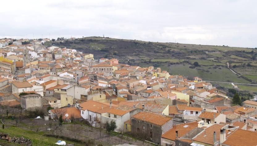
Pathways Romana - Torralba (E 201)
Pathways Romana - Cossoine (E 202)
Pathways Cava S. Antonio - Sa Funtana (Trail E 205A)
Points of interest
Skip POI slider and jump to the next section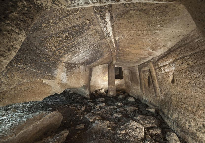
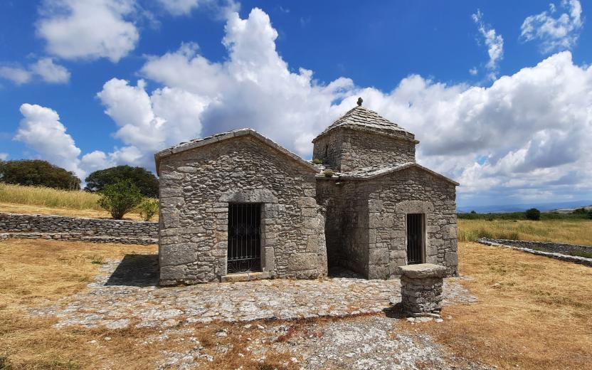
Points of interest Domus de Janas of Monte Airadu
Opinions
No reviews yet for this path
