The route was created as part of a collaboration between the GAL Ogliastra and the FoReSTAS Agency, with the aim of offering hikers an immersive experience in the natural and scenic beauty of the Ogliastra area. The itinerary features points of interest along every section. You can choose your starting stage and build your own customized route, traveling from north to south or from south to north. The direction of travel may change, but the quality of the landscape remains unchanged.
The territory
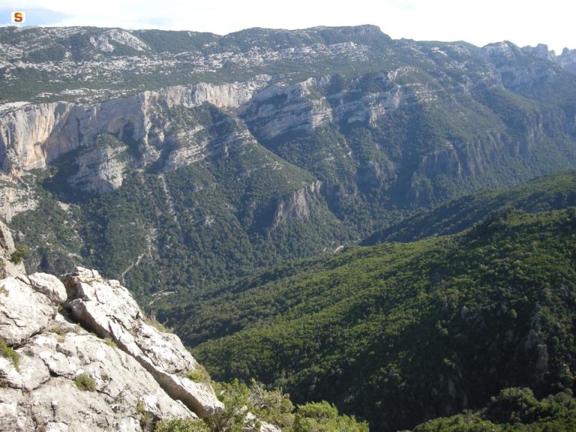
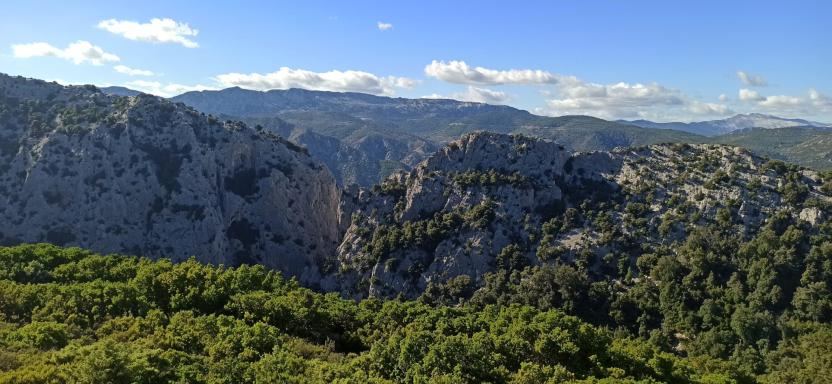
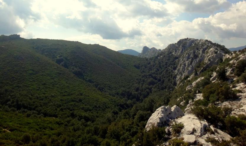
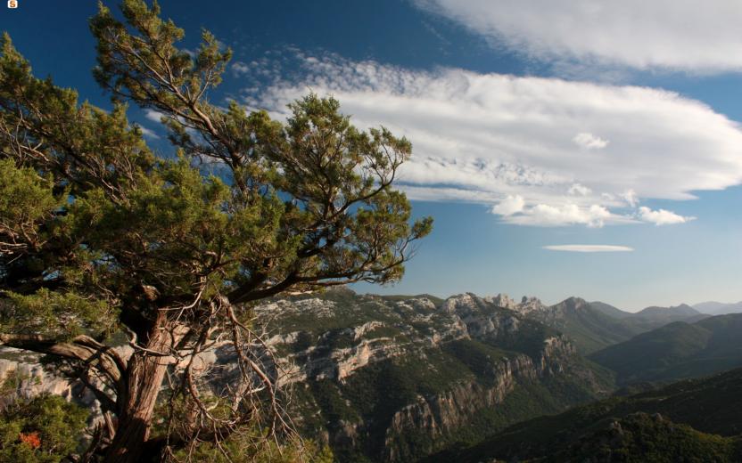
This stretch of the trail crosses the Supramonte of Urzulei and Baunei, a landscape of remote plateaus, deep gorges, and sheer cliffs plunging toward the sea. It’s a region where the limestone terrain has carved out grand and dramatic features: sinkholes, canyons, dry riverbeds (codule), and rocky spires alternate with ancient forests and hidden corners, where human presence is subtle and ancient. Here, biodiversity is remarkable, and the environment retains a rare authenticity—between archaeological sites and traditional shepherd huts, deep silences and breathtaking views over the Mediterranean.
The path
These final stages lead from the heart of the eastern Supramonte to the sea, crossing some of the most spectacular and pristine landscapes in Sardinia.
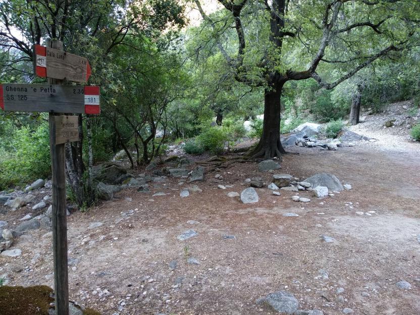
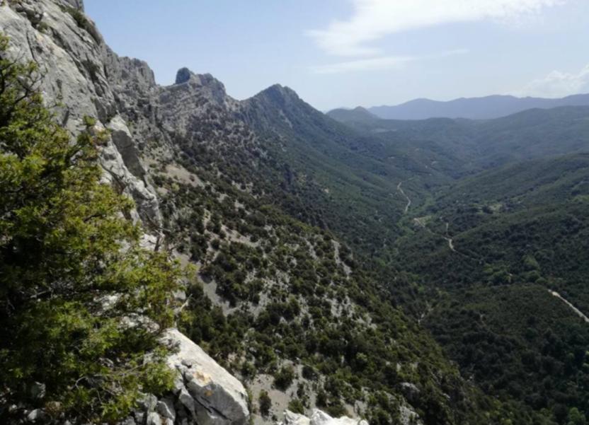
The route begins in the Supramonte of Urzulei, winding through panoramic ridges, sinkholes, and ancient forests, with the chance to visit the famous Gorropu Canyon or, for more experienced hikers, to take a detour to the scenic Punta Cucuttos. From here, descending, you reach the Ghenna Silana pass, which overlooks the coastal Supramonte, shared by the territories of Baunei, Dorgali, and Urzulei. Before continuing, it’s highly recommended to pause and explore some of the area’s natural wonders: Cala Goloritzé, Cala Sisine, and Cala Biriala. The trail resumes through pine and holm oak woods, crossing the Natural Pools of Mamutorco (23) and climbing toward Genna Salbene, in a striking landscape of granite outcrops and wide-open views.
The final stage—one of the most thrilling of the entire route—descends from the Silana pass to the beach of Cala Luna, following the 20 km canyon of Codula Elune (15). Along the way, hikers will encounter the Nuragic village of Or Murales (13), ancient shepherd huts, and dramatic limestone gorges shaped by time. Reaching the sea is a spectacular finale, framed by oleanders, caves, and towering cliffs above the deep blue of the Mediterranean.
From Genna Salbene to Cala Luna
A long and demanding stage, connecting to the Codula Elune, already partially travelled in the segment between Ghenna Silana and Cala Luna.
An alternative intermediate variant is also available, useful for avoiding the most exposed section and for enjoying panoramic views of the codula right from the start.
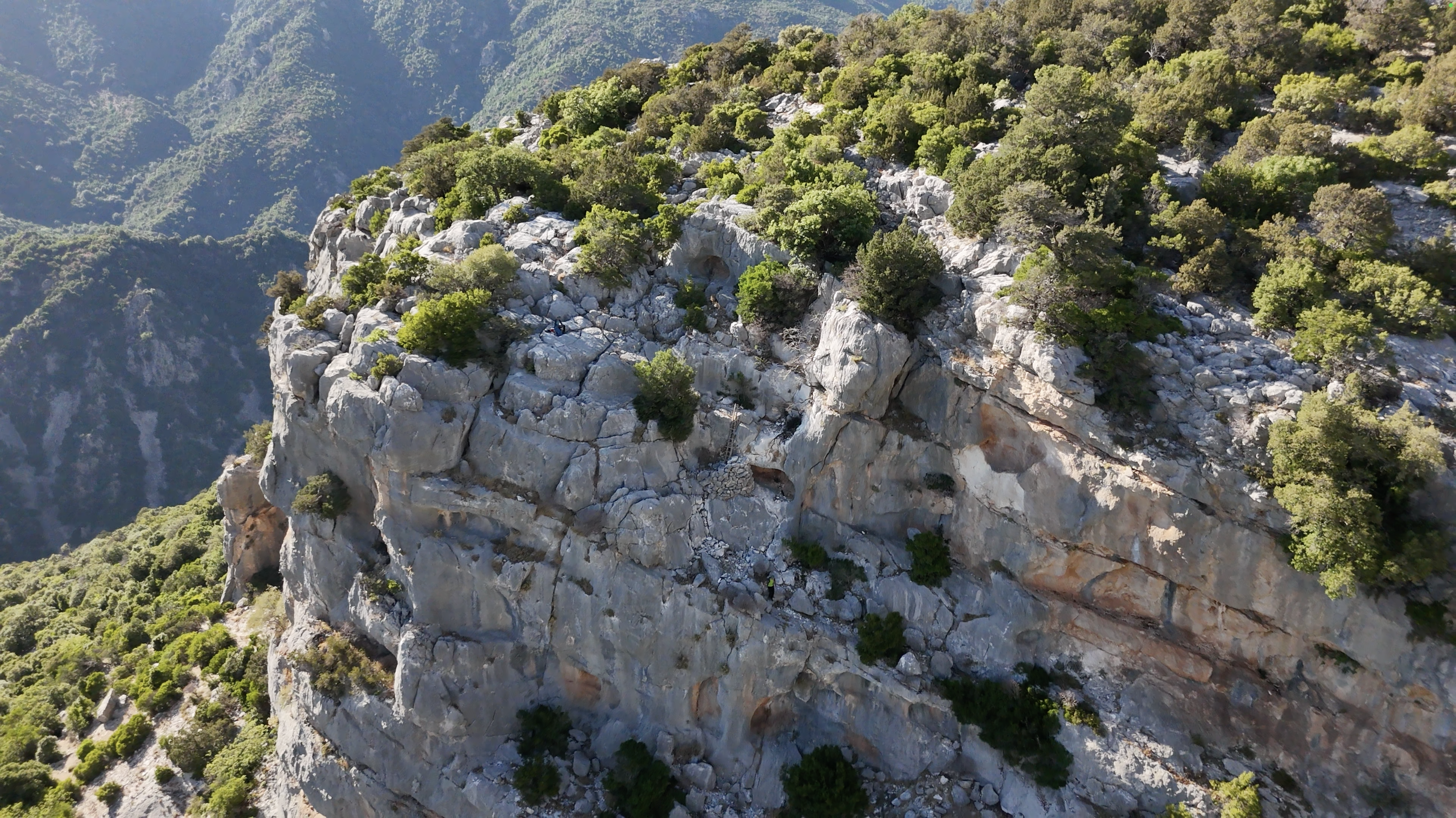
The route begins on the Marghine plateau, on the border between Baunei and Urzulei, crossing a partially marshy area that was once used for the free-range grazing of pigs, sheep, and cattle. Upon reaching the base of the majestic Monte Oseli—an imposing dolomitic bastion marking the beginning of the roughly 20 km of the Codula Elune—the trail continues along the eastern slopes of Monte Oseli and S’Atta Ostinu. From here, it reaches Gorropu de Ghirofai, a small canyon overlooking the codula, also known as Gorropeddu.
The path continues toward Genna ‘e Cuccureddu, a panoramic viewpoint over the Esone plateau, which gives access to the western side of the codula. Beforereaching the Ghirofai sheepfold, hikers face S’Iscalone de Ghirofai, a technical but not excessively difficult passage equipped with traditional juniper trunks installed by the shepherd-climbers of the Supramonte. This is the only exposed section of the trail. From here, the descent becomes gentler and more scenic, passing through Teletottes and following the riverbed all the way to Cala Luna.
The intermediate variant allows hikers to avoid the exposed section at S’Iscalone de Ghirofai and offers spectacular views of the Codula Elune from the very beginning.
After reaching the base of Monte Oseli, at the point known as Su Runcu ‘e sa Preita, a left turn bypasses the massif from the west. After about one kilometer on a paved road, a technical path begins, crossing scree slopes and old landslides—typical of the dolomitic cliffs in this area.
Though rugged and demanding, this territory was inhabited for much of the 20th century by families who, through intelligence and adaptation, practiced agriculture and pastoralism in harmony with the environment, ensuring a continuous and sustainable presence.
The trail then leads to Iscalone Orrubiu, another passage aided by juniper trunks. Though less technical than the previous one, it is highly panoramic and allows access to the opposite side of the codula, where it rejoins the main trail near the Ghirofai sheepfold.