Accessible trails
Sentieri per tutti...in questa categoria rientrano i sentieri progettati o riadattati perchè il contatto con l'ambiente naturale sia sempre di stimolo al miglioramento della vita personale di chiunque, con attenzione alle condizioni di disabilità motoria, sensoriale o della sfera psichica e relazionale...

Image credits Sardegna Digital Library Regione Sardegna
Results
Pathways S.P.26 al km 4 - Suttaterra (B 163)

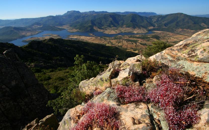
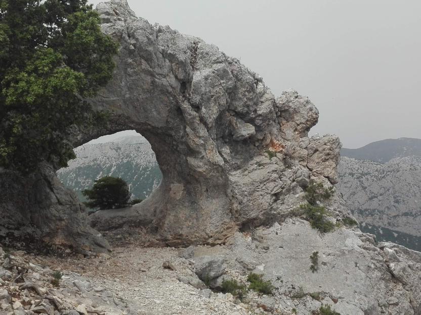
CMSB – STAGE 11 - FROM MONTI MANNU TO ARENAS
From a naturalistic and landscape point of view, this is one of the most striking stages of the Trail, thanks to the extraordinary beauty of the granite reliefs of Piscina Irgas that were modelled by watercourses.
The holm oak woods, the Mediterranean scrub and the various mining excavations along the way are also fascinating.
This route is not very challenging because of the length, but because of the elevation gains that you need to overcome.
Safety and useful tips
Along the way, you will find a series of fords: the first is on the Rio Cannisoni before the steep climb along the path leading to the waterfalls of Piscinas Irgas; after the downhill from the waterfall viewpoint, you have to cross the Rio Oriddano less than three times; finally, you have to ford the Canal of Perdu Marras.
When you reach the viewpoint on the waterfalls of Piscinas Irgas, it is advisable to stay on the path without venturing into the gorge that houses the basin into which the waterfalls pour. As a matter of fact, this deviation is very challenging, because it proceeds along a poorly defined and very steep path which, if taken, must be tackled both downhill to reach the reservoir and uphill to resume the route.
In Arenas, you will see some ruined mining buildings; avoid crossing any fences and/or venturing inside them, but always admire them from a distance without leaving the Trail.
The stage runs through an isolated territory, therefore it is good practice to communicate the departure from Monti Mannu and the arrival in Arenas (in Arenas the phone connection will work in elevated areas and in particular near the buildings of the old Genne Carru Mine, which you will encounter at the beginning of the next stage). It is therefore advisable to download the offline version of the stage track.
Informazioni utili
The stage presents a high difficulty especially due to the differences in altitude encountered. The route has a length of 15.6 km, which can be done in 5 hours and 30 minutes and has an uphill difference in height of 912 m and a downhill difference of 667 m.
FOR UPDATED INFORMATION, CONSULT THE STAGE SHEET ON THE OFFICIAL WEBSITE
Tipologia itinerario
- Log in to post comments
Links
Photogallery
CMSB – TAPPA 11: DA MONTI MANNU A ARENAS
Grazie alla straordinaria bellezza dei rilievi granitici di Piscina Irgas che sono stati modellati dai corsi d’acqua nel corso dei secoli, questa è, dal punto di vista naturalistico e paesaggistico, sicuramente una delle tappe più suggestive del Cammino.
Di grande fascino anche le foreste di lecci, la macchia mediterranea e i numerosi scavi minerari che si incontrano lungo il percorso.
Il percorso è da considerarsi impegnativo non tanto per la lunghezza, quanto per i dislivelli che occorre superare.
Informazioni utili
La tappa presenta una difficoltà alta soprattutto a causa dei dislivelli incontrati. Il percorso ha una lunghezza di 15,6 km, percorribili in 5 ore e 30 minuti e un dislivello in salita di 912 m e in discesa di 667 m.
PER LE INFORMAZIONI AGGIORNATE, CONSULTA LA SCHEDA DELLA TAPPA, SUL SITO UFFICIALE
Il Cammino Minerario di Santa Barbara
Si tratta del primo, tra i cammini sardi, ad essere stato iscritto al registro istituito dalla Regione Sarda nel 2012 con DGR48/9 ("Registro dei cammini di Sardegna, degli itinerari religiosi e dello spirito"). Attualmente è gestito dall'omonima Fondazione.
LA STORIA DEL PROGETTO
L’idea di costruire un itinerario nell’area più estesa e rappresentativa del Parco Geominerario Storico Ambientale della Sardegna, il Sulcis-Iglesiente-Guspinese, riscoprendo gli antichi cammini minerari oggi in gran parte abbandonati, è nata dai volontari dell’Associazione ONLUS Pozzo Sella Per il Parco Geominerario a seguito della grande partecipazione dei cittadini alle escursioni organizzate dalla stessa associazione dopo aver reso fruibili numerosi percorsi minerari.
Con il Cammino Minerario di Santa Barbara si vuole perseguire l’obiettivo di tramandare la memoria degli uomini che nei secoli e nei millenni passati hanno realizzato e percorso gli antichi cammini minerari con il piacere di riscoprire a passo lento la bellezza del territorio.
Un Protocollo d’intesa è stato sottoscritto tra i Comuni di Iglesias, Buggerru, Fluminimaggiore, Arbus, Guspini, Gonnosfanadiga, Villacidro, Domusnovas, Musei, Villamassargia. Narcao, Nuxis, Santadi, Piscinas, Giba, Masainas, San Giovanni Suergiu, Sant’Antioco, Carbonia e Gonnesa, le Diocesi di Iglesias e di Ales Terralba, le Province di Carbonia Iglesias e del Medio Campidano, il Consorzio del Parco Geominerario Storico Ambientale della Sardegna, l’ANCI SARDEGNA e l’Associazione Pozzo Sella: si tratta di un partenariato per la costruzione e la gestione dell’itinerario storico, culturale, ambientale e religioso denominato “Cammino Minerario di Santa Barbara”.
PER MAGGIORI INFORMAZIONI, DETTAGLI E INFO AGGIORNATE SULLE TAPPE
Si consiglia di consultare il sito ufficiale del cammino: www.camminominerariodisantabarbara.org/
Tipologia itinerario
- Log in to post comments
Links
Photogallery
Roadbook
Dalla Cantina Ferraris si procede lungo il percorso fino alla Cascata Piscina Irgas. La cascata è una delle più famose presenti nel territorio comunale di Villacidro assieme a quella di Sa Spendula e di Muru Mannu (o grande muro) in sardo. Ha un salto di circa 45 m e nasce da un orrido del monte Piscina Irgas che attraversa tutto l’altopiano di Oridda e che, scorrendo scende per tutta la vallata fino a confluire con il Rio Leni. Con il suo getto, visibile prettamente nella stagione invernale, dopo piogge copiose e abbondanti, crea una serie di vasche d'acqua naturali lungo quasi tutto il percorso del fiume Oridda.
Si prosegue sulla pista prima in salita e poi raggiunto il punto più alto del percorso a 817 mt. si comincia una graduale discesa fino a giungere alla miniera di Arenas, nei pressi della vecchia stazione per il peso dei convogli. La miniera è composta da una decina di stabili residenziali e da imponenti fabbricati adibiti a laveria e impianto di flottazione. Tutta l’area abbisogna di interventi di ripristino ambientale e messa in sicurezza delle dighe e discariche.
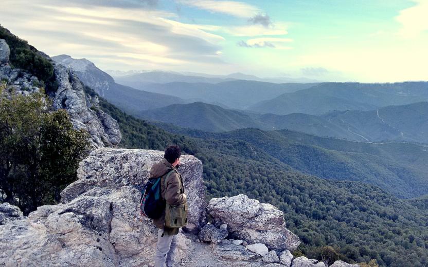
CMSB – STAGE 21 - FROM IS ZUDDAS TO MASAINAS
This stage will lead you to barite quarries and several archaeological sites (Domus de janas of Su Cungiau de Tuttui, Nuraghi Moddizzi, Murrecci and Corongius Longus).
Lush vegetation with beautiful juniper trees covers the hills above the urban centre of Masainas.
You will have occasional glimpses of the landscape, where you can admire the sea in the distance.
The uphill slope that must be climbed at the start of the route to come up from the Is Zuddas caves (102 m above sea level) and reach the pass of Monte Moddizzi (374 m above sea level) is quite challenging.
Safety and useful tips
Upon leaving Is Zuddas, follow the SP 70 road for about 500 m to arrive in Su Benatzu. Pay attention to vehicular traffic and to the crossing in order to reach the correct side of the road.
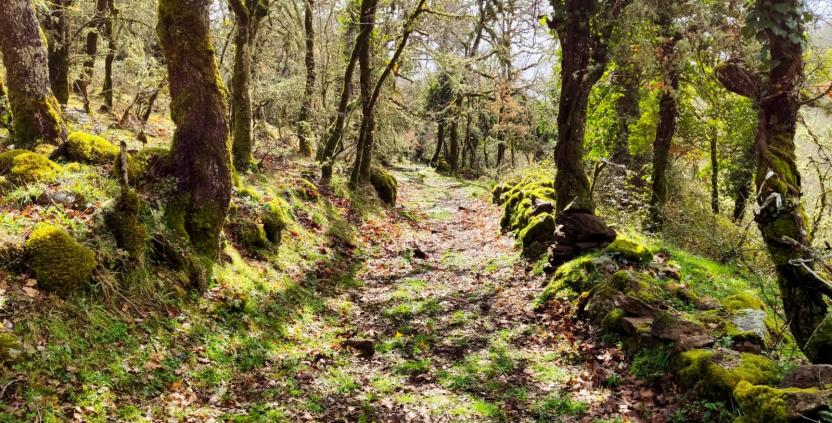
Afterwards, you can proceed quite easily along the signed dirt roads that characterise the itinerary. However, it must be said that the stage is very long, therefore it is necessary to prepare adequately.
As you arrive in Piscinas, you will walk through the main street of the village, which is in fact the SS 293 road, therefore pay attention to urban traffic.
Also when you reach Giba, you will find the same situation as before, as you have to cross part of the town on the main road which is still the SS 293. Therefore, pay attention to urban traffic and any crossings.
Upon arriving in Masainas, just before reaching the memorial stone, you have to cross the southern outskirts of the village while passing through Via Roma, which is none other than the urban route of the SS 195; therefore make sure to pay attention when crossing and passing along the streets of the village.
Informazioni utili
The stage is considered among the easy ones. The route has a length of 28.1 km, which can be covered in 8 hours and an uphill difference in height of 826 m and downhill of 873 m.
FOR UPDATED INFORMATION, CONSULT THE STAGE SHEET ON THE OFFICIAL WEBSITE
Tipologia itinerario
- Log in to post comments