Start website main content

Accessible trails

1 pathway

Sentieri per tutti...in questa categoria rientrano i sentieri progettati o riadattati perchè il contatto con l'ambiente naturale sia sempre di stimolo al miglioramento della vita personale di chiunque, con attenzione alle condizioni di disabilità motoria, sensoriale o della sfera psichica e relazionale...

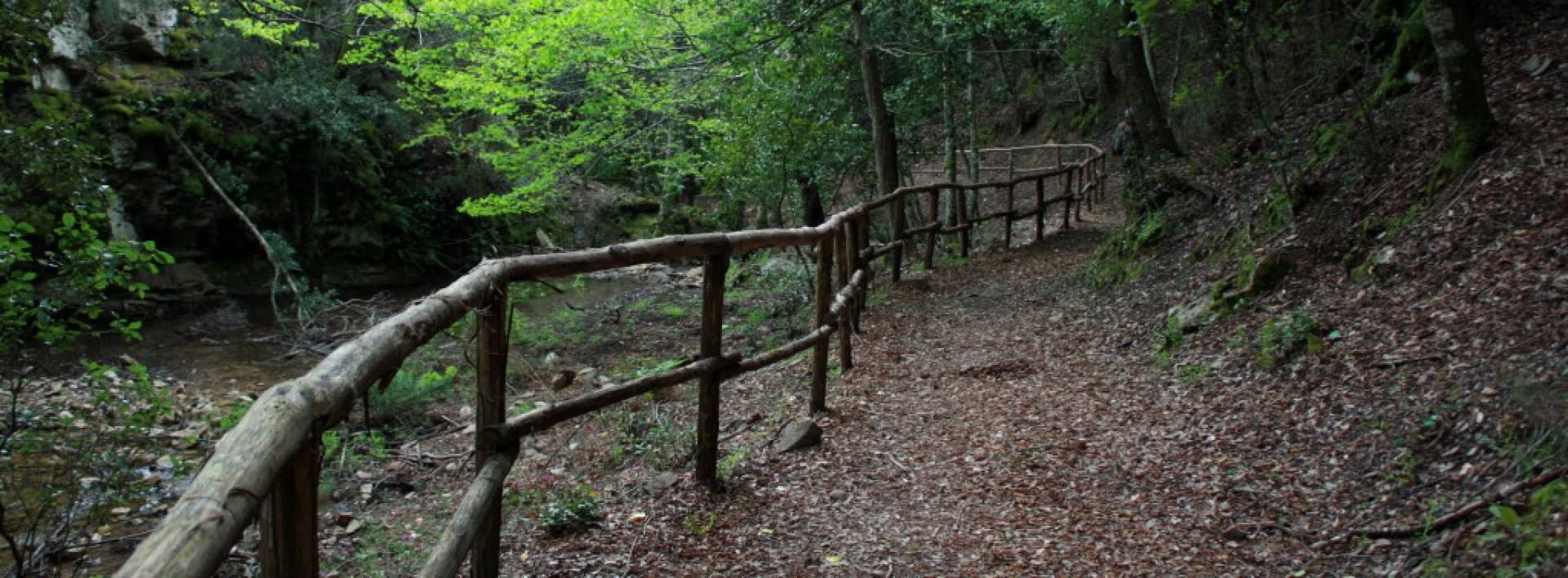
Rio Ermolinos.jpg

Results

Teti, Abini, arrivo itinerario del GAL BMG

Punto di arrivo dell'itinerario del GAL BMG

How to get here

Raggiunto l’agriturismo di Abini si scende a lambire il Taloro e qui, in una vasta area prativa proprio sotto l’agriturismo, si incontrano le monumentali capanne di Abini. Il villaggio protosardo deve la sua fortuna al ritrovamento di celebri bronzetti, come il guerriero con due scudi e quattro occhi, uno dei più begli esempi di arte protosarda. La monumentalità degli edifici finora scavati suggerisce che si trattasse indubbiamente di un centro di grande importanza e stupisce incontrarlo in un luogo oggi così suggestivo ed isolato. Dopo la visita al sito si ritorna per la strada percorsa, magari usufruendo dell’ospitalità del vicino agriturismo prima di rimettersi in cammino

Route location luogo d'interesse

Rifugio, presidi abitati

Geographical area Barbagia

Teti, Abini. The sanctuary of the ancient Sardinians

Access 

From Teti, take the SP4 downhill towards Lake Cucchinadorza, one of the three large reservoirs used for the production of hydroelectric energy. Just before the dam, on the left of the road, there is a clearing where you can park. 

Il Taloro - The Taloro 

You turn back a few dozen metres, taking a dirt road that leads slightly downhill in a north-westerly direction, passing a gate that is always open. The road continues downhill, keeping to the right of the gorge of the Taloro river, interrupted upstream by the barrage of the dam of the Cucchinadorza. Soon you come across two gates side by side: take the one on the right, which is never locked and serves to regulate livestock traffic. Immediately, a dirt track begins, initially in good condition, then increasingly rutted. The path enters the Taloro gorge: the river, once stormy and impetuous, is often dried up due to the interruptions of the dams upstream, but it still flows with a roar in winter and spring. 

Abini 

The road bends slightly to the west, still within sight of the river. It climbs slightly over a wide ridge, flanked by a woodland and shrubland, then descends in narrow hairpin bends. The road goes just above a farmstead: ignore the first fork to the left and then, at a sharp right-hand bend that descends towards the farmsteads, take a left along the less obvious tracks (GPS useful), almost immediately taking up a good dirt track that heads towards the Abini agriturismo. You descend to lap the Taloro and here, in a vast meadowy area just below the agritourism, you come across the monumental huts of Abini. The proto-Sardinian village owes its fortune to the discovery of famous bronze statues, such as the warrior with two shields and four eyes, one of the finest examples of proto-Sardinian art. The monumentality of the buildings excavated so far suggests that it was undoubtedly a centre of great importance and it is surprising to come across it in such an evocative and isolated place. After visiting the site, return along the road travelled, perhaps taking advantage of the hospitality of the nearby agriturismo before setting off again.

Lenght 27.100 m

teti.gpx

Total elevation gain 1 252 metri

Teti, Abini. Il santuario degli antichi Sardi

Accesso 

Da Teti si prende la SP4 in discesa, in direzione del Lago di Cucchinadorza, uno dei tre grandi bacini utilizzati per la produzione di energia idroelettrica. Poco prima della diga, sulla sinistra della strada, si trova uno spiazzo dove è possibile posteggiare. 

Il Taloro 

Si ritorna indietro di poche decine di metri, imboccando una sterrata che si stacca in lieve discesa in direzione nordovest, superando un cancello sempre aperto. 

La strada prosegue in discesa, tenendo sulla destra la gola del Fiume Taloro, interrotta a monte dallo sbarramento della diga di Cucchinadorza

Ben presto si incontrano due cancelli affiancati: si prende quello a destra che non è mai sbarrato e serve a regimare il traffico del bestiame. Subito inizia una sterrata, inizialmente in buone condizioni, poi sempre più disastrata. Il percorso si inoltra nella gola del Taloro: il fiume, un tempo tempestoso e irruento, è spesso in secca a causa delle interruzioni delle dighe a monte, ma scorre ancora con fragore in inverno e primavera. 

Abini 

La strada piega leggermente ad ovest, sempre in vista del fiume. Si sale leggermente su un vasto costone, affiancati da bosco e macchia, poi si scende per stretti tornanti. La strada si porta poco più in alto di una azienda agricola: si ignora il primo bivio a sinistra e poi, in corrispondenza di un brusco tornante a destra che scende verso i caseggiati, si prende a sinistra per tracce meno evidenti (utile il GPS) riprendendo quasi subito una bella sterrata che si dirige verso l’agriturismo di Abini

Si scende a lambire il Taloro e qui, in una vasta area prativa proprio sotto l’agriturismo, si incontrano le monumentali capanne di Abini. Il villaggio protosardo deve la sua fortuna al ritrovamento di celebri bronzetti, come il guerriero con due scudi e quattro occhi, uno dei più begli esempi di arte protosarda. La monumentalità degli edifici finora scavati suggerisce che si trattasse indubbiamente di un centro di grande importanza e stupisce incontrarlo in un luogo oggi così suggestivo ed isolato. 

Dopo la visita al sito si ritorna per la strada percorsa, magari usufruendo dell’ospitalità del vicino agriturismo prima di rimettersi in cammino.

Lenght 27.100 m

teti.gpx

Total elevation gain 1 252 metri

Tiana town, starting point of the GAL BMG itinerary

GAL BMG itinerary starting point
 

How to get here

From Tiana town center, continue towards Tonara on SS 128, slightly downhill and high above the wooded valley. Shortly you reach a small clearing where, on the right, are the signs to reach the Gualchiera, sa cracchera de tziu Bellu, today a museum of industrial archeology.
 

Route location centro abitato

Rifugio, presidi abitati

Abitato di Tiana, partenza itinerario del GAL BMG

Punto di partenza dell'itinerario del GAL BMG

How to get here

Dal centro abitato di Tiana si prosegue in direzione Tonara sulla SS 128, in lieve discesa e alti sopra la vallata boscosa. In breve si raggiunge un piccolo slargo dove, sulla destra, si trovano le indicazioni per raggiungere la Gualchiera, sa cracchera de tziu Bellu, oggi un museo di archeologia industriale

Route location centro abitato

Rifugio, presidi abitati

Tiana, the Gualchiera, arrival point of the GAL BMG itinerary

This is the arrival point of the GAL BMG itinerary (The Gualchiera of Tiana and the water routes).

The Gualchiera (Fulling Mill)

Tiana is the symbolic town of orbace, a fabric obtained through a mechanical process involving the felting of wool. For the energy required in this proto-industrial process, there were Gualchiere (fulling mills), structures similar to watermills that used the force of streams to operate the machinery. The one in Tiana has been splendidly restored, unique among the many that once existed in the area, and is located in a green area, on the suspended terraces around the Tino stream at its confluence with the Torrei stream. It can be visited by appointment.

How to get here

The road continues along the right hydrographic bank of the Torrei River, in a mountainous environment, overlooked by large rocky cliffs and often bordered by a dense forest. On the right, some rocks offer splendid panoramic views of the surroundings. The road becomes a narrow path that cuts through the vegetation, immersed in a beautiful forest broken only by sudden scree 1 slopes and rocky outcrops. Reaching an altitude of 750 meters above sea level, you will find a ford on the right, after which you take an uphill dirt road that soon leads back to the paved road serving the dam on the Torrei River, located a few kilometers upstream. From here, you can either retrace your steps or, especially if you have a mountain bike, return to the village by road, turning right and then right again once you reach the main road.

Route location luogo d'interesse

Rifugio, presidi abitati

Tiana, la gualchiera, arrivo itinerario del GAL BMG

Questo è il punto di arrivo dell'itinerario del GAL BMG (La Gualchiera di Tiana e le vie dell'acqua).

La Gualchiera 

Tiana è il paese simbolo dell’orbace, il tessuto ottenuto con un procedimento meccanico grazie all’infeltrimento della lana. Per l’energia richiesta in questo processo proto-industriale esistevano le Gualchiere, strutture simili ai mulini idraulici che utilizzavano la forza dei torrenti per il funzionamento dei macchinari. Quella di Tiana è stata splendidamente restaurata, unica tra la molte presenti un tempo nella zona e si trova in un’area immersa nel verde, sulle terrazze sospese intorno al torrente Tino presso la conlfuenza col Torrei. Si può visitare previo appuntamento. 

How to get here

La strada si inoltra sul fianco destro idrografico del Rio Torrei, in ambiente montano, sovrastata da grossi rocciai e affiancata spesso da un bosco fitto. Sulla destra, alcune rocce permettono splendide viste panoramiche d’intorno.  La strada diviene uno stretto sentiero che fora la vegetazione, immerso in un bel bosco rotto soltanto da improvvisi ghiaioni e rocciai. Giunti a quota 750 mslm si incontra, sulla destra, un guado, superato il quale si percorre una strada sterrata in salita che in breve riconduce alla strada asfaltata che serve la diga sul Rio Torrei, posta qualche km più a monte. Da qui è possibile tornare sui propri passi oppure, soprattutto se muniti di una mountain bike, ritornare via strada al paese prendendo a destra e poi nuovamente a destra una volta giunti alla statale.

Route location luogo d'interesse

Rifugio, presidi abitati

Tiana, la gualchiera. Waterways

Access 

From the centre of Tiana, continue in the direction of Tonara on the SS 128, slightly downhill and high above the wooded valley. You soon reach a small rocky lay-by where, on the right, you will find the signs for reaching the Gualchiera, sa cracchera de tziu Bellu, which is today a museum of industrial archaeology

La Gualchiera - The Fullers 

Tiana is the symbolic village of orbace (rough wool), the fabric obtained by a mechanical process of felting wool. For the energy required in this proto-industrial process, there were the Fullers, structures similar to hydraulic mills that used by the power of water to drive the machinery. The one in Tiana has been beautifully restored, unique among the many once present in the area, and is located in an area surrounded by greenery, on the terraces suspended around the Tino stream at the point it merges with the Torrei. It can be visited only by appointment

Il Rio Torrei - The Torrei Stream 

Once you have visited the river, you can continue along a short nature trail along the hazel groves bordering the river, or take a route through the heart of the area. You then return to route 128 for a few hundred metres where, before a bridge turn left onto a cobbled road and then a dirt road, following the signs for the Ospitone path. The road runs along the hydrographic right bank of the Rio Torrei, in a mountainous environment, overhung by large rocks and often flanked by dense woodland. On the right, some rocks allow splendid panoramic views of the surroundings. 

The Path 

As you continue, you gain altitude, temporarily moving away from the river bed and then returning to it near a spring. The road becomes a narrow path that cuts through the vegetation, immersed in a beautiful forest broken only by sudden scree and rocks. At an altitude of 750 metres, you come to a ford on the right, after which you follow a dirt road uphill that soon leads back to the asphalt road serving the dam on the Rio Torrei, located a few kilometres further upstream. From here it is possible to retrace your steps or, especially if equipped with a mountain bike, to return by road to the village, taking a right and then another right once one reaches the public road.

Lenght 9.200 m

tiana.gpx

Total elevation gain 403 metri

Tiana, la gualchiera. Le vie dell’acqua

Accesso 

Dal centro abitato di Tiana si prosegue in direzione Tonara sulla SS 128, in lieve discesa e alti sopra la vallata boscosa. In breve si raggiunge un piccolo slargo dove, sulla destra, si trovano le indicazioni per raggiungere la Gualchiera, sa cracchera de tziu Bellu, oggi un museo di archeologia industriale

La Gualchiera 

Tiana è il paese simbolo dell’orbace, il tessuto ottenuto con un procedimento meccanico grazie all’infeltrimento della lana. Per l’energia richiesta in questo processo proto-industriale esistevano le Gualchiere, strutture simili ai mulini idraulici che utilizzavano la forza dei torrenti per il funzionamento dei macchinari. Quella di Tiana è stata splendidamente restaurata, unica tra la molte presenti un tempo nella zona e si trova in un’area immersa nel verde, sulle terrazze sospese intorno al torrente Tino presso la conlfuenza col Torrei. Si può visitare previo appuntamento. 

Il rio Torrei 

Una volta effettuata la visita si può proseguire per un breve sentiero naturalistico lungo i noccioleti che costeggiano il fiume, oppure proseguire per un itinerario nel cuore del territorio. Si riprende quindi la 128 per poche centinaia di metri dove, prima di un ponte, si prende a sinistra per una strada selciata e poi sterrata, seguendo le indicazioni per il cammino di Ospitone. La strada si inoltra sul fianco destro idrografico del Rio Torrei, in ambiente montano, sovrastata da grossi rocciai e affiancata spesso da un bosco fitto. Sulla destra, alcune rocce permettono splendide viste panoramiche d’intorno. 

Il sentiero 

Man mano che si prosegue si guadagna quota, allontanandosi temporaneamente dal greto del torrente e poi ritornandovi nei pressi di una sorgente. La strada diviene uno stretto sentiero che fora la vegetazione, immerso in un bel bosco rotto soltanto da improvvisi ghiaioni e rocciai. Giunti a quota 750 si incontra, sulla destra, un guado, superato il quale si percorre una strada sterrata in salita che in breve riconduce alla strada asfaltata che serve la diga sul Rio Torrei, posta qualche km più a monte. Da qui è possibile tornare sui propri passi oppure, soprattutto se muniti di una mountain bike, ritornare via strada al paese prendendo a destra e poi nuovamente a destra una volta giunti alla statale.

Lenght 9.200 m

tiana.gpx

Total elevation gain 403 metri