Start website main content

Nordic Walking

51 pathways

La camminata nordica o camminata con bastoni (in inglese nordic walking o pole walking) è attività fisica e sportiva che ben si coniuga con percorsi in bosco, in pianura o in vallate, lungo scogliere o spiagge.  La Rete dei sentieri della Sardegna offre tantissime occasioni per cimentarsi nella camminata nordica... 

Nordic-walking.png

Results

Teti, Abini. Il santuario degli antichi Sardi

Accesso 

Da Teti si prende la SP4 in discesa, in direzione del Lago di Cucchinadorza, uno dei tre grandi bacini utilizzati per la produzione di energia idroelettrica. Poco prima della diga, sulla sinistra della strada, si trova uno spiazzo dove è possibile posteggiare. 

Il Taloro 

Si ritorna indietro di poche decine di metri, imboccando una sterrata che si stacca in lieve discesa in direzione nordovest, superando un cancello sempre aperto. 

La strada prosegue in discesa, tenendo sulla destra la gola del Fiume Taloro, interrotta a monte dallo sbarramento della diga di Cucchinadorza

Ben presto si incontrano due cancelli affiancati: si prende quello a destra che non è mai sbarrato e serve a regimare il traffico del bestiame. Subito inizia una sterrata, inizialmente in buone condizioni, poi sempre più disastrata. Il percorso si inoltra nella gola del Taloro: il fiume, un tempo tempestoso e irruento, è spesso in secca a causa delle interruzioni delle dighe a monte, ma scorre ancora con fragore in inverno e primavera. 

Abini 

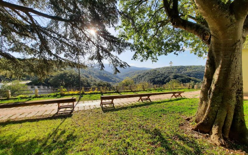
La strada piega leggermente ad ovest, sempre in vista del fiume. Si sale leggermente su un vasto costone, affiancati da bosco e macchia, poi si scende per stretti tornanti. La strada si porta poco più in alto di una azienda agricola: si ignora il primo bivio a sinistra e poi, in corrispondenza di un brusco tornante a destra che scende verso i caseggiati, si prende a sinistra per tracce meno evidenti (utile il GPS) riprendendo quasi subito una bella sterrata che si dirige verso l’agriturismo di Abini

Si scende a lambire il Taloro e qui, in una vasta area prativa proprio sotto l’agriturismo, si incontrano le monumentali capanne di Abini. Il villaggio protosardo deve la sua fortuna al ritrovamento di celebri bronzetti, come il guerriero con due scudi e quattro occhi, uno dei più begli esempi di arte protosarda. La monumentalità degli edifici finora scavati suggerisce che si trattasse indubbiamente di un centro di grande importanza e stupisce incontrarlo in un luogo oggi così suggestivo ed isolato. 

Dopo la visita al sito si ritorna per la strada percorsa, magari usufruendo dell’ospitalità del vicino agriturismo prima di rimettersi in cammino.

Lenght 27.100 m

teti.gpx

Total elevation gain 1 252 metri

Sentiero Italia (Stage Z26) Su Niu ‘e S’Achili – Burcei

Overview of the itinerary

Sentiero Italia runs the length of the island’s eastern side, covering its most important mountains, in 28 stages.  Starting from the north: it flanks the Monte Limbara massif, crosses the limestones of Mont’Albo and Tuttavista, skirting the Gulf of Orosei, it crosses the Supramonte, Gennargentu and the Tacchi of Ogliastra and reaches Perdasdefogu.  Further south, it passes through Armungia and the Gerrei sub-region. Lastly, it touches on the villages of Burcei and San Gregorio, continuing on the Sette Fratelli massif to the old prisons of Castiadas.

General information on Sentiero Italia (Grand Italian Trail)

Sentiero Italia, or Grand Italian Trail, as also explained on the official website, is a walking route that crosses the whole of Italy, using mainly but not exclusively “registered trails”.   
In particular, in Sardinia, not all the stages of the Sentiero Italia of CAI (Italian Alpine Club) are made of trails already included in the registry of the Sardinia Trail Network (RES), either because they have not yet been tested and approved or simply because they cannot be registered as they do not meet the requirements.  However, as a whole, the Sentiero Italia is the single longest walking route currently crossing Sardinia from the north (S. Teresa Gallura, stage Z 1) to the south (Castiadas, end of stage Z 28), touching on the most fascinating mountain areas in central-eastern Sardinia: the plateau of Buddusò, Tepilora, the Cedrino river valley, the ancient forests of Montes, Perda Liana and the regional forest of Montarbu, Monte Genis, and lastly the regional forest of Settefratelli (among the many crossed by the various stages of this long hiking itinerary).

Information on this stage of the trail

From Su Niu e S’Achili, the trail becomes challenging, alternating uphill and downhill stretches on Monte Carareddu through the Bruncu Muscadroxu plateau, and then on to Monte Genis and Monte Serpeddì

This stage is challenging in terms of length and elevation gain and is mainly on paved, dirt and tarmac roads 

It ends in Burcei, a small farmers’ town whose name derives from ‘burrei’, herd of oxen.

Lenght 27.400 m

SI Z26.gpx

Total elevation gain 1 338 metri

Geographical area Gerrei Sarrabus-Sette Fratelli

Sentiero Italia (Tappa Z26) Su Niu ‘e S’Achili – Burcei

In sintesi

Il Sentiero Italia attraversa in lunghezza il settore orientale dell’isola toccandone i sistemi montuosi più rilevanti, in 28 tappe.  Partendo da nord: tocca il massiccio del Monte Limbara, attraversa i calcari del Mont'Albo e del Tuttavista sfiorando il Golfo di Orosei,  attraversa il Supramonte, il Gennargentu, i Tacchi dell’Ogliastra e giunge a Perdasdefogu.  Più a sud, transita da Armungia e dalla subregione del Gerrei. Infine tocca l’abitato di Burcei e San Gregorio, per continuare nel massiccio dei Sette Fratelli fino alle vecchie carceri di Castiadas.

Informazioni generali sull'itinerario sentiero Italia

Il Sentiero Italia, come spiegato anche nel sito ufficiale, è un itinerario (o Cammino) lungo tutta l'Italia, che utilizza prevalentemente ma non esclusivamente "sentieri accatastati".   
In particolare, in Sardegna, non tutte le tappe del Sentiero Italia del CAI coincidono con sentieri già inseriti nel catasto della Rete Escursionistica della Sardegna (RES), perché non hanno ancora superato le verifiche di percorribilità oppure semplicemente perché non possono essere accatastati non avendone i requisiti.  Tuttavia, nel suo insieme, il Sentiero Italia rappresenta l'unica, la più grande dorsale escursionistica che attraversa attualmente la nostra Isola da nord (S. Teresa Gallura, tappa Z 1) a sud (Castiadas, fine tappa Z 28) toccando le aree montane della Sardegna centro-Orientale più affascinanti: l'altopiano di Buddusò, Tepilora, la valle del Cedrino, i boschi vetusti di Montes, Perda Liana e la foresta demaniale di Montarbu, il Monte Genis, e infine la foresta demaniale di Settefratelli (tra le tante attraversate dal lungo itinerario escursionistico a tappe).

Info sul percorso di questa tappa

Da Su Niu e S'Achili inizia un impegnativo saliscendi sul Monte Carareddu attraverso l’altipiano di Bruncu Muscadroxu, a seguire il Monte Genis e il Monte Serpeddì

Si tratta di una tappa impegnativa per lunghezza e dislivello che si svolge prevalentemente su strade carrozzabili, bianche e asfaltate. 

Conclusione a Burcei, paese a vocazione pastorale il cui nome deriva da “burrei”, branco di buoi.

Informazioni utili

Lungo il percorso non sarà sempre presente la copertura telefonica

Lenght 27.400 m

SI Z26.gpx

Total elevation gain 1 338 metri

Geographical area Gerrei Sarrabus-Sette Fratelli

CMSB – STAGE 21 - FROM IS ZUDDAS TO MASAINAS

This stage will lead you to barite quarries and several archaeological sites (Domus de janas of Su Cungiau de Tuttui, Nuraghi Moddizzi, Murrecci and Corongius Longus).

Lush vegetation with beautiful juniper trees covers the hills above the urban centre of Masainas.

You will have occasional glimpses of the landscape, where you can admire the sea in the distance.

The uphill slope that must be climbed at the start of the route to come up from the Is Zuddas caves (102 m above sea level) and reach the pass of Monte Moddizzi (374 m above sea level) is quite challenging.

Safety and useful tips

Upon leaving Is Zuddas, follow the SP 70 road for about 500 m to arrive in Su BenatzuPay attention to vehicular traffic and to the crossing in order to reach the correct side of the road.

Afterwards, you can proceed quite easily along the signed dirt roads that characterise the itinerary. However, it must be said that the stage is very long, therefore it is necessary to prepare adequately.

As you arrive in Piscinas, you will walk through the main street of the village, which is in fact the SS 293 road, therefore pay attention to urban traffic.

Also when you reach Giba, you will find the same situation as before, as you have to cross part of the town on the main road which is still the SS 293. Therefore, pay attention to urban traffic and any crossings.

Upon arriving in Masainas, just before reaching the memorial stone, you have to cross the southern outskirts of the village while passing through Via Roma, which is none other than the urban route of the SS 195; therefore make sure to pay attention when crossing and passing along the streets of the village.

Informazioni utili

The stage is considered among the easy ones. The route has a length of 28.1 km, which can be covered in 8 hours and an uphill difference in height of 826 m and downhill of 873 m.

FOR UPDATED INFORMATION, CONSULT THE STAGE SHEET ON THE OFFICIAL WEBSITE

Lenght 28.100 m

Links

CMSB tappa-21-da-zuddas-masainas.gpx

Total elevation gain 747 metri

Geographical area Iglesiente

Elevation gain 826 metri

Negative elevation 873 metri

CMSB – Tappa 21: DA IS ZUDDAS A MASAINAS

Questa tappa è caratterizzata dalle cave di barite e dai  numerosi siti archeologici che si trovano nel territorio come la domus de janas di Su Cungiau de Tuttui e i nuraghi di Moddizzi, Murrecci e Corongius Longus.

Un lussureggiante manto vegetale con bellissimi esemplari di ginepro copre i rilievi che sovrastano il centro urbano di Masainas e a tratti si aprono squarci di paesaggio, dove la vista arriva fino al mare.

Si tratta di una tappa abbastanza impegnativa considerato lo strappo in salita da affrontare all’inizio del percorso per risalire dalle grotte Is Zuddas (102 m/slm) alla sella del Monte Moddizzi (374 m/slm)

Informazioni utili

La tappa è considerata  tra quelle facili. Il percorso ha una lunghezza di 28,1  km, percorribili in 8 ore e un  dislivello  in salita di 826  m e in discesa  di 873 m.
PER LE INFORMAZIONI AGGIORNATE, CONSULTA LA SCHEDA DELLA TAPPA, SUL SITO UFFICIALE 

Il Cammino Minerario di Santa Barbara

Si tratta del primo, tra i cammini sardi, ad essere stato iscritto al registro istituito dalla Regione Sarda nel 2012 con DGR48/9 ("Registro dei cammini di Sardegna, degli itinerari religiosi e dello spirito"). Attualmente è gestito dall'omonima Fondazione.

LA STORIA DEL PROGETTO

L’idea di costruire un itinerario nell’area più estesa e rappresentativa del Parco Geominerario Storico Ambientale della Sardegna, il Sulcis-Iglesiente-Guspinese, riscoprendo gli antichi cammini minerari oggi in gran parte abbandonati, è nata dai volontari dell’Associazione ONLUS Pozzo Sella Per il Parco Geominerario a seguito della grande partecipazione dei cittadini alle escursioni organizzate dalla stessa associazione dopo aver reso fruibili numerosi percorsi minerari.

Con il Cammino Minerario di Santa Barbara si vuole perseguire l’obiettivo di tramandare la memoria degli uomini che nei secoli e nei millenni passati hanno realizzato e percorso gli antichi cammini minerari con il piacere di riscoprire a passo lento la bellezza del territorio.

Un Protocollo d’intesa è stato sottoscritto tra i Comuni di Iglesias, Buggerru, Fluminimaggiore, Arbus, Guspini, Gonnosfanadiga, Villacidro, Domusnovas, Musei, Villamassargia. Narcao, Nuxis, Santadi, Piscinas, Giba, Masainas, San Giovanni Suergiu, Sant’Antioco, Carbonia e Gonnesa, le Diocesi di Iglesias e di Ales Terralba, le Province di Carbonia Iglesias e del Medio Campidano, il Consorzio del Parco Geominerario Storico Ambientale della Sardegna, l’ANCI SARDEGNA e l’Associazione Pozzo Sella: si tratta di un  partenariato per la costruzione e la gestione dell’itinerario storico, culturale, ambientale e religioso denominato “Cammino Minerario di Santa Barbara”.

PER MAGGIORI INFORMAZIONI, DETTAGLI E INFO AGGIORNATE SULLE TAPPE

Si consiglia di consultare il sito ufficiale del cammino: www.camminominerariodisantabarbara.org/

Lenght 28.100 m

Links

CMSB tappa-21-da-zuddas-masainas.gpx

Total elevation gain 747 metri

Geographical area Iglesiente

Elevation gain 826 metri

Negative elevation 873 metri

Meana, Ortuabis. The ancient crossroads

Access 

From the inhabited village of Meana, the Ortuabis plateau can be reached via the SS 128 road by car and bicycle, or by following the signs for the nuraghe Nolza at the exit of the village. This leads to a fine asphalt road that proceeds on a lonely descent into the valley, reaching below the forest, the first fork at the bottom of the valley, where you take a right turn. 

The vineyards and the Nuraghe 

You continue uphill, on a ridge from which there is a beautiful view of the village. The more wooded areas are behind you and you find yourself on rolling hillsides occupied by beautiful vineyards. High up on a raised hill is the massive silhouette of the nuraghe Nolza. You continue along this road, always lined with vineyards and following the signs until you reach the ticket office. The expert tour guides and the extraordinary view from the top of the nuraghe make it an extraordinary and essential visit to discover this corner of Sardinia. 

The forest 

Leaving the nuraghe, turn right onto the asphalt road, keeping slightly above the railway. The road becomes a dirt track, slightly uphill: here you take a left and then a right, in quick succession, to finally return to the asphalt road where you take another right, slightly uphill, passing by a disused quarry and then into a beautiful wood where the gradient drops. Here you meet the SS128 again and where you can arrive by car, skipping the first part of the itinerary. Follow the public road on the right until the sign km 74, where there is a sign indicating the hiking trail. Here you enter the forest, pass an open barrier and begin to follow a slightly downhill dirt road. 

The kilns 

The road keeps a firebreak on the right and winds along the same route as the aqueduct on a limestone plateau, formerly used for the production of lime, which was produced in large furnaces. The dirt road gradually deteriorates and you come to a barely noticeable fork where you keep to the right to visit a large lime kiln, located on a gentle slope. You resume heading north on a barely noticeable path, sometimes getting off your bike and soon reaching the area where the Ortuabis reception area is located, currently awaiting management. Take the dirt road that serves the area, turning left once you have passed the larger structures and entering the forest, which also has numerous charcoal burners' farmyards. When you come to a fork in the road, you can take a left to visit a large kiln, then right again returning to route SS128 and, by the known road, retracing the outward route to the village.

Lenght 33.100 m

meana.gpx

Total elevation gain 1 193 metri

Meana, Ortuabis. Le antiche crocevie

Accesso 

Dall’abitato di Meana, l’altopiano di Ortuabis si può raggiungere tramite la SS 128 in auto e in bicicletta, oppure seguendo le indicazioni per Nuraghe Nolza all’uscita del paese. Si imbocca così una bella strada asfaltata che procede solitaria e in discesa nella vallata, raggiungendo sotto il bosco un primo bivio nel fondovalle, dove si prende a destra. 

I vigneti e il nuraghe 

Si continua in salita, su un costone da cui si ammira un bel panorama sul paese. Le zone più boscate sono rimaste alle spalle e ci si trova su colline ondulate occupate da splendidi vigneti. In alto, su un colle rilevato, si staglia la sagoma massiccia del Nuraghe Nolza. Si continua sulla strada, sempre affiancati dai vigneti e seguendo le indicazioni fino a raggiungere la biglietteria. Le esperte guide turistiche e lo straordinario panorama che si vede dalla vetta del nuraghe rendono la sua visita straordinaria e fondamentale nella scoperta di quest’angolo di Sardegna. 

La foresta 

Lasciato il nuraghe si prende a destra sulla asfaltata, tenendosi poco più alti della ferrovia. La strada diviene sterrata, in leggera salita: qui si prende a sinistra e poi a destra, in rapida successione, ritornando infine su strada asfaltata dove si prende ancora a destra, in leggera salita, passando accanto ad una cava dismessa e poi in un bel bosco dove la pendenza si abbatte. 

Qui si incontra nuovamente la SS128 e qui si potrebbe arrivare in auto, saltando la prima parte dell’itinerario. Si segue la statale sulla destra fino al km 74 dove si individua un cartello che segnala l’itinerario escursionistico. Qui si entra nel bosco, superando una sbarra sempre aperta e cominciando a percorrere una sterrata in leggera discesa. 

Le fornaci 

La strada tiene sulla destra una striscia frangifuoco e si snoda seguendo lo stesso percorso dell’acquedotto su un altopiano calcareo, in passato usato per la produzione della calce che veniva prodotta in grandi fornaci. La sterrata peggiora gradualmente e si incontra un bivio appena accennato dove si tiene la destra per visitare una grande fornace della calce, posta su un declivio poco pronunciato. Si riprende la direzione nord su un sentiero poco accennato, talvolta scendendo dalla bicicletta e giungendo ben presto alla zona dove sorge l’area ricettiva di Ortuabis, al momento in attesa di una gestione. Si prende la sterrata che serve la zona, svoltando a sinistra una volta oltrepassate le strutture maggiori ed inoltrandosi nel bosco che presenta anche numerose aie dei carbonai. Quando si incontra un bivio, si può prendere a sinistra per visitare una grossa fornace, poi ancora a destra ritornando sulla 128 e, per strada nota, ripercorrendo il tracciato dell’andata fino al paese.

Lenght 33.100 m

meana.gpx

Total elevation gain 1 193 metri

Contiene carte
Spento

Sentiero Italia (Stage Z10A) Vecchia Cantoniera di Sant’Anna – Norghio

Overview of the itinerary

Sentiero Italia runs the length of the island’s eastern side, covering its most important mountains, in 28 stages.  Starting from the north: it flanks the Monte Limbara massif, crosses the limestones of Mont’Albo and Tuttavista, skirting the Gulf of Orosei, it crosses the Supramonte, Gennargentu and the Tacchi of Ogliastra and reaches Perdasdefogu.  Further south, it passes through Armungia and the Gerrei sub-region. Lastly, it touches on the villages of Burcei and San Gregorio, continuing on the Sette Fratelli massif to the old prisons of Castiadas.

General information on Sentiero Italia (Grand Italian Trail)

Sentiero Italia, or Grand Italian Trail, as also explained on the official website, is a walking route that crosses the whole of Italy, using mainly but not exclusively “registered trails”.   
In particular, in Sardinia, not all the stages of the Sentiero Italia of CAI (Italian Alpine Club) are made of trails already included in the registry of the Sardinia Trail Network (RES), either because they have not yet been tested and approved or simply because they cannot be registered as they do not meet the requirements.  However, as a whole, the Sentiero Italia is the single longest walking route currently crossing Sardinia from the north (S. Teresa Gallura, stage Z 1) to the south (Castiadas, end of stage Z 28), touching on the most fascinating mountain areas in central-eastern Sardinia: the plateau of Buddusò, Tepilora, the Cedrino river valley, the ancient forests of Montes, Perda Liana and the regional forest of Montarbu, Monte Genis, and lastly the regional forest of Settefratelli (among the many crossed by the various stages of this long hiking itinerary).

Information on this stage of the trail

This is a long and very varied section, which involves crossing the Montalbo ridge, walking for a good stretch on the ridge in typically karst environments with sweeping 360° views, and crossing the entire southern slope, densely wooded, down to the bottom of the valley, which is crossed by provincial road SP 45 and state road SS 131 DCN, near Monte Pizzinnu

After passing these main roads, and still in a densely wooded environment, the route climbs up the northern slope of the Remulis Mountains to an elevation of 500 m asl, then continues north to the Janna pass, from where a stretch of blacktop road leads to the Norghio stop point. 

This stage alternates paths, livestock trails, forest tracks and stretches of blacktop road, making it very varied but, given the differences in elevation, also quite challenging. Given its length, you may choose to split the stage into two or more days, with wild camping overnight at suitable points in the Altudè (N 40.48638° E 9.56507°) and Talachè localities (N 40.48356° E 9.62311°) or booking accommodation with Tonino Taras (mobile: 3496351871) at the Ammentos inn (N 40.54168° E 9.60236°), former Cantoniera Guzzurra on SP 3, which can be reached via a short detour on CAI numbered paths; please note that the inn is closed in winter.

We recommend extreme caution in the event of fog, which is frequent on high ground. Please also be mindful that there are very few water fountains along the route.

Itinerary roadbook

Lenght 33.400 m

SI Z10A.gpx

Total elevation gain 1 947 metri

Geographical area Baronie e Montalbo