Start website main content

Nordic Walking

51 pathways

La camminata nordica o camminata con bastoni (in inglese nordic walking o pole walking) è attività fisica e sportiva che ben si coniuga con percorsi in bosco, in pianura o in vallate, lungo scogliere o spiagge.  La Rete dei sentieri della Sardegna offre tantissime occasioni per cimentarsi nella camminata nordica... 

Nordic-walking.png

Results

Sentiero Italia (Stage Z07) Caserma Forestale Bolostiu – Alà dei Sardi

Overview of the itinerary

Sentiero Italia runs the length of the island’s eastern side, covering its most important mountains, in 28 stages.  Starting from the north: it flanks the Monte Limbara massif, crosses the limestones of Mont’Albo and Tuttavista, skirting the Gulf of Orosei, it crosses the Supramonte, Gennargentu and the Tacchi of Ogliastra and reaches Perdasdefogu.  Further south, it passes through Armungia and the Gerrei sub-region. Lastly, it touches on the villages of Burcei and San Gregorio, continuing on the Sette Fratelli massif to the old prisons of Castiadas.

General information on Sentiero Italia (Grand Italian Trail)

Sentiero Italia, or Grand Italian Trail, as also explained on the official website, is a walking route that crosses the whole of Italy, using mainly but not exclusively “registered trails”.   
In particular, in Sardinia, not all the stages of the Sentiero Italia of CAI (Italian Alpine Club) are made of trails already included in the registry of the Sardinia Trail Network (RES), either because they have not yet been tested and approved or simply because they cannot be registered as they do not meet the requirements.  However, as a whole, the Sentiero Italia is the single longest walking route currently crossing Sardinia from the north (S. Teresa Gallura, stage Z 1) to the south (Castiadas, end of stage Z 28), touching on the most fascinating mountain areas in central-eastern Sardinia: the plateau of Buddusò, Tepilora, the Cedrino river valley, the ancient forests of Montes, Perda Liana and the regional forest of Montarbu, Monte Genis, and lastly the regional forest of Settefratelli (among the many crossed by the various stages of this long hiking itinerary).

Information on this stage of the trail

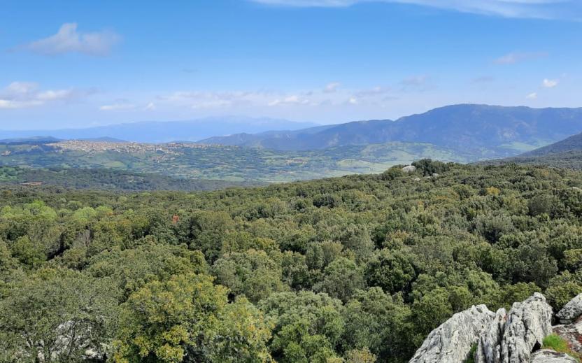
This leg of the trail is particularly fascinating because of the many places of interest along the way. The first is the charming hamlet of Badde Suelzu consisting of a dozen houses and... as many inhabitants. The prehistoric Sanctuary of Sos Nurattolos is next, with the ruins of stone huts, a sacred spring, and a megaron-type temple

After walking past a few wind turbines and a mountain shrine to the Madonna della Neve (Our Lady of the Snows), you will reach Alà dei Sardi. Just before the village, it is worth making a small detour to visit the megalithic wall of Sos Alchibusos, on the granite hill of Sa Torolia.

Lenght 18.000 m

SI Z07.gpx

Total elevation gain 765 metri

Geographical area Monteacuto

Sentiero Italia (Tappa Z07) Caserma Forestale Bolostiu – Alà dei Sardi

In sintesi

Il Sentiero Italia attraversa in lunghezza il settore orientale dell’isola toccandone i sistemi montuosi più rilevanti, in 28 tappe.  Partendo da nord: tocca il massiccio del Monte Limbara, attraversa i calcari del Mont'Albo e del Tuttavista sfiorando il Golfo di Orosei,  attraversa il Supramonte, il Gennargentu, i Tacchi dell’Ogliastra e giunge a Perdasdefogu.  Più a sud, transita da Armungia e dalla subregione del Gerrei. Infine tocca l’abitato di Burcei e San Gregorio, per continuare nel massiccio dei Sette Fratelli fino alle vecchie carceri di Castiadas.

Informazioni generali sull'itinerario sentiero Italia

Il Sentiero Italia, come spiegato anche nel sito ufficiale, è un itinerario (o Cammino) lungo tutta l'Italia, che utilizza prevalentemente ma non esclusivamente "sentieri accatastati".   
In particolare, in Sardegna, non tutte le tappe del Sentiero Italia del CAI coincidono con sentieri già inseriti nel catasto della Rete Escursionistica della Sardegna (RES), perché non hanno ancora superato le verifiche di percorribilità oppure semplicemente perché non possono essere accatastati non avendone i requisiti.  Tuttavia, nel suo insieme, il Sentiero Italia rappresenta l'unica, la più grande dorsale escursionistica che attraversa attualmente la nostra Isola da nord (S. Teresa Gallura, tappa Z 1) a sud (Castiadas, fine tappa Z 28) toccando le aree montane della Sardegna centro-Orientale più affascinanti: l'altopiano di Buddusò, Tepilora, la valle del Cedrino, i boschi vetusti di Montes, Perda Liana e la foresta demaniale di Montarbu, il Monte Genis, e infine la foresta demaniale di Settefratelli (tra le tante attraversate dal lungo itinerario escursionistico a tappe).

Info sul percorso di questa tappa

La particolarità di questa tappa sono i numerosi luoghi di interesse che si incontrano lungo la strada. Il primo è l’incantevole borgo di Badde Suelzu composto da una decina di case e… altrettanti abitanti. A seguire si incontra il Santuario di Sos Nurattolos con le sue capanne, una fonte sacra, il tempietto e un magaron

Dopo aver incrociato alcune pale eoliche e una Madonna della Neve si giunge ad Alà dei Sardi. Poco prima dell’abitato vale la pena fare una piccola deviazione per visitare per visitare la muraglia di Sos Alchibusos che si trova sull’altura granitica di Sa Torolia.


Informazioni utili

Lungo il percorso non sarà sempre presente la copertura telefonica

Lenght 18.000 m

SI Z07.gpx

Total elevation gain 765 metri

Geographical area Monteacuto