Horse
Ippovia è un itinerario percorribile a cavallo, raramente asfaltato, che attraversa riserve naturali, boschi, colline e vallate, talvolta costeggiando corsi d'acqua e spiagge, attraversando evidenze storiche-culturali o borghi. L'ippovia consente la pratica dell'equiturismo ma può anche essere percorsa a piedi. Lungo il percorso si prevedono tappe, distanti non più di 20 km, dove cavaliere e cavallo possano trovare assistenza, ristoro ed eventuale pernottamento...

Results
Funtana 'e Cannas (trail junction C-610 and 611)
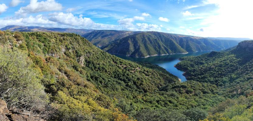
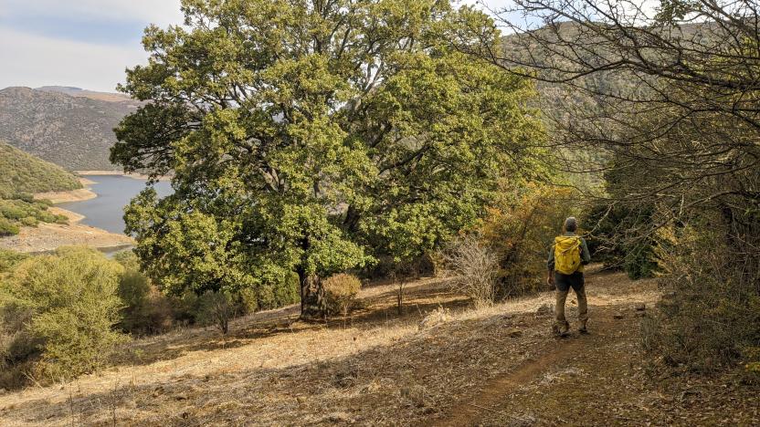
End point of the C 610 Trail, which starts from the banks of the lower Flumendosa basin (in the municipality of Nurri, Bau sa Mardina locality) and arrives after about 8 km at this spring (recently restored by the Municipality). The C 611 trail also starts from here, entering the territory of Orroli and heading towards the Nuraghe Arrubiu area, always keeping the lake in view.
Funtana 'e Cannas (snodo sentieri C- 610 e 611)
Punto di arrivo del Sentiero C 610 partito dalle sponde del bacino del basso Flumendosa (in comune di Nurri, località Bau sa Mardina) per giungere dopo circa 8 km in questa sorgente (recentemente risistemata dal Comune) da cui parte anche il sentiero C 611 che penetra in agro di Orroli dirigendosi verso l'area del Nuraghe Arrubiu, mantenendosi sempre con lo sguardo sul lago.
Monti 'e nuxi mountain colony
Nearby is the archaeological site of the Monti 'e Nuxi sacred area. Trails C 552 and C 553 start from this point.
Parking is available in front of the large building (a municipal mountain colony or "refuge" currently disused).
In the immediate vicinity, a variety of archaeological areas:
- The Nuragic sanctuary of Monti 'e Nuxi
- The Nuragic sacred area of Monti 'e Nuxi
- The megalithic enclosure of Monte S. Vittoria
- Several Nuraghi with the same names (S. Vittoria and Monti 'e Nuxi)
How to get here
Provincial Road 53 "panoramic" ascent from Esterzili towards the summit of Monte S.Vittoria.
Colonia montana di Monti 'e nuxi
Nelle vicinanze si trova il sito archeologico dell'area sacra di Monti 'e nuxi. Da questo punto partono i sentieri C 552 e C 553.
Di fronte al grosso edificio (una colonia o "rifugio" montano comunale attualmente in disuso) è possibile parcheggiare.
Nelle immediate vicinanze, un florilegio di aree archeologiche:
- il santuario nuragico di Monti 'e Nuxi
- l'area sacra nuragica di Monti 'e Nuxi
- il recinto megalitico di monte S.Vittoria
- alcuni nuraghi omonimi (S.Vittoria e Monti 'e Nuxi)
How to get here
Strada Provinciale 53 "panoramica" salita dal paese di Esterzili verso la cima di monte S.Vittoria
Domu 'e Urxia Temple
The Domu 'e Urxia temple (or Domu de Orgia) is an important Nuragic archaeological site located in the territory of Esterzili. It is the arrival point of trail C 552 and the starting point of C 554.
The temple, situated at almost 1000 meters above sea level, is of the megaron type and is the largest of this typology among those present on the island. Enclosed within an elliptical sacred enclosure, the building is constructed with schist blocks. The temple has a rectangular plan of approximately 10x20 meters and consists of two chambers preceded by an in antis vestibule.
The excavations, which have brought to light several bronze statuettes, have allowed the complex to be dated to the second half of the 2nd millennium BC, with frequentations up to the Roman era.
Background informations
The Domu 'e Urxìa building is located at an altitude of 978 meters above sea level, near an old track for transhumant livestock, at the crossroads of the drove road towards the Cuccurueddi cliff, in an area of high pastures appreciated by shepherds and characterized by the intense scent of thyme (armidda). Not far from the construction, on the ridge and slopes of Monte Santa Vittoria, over an area of several hectares, there are also the ruins of a notable Nuragic village of circular-plan huts, enclosed within a space partly surrounded by cyclopean walls, a nuraghe, a curious megalithic enclosure, and a sacred well at the Monti 'e Nuxi spring, famous for its very fresh waters. The area was therefore inhabited by the Nuragic people since the most remote antiquity and already frequented between the second and first millennium BC. The rectangular temple has an elongated rectangular plan and is built with enormous blocks of greyish crystalline schist stone, called 'perda zippòrra' in the local dialect, perhaps because it is the same material once used for honorary and funerary cippi, as well as for the covering of small bridges and rustic dwellings.
Urxia was, according to some legends, the name of an evil fairy linked to a well-known Sardinian fairy tale (sa musca macedda).
Links
How to get here
Provincial Road 53 "panoramic" ascent from Esterzili towards the summit of Monte S.Vittoria.