The route was created as part of a collaboration between the GAL Ogliastra and the FoReSTAS Agency, with the aim of offering hikers an immersive experience in the natural and scenic beauty of the Ogliastra area. The itinerary features points of interest along every section. You can choose your starting stage and build your own customized route, traveling from north to south or from south to north. The direction of travel may change, but the quality of the landscape remains unchanged.
The territory
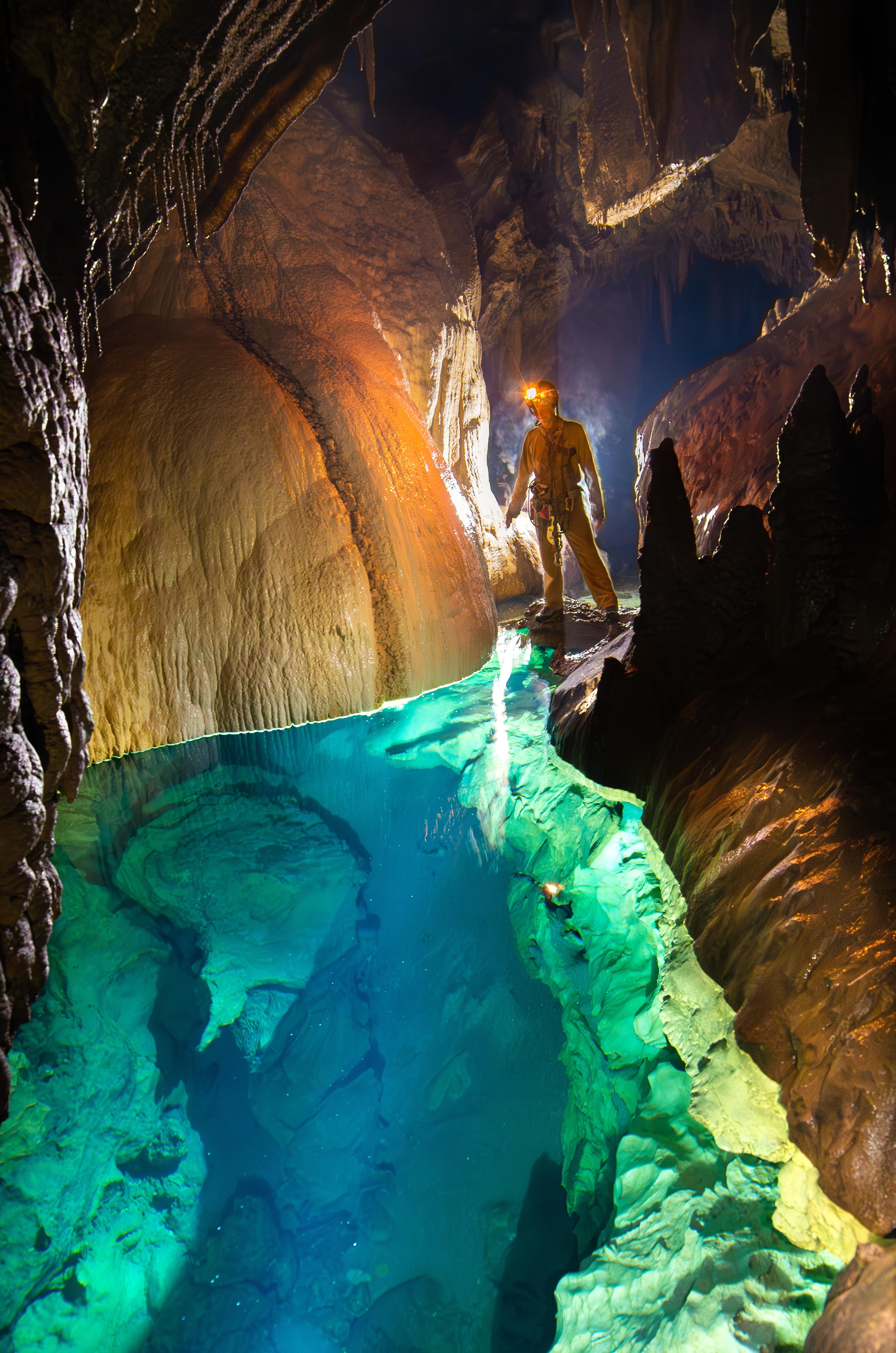
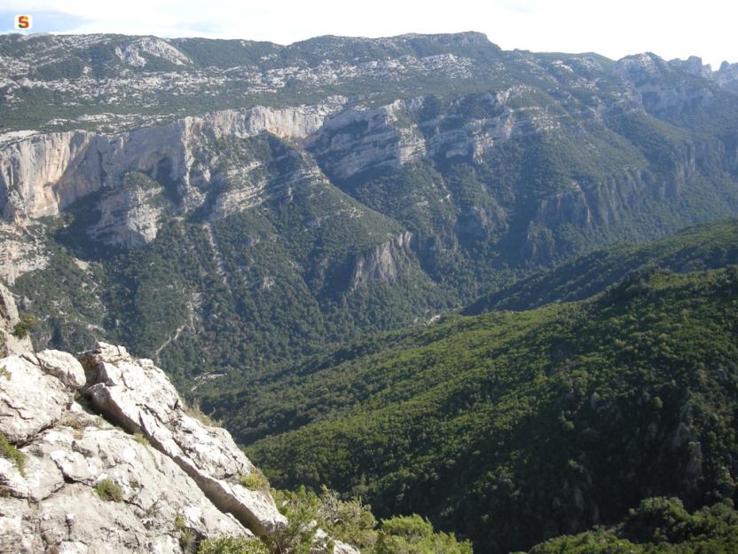
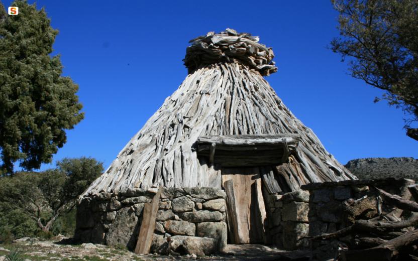
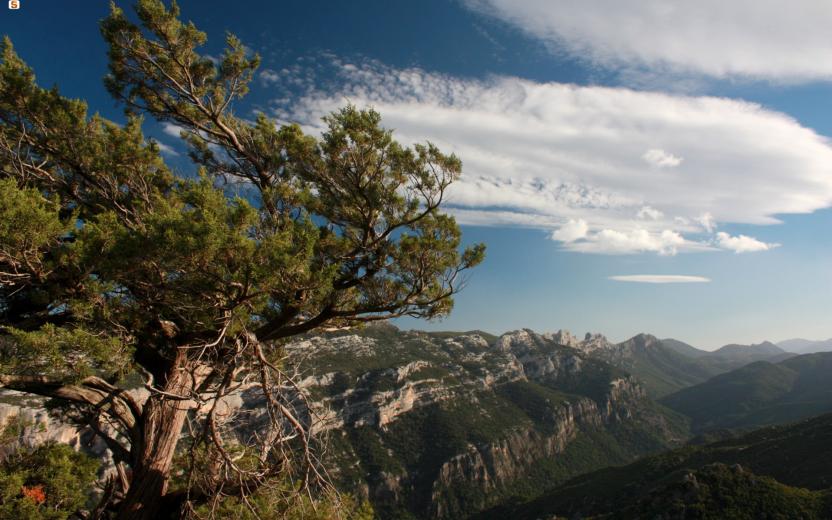
This stretch of the trail crosses the Supramonte of Urzulei and Baunei, a landscape of remote plateaus, deep gorges, and sheer cliffs plunging toward the sea. It’s a region where the limestone terrain has carved out grand and dramatic features: sinkholes, canyons, dry riverbeds (codule), and rocky spires alternate with ancient forests and hidden corners, where human presence is subtle and ancient. Here, biodiversity is remarkable, and the environment retains a rare authenticity—between archaeological sites and traditional shepherd huts, deep silences and breathtaking views over the Mediterranean.
The path
These final stages lead from the heart of the eastern Supramonte to the sea, crossing some of the most spectacular and pristine landscapes in Sardinia.
The route begins in the Supramonte of Urzulei, winding through panoramic ridges, sinkholes, and ancient forests, with the chance to visit the famous Gorropu Canyon or, for more experienced hikers, to take a detour to the scenic Punta Cucuttos. From here, descending, you reach the Ghenna Silana pass, which overlooks the coastal Supramonte, shared by the territories of Baunei, Dorgali, and Urzulei. Before continuing, it’s highly recommended to pause and explore some of the area’s natural wonders: Cala Goloritzé, Cala Sisine, and Cala Biriala. The trail resumes through pine and holm oak woods, crossing the Natural Pools of Mamutorco (23) and climbing toward Genna Salbene, in a striking landscape of granite outcrops and wide-open views.
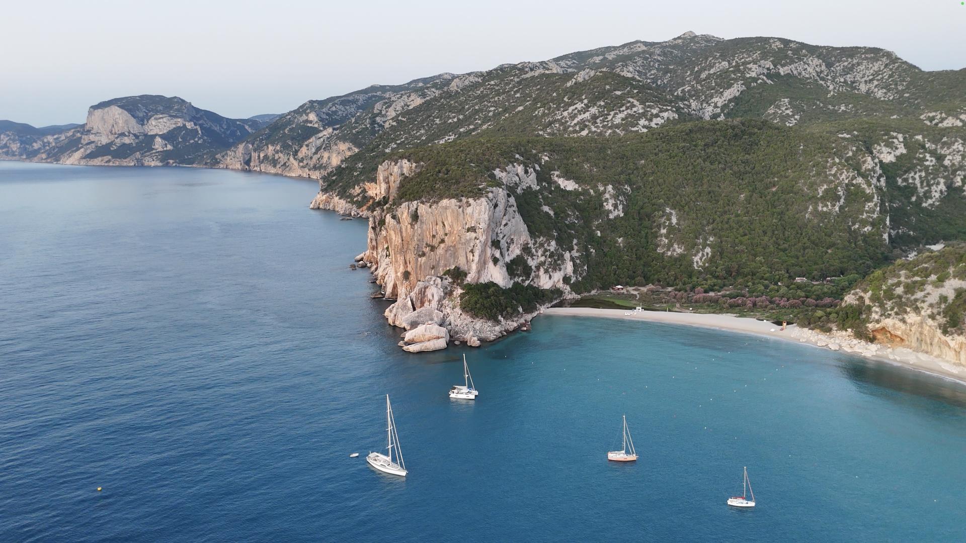
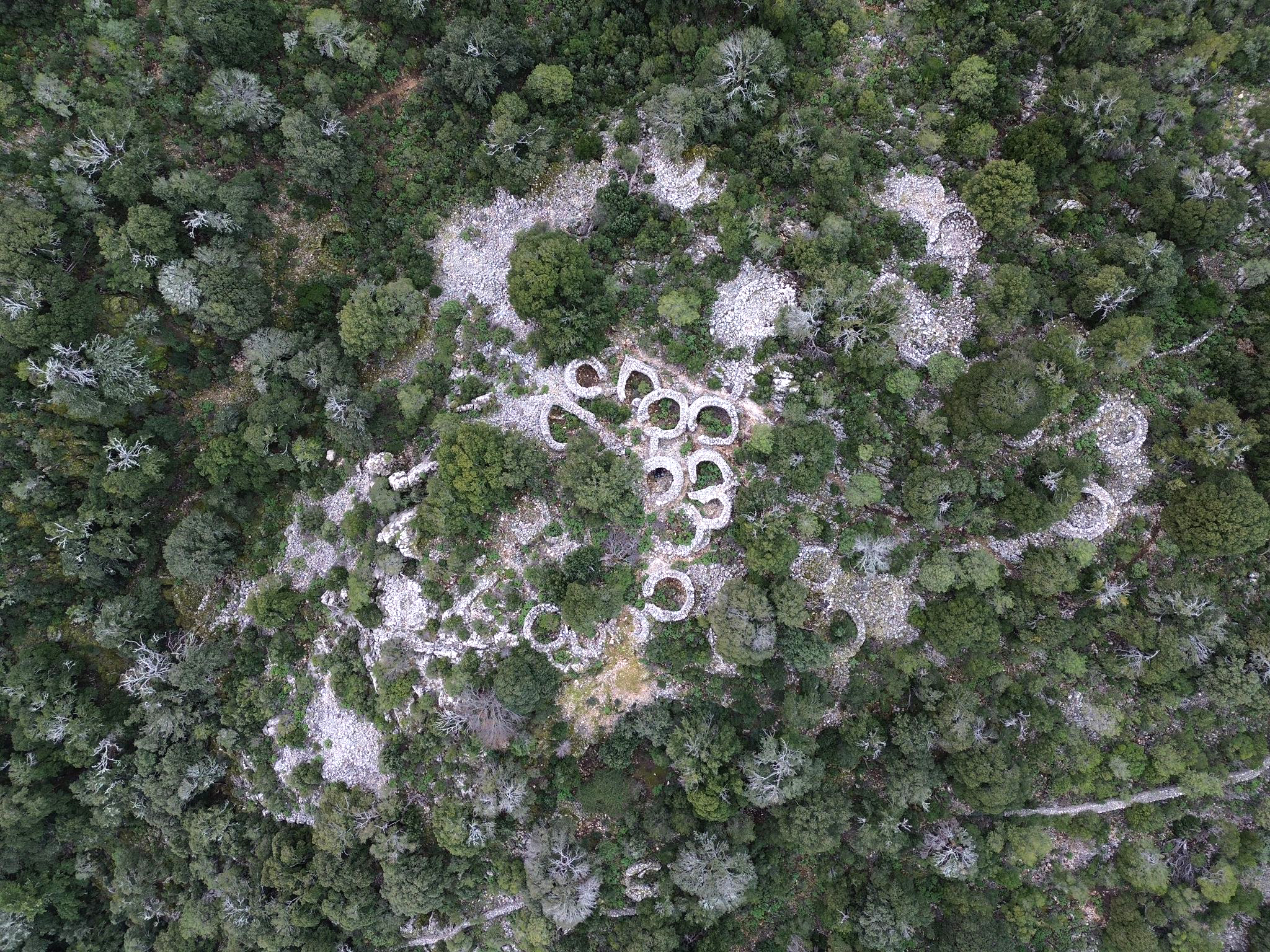
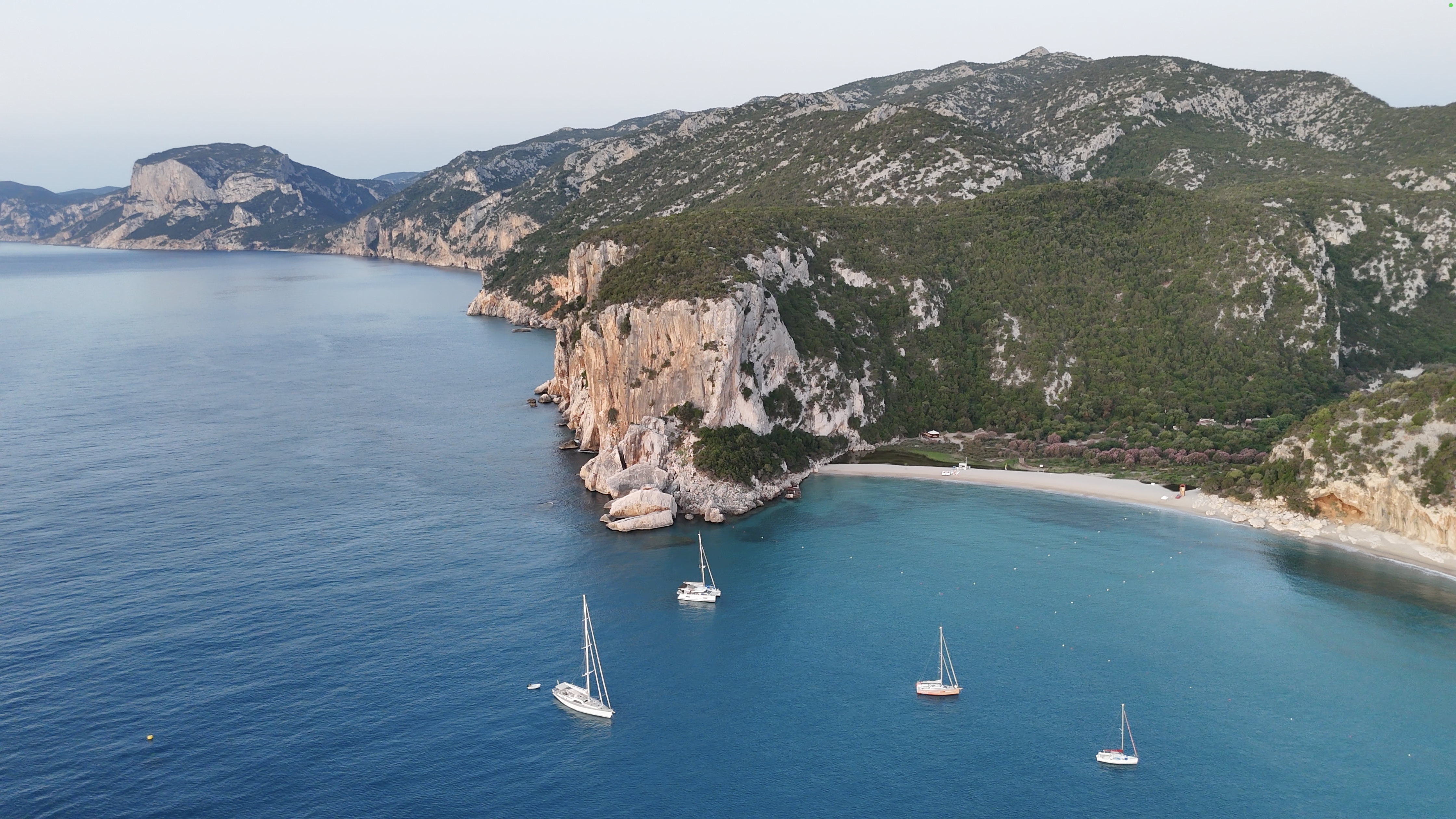
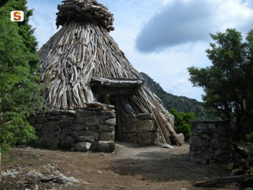
The final stage—one of the most thrilling of the entire route—descends from the Silana pass to the beach of Cala Luna, following the 20 km canyon of Codula Elune (15). Along the way, hikers will encounter the Nuragic village of Or Murales (13), ancient shepherd huts, and dramatic limestone gorges shaped by time. Reaching the sea is a spectacular finale, framed by oleanders, caves, and towering cliffs above the deep blue of the Mediterranean.
From Genna Silana to Cala Luna
The final stage of the route is both fascinating and evocative, descending from the 1,000-meter altitude of Ghenna Silana to the crystal-clear waters of Cala Luna, one of Sardinia’s most iconic beaches.
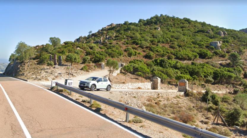
The trail winds through mountain environments and coastal landscapes, and after about 2.5 km from the starting point—near Ghenna ‘e Petha (at km 187 of State Road 125)—it enters the heart of the Codula Elune, a canyon about 20 km long that leads directly to the beach.
This stage is notable for its exceptional natural and cultural heritage.
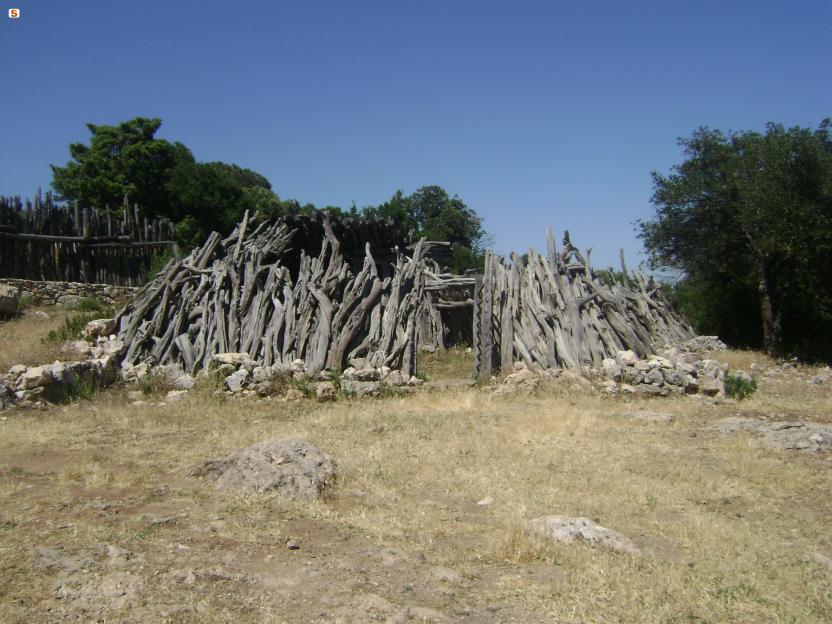
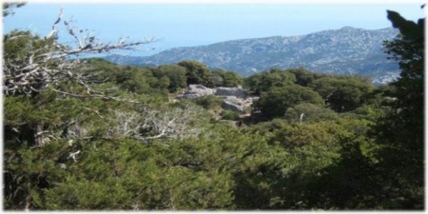
At the start, on the right-hand side of the trail, you can admire the sounding stones sculpted by Sardinian artist Pinuccio Sciola. A dirt road continues for about two kilometers, leading to the wildlife oasis of Sa Portiscra. From here, in just a few minutes, a short detour brings you to the evocative Nuragic village of Or Murales, which preserves over 90 huts dating to the Middle and Late Bronze Age,
a true plunge into the island’s ancient history.
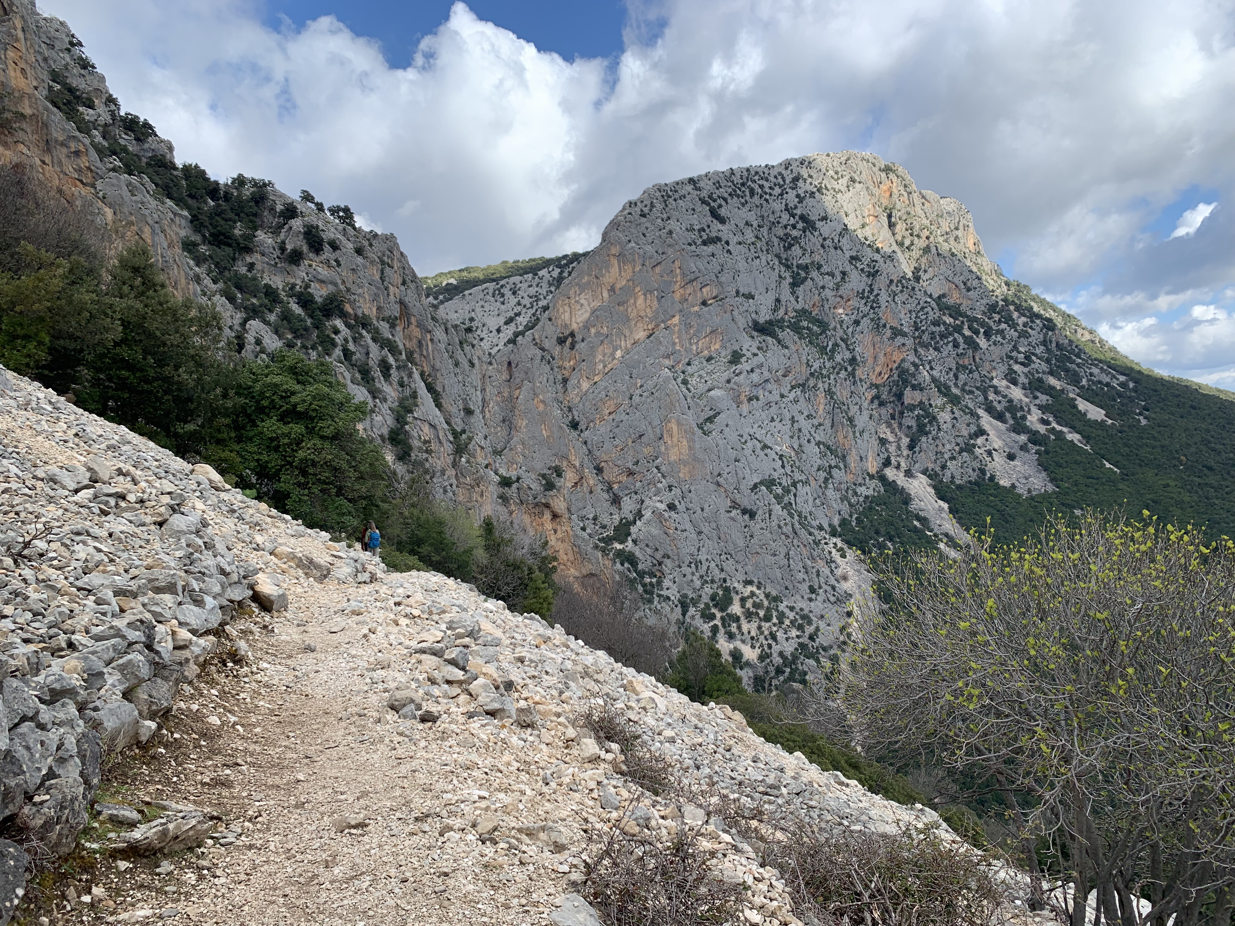
The trail continues along a wide, comfortable track surrounded by a lush holm oak forest, reaching the Sa Tilimba sheepfold. From here, an old mule track begins a steady descent to Bacu Sarachinu, a dramatic valley that marks the natural boundary between the territories of Urzulei and Dorgali. The limestone cliffs here give rise to spires, pinnacles, and spectacular rock formations that frame breathtaking views over the sea.
Although some sections of the descent into the canyon are technical, the path does not present significant difficulty.
The trail passes through a mixed forest of holm oaks, ash, and mastic trees, eventually giving way to the dry riverbed of the Codula Elune, where, in the milder months, blooming oleanders color the landscape with vivid hues.
From here, the route follows the canyon all the way to Cala Luna, a cove of pale sand nestled between cliffs and sea caves.