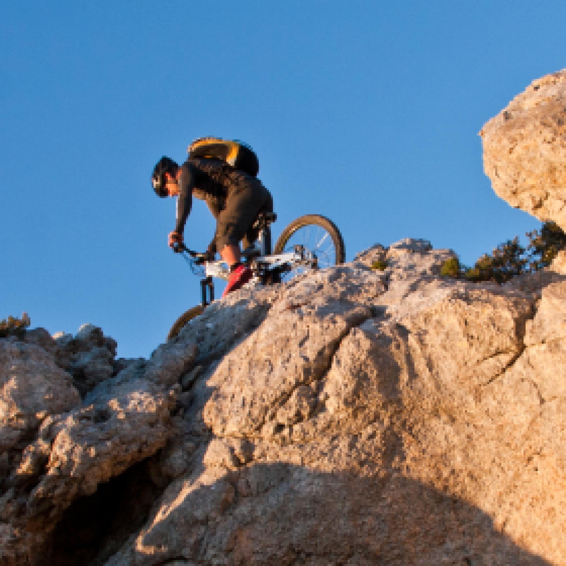
Mountain Bike
Le varie categorie del mountain biking ne fanno un universo a sé stante nel campo del turismo attivo: cross country, all mountain, enduro e freeride, downhill e bike orienteering...possono essere praticati quasi ovunque, ma la maggior parte dei biker pedalano fuoristrada, lungo sentieri di campagna, piste forestali o singletrack (creati e mantenuti principalmente dal passaggio). Gruppi sociali più o meno formalizzati sono frequenti, specialmente nelle uscite più lunghe...

Results
Pathways Da Leustra a Santa Maria (T-782)
Sentiero Italia (Stage Z21A) Taquisara - Ulassai
Overview of the itinerary
Sentiero Italia runs the length of the island’s eastern side, covering its most important mountains, in 28 stages. Starting from the north: it flanks the Monte Limbara massif, crosses the limestones of Mont’Albo and Tuttavista, skirting the Gulf of Orosei, it crosses the Supramonte, Gennargentu and the Tacchi of Ogliastra and reaches Perdasdefogu. Further south, it passes through Armungia and the Gerrei sub-region. Lastly, it touches on the villages of Burcei and San Gregorio, continuing on the Sette Fratelli massif to the old prisons of Castiadas.
General information on Sentiero Italia (Grand Italian Trail)
Sentiero Italia, or Grand Italian Trail, as also explained on the official website, is a walking route that crosses the whole of Italy, using mainly but not exclusively “registered trails”.
In particular, in Sardinia, not all the stages of the Sentiero Italia of CAI (Italian Alpine Club) are made of trails already included in the registry of the Sardinia Trail Network (RES), either because they have not yet been tested and approved or simply because they cannot be registered as they do not meet the requirements. However, as a whole, the Sentiero Italia is the single longest walking route currently crossing Sardinia from the north (S. Teresa Gallura, stage Z 1) to the south (Castiadas, end of stage Z 28), touching on the most fascinating mountain areas in central-eastern Sardinia: the plateau of Buddusò, Tepilora, the Cedrino river valley, the ancient forests of Montes, Perda Liana and the regional forest of Montarbu, Monte Genis, and lastly the regional forest of Settefratelli (among the many crossed by the various stages of this long hiking itinerary).
Information on this stage of the trail
The original stage was quite long, around 28 km, so it has been split into two parts.
Route 21A is the longest section, about 17 km, ending in the small town of Ulassai, home to artist Maria Lai and a climbing mecca with many bolted routes of varying levels of difficulty.
The start point is close to the town park, where there is also a fountain. The route starts uphill, along a clearly marked path. The first destination is nuraghe Serbissi, at an elevation of 947 m asl. Having left the nuraghe, which is managed by a local cooperative, the path turns downhill and then after a series of easy ascents and descents, reaches the Urceni nuraghe (934 m asl). Here you will find a fork; take the southern path and after a brief stop at the Urceni fountain, continue in the direction of the San Giorgio hotel (only open in summer). After a few hundred metres, you can stop for a picnic at the abundant Sa Brecca spring.
On the way to the car park of the Cave of Su Marmuri, you will encounter the Sanu nuraghe, which does not offer much opportunity at the moment for viewing or exploration because it has not yet undergone archaeological excavations. From the cave’s car park, walk along a short stretch of blacktop road, which you will then leave to take the path that, running alongside the sports field, offers beautiful views of the town. This final section is known as the Maria Lai trail.
This is a very scenic stage suitable for fairly fit hikers. The final section, from the sports field onwards, is recommended for experienced hikers as there are two exposed stretches, albeit equipped with a steel cable.
- Log in to post comments
Photogallery
Sentiero Italia (Tappa Z21A) Taquisara - Ulassai
In sintesi
Il Sentiero Italia attraversa in lunghezza il settore orientale dell’isola toccandone i sistemi montuosi più rilevanti, in 28 tappe. Partendo da nord: tocca il massiccio del Monte Limbara, attraversa i calcari del Mont'Albo e del Tuttavista sfiorando il Golfo di Orosei, attraversa il Supramonte, il Gennargentu, i Tacchi dell’Ogliastra e giunge a Perdasdefogu. Più a sud, transita da Armungia e dalla subregione del Gerrei. Infine tocca l’abitato di Burcei e San Gregorio, per continuare nel massiccio dei Sette Fratelli fino alle vecchie carceri di Castiadas.
Informazioni generali sull'itinerario sentiero Italia
Il Sentiero Italia, come spiegato anche nel sito ufficiale, è un itinerario (o Cammino) lungo tutta l'Italia, che utilizza prevalentemente ma non esclusivamente "sentieri accatastati".
In particolare, in Sardegna, non tutte le tappe del Sentiero Italia del CAI coincidono con sentieri già inseriti nel catasto della Rete Escursionistica della Sardegna (RES), perché non hanno ancora superato le verifiche di percorribilità oppure semplicemente perché non possono essere accatastati non avendone i requisiti. Tuttavia, nel suo insieme, il Sentiero Italia rappresenta l'unica, la più grande dorsale escursionistica che attraversa attualmente la nostra Isola da nord (S. Teresa Gallura, tappa Z 1) a sud (Castiadas, fine tappa Z 28) toccando le aree montane della Sardegna centro-Orientale più affascinanti: l'altopiano di Buddusò, Tepilora, la valle del Cedrino, i boschi vetusti di Montes, Perda Liana e la foresta demaniale di Montarbu, il Monte Genis, e infine la foresta demaniale di Settefratelli (tra le tante attraversate dal lungo itinerario escursionistico a tappe).
Info sul percorso di questa tappa
La tappa originaria essendo abbastanza lunga, circa 28 km, si è preferito suddividerla in due parti.
La 21A rappresenta il tratto più lungo, circa 17 km e ben si presta per accogliere l’escursionista a fine tappa nel centro abitato di Ulassai, il paese dell’artista Maria Lai e località con numerose vie su parete con vari gradi di difficoltà.
La partenza è nei pressi del parco comunale dove è presente anche una fontana. Si inizia in salita, lungo un sentiero ben evidente, con la prima meta da raggiungere, il nuraghe Serbissi a quota 947 slm. Lasciato il nuraghe, gestito da una cooperativa locale, si percorre prima in discesa e successivamente in un saliscendi poco impegnativo, un agevole tratturo che ci porta al nuraghe Urceni (934 slm). Nel bivio presente in sito si prende la direzione sud e dopo una breve sosta nella omonima fontana Urceni si prosegue in direzione dell’albergo San Giorgio (aperto solo nel periodo estivo). Dopo poche centinaia di metri si potrà fare una sosta nell’area picnic presso la copiosa fonte di Sa Brecca.
Lungo il percorso che ci porta al parcheggio della grotta Su Marmuri incontriamo il nuraghe Sanu che al momento non offre grandi opportunità perché non è stato ancora interessato da scavi archeologici. Dal parcheggio della grotta percorriamo un breve tratto di strada bitumata che lasciamo per prendere il sentiero che, costeggiando il capo sportivo, ci porta a scoprire un panorama molto bello, dominante il centro abitato. Questo tratto finale è conosciuto come il sentiero di Maria Lai.
Tappa molto panoramica ed alla portata di escursionisti sufficientemente allenati con l’avvertenza che il tratto finale, dal campo sportivo in poi, è consigliato ad escursionisti esperti in quanto ci sono due tratti esposti, anche se presente un cavo di acciaio.
Lungo il percorso non sarà sempre presente la copertura telefonica
- Log in to post comments
Photogallery
Pathways Su Marmuri trail (C-505)
Sentiero Italia (Stage Z06) Monti – Caserma Forestale Bolostiu
Overview of the itinerary
Sentiero Italia runs the length of the island’s eastern side, covering its most important mountains, in 28 stages. Starting from the north: it flanks the Monte Limbara massif, crosses the limestones of Mont’Albo and Tuttavista, skirting the Gulf of Orosei, it crosses the Supramonte, Gennargentu and the Tacchi of Ogliastra and reaches Perdasdefogu. Further south, it passes through Armungia and the Gerrei sub-region. Lastly, it touches on the villages of Burcei and San Gregorio, continuing on the Sette Fratelli massif to the old prisons of Castiadas.
General information on Sentiero Italia (Grand Italian Trail)
Sentiero Italia, or Grand Italian Trail, as also explained on the official website, is a walking route that crosses the whole of Italy, using mainly but not exclusively “registered trails”.
In particular, in Sardinia, not all the stages of the Sentiero Italia of CAI (Italian Alpine Club) are made of trails already included in the registry of the Sardinia Trail Network (RES), either because they have not yet been tested and approved or simply because they cannot be registered as they do not meet the requirements. However, as a whole, the Sentiero Italia is the single longest walking route currently crossing Sardinia from the north (S. Teresa Gallura, stage Z 1) to the south (Castiadas, end of stage Z 28), touching on the most fascinating mountain areas in central-eastern Sardinia: the plateau of Buddusò, Tepilora, the Cedrino river valley, the ancient forests of Montes, Perda Liana and the regional forest of Montarbu, Monte Genis, and lastly the regional forest of Settefratelli (among the many crossed by the various stages of this long hiking itinerary).
Information on this stage of the trail
The starting point is the village of Monti, near the Vermentino winery. After walking a little less than 2 km on a blacktop road, used by local traffic, a 2.3 km stretch on a livestock trail begins. From here the route is on a path, for about 1 km, to the Sos Sambinzos locality (in this stretch there are two fords on the rio Crasta), from where the trail will take you back to a livestock trail that will lead you, through private land (with stiles to pass over the boundary wall) to the Monte Olia regional forest. The forest is crossed by several tracks, which are used by the Forest Rangers also for wildfire control. In this stretch, you can deviate slightly from the route to stop at the ‘Pedra Bianca’ spring and the nearby hut, fairly comfortable and freely accessible, used by the staff of Fo.Re.S.T.A.S.
After retracing your steps back from the spring, to the main trail, continue on a dirt road towards the ford on the Seleme river. Along its course, the river forms beautiful natural pools known as ‘Salomone’, some of which are near the ford.
After crossing the river, the route climbs up a trail that follows a firebreak, and then continues on a dirt road to the ‘Bolostiu’ forest ranger station. If the Seleme river is impassable, you must head, within the regional forest, towards the forest ranger station of Monte Olia, bordering road SS 389, which connects Monti with Alà dei Sardi, and return to the path from the blacktop road heading to the village of Badde Suelzu.
Notes
The ford across the Seleme river can be challenging (it may be impassable in the winter months but you can take an alternative route via SS 389).
At the Bolostiu stop point there is a station of the Fo.Re.S.T.A.S. Regional Agency.. At present, accommodation is not available but hikers can pitch their tent.
- Log in to post comments
Photogallery
Sentiero Italia (Tappa Z06) Monti – Caserma Forestale Bolostiu
In sintesi
Il Sentiero Italia attraversa in lunghezza il settore orientale dell’isola toccandone i sistemi montuosi più rilevanti, in 28 tappe. Partendo da nord: tocca il massiccio del Monte Limbara, attraversa i calcari del Mont'Albo e del Tuttavista sfiorando il Golfo di Orosei, attraversa il Supramonte, il Gennargentu, i Tacchi dell’Ogliastra e giunge a Perdasdefogu. Più a sud, transita da Armungia e dalla subregione del Gerrei. Infine tocca l’abitato di Burcei e San Gregorio, per continuare nel massiccio dei Sette Fratelli fino alle vecchie carceri di Castiadas.
Informazioni generali sull'itinerario sentiero Italia
Il Sentiero Italia, come spiegato anche nel sito ufficiale, è un itinerario (o Cammino) lungo tutta l'Italia, che utilizza prevalentemente ma non esclusivamente "sentieri accatastati".
In particolare, in Sardegna, non tutte le tappe del Sentiero Italia del CAI coincidono con sentieri già inseriti nel catasto della Rete Escursionistica della Sardegna (RES), perché non hanno ancora superato le verifiche di percorribilità oppure semplicemente perché non possono essere accatastati non avendone i requisiti. Tuttavia, nel suo insieme, il Sentiero Italia rappresenta l'unica, la più grande dorsale escursionistica che attraversa attualmente la nostra Isola da nord (S. Teresa Gallura, tappa Z 1) a sud (Castiadas, fine tappa Z 28) toccando le aree montane della Sardegna centro-Orientale più affascinanti: l'altopiano di Buddusò, Tepilora, la valle del Cedrino, i boschi vetusti di Montes, Perda Liana e la foresta demaniale di Montarbu, il Monte Genis, e infine la foresta demaniale di Settefratelli (tra le tante attraversate dal lungo itinerario escursionistico a tappe).
Info sul percorso di questa tappa
Si parte dal centro abitato di Monti, in prossimità della cantina del Vermentino. Dopo aver percorso poco meno di 2 km su strada asfaltata, con presenza di traffico locale, inizia il tratto su tratturo che si percorre per circa 2,3 km. Da questo punto il percorso è su sentiero, per poco più di un km, fino alla località Sos Sambinzos (in questo tratto sono presenti due guadi sul rio Crasta), dove riprendiamo un tratturo che ci porterà, attraversando anche una proprietà privata (con apposite scalette messe in opera nella recinzione) ad entrare nella foresta demaniale di Monte Olia. All'interno del demanio sono presenti numerose piste più o meno utilizzate dal personale anche per la gestione antincendio. In questo tratto si è previsto una piccola deviazione per la presenza di una sorgente "Pedra Bianca" e di un locale di ricovero abbastanza confortevole e di libero accesso, utilizzato dal personale di Fo.Re.S.T.A.S.
Ripercorso il breve tratto che ci ha portato alla sorgente, si prosegue su sterrata in direzione del guado sul fiume Seleme. Questo fiume lungo il suo percorso forma delle piscine naturali molto belle conosciute con il nome “Salomone”, alcune nei pressi del guado.
Attraversato il fiume ci si inerpica, su sentiero realizzato all'interno di una fascia frangifuoco, per poi proseguire su sterrata fino alla caserma forestale di "Bolostiu". Nell'eventualità il fiume Seleme non sia attraversabile è necessario dirigersi, all'interno del demanio forestale, in direzione della caserma forestale di Monte Olia confinante con la S.S. 389 che collega Monti con Alà dei Sardi e riprendere il sentiero utilizzando la strada asfaltata per il borgo di Badde Suelzu.
Note
Guado difficoltoso sul fiume Seleme (impraticabile nei mesi invernali ma con possibile via di "fuga" su S.S. 389).
Nel posto tappa Bolostiu è presente una caserma dell'Agenzia Regionale Fo.Re.S.T.A.S.. Attualmente solo possibilità di pernottamento con tenda.
Lungo il percorso non sarà sempre presente la copertura telefonica
- Log in to post comments
Photogallery
CMSB – STAGE 09 – FROM PERD'E PIBERA TO VILLACIDRO
This stage is not too long, but quite challenging.
You will pass through majestic holm oak woods while walking on granite rocks and crossing several streams, until you reach the lush citrus and cherry tree gardens of Villa Scema.
From the mine chapel of Perd'e Pibera, to the ancient church of Villacidro, which is dedicated to Santa Barbara, the cult of the patron saint of miners is strongly present.
A variant of the stage involves the route passing through the Villascema Park and for a stretch running along the shores of Lake Leni.
Safety and useful tips
The route proceeds uphill from Perd'e Pibera to Sella di Genna Farraceus, then the path continues downhill to the park of Villa Scema, where you have to ford the Rio Derettu. Should this watercourse be in flood and the ford impassable, it is recommended to proceed through the alternative route that runs directly on the asphalted road. If you take such a route, pay attention to vehicular traffic.
In the vicinity of Villacidro, the route winds through the residential area, therefore you must pay attention to urban traffic.
The stage is challenging due to its length and elevation gains, so you should adequately prepare for it.
The stage is not too long but quite challenging. The route has a length of 15.6 km, which can be done in 5 hours and 30 minutes and has an uphill difference in height of 975 m and a downhill difference of 1098 m.
FOR UPDATED INFORMATION, CONSULT THE STAGE SHEET ON THE OFFICIAL WEBSITE
- Log in to post comments