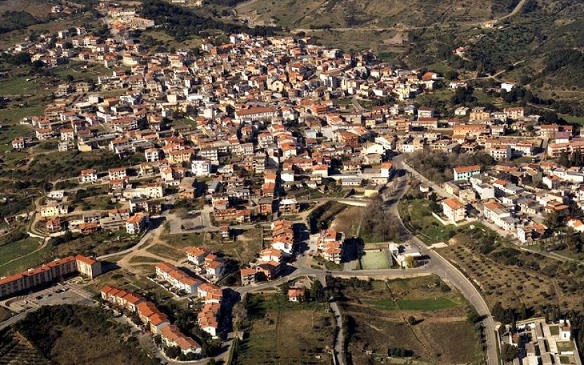
The route was created as part of a collaboration between the GAL Ogliastra and the FoReSTAS Agency, with the aim of offering hikers an immersive experience in the natural and scenic beauty of the Ogliastra area. The itinerary features points of interest along every section. You can choose your starting stage and build your own customized route, traveling from north to south or from south to north. The direction of travel may change, but the quality of the landscape remains unchanged.
The path
The initial stretch of the route from Perd’e Pera (Gairo) to Tertenia stands out for its suggestive coastal path, which laps the sea between black pebbles, hidden coves and rock formations shaped by time. Along the route you will encounter wild environments and spectacular views such as that of Sa Perda Stampada.
The coastal landscape is also characterized by the famous red rocks of Ogliastra: porphyry formations sculpted by the wind, which rise in pinnacles and cliffs overlooking the sea, creating a chromatic contrast of rare intensity with the waters below, which fade from emerald green to deep blue.
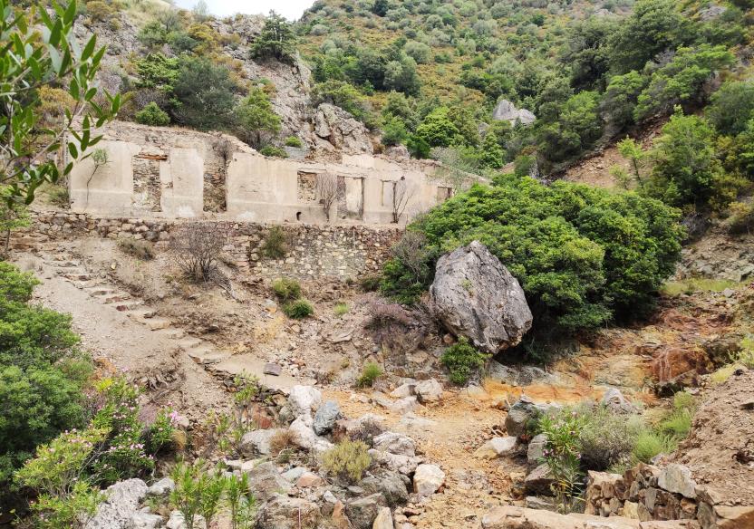
The next stage, from Tertenia to Cea Arci (Ulassai), heads inland, crossing olive groves and agricultural areas and then immersing itself in thick holm oak forests. The route winds along the slopes of the Rio Corongiu, crossing the abandoned mining area of Talentinu and reaching Cea Arci, where a sheepfold guards the remains of an ancient nuraghe. The limestone and dolomitic formations here shape a harsh and fascinating landscape, marked by a long interaction between human activities and nature, today returned to a silent balance.
The following stage, from Perdasdefogu to Nuraghe S’Ulimu (Ulassai), opens up between cork oak and holm oak woods, entering a karst environment rich in joints and natural cavities, such as the deep Sa Brecca. The path alternates between shady stretches and panoramic areas, with views of the cultivated valley and the Tacchi di Ulassai, before descending to the ford of a river and climbing back up towards the archaeological sites of Nuraghe Trutturis and S’Ulimu, witnesses of a long settlement continuity. In this stretch of inland Sardinia, the journey becomes a profound exploration of landscape and history, in a continuous balance between the shaping force of nature and the stratified memory of man.
The itinerary concludes with a final stage that, starting from the Nuraghe S’Ulimu, winds through Mediterranean scrub, wetlands, and scenic panoramic viewpoints, eventually reaching the Sant’Antonio area, near a welcoming destination for hikers.
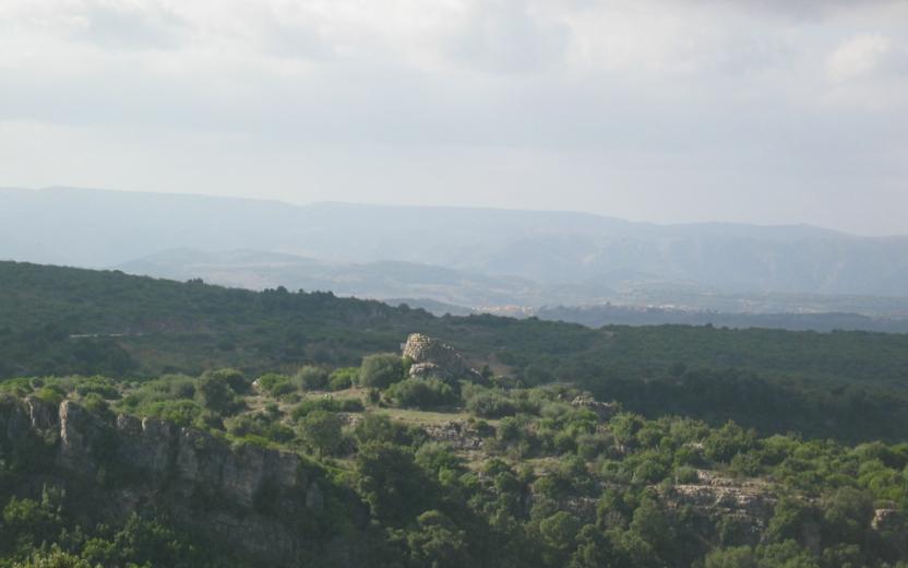
From Tertenia to Perdasdefogu
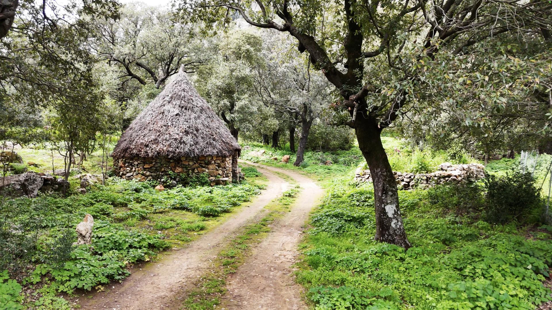
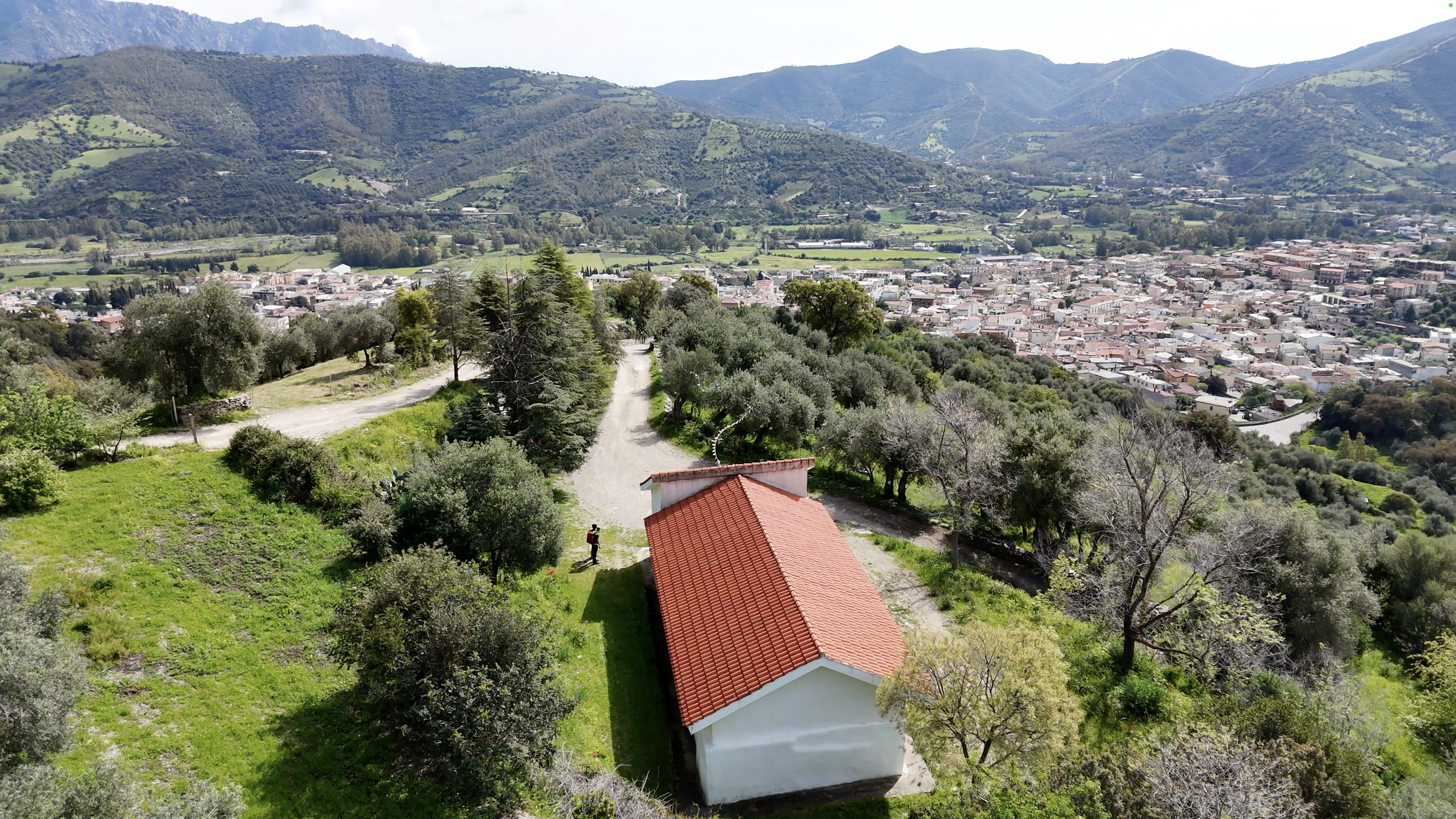
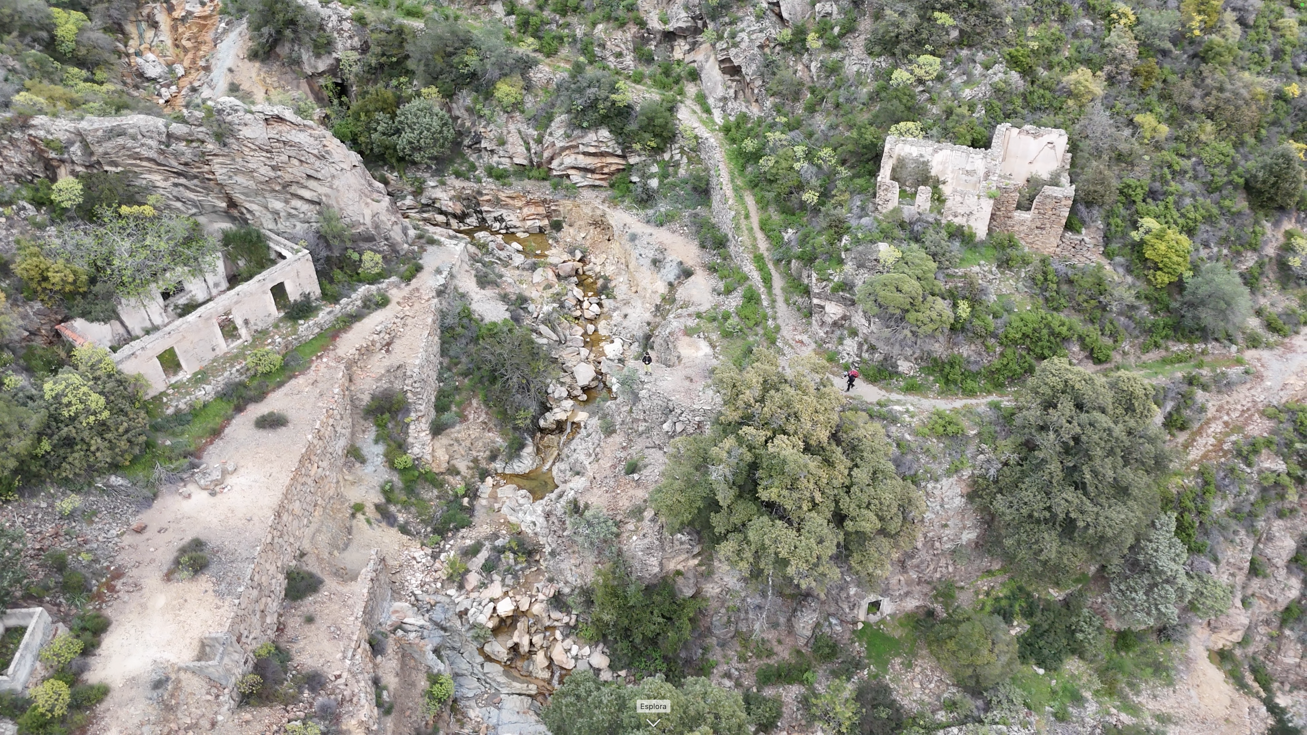
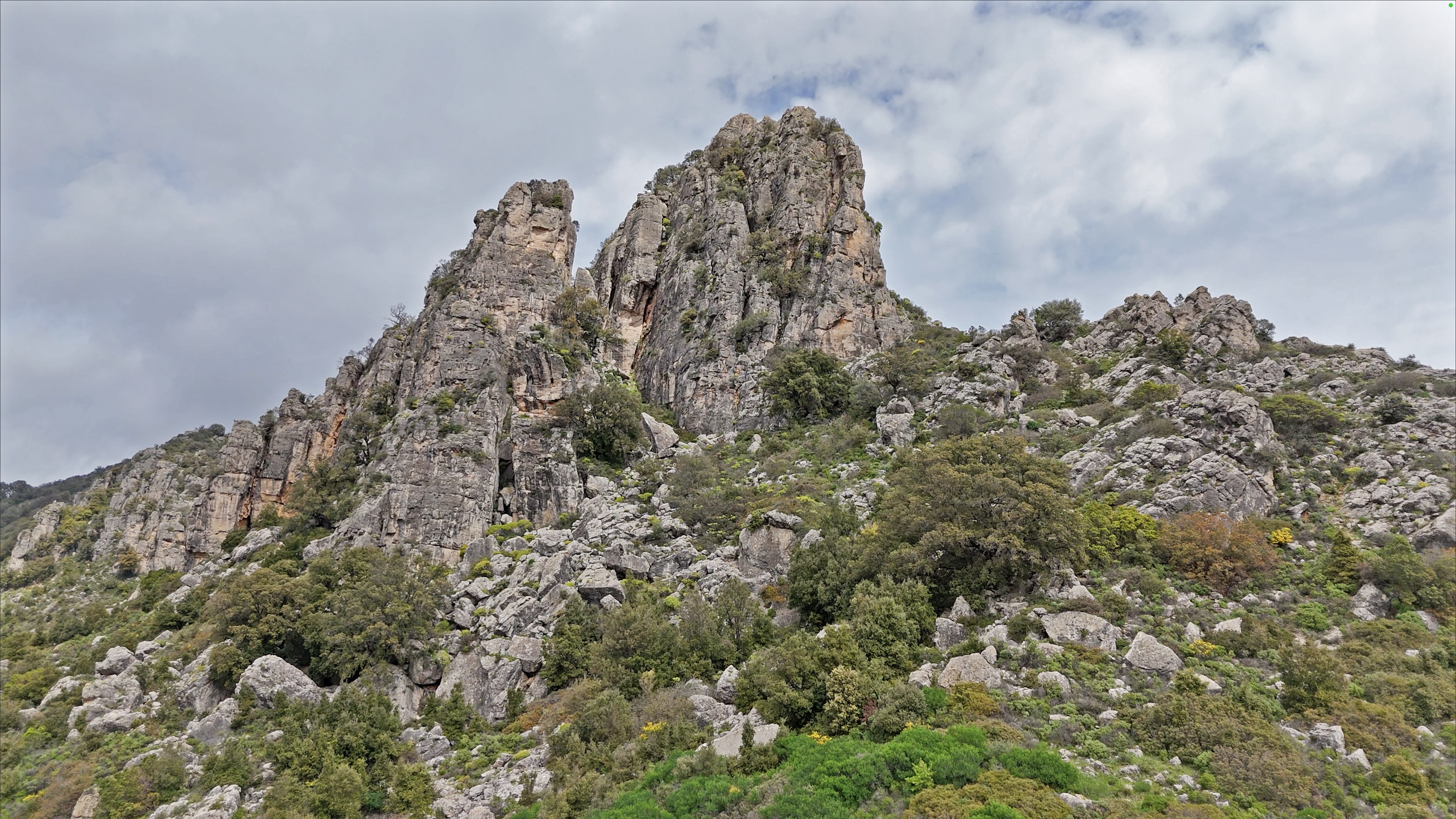
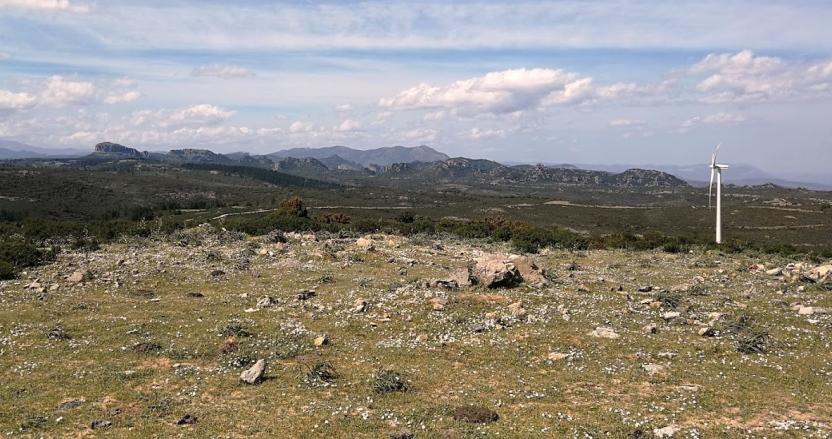
A panoramic itinerary rich in points of interest yet still little known. The first part climbs uphill above the town of Tertenia through an agricultural landscape dominated by olive groves, eventually entering an intriguing holm oak forest. Along the way, at Monte Giuilea, you encounter a sheepfold (18), restored and equipped with a picnic area, adjacent to the homonymous small barracks—also recently renovated—built in the early 1900s by lumberjacks and later used as a military post during World War II. The second part follows the Rio Corongiu, offering evocative panoramas, passing by a fountain at Funtana Giuncus (water availability may depend on the season), and crossing the abandoned Talentinu mining area, now a silent witness to the industrial past of this territory. At the end of the initial climb — which is quite challenging — there is a rest area for a short, refreshing break. Upon reaching Cea Arci in the municipality of Ulassai, you come across a sheepfold/farmstead that houses the remains of a nuraghe, from which the area takes its name. From here, the route continues along a dirt road, crossing the state road connecting Jerzu and Ulassai to Perdasdefogu, the town famous for having an high number of centenarians. Along this stretch, you’ll find a wind farm set within an area dedicated to grazing and agriculture. Particularly striking are the views of the limestone and dolomite formations that characterize the geology of the entire area. At the starting point of the route, there are no designated parking areas. It is recommended to leave your car in the town center and, if needed, use a transfer service with local guides. There are no refreshment points along the itinerary. A pleasant break is possible at the farmstead in the locality of Cea Arci (23), where the homonymous nuraghe can be visited. |